

香港中文大學地理與資源管理系

課程簡介

The GRM Departmental Award for Outstanding Research Output is to recognize the outstanding efforts of the department’s full-time faculty members in publishing high-quality research outputs in top-tier academic journals. The award is given annually to faculty members with one or more papers published in a journal ranked in the top 10% of a subject category based on the Journal Impact Factor published in Clarivate’s Journal Citation Reports.

2022-23

Theorising with urban China: Methodological and tactical experiments for a more global urban studies. Dialogues in Human Geography

Teo, S. S., Chung, C. K. L., & Wang, Z. (2023). Theorising with urban China: Methodological and tactical experiments for a more global urban studies. Dialogues in Human Geography0(0). https://doi.org/10.1177/20438206231156656

2022 Journal Impact Factor (JIF): 27.5

2022 JIF Rank in Subject Category: 1/86 (Top 1%)
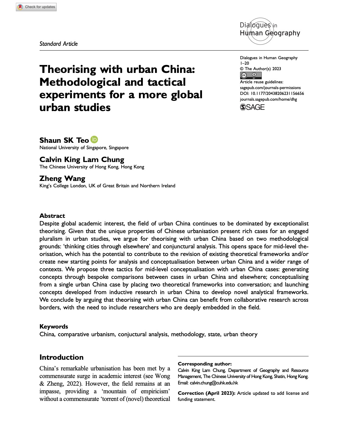
Despite global academic interest, the field of urban China continues to be dominated by exceptionalist theorising. Given that the unique properties of Chinese urbanisation present rich cases for an engaged pluralism in urban studies, we argue for theorising with urban China based on two methodological grounds: ‘thinking cities through elsewhere’ and conjunctural analysis. This opens space for mid-level theorisation, which has the potential to contribute to the revision of existing theoretical frameworks and/or create new starting points for analysis and conceptualisation between urban China and a wider range of contexts. We propose three tactics for mid-level conceptualisation with urban China cases: generating concepts through bespoke comparisons between cases in urban China and elsewhere; conceptualising from a single urban China case by placing two theoretical frameworks into conversation; and launching concepts developed from inductive research in urban China to develop novel analytical frameworks. We conclude by arguing that theorising with urban China can benefit from collaborative research across borders, with the need to include researchers who are deeply embedded in the field.

The purchase intention of electric vehicles in Hong Kong, a high-density Asian context, and main differences from a Nordic context

Ka Kit Sun, Sylvia Y. He, John Thøgersen (2022). The purchase intention of electric vehicles in Hong Kong, a high-density Asian context, and main differences from a Nordic context. Transport Policy,128, 98-112. https://doi.org/10.1016/j.tranpol.2022.09.009

2022 Journal Impact Factor (JIF): 6.8

2022 JIF Rank in Subject Category: 26/380 (Top 7%)
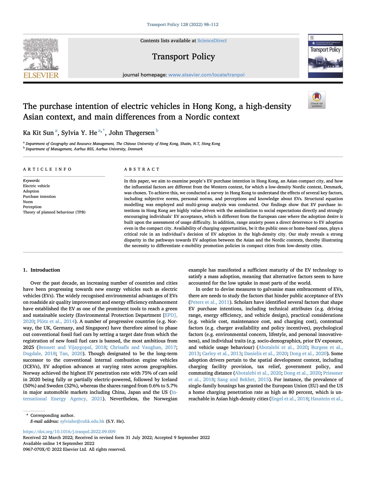
In this paper, we aim to examine people’s EV purchase intention in Hong Kong, an Asian compact city, and how the influential factors are different from the Western context, for which a low-density Nordic context, Denmark, was chosen. To achieve this, we conducted a survey in Hong Kong to understand the effects of several key factors, including subjective norms, personal norms, and perceptions and knowledge about EVs. Structural equation modelling was employed and multi-group analysis was conducted. Our findings show that EV purchase intentions in Hong Kong are highly value-driven with the assimilation to social expectations directly and strongly encouraging individuals’ EV acceptance, which is different from the European case where the adoption desire is built upon the assessment of usage difficulty. In addition, range anxiety poses a direct deterrence to EV adoption even in the compact city. Availability of charging opportunities, be it the public ones or home-based ones, plays a critical role in an individual’s decision of EV adoption in the high-density city. Our study reveals a strong disparity in the pathways towards EV adoption between the Asian and the Nordic contexts, thereby illustrating the necessity to differentiate e-mobility promotion policies in compact cities from low-density cities.

Liveability and migration intention in Chinese resource-based economies: Findings from seven cities with potential for population shrinkage

Sylvia Y. He, Xueying Chen, Murat Es, Yuanyuan Guo, Ka Kit Sun, Zeli Lin (2022). Liveability and migration intention in Chinese resource-based economies: Findings from seven cities with potential for population shrinkage. Cities, 131, 103961. https://doi.org/10.1016/j.cities.2022.103961

2022 Journal Impact Factor (JIF): 6.7

2022 JIF Rank in Subject Category: 3/43 (Top 7.0%)
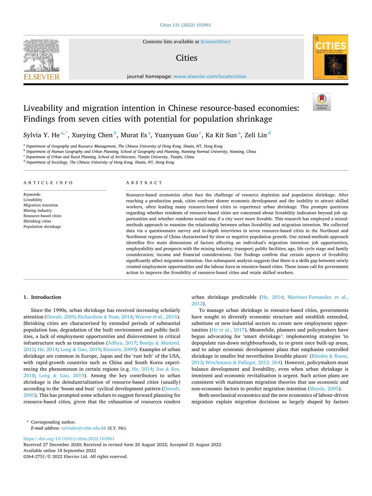
Resource-based economies often face the challenge of resource depletion and population shrinkage. After reaching a production peak, cities confront slower economic development and the inability to attract skilled workers, often leading many resource-based cities to experience urban shrinkage. This prompts questions regarding whether residents of resource-based cities are concerned about liveability indicators beyond job opportunities and whether residents would stay if a city were more liveable. This research has employed a mixed-methods approach to examine the relationship between urban liveability and migration intention. We collected data via a questionnaire survey and in-depth interviews in seven resource-based cities in the Northeast and Northwest regions of China characterised by slow or negative population growth. Our mixed-methods approach identifies five main dimensions of factors affecting an individual’s migration intention: job opportunities, employability and prospects with the mining industry; transport; public facilities; age, life cycle stage and family consideration; income and financial considerations. Our findings confirm that certain aspects of liveability significantly affect migration intention. Our subsequent analysis suggests that there is a skills gap between newly created employment opportunities and the labour force in resource-based cities. These issues call for government action to improve the liveability of resource-based cities and retain skilled workers.

Influential factors in customer satisfaction of transit services: Using crowdsourced data to capture the heterogeneity across individuals, space and time

Shuli Luo, Sylvia Y. He, Susan Grant-Muller, Linqi Song (2023).Influential factors in customer satisfaction of transit services: Using crowdsourced data to capture the heterogeneity across individuals, space and time. Transport Policy,131, 173-183. https://doi.org/10.1016/j.tranpol.2022.12.011

2022 Journal Impact Factor (JIF): 6.8

2022 JIF Rank in Subject Category: 26/380 (Top 6.8%)
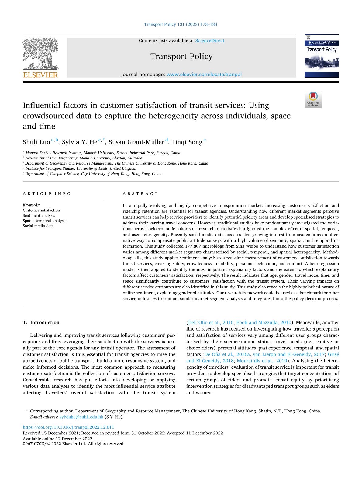
In a rapidly evolving and highly competitive transportation market, increasing customer satisfaction and ridership retention are essential for transit agencies. Understanding how different market segments perceive transit services can help service providers to identify potential priority areas and develop specialised strategies to address their varying travel concerns. However, traditional studies have predominantly investigated the variations across socioeconomic cohorts or travel characteristics but ignored the complex effect of spatial, temporal, and user heterogeneity. Recently social media data has attracted growing interest from academia as an alternative way to compensate public attitude surveys with a high volume of semantic, spatial, and temporal information. This study collected 177,807 microblogs from Sina Weibo to understand how customer satisfaction varies among different market segments characterised by social, temporal, and spatial heterogeneity. Methodologically, this study applies sentiment analysis as a real-time measurement of customers’ satisfaction towards transit services, covering safety, crowdedness, reliability, personnel behaviour, and comfort. A beta regression model is then applied to identify the most important explanatory factors and the extent to which explanatory factors affect customers’ satisfaction, respectively. The result indicates that age, gender, travel mode, time, and space significantly contribute to customers’ satisfaction with the transit system. Their varying impacts on different service attributes are also identified in this study. This study also reveals the highly polarised nature of online sentiment, explaining gendered attitudes. Our research framework could be used as a benchmark for other service industries to conduct similar market segment analysis and integrate it into the policy decision process.

Examining the non-linear effects of transit accessibility on daily trip duration: A focus on the low-income population

Sui Tao, Long Cheng, Sylvia He, Frank Witlox (2023). Examining the non-linear effects of transit accessibility on daily trip duration: A focus on the low-income population. Journal of Transport Geography,109,103600. https://doi.org/10.1016/j.jtrangeo.2023.103600

2022 Journal Impact Factor (JIF): 6.1

2022 JIF Rank in Subject Category: 7/86 (Top 8.1%)
Public transit provides an affordable and reliable transport option especially to the vulnerable groups. However, the relevance of transit accessibility to the daily mobility of different social strata has not been fully understood. It remains unclear to what extent the low-income may benefit from enhanced transit accessibility compared to others. Focusing on an Asian metropolis—Hong Kong, this study investigates the interplay between transit accessibility and daily trip duration with a particular focus on the low-income population via a machine-learning approach (Gradient Boosting Decision Tree). Our findings indicate that network accessibility by Mass Transit Rail (MTR) exerts a weaker effect on the duration of mandatory and discretionary trips of the low-income than for the non-low-income for these trips. This implies the presence of possible barriers of using MTR among the low-income. Moreover, marked threshold effects are identified for both MTR and bus accessibility especially in relation to the mandatory and maintenance trips of the low-income. Based on these findings, policy recommendations are proposed to help strengthen the linkage between improvement of transit accessibility and equitable mobility conditions across society.

An investigation into the impact of the built environment on the travel mobility gap using mobile phone data

Yu Pan, Sylvia Y. He (2023). An investigation into the impact of the built environment on the travel mobility gap using mobile phone data. Journal of Transport Geography,108, 103571. https://doi.org/10.1016/j.jtrangeo.2023.103571

2022 Journal Impact Factor (JIF): 6.1

2022 JIF Rank in Subject Category: 7/86 (Top 8.1%)
The travel mobility gap is among the indicators that can be used to evaluate the level of social and transport inequity. To achieve a large and representative sample for this investigation of the different impacts of the built environment on travel mobility of various income and migrant groups, we have utilized big data from mobile phones for over 10 million users in Shenzhen, China. Travel mobility was measured by non-commute travel frequency and activity space. Our descriptive analysis demonstrates lower-income groups and migrant workers have lower levels of travel mobility than higher-income groups and non-migrant workers. The results produced by our linear regression models also reveal a significant travel mobility gap between different income and migration groups. That gap appears to be positively impacted by job density and bus stop distance and negatively impacted by residential density and metro station distance. Our modeling results also demonstrate that the travel mobility gap is larger in the outer suburbs than in the city center and inner suburbs. Our research findings reveal that the built environment influences the travel mobility gap, which implies that marginalized groups experience some degree of social inequality and exclusion. Based on these findings, we provide policy recommendations that aim to reduce the travel mobility gap between the marginalized and reference groups.

Walking accessibility to non-work facilities and travel patterns in suburban new towns

Sui Tao, Sylvia Y. He, Xueying Chen, Jeongwoo Lee, Meng Liu (2023). Walking accessibility to non-work facilities and travel patterns in suburban new towns. Cities,137,104324. https://doi.org/10.1016/j.cities.2023.104324

2022 Journal Impact Factor (JIF): 6.7

2022 JIF Rank in Subject Category: 3/43 (Top 7.0%)
Previous research on the self-containment of new towns has focused on access to employment and commute travel; little research has been documented regarding access to non-work facilities and its relation to non-work active travel, overlooking an important aspect to assessing the self-containment of new towns. Drawing on multiple sources of data in Hong Kong, we measure walking accessibility to three main types of non-work facilities (markets, restaurants and parks) as major destinations for non-work travel. Through a series of statistical analysis, we investigate in detail the effects of accessibility on the probability and duration of home-based walking trips. Our findings indicate that: (1) new towns were more disadvantaged and less equitable in terms of the accessibility to non-work facilities than urban areas; and (2) accessibility increased both the likelihood and duration of new town residents’ walking trips particularly for grocery-shopping and dining-out purposes. The findings indicate that enhancing accessibility to non-work facilities in new towns can be beneficial in terms of both achieving self-containment and promoting more sustainable travel behaviour. Recommendations are proposed accordingly to help create more pedestrian-friendly environment, and balanced provision of non-work facilities in and around new towns and other suburban developments.

Healthy cities initiative in China: Progress, challenges, and the way forward

Yuqi Bai, Yutong Zhang, Olena Zotova, Helen Pineo, José Siri, Lu Liang, Xiangyu Luo, Mei-Po Kwan, John Ji, Xiaopeng Jiang, Cordia Chu, Na Cong, Vivian Lin, William Summerskill, Yong Luo, Hongjun Yu, Tinghai Wu, Changhong Yang, Jing Li, Yixiong Xiao, Jingbo Zhou, Dejing Dou, Hui Xiong, Lee Ligang Zhang, Lan Wang, Shu Tao, Bojie Fu, Yong Zhang, Bing Xu, Jun Yang, Peng Gong (2022). Healthy cities initiative in China: Progress, challenges, and the way forward. The Lancet Regional Health – Western Pacific, 27,100539. https://doi.org/10.1016/j.lanwpc.2022.100539

2022 Journal Impact Factor (JIF): 7.1

2022 JIF Rank in Subject Category: 7/106 (Top 6.6%)
China implemented the first phase of its National Healthy Cities pilot program from 2016-20. Along with related urban health governmental initiatives, the program has helped put health on the agenda of local governments while raising public awareness. Healthy City actions taken at the municipal scale also prepared cities to deal with the COVID-19 pandemic. However, after intermittent trials spanning the past two decades, the Healthy Cities initiative in China has reached a crucial juncture. It risks becoming inconsequential given its overlap with other health promotion efforts, changing public health priorities in response to the pandemic, and the partial adoption of the Healthy Cities approach advanced by the World Health Organization (WHO). We recommend aligning the Healthy Cities initiative in China with strategic national and global level agendas such as Healthy China 2030 and the Sustainable Development Goals (SDGs) by providing an integrative governance framework to facilitate a coherent intersectoral program to systemically improve population health. Achieving this alignment will require leveraging the full spectrum of best practices in Healthy Cities actions and expanding assessment efforts.

The effect of eye-level street greenness exposure on walking satisfaction: The mediating role of noise and PM2.5

Jiangyu Song, Suhong Zhou, Mei-Po Kwan, Shen Liang, Junwen Lu, Fengrui Jing, Linsen Wang (2022). The effect of eye-level street greenness exposure on walking satisfaction: The mediating role of noise and PM2.5. Urban Forestry & Urban Greening, 77, 127752. https://doi.org/10.1016/j.ufug.2022.127752

2022 Journal Impact Factor (JIF): 6.4

2022 JIF Rank in Subject Category: 2/69 (Top 2.9%)
While there are plenty of studies on the effects of neighborhood and park greenness on personal overall satisfaction and walking behavior, the relationship between street greenness exposure and walking satisfaction has received limited attention. Also, the possible pathways by which street greenness exposure affects walking satisfaction need to be further examined. To fill these research gaps, we measured eye-level street greenness using street view images, machine learning techniques and global position systems. A structural equation model was used to examine the mediating effects of objective noise and PM2.5 exposure and related subjective annoyance, on the relationship between street greenness exposure and people’s walking satisfaction. The results showed that street greenness exposure not only had a significant direct effect on walking satisfaction, but also has a significant indirect effect on walking satisfaction through subjective environmental annoyances (including noise and PM2.5 annoyances) rather than through objective noise and PM2.5 exposures. Besides physical activity and social interaction, the indirect effect of street greenness exposure on walking satisfaction through subjective environmental pollution annoyance accounted for about 17.39% of the total effect and cannot be ignored. These results suggest that the urban greenness layout policy should not only consider residential greenness but should improve people’s environmental perception and walking satisfaction by allocating more greenness on streets with high noise and PM2.5 levels.

Estimating the CO2 emissions of Chinese cities from 2011 to 2020 based on SPNN-GNNWR

Lizhi Miao, Sheng Tang, Xinting Li, Dingyu Yu, Yamei Deng, Tian Hang, Haozhou Yang, Yunxuan Liang, Mei-Po Kwan, Lei Huang (2023). Estimating the CO2 emissions of Chinese cities from 2011 to 2020 based on SPNN-GNNWR. Environmental Research, 218, 115060. https://doi.org/10.1016/j.envres.2022.115060

2022 Journal Impact Factor (JIF): 8.3

2022 JIF Rank in Subject Category: 16/207 (Top 7.7%)
Global warming is a serious threat to human survival and health. Facing increasing global warming, the issue of CO2 emissions has attracted more attention. China is a major contributor of anthropogenic CO2 emissions and so it is essential to accurately estimate China’s CO2 emissions and analyze their changing characteristics. This study recalculates CO2 emissions from Chinese cities from 2011 to 2020 using the SPNN-GNNWR model and multiple factors to reduce the uncertainty in emission estimates. The SPNN-GNNWR model has excellent predictions (R2: 0.925, 10-fold CV R2: 0.822) when cross-validation is used. The results indicate that the total CO2 emissions in China calculated by the model are close to those accounted for by other authorities in the world, with the total CO2 emissions increasing from 9.122 billion tonnes in 2011 to 9.912 billion tonnes in 2020. The city with the largest increase in CO2 emissions is Tianjin, and the city with the largest decrease is Beijing. The study also reveals the regional differences in CO2 emissions in Chinese mainland, including emissions, emission intensity and per capita emissions. Capturing and understanding the emissions and the related socioeconomic characteristics of different cities can help to develop effective emission mitigation strategies.

Examining energy inequality under the rapid residential energy transition in China through household surveys

Wang, Q., Fan, J., Kwan, MPet al. (2023). Examining energy inequality under the rapid residential energy transition in China through household surveys. Nature Energy, 8, 251–263. https://doi.org/10.1038/s41560-023-01193-z

2022 Journal Impact Factor (JIF): 56.7

2022 JIF Rank in Subject Category: 2/344 (Top 0.6%)
Since 2013, China has initiated a rapid energy transition that replaces traditional solid fuels with modern clean energy. Despite the tremendous success of the energy transition, its impacts on household energy costs and associated energy inequality remain largely unexplored. Here we use data from a large nationwide household survey to investigate these trends. We find that about two-fifths (43.0%) of surveyed households switched from traditional solid fuels to clean energy during 2013–2017. However, 56.1% to ~61.0% of them were from extremely poor or poor households, causing deep concern for increasing household energy burden. Accordingly, the share of surveyed households in energy poverty increased from 30.1% to 34.2%. Despite the declining inequality in energy cost, a growing inequality in energy burden was revealed during 2013–2017. Our results demonstrate that the energy burden on rural households increased due to the dramatic rise in the cost of clean energy, while urban households tend to spend a lower and decreased proportion of their income on energy.

COVID-19 infection rate but not severity is associated with availability of greenness in the United States

Jian Lin, Bo Huang, Mei-Po Kwan, Min Chen, Qiang Wang (2023). COVID-19 infection rate but not severity is associated with availability of greenness in the United States. Landscape and Urban Planning, 233, 104704. https://doi.org/10.1016/j.landurbplan.2023.104704

2022 Journal Impact Factor (JIF): 9.1

2022 JIF Rank in Subject Category: 7/171 (Top 4.1%)
Human exposure to greenness is associated with COVID-19 prevalence and severity, but most relevant research has focused on the relationships between greenness and COVID-19 infection rates. In contrast, relatively little is known about the associations between greenness and COVID-19 hospitalizations and deaths, which are important for risk assessment, resource allocation, and intervention strategies. Moreover, it is unclear whether greenness could help reduce health inequities by offering more benefits to disadvantaged populations. Here, we estimated the associations between availability of greenness (expressed as population-density-weighted normalized difference vegetation index) and COVID-19 outcomes across the urban–rural continuum gradient in the United States using generalized additive models with a negative binomial distribution. We aggregated individual COVID-19 records at the county level, which includes 3,040 counties for COVID-19 case infection rates, 1,397 counties for case hospitalization rates, and 1,305 counties for case fatality rates. Our area-level ecological study suggests that although availability of greenness shows null relationships with COVID-19 case hospitalization and fatality rates, COVID-19 infection rate is statistically significant and negatively associated with more greenness availability. When performing stratified analyses by different sociodemographic groups, availability of greenness shows stronger negative associations for men than for women, and for adults than for the elderly. This indicates that greenness might have greater health benefits for the former than the latter, and thus has limited effects for ameliorating COVID-19 related inequity. The revealed greenness-COVID-19 links across different space, time and sociodemographic groups provide working hypotheses for the targeted design of nature-based interventions and greening policies to benefit human well-being and reduce health inequity. This has important implications for the post-pandemic recovery and future public health crises.

Artificial intelligence and visual analytics in geographical space and cyberspace: Research opportunities and challenges

Min Chen, Christophe Claramunt, Arzu Çöltekin, Xintao Liu, Peng Peng, Anthony C. Robinson, Dajiang Wang, Josef Strobl, John P. Wilson, Michael Batty, Mei-Po Kwan, Maryam Lotfian, François Golay, Stéphane Joost, Jens Ingensand, Ahmad M. Senousi, Tao Cheng, Temenoujka Bandrova, Milan Konecny, Paul M. Torrens, Alexander Klippel, Songnian Li, Fengyuan Zhang, Li He, Jinfeng Wang, Carlo Ratti, Olaf Kolditz, Hui Lin, Guonian Lü (2023). Artificial intelligence and visual analytics in geographical space and cyberspace: Research opportunities and challenges. Earth-Science Reviews, 241, 104438. https://doi.org/10.1016/j.earscirev.2023.104438

2022 Journal Impact Factor (JIF): 12.1

2022 JIF Rank in Subject Category: 5/202 (Top 2.5%)
In recent decades, we have witnessed great advances on the Internet of Things, mobile devices, sensor-based systems, and resulting big data infrastructures, which have gradually, yet fundamentally influenced the way people interact with and in the digital and physical world. Many human activities now not only operate in geographical (physical) space but also in cyberspace. Such changes have triggered a paradigm shift in geographic information science (GIScience), as cyberspace brings new perspectives for the roles played by spatial and temporal dimensions, e.g., the dilemma of placelessness and possible timelessness. As a discipline at the brink of even bigger changes made possible by machine learning and artificial intelligence, this paper highlights the challenges and opportunities associated with geographical space in relation to cyberspace, with a particular focus on data analytics and visualization, including extended AI capabilities and virtual reality representations. Consequently, we encourage the creation of synergies between the processing and analysis of geographical and cyber data to improve sustainability and solve complex problems with geospatial applications and other digital advancements in urban and environmental sciences.

Estimation of urban-scale photovoltaic potential: A deep learning-based approach for constructing three-dimensional building models from optical remote sensing imagery

Longxu Yan, Rui Zhu, Mei-Po Kwan, Wei Luo, De Wang, Shangwu Zhang, Man Sing Wong, Linlin You, Bisheng Yang, Biyu Chen, Ling Feng (2023). Estimation of urban-scale photovoltaic potential: A deep learning-based approach for constructing three-dimensional building models from optical remote sensing imagery. Sustainable Cities and Society, 93, 104515. https://doi.org/10.1016/j.scs.2023.104515

2022 Journal Impact Factor (JIF): 11.7

2022 JIF Rank in Subject Category: 1/68 (Top 1.5%)
Building-integrated photovoltaics are increasingly used to build low-carbon buildings and promote energy transition. However, the absence of three-dimensional (3D) building models may hinder accurate estimation of photovoltaic (PV) potential on 3D urban surfaces. This study develops a detail-oriented deep learning approach, which for the first time constructs 3D buildings from high-resolution satellite images and estimates PV potential. Specifically, two convolutional neural networks, i.e., the Rooftop Segmentation Model and Height Prediction Model, were developed by advancing the basic DeepLabv3+ architecture and integrating dedicated layers, adaptive activation functions, and hybrid losses. Next, the two models were trained and tested on a self-made dataset targeted at Shanghai and an open datasets under standard data augmentation and transfer learning strategies. Then, morphological post-processing procedures were developed to cluster and regularize individual rooftops with estimated heights. Finally, PV potentials in typical areas were estimated and compared. Accuracy assessments suggest satisfactory rooftop segmentationand building height estimation. The absolute relative error between the PV potentials derived from the actual and predicted building models showed little difference, implying the reliability of the extracted buildings. The proposed model is novel and effective for constructing 3D building models that can facilitate PV penetration and urban studies in various fields.

Large increase in CH4 emission following conversion of coastal marsh to aquaculture ponds caused by changing gas transport pathways

Ping Yang, Derrick Y.F. Lai, Hong Yang, Yongxin Lin, Chuan Tong, Yan Hong, Yalan Tian, Chen Tang, Kam W. Tang (2022). Large increase in CH4 emission following conversion of coastal marsh to aquaculture ponds caused by changing gas transport pathways. Water Research, 222,118882. https://doi.org/10.1016/j.watres.2022.118882

2022 Journal Impact Factor (JIF): 12.8

2022 JIF Rank in Subject Category: 1/103 (Top 1.0%)
Methane emissions from aquatic ecosystems play an important role in global carbon cycle and climate change. Reclamation of coastal wetlands for aquaculture use has been shown to have opposite effects on sediment CH4 production potential and CH4 emission flux, but the underlying mechanism remained unclear. In this study, we compared sediment properties, CH4 production potential, emission flux, and CH4 transport pathways between a brackish marsh and the nearby reclaimed aquaculture ponds in the Min River Estuary in southeastern China. Despite that the sediment CH4 production potential in the ponds was significantly lower than the marsh, CH4 emission flux in the ponds (17.4 ± 2.7 mg m−2 h−1) was 11.9 times higher than the marsh (1.3 ±  0.2 mg m−2 h−1). Plant-mediated transport accounted for 75% of the total CH4 emission in the marsh, whereas ebullition accounted for 95% of the total CH4 emission in the ponds. CH4 emission fluxes in both habitat types were highest in the summer. These results suggest that the increase in CH4 emission following the conversion of brackish marsh to aquaculture ponds was not caused by increased sediment CH4 production, but rather by eliminating rhizospheric oxidation and shifting the major transport pathway to ebullition, allowing sediment CH4 to bypass oxidative loss. This study improves our understanding of the impacts of modification of coastal wetlands on greenhouse gas dynamics.

Land use and land cover changes in coastal and inland wetlands cause soil carbon and nitrogen loss

Tan, L., Ge, Z., Ji, Y., Lai, D. Y. F., Temmerman, S., Li, S., Li, X., & Tang, J. (2022). Land use and land cover changes in coastal and inland wetlands cause soil carbon and nitrogen loss. Global Ecology and Biogeography, 31, 2541–2563. https://doi.org/10.1111/geb.13597

2022 Journal Impact Factor (JIF): 6.4

2022 JIF Rank in Subject Category: 4/49 (Top 8.2%)
Natural wetlands are widely considered important for mitigation of climate change, but they have been impacted by land use and land cover change (LULCC), often resulting in ecosystem degradation and significant changes in soil carbon (C) and nitrogen (N) dynamics. However, the impact of various LULCC types on wetland soil C and N dynamics remains unclear.

Conversion of coastal wetland to aquaculture ponds decreased N2O emission: Evidence from a multi-year field study

Ping Yang, Kam W. Tang, Chuan Tong, Derrick Y.F. Lai, Linhai Zhang, Xiao Lin, Hong Yang, Lishan Tan, Yifei Zhang, Yan Hong, Chen Tang, Yongxin Lin (2022). Conversion of coastal wetland to aquaculture ponds decreased N2O emission: Evidence from a multi-year field study. Water Research, 227,119326. https://doi.org/10.1016/j.watres.2022.119326

2022 Journal Impact Factor (JIF): 12.8

2022 JIF Rank in Subject Category: 1/103 (Top 1.0%)
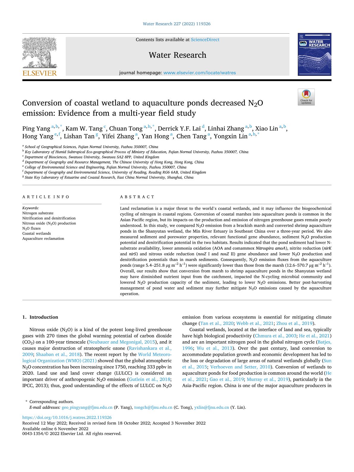
Land reclamation is a major threat to the world’s coastal wetlands, and it may influence the biogeochemical cycling of nitrogen in coastal regions. Conversion of coastal marshes into aquaculture ponds is common in the Asian Pacific region, but its impacts on the production and emission of nitrogen greenhouse gases remain poorly understood. In this study, we compared N2O emission from a brackish marsh and converted shrimp aquaculture ponds in the Shanyutan wetland, the Min River Estuary in Southeast China over a three-year period. We also measured sediment and porewater properties, relevant functional gene abundance, sediment N2O production potential and denitrification potential in the two habitats. Results indicated that the pond sediment had lower N-substrate availability, lower ammonia oxidation (AOA and comammox Nitrospira amoA), nitrite reduction (nirK and nirS) and nitrous oxide reduction (nosZ Ⅰ and nosZ Ⅱ) gene abundance and lower N2O production and denitrification potentials than in marsh sediments. Consequently, N2O emission fluxes from the aquaculture ponds (range 5.4–251.8 μg m–2 h–1) were significantly lower than those from the marsh (12.6–570.7 μg m–2 h–1). Overall, our results show that conversion from marsh to shrimp aquaculture ponds in the Shanyutan wetland may have diminished nutrient input from the catchment, impacted the N-cycling microbial community and lowered N2O production capacity of the sediment, leading to lower N2O emissions. Better post-harvesting management of pond water and sediment may further mitigate N2O emissions caused by the aquaculture operation.

Diffusive nitrous oxide (N2O) fluxes across the sediment-water-atmosphere interfaces in aquaculture shrimp ponds in a subtropical estuary: Implications for climate warming

Yalan Tian, Ping Yang, Hong Yang, Huimin Wang, Linhai Zhang, Chuan Tong, Derrick Y.F. Lai, Yongxin Lin, Lishan Tan, Yan Hong, Chen Tang, Kam W. Tang (2023). Diffusive nitrous oxide (N2O) fluxes across the sediment-water-atmosphere interfaces in aquaculture shrimp ponds in a subtropical estuary: Implications for climate warming. Agriculture, Ecosystems & Environment, 341, 108218. https://doi.org/10.1016/j.agee.2022.108218

2022 Journal Impact Factor (JIF): 6.6

2022 JIF Rank in Subject Category: 2/58 (Top 3.4%)
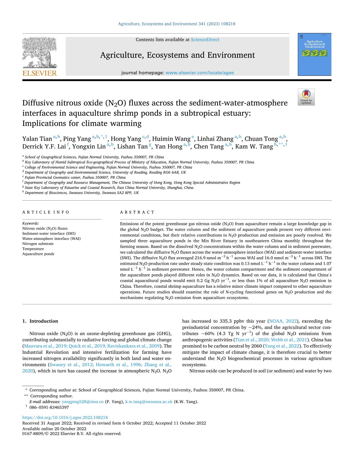
Emissions of the potent greenhouse gas nitrous oxide (N2O) from aquaculture remain a large knowledge gap in the global N2O budget. The water column and the sediment of aquaculture ponds present very different environmental conditions, but their relative contributions to N2O production and emission are poorly resolved. We sampled three aquaculture ponds in the Min River Estuary in southeastern China monthly throughout the farming season. Based on the dissolved N2O concentrations within the water column and in sediment porewater, we calculated the diffusive N2O fluxes across the water-atmosphere interface (WAI) and sediment-water interface (SWI). The diffusive N2O flux averaged 216.9 nmol m−2 h−1 across WAI and 16.0 nmol m−2 h−1 across SWI. The estimated N2O production rate under steady-state condition was 0.13 nmol L−1 h−1 in the water column and 1.07 nmol L−1 h−1 in sediment porewater. Hence, the water column compartment and the sediment compartment of the aquaculture ponds played different roles in N2O dynamics. Based on our data, it is calculated that China’s coastal aquacultural ponds would emit 0.2 Gg N2O yr−1, or less than 1% of all aquaculture N2O emission in China. Therefore, coastal shrimp aquaculture has a relative minor climate impact compared to other aquaculture operations. Future studies should examine the role of N-cycling functional genes on N2O production and the mechanisms regulating N2O emission from aquaculture ecosystems.

Contrasting effects of aeration on methane (CH4) and nitrous oxide (N2O) emissions from subtropical aquaculture ponds and implications for global warming mitigation

Ping Yang, Kam W. Tang, Hong Yang, Chuan Tong, Linhai Zhang, Derrick Y.F. Lai, Yan Hong, Lishan Tan, Wanyi Zhu, Chen Tang (2023). Contrasting effects of aeration on methane (CH4) and nitrous oxide (N2O) emissions from subtropical aquaculture ponds and implications for global warming mitigation. Journal of Hydrology, 617, Part A,128876. https://doi.org/10.1016/j.jhydrol.2022.128876

2022 Journal Impact Factor (JIF): 6.4

2022 JIF Rank in Subject Category: 15/202 (Top 7.4%)
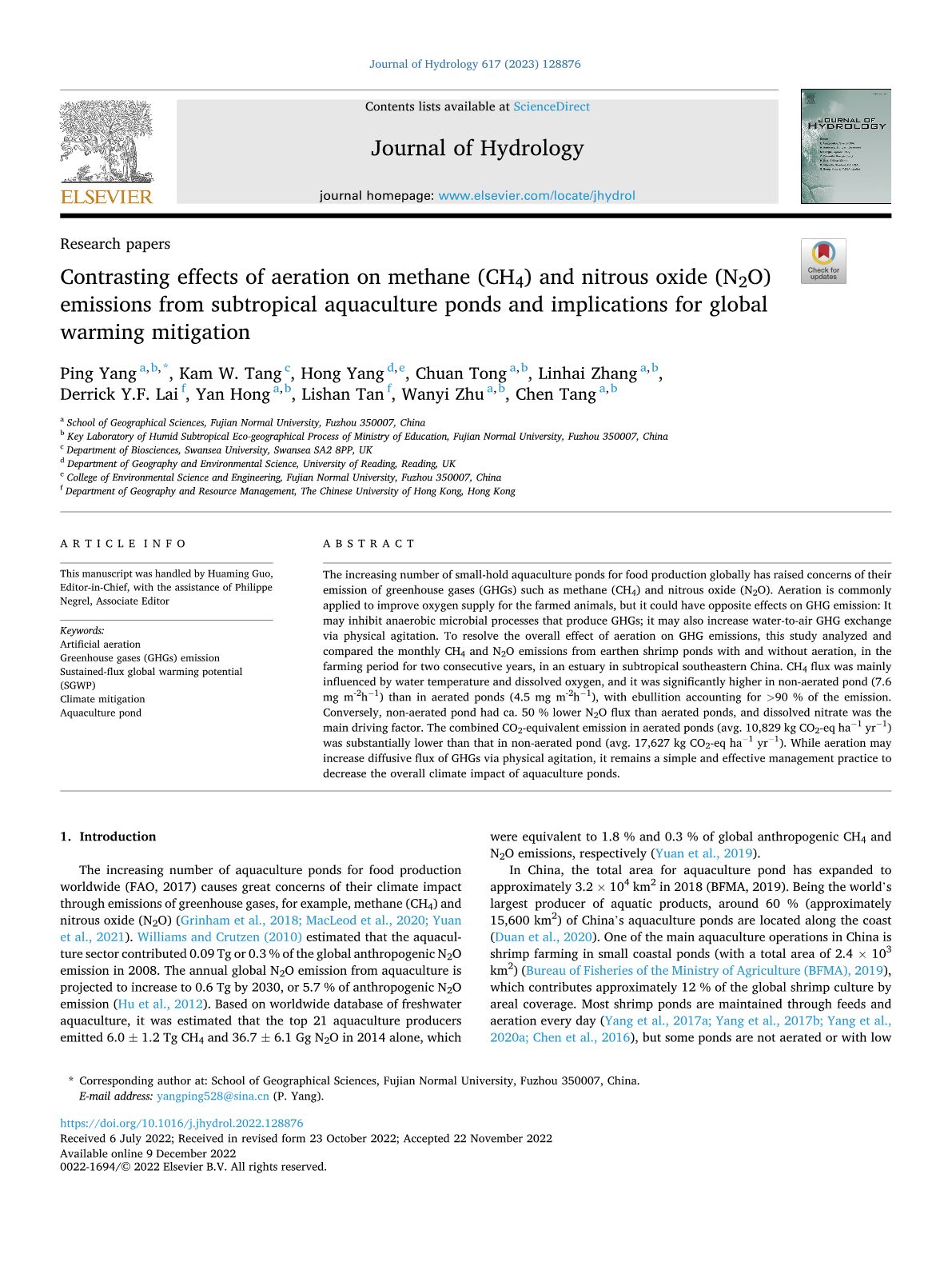
The increasing number of small-hold aquaculture ponds for food production globally has raised concerns of their emission of greenhouse gases (GHGs) such as methane (CH4) and nitrous oxide (N2O). Aeration is commonly applied to improve oxygen supply for the farmed animals, but it could have opposite effects on GHG emission: It may inhibit anaerobic microbial processes that produce GHGs; it may also increase water-to-air GHG exchange via physical agitation. To resolve the overall effect of aeration on GHG emissions, this study analyzed and compared the monthly CH4 and N2O emissions from earthen shrimp ponds with and without aeration, in the farming period for two consecutive years, in an estuary in subtropical southeastern China. CH4 flux was mainly influenced by water temperature and dissolved oxygen, and it was significantly higher in non-aerated pond (7.6 mg m-2h−1) than in aerated ponds (4.5 mg m-2h−1), with ebullition accounting for >90 % of the emission. Conversely, non-aerated pond had ca. 50 % lower N2O flux than aerated ponds, and dissolved nitrate was the main driving factor. The combined CO2-equivalent emission in aerated ponds (avg. 10,829 kg CO2-eq ha−1 yr−1) was substantially lower than that in non-aerated pond (avg. 17,627 kg CO2-eq ha−1 yr−1). While aeration may increase diffusive flux of GHGs via physical agitation, it remains a simple and effective management practice to decrease the overall climate impact of aquaculture ponds.

Mapping the spatial distribution of nocturnal urban heat island based on Local Climate Zone framework

Yingsheng Zheng, Chao Ren, Yuan Shi, Steve H.L. Yim, Derrick Y.F. Lai, Yong Xu, Can Fang, Wenjie Li (2023). Mapping the spatial distribution of nocturnal urban heat island based on Local Climate Zone framework. Building and Environment, 234, 110197. https://doi.org/10.1016/j.buildenv.2023.110197

2022 Journal Impact Factor (JIF): 7.4

2022 JIF Rank in Subject Category: 6/139 (Top 4.3%)

A spatial understanding of street-scale urban heat island (UHI) is essential but challenging in Hong Kong, due to its highly heterogeneous urban environment and a limited weather station monitoring network. Night-time mobile measurements were conducted during the summertime of 2014 to monitor UHI variation at local level. Three measurement routes and a total of 80 sample sites were selected according to the Local Climate Zone (LCZ) framework. The measured climatic data and urban morphology data were synergized and analyzed at LCZ scale through Geographical Information System (GIS). Stepwise Multiple Linear Regression (MLR) and Partial Least Square Regression (PLSR) were applied to quantify the connections between urban form and local UHI conditions of LCZ. Mean sky view factor, total street length, and pervious surface fraction of LCZ sites have been found to be the most explanatory variables of local UHI intensity, and over 50% of UHI variations can be explained by both statistical models of stepwise MLR and PLSR. An UHI evaluation map of urban areas in Hong Kong has been developed based on the statistical models, through which UHI hotspots have been identified. LCZ-based UHI mitigation strategies were further developed for climatic planning of Outline Zoning Plan areas. The results indicate that urban forms have significant influences on UHI development at local scale, and an optimal design of urban morphology is necessary for UHI mitigation and climate adaptation.

Responses of coastal sediment organic and inorganic carbon to habitat modification across a wide latitudinal range in southeastern China

Yan Hong, Linhai Zhang, Ping Yang, Chuan Tong, Yongxin Lin, Derrick Y. F. Lai, Hong Yang, Yalian Tian, Wanyi Zhu, Kam W. Tang (2023). Responses of coastal sediment organic and inorganic carbon to habitat modification across a wide latitudinal range in southeastern China. CATENA, 225, 107034. https://doi.org/10.1016/j.catena.2023.107034

2022 Journal Impact Factor (JIF): 6.2

2022 JIF Rank in Subject Category: 17/202 (Top 8.4%)
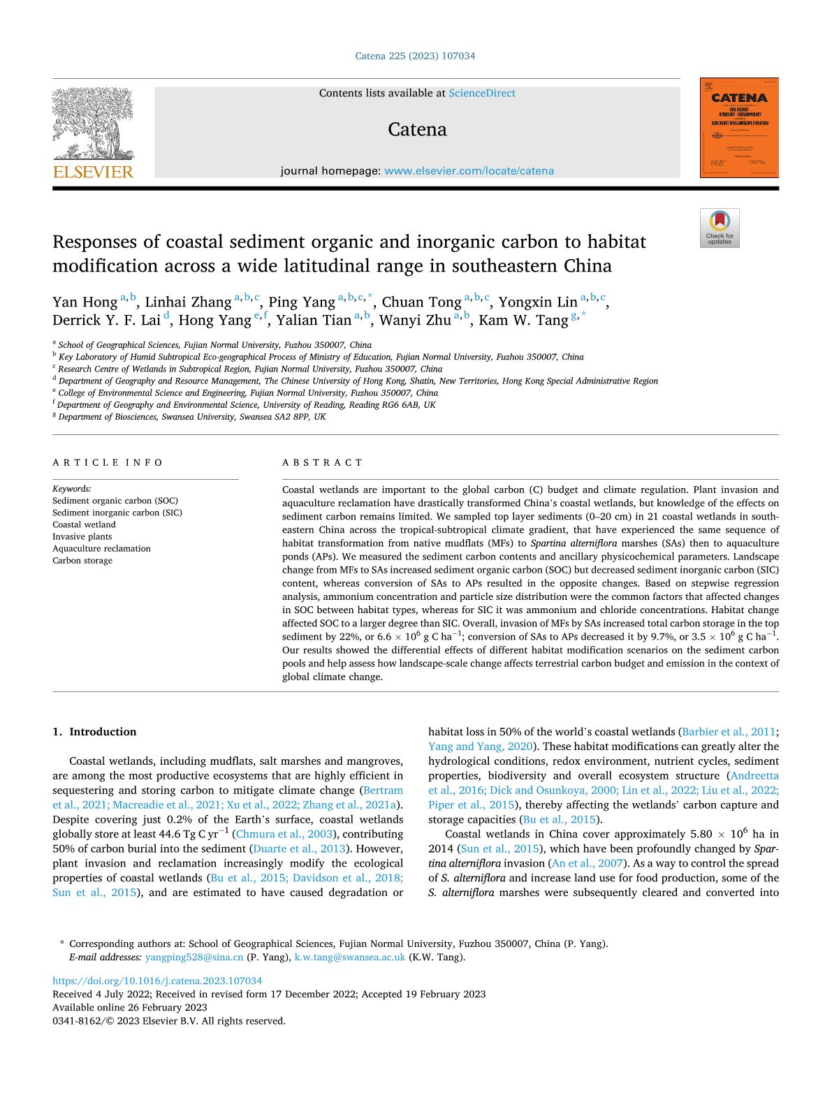
Coastal wetlands are important to the global carbon (C) budget and climate regulation. Plant invasion and aquaculture reclamation have drastically transformed China’s coastal wetlands, but knowledge of the effects on sediment carbon remains limited. We sampled top layer sediments (0–20 cm) in 21 coastal wetlands in southeastern China across the tropical-subtropical climate gradient, that have experienced the same sequence of habitat transformation from native mudflats (MFs) to Spartina alterniflora marshes (SAs) then to aquaculture ponds (APs). We measured the sediment carbon contents and ancillary physicochemical parameters. Landscape change from MFs to SAs increased sediment organic carbon (SOC) but decreased sediment inorganic carbon (SIC) content, whereas conversion of SAs to APs resulted in the opposite changes. Based on stepwise regression analysis, ammonium concentration and particle size distribution were the common factors that affected changes in SOC between habitat types, whereas for SIC it was ammonium and chloride concentrations. Habitat change affected SOC to a larger degree than SIC. Overall, invasion of MFs by SAs increased total carbon storage in the top sediment by 22%, or 6.6 × 106 g C ha−1; conversion of SAs to APs decreased it by 9.7%, or 3.5 × 106 g C ha−1. Our results showed the differential effects of different habitat modification scenarios on the sediment carbon pools and help assess how landscape-scale change affects terrestrial carbon budget and emission in the context of global climate change.

Effects of landscape modification on coastal sediment nitrogen availability, microbial functional gene abundances and N2O production potential across the tropical-subtropical gradient

Ping Yang, Kam W. Tang, Linhai Zhang, Xiao Lin, Hong Yang, Chuan Tong, Yan Hong, Lishan Tan, Derrick Y.F. Lai, Yalan Tian, Wanyi Zhu, Manjing Ruan, Yongxin Lin (2023). Effects of landscape modification on coastal sediment nitrogen availability, microbial functional gene abundances and N2O production potential across the tropical-subtropical gradient. Environmental Research, 227, 115829. https://doi.org/10.1016/j.envres.2023.115829

2022 Journal Impact Factor (JIF): 8.3

2022 JIF Rank in Subject Category: 16/207 (Top 7.7%)
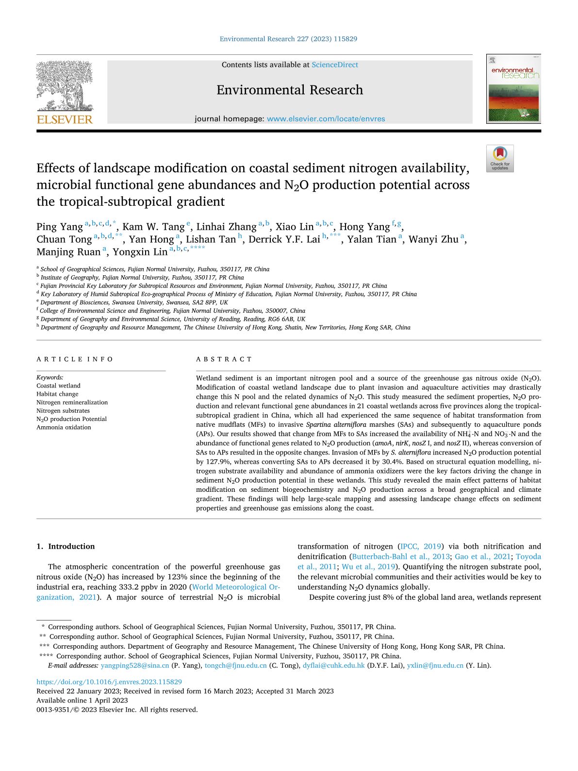
Wetland sediment is an important nitrogen pool and a source of the greenhouse gas nitrous oxide (N2O). Modification of coastal wetland landscape due to plant invasion and aquaculture activities may drastically change this N pool and the related dynamics of N2O. This study measured the sediment properties, N2O production and relevant functional gene abundances in 21 coastal wetlands across five provinces along the tropical-subtropical gradient in China, which all had experienced the same sequence of habitat transformation from native mudflats (MFs) to invasive Spartina alterniflora marshes (SAs) and subsequently to aquaculture ponds (APs). Our results showed that change from MFs to SAs increased the availability of NH4+-N and NO3-N and the abundance of functional genes related to N2O production (amoAnirKnosZ Ⅰ, and nosZ Ⅱ), whereas conversion of SAs to APs resulted in the opposite changes. Invasion of MFs by S. alterniflora increased N2O production potential by 127.9%, whereas converting SAs to APs decreased it by 30.4%. Based on structural equation modelling, nitrogen substrate availability and abundance of ammonia oxidizers were the key factors driving the change in sediment N2O production potential in these wetlands. This study revealed the main effect patterns of habitat modification on sediment biogeochemistry and N2O production across a broad geographical and climate gradient. These findings will help large-scale mapping and assessing landscape change effects on sediment properties and greenhouse gas emissions along the coast.

Assessing the Spatiotemporal Characteristics, Factor Importance, and Health Impacts of Air Pollution in Seoul by Integrating Machine Learning into Land-Use Regression Modeling at High Spatiotemporal Resolutions

Yue Li, Tageui Hong, Yefu Gu, Zhiyuan Li, Tao Huang, Harry Fung Lee, Yeonsook Heo, and Steve H. L. Yim (2023). Assessing the Spatiotemporal Characteristics, Factor Importance, and Health Impacts of Air Pollution in Seoul by Integrating Machine Learning into Land-Use Regression Modeling at High Spatiotemporal Resolutions. Environmental Science & Technology, 57 (3), 1225-1236. https://doi.org/10.1021/acs.est.2c03027

2022 Journal Impact Factor (JIF): 11.4

2022 JIF Rank in Subject Category: 19/275 (Top 6.9%)
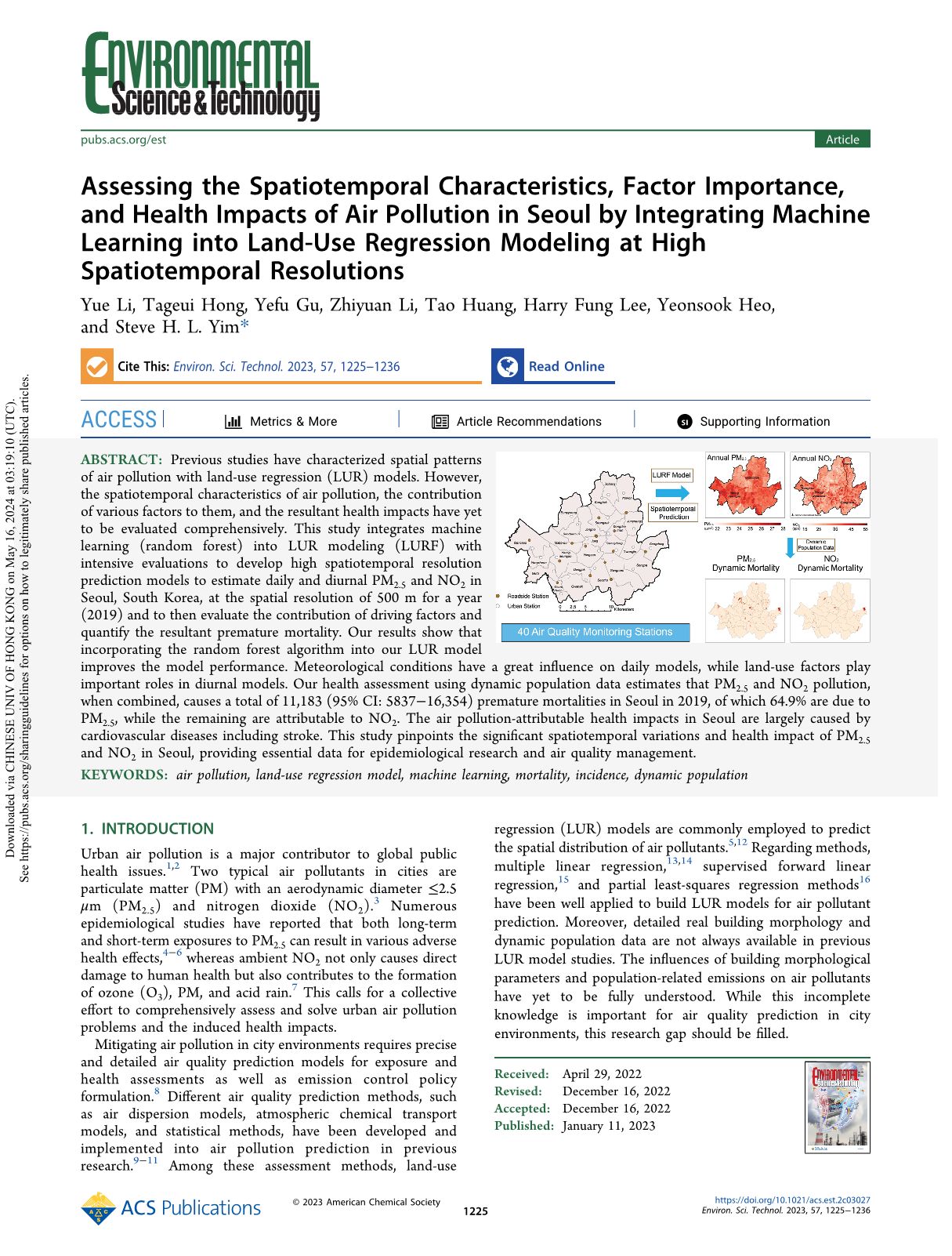
Previous studies have characterized spatial patterns of air pollution with land-use regression (LUR) models. However, the spatiotemporal characteristics of air pollution, the contribution of various factors to them, and the resultant health impacts have yet to be evaluated comprehensively. This study integrates machine learning (random forest) into LUR modeling (LURF) with intensive evaluations to develop high spatiotemporal resolution prediction models to estimate daily and diurnal PM2.5 and NO2 in Seoul, South Korea, at the spatial resolution of 500 m for a year (2019) and to then evaluate the contribution of driving factors and quantify the resultant premature mortality. Our results show that incorporating the random forest algorithm into our LUR model improves the model performance. Meteorological conditions have a great influence on daily models, while land-use factors play important roles in diurnal models. Our health assessment using dynamic population data estimates that PM2.5 and NO2 pollution, when combined, causes a total of 11,183 (95% CI: 5837–16,354) premature mortalities in Seoul in 2019, of which 64.9% are due to PM2.5, while the remaining are attributable to NO2. The air pollution-attributable health impacts in Seoul are largely caused by cardiovascular diseases including stroke. This study pinpoints the significant spatiotemporal variations and health impact of PM2.5 and NO2 in Seoul, providing essential data for epidemiological research and air quality management.

Can urban polycentricity improve air quality? Evidence from Chinese cities

Will W. Qiang, Haowen Luo, Yuxuan Xiao, David W.H. Wong, Alex S. Shi, Ziwei Lin, Bo Huang, Harry F. Lee (2023). Can urban polycentricity improve air quality? Evidence from Chinese cities. Journal of Cleaner Production, 406, 137080. https://doi.org/10.1016/j.jclepro.2023.137080

2022 Journal Impact Factor (JIF): 11.1

2022 JIF Rank in Subject Category: 22/275 (Top 8.0%)
This study utilizes high-resolution population grid data from 2004 to 2018 to assess the extent of urban polycentricity in 284 Chinese prefecture-level cities. A new method for measuring urban polycentricity is devised using the Clauset-Newman-Moore grey modularity maximization algorithm. Additionally, the Spatial Durbin Model is applied to investigate the effect of urban polycentricity on the mean and spatial variation of PM2.5 concentrations. Our statistical results show that the increased distance between urban centers and the increased size disparity between the large and small centers effectively reduces air pollution within the city. On the other hand, in cities with a strong clustering of urban centers and significant size disparity between main and sub-centers, the polycentric urban structure cannot help reduce air pollution but merely shift it to other urban centers within the city. Hence, interpreting the severity of urban air pollution solely on the basis of the citywide average of air pollution may be insufficient. It is necessary to consider the possible relocation of air-polluting activities associated with polycentric urban structures. Policymakers should take into account the potential spatial inequality of air pollution driven by urban polycentricity.

Development of an integrated machine-learning and data assimilation framework for NOx emission inversion

Yiang Chen, Jimmy C.H. Fung, Dehao Yuan, Wanying Chen, Tung Fung, Xingcheng Lu (2023). Development of an integrated machine-learning and data assimilation framework for NOx emission inversion. Science of The Total Environment, 871, 161951. https://doi.org/10.1016/j.scitotenv.2023.161951

2022 Journal Impact Factor (JIF): 9.8

2022 JIF Rank in Subject Category: 26/275 (Top 9.5%)
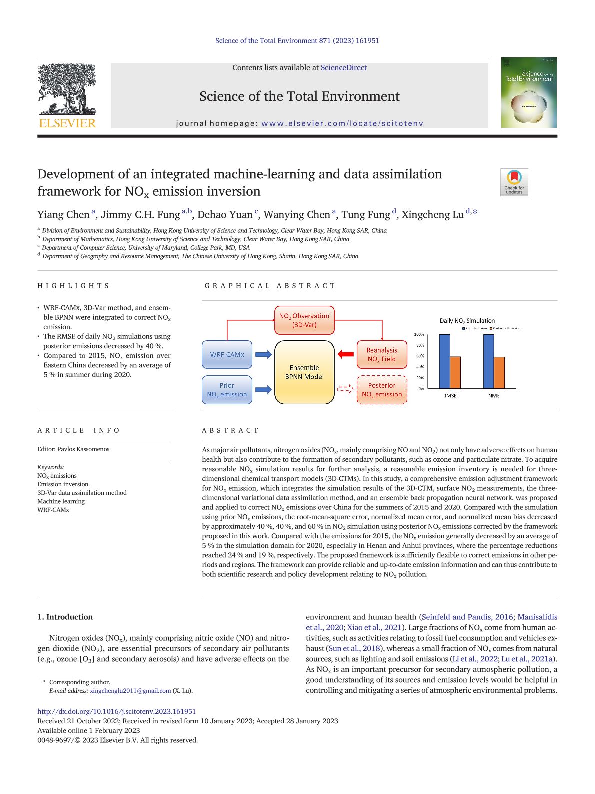
As major air pollutants, nitrogen oxides (NOx, mainly comprising NO and NO2) not only have adverse effects on human health but also contribute to the formation of secondary pollutants, such as ozone and particulate nitrate. To acquire reasonable NOx simulation results for further analysis, a reasonable emission inventory is needed for three-dimensional chemical transport models (3D-CTMs). In this study, a comprehensive emission adjustment framework for NOx emission, which integrates the simulation results of the 3D-CTM, surface NO2 measurements, the three-dimensional variational data assimilation method, and an ensemble back propagation neural network, was proposed and applied to correct NOx emissions over China for the summers of 2015 and 2020. Compared with the simulation using prior NOx emissions, the root-mean-square error, normalized mean error, and normalized mean bias decreased by approximately 40 %, 40 %, and 60 % in NO2 simulation using posterior NOx emissions corrected by the framework proposed in this work. Compared with the emissions for 2015, the NOx emission generally decreased by an average of 5 % in the simulation domain for 2020, especially in Henan and Anhui provinces, where the percentage reductions reached 24 % and 19 %, respectively. The proposed framework is sufficiently flexible to correct emissions in other periods and regions. The framework can provide reliable and up-to-date emission information and can thus contribute to both scientific research and policy development relating to NOx pollution.

Global PM2.5 Prediction and Associated Mortality to 2100 under Different Climate Change Scenarios

Wanying Chen, Xingcheng Lu, Dehao Yuan, Yiang Chen, Zhenning Li, Yeqi Huang, Tung Fung, Haochen Sun, and Jimmy C.H. Fung (2023). Global PM2.5 Prediction and Associated Mortality to 2100 under Different Climate Change Scenarios. Environmental Science & Technology, 57 (27), 10039-10052. https://doi.org/10.1021/acs.est.3c03804

2022 Journal Impact Factor (JIF): 11.4

2022 JIF Rank in Subject Category: 19/275 (Top 6.9%)
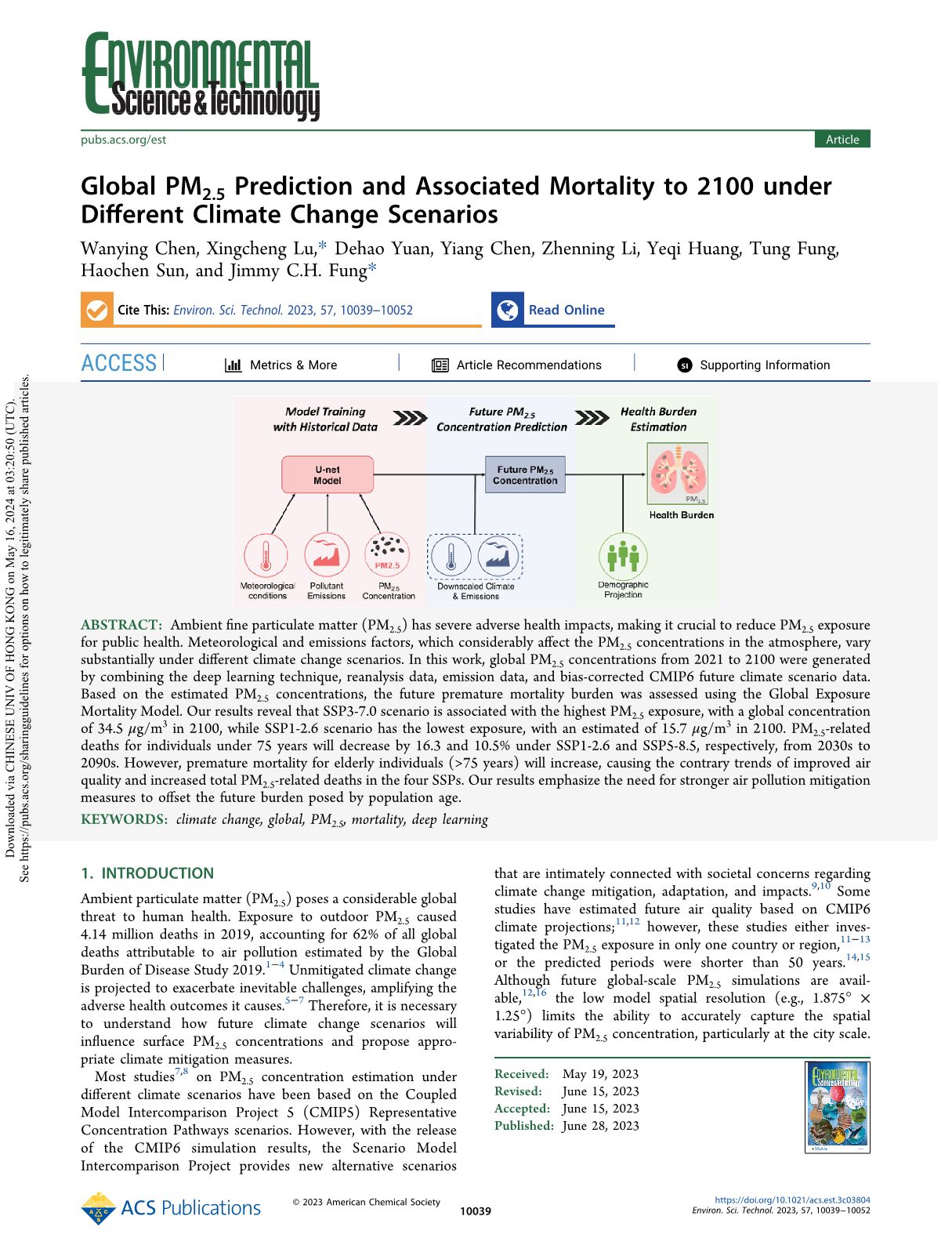
Ambient fine particulate matter (PM2.5) has severe adverse health impacts, making it crucial to reduce PM2.5 exposure for public health. Meteorological and emissions factors, which considerably affect the PM2.5 concentrations in the atmosphere, vary substantially under different climate change scenarios. In this work, global PM2.5 concentrations from 2021 to 2100 were generated by combining the deep learning technique, reanalysis data, emission data, and bias-corrected CMIP6 future climate scenario data. Based on the estimated PM2.5 concentrations, the future premature mortality burden was assessed using the Global Exposure Mortality Model. Our results reveal that SSP3-7.0 scenario is associated with the highest PM2.5 exposure, with a global concentration of 34.5 μg/m3 in 2100, while SSP1-2.6 scenario has the lowest exposure, with an estimated of 15.7 μg/m3 in 2100. PM2.5-related deaths for individuals under 75 years will decrease by 16.3 and 10.5% under SSP1-2.6 and SSP5-8.5, respectively, from 2030s to 2090s. However, premature mortality for elderly individuals (>75 years) will increase, causing the contrary trends of improved air quality and increased total PM2.5-related deaths in the four SSPs. Our results emphasize the need for stronger air pollution mitigation measures to offset the future burden posed by population age.

Regional source apportionment of trace metals in fine particulate matter using an observation-constrained hybrid model

Liao, K., Zhang, J., Chen, Y., Lu, X., Fung, J.C.H., Ying, Q., and Yu JZ (2023). Regional source apportionment of trace metals in fine particulate matter using an observation-constrained hybrid model. npj Climate and Atmospheric Science 6, 65. https://doi.org/10.1038/s41612-023-00393-4

2022 Journal Impact Factor (JIF): 9.0

2022 JIF Rank in Subject Category: 5/94 (Top 5.3%)
Trace metals in fine particulate matter (PM2.5) are of significant concern in environmental chemistry due to their toxicity and catalytic capability. An observation-constrained hybrid model is developed to resolve regional source contributions to trace metals and other primary species in PM2.5. In this method, source contributions to primary PM2.5 (PPM2.5) from the Community Multiscale Air Quality (CMAQ) Model at each monitoring location are improved to align better with the observation data by applying source-specific scaling factors estimated from a unique regression model. The adjusted PPM2.5 predictions and chemical speciation data are then used to generate observation-constrained source profiles of primary species. Finally, spatial distributions of their source contributions are produced by multiplying the improved CMAQ PPM2.5 contributions with the deduced source profiles. The model is applied to the Pearl River Delta (PRD) region, China using daily observation data collected at multiple stations in 2015 to resolve source contributions to 8 trace metals, elemental carbon, primary organic carbon, and 10 other primary species. Compared to three previous methods, the new model predicts 13 species with smaller model errors and 16 species with less model biases in 10-fold cross validation analysis. The source profiles determined in this study also show good agreement with those collected from the literature. The new model shows that during 2015 in the PRD region, Cu is mainly from the area sources (31%), industry sector (27%), and power generation (20%), with an annual average concentration as high as 50 ng m−3 in some districts. Meanwhile, major contributors to Mn are area sources (40%), emission from outside PRD (23%) and power generation (17%), leading to a mean level of around 10 ng m−3. Such information is essential in assessing the epidemiological impacts of trace metals as well as formulating effective control measures to protect public health.

SAR-TSCC: A Novel Approach for Long Time Series SAR Image Change Detection and Pattern Analysis

W. Li, P. Ma, H. Wang and C. Fang (2023). SAR-TSCC: A Novel Approach for Long Time Series SAR Image Change Detection and Pattern Analysis. IEEE Transactions on Geoscience and Remote Sensing, 61, 1-16, 5203016. https://doi.org/10.1109/TGRS.2023.3243900

2022 Journal Impact Factor (JIF): 8.2

2022 JIF Rank in Subject Category: 5/87 (Top 5.7%)
Change detection has played an increasingly important role in multitemporal remote sensing applications recently. Long time series analysis is providing new information of land cover changes and improving the quality and accuracy of the change information being derived from remote sensing. The purpose of this study is to dig for more change temporal information and change pattern information from synthetic aperture radar (SAR) image time series (ITS), which is of great significance for monitoring urban area changes, conducting land use surveys, and renovating illegal constructions. In the study, a novel unified framework for long time series SAR image change detection and change pattern analysis (SAR-TSCC) was proposed for land cover change mapping. To obtain the most notable change time rapidly, a fast SAR ITS change point search method based on pruned exact linear time (SAR-PELT) algorithm was adopted. Meanwhile, the deep time series classification network, named SAR time series transformer (SAR-TST), was implemented to recognize the change patterns, which is based on time series transformer (TST) architecture. Considering the lack of real training data, a novel synthetic data generation method is developed. The combination of the synthetic and real data enhanced the generalization of the classifiers. The proposed framework was used for monitoring a large urbanization area in the northwest of Hong Kong, China. The Cosmo Skymed (CSK) time series data acquired from 2013 to 2020 were exploited for land cover change analysis. Experiment results showed that our approach achieved the state-of-the-art performance, as the time accuracy reached 86% and the classification accuracy on the four main change patterns (impulse, step, cycle, and complex) is over 99%. In particular, the proposed SAR-TST model showed remarkable advantages in the presence of insufficient real data.

Automatic detection and classification of land subsidence in deltaic metropolitan areas using distributed scatterer InSAR and Oriented R-CNN

Zherong Wu, Peifeng Ma, Yi Zheng, Feng Gu, Lin Liu, Hui Lin (2023). Automatic detection and classification of land subsidence in deltaic metropolitan areas using distributed scatterer InSAR and Oriented R-CNN. Remote Sensing of Environment, 290,113545. https://doi.org/10.1016/j.rse.2023.113545

2022 Journal Impact Factor (JIF): 13.5

2022 JIF Rank in Subject Category: 11/275 (Top 4.0%)
Multi-temporal interferometric synthetic aperture radar (InSAR) is an effective tool for measuring large-scale land subsidence. However, the measurement points generated by InSAR are too many to be manually analyzed, and automatic subsidence detection and classification methods are still lacking. In this study, we developed an oriented R-CNN deep learning network to automatically detect and classify subsidence bowls using InSAR measurements and multi-source ancillary data. We used 541 Sentinel-1 images acquired during 2015–2021 to map land subsidence of the Guangdong-Hong Kong-Macao Greater Bay Area by resolving persistent and distributed scatterers. Multi-source data related to land subsidence, including geological and lithological, land cover, topographic, and climatic data, were incorporated into deep learning, allowing the local subsidence to be classified into seven categories. The results showed that the oriented R-CNN achieved an average precision (AP) of 0.847 for subsidence detection and a mean AP (mAP) of 0.798 for subsidence classification, which outperformed the other three state-of-the-art methods (Rotated RetinaNet, R3Det, and ReDet). An independent effect analysis showed that incorporating all datasets improved the AP by 11.2% for detection and the mAP by 73.9% for classification, respectively, compared with using InSAR measurements only. Combining InSAR measurements with globally available land cover and digital elevation model data improved the AP for subsidence detection to 0.822, suggesting that our methods can be potentially transferred to other regions, which was further validated this using a new dataset in Shanghai. These results improve the understanding of deltaic subsidence and facilitate geohazard assessment and management for sustainable environments.

Environmental justice and ecological civilization in the Pearl River Delta, China

Li, C., Ng, M. K., Xu, Y., & Yow, T. C. (2023). Environmental justice and ecological civilization in the Pearl River Delta, China. Eurasian Geography and Economics, 1–30. https://doi.org/10.1080/15387216.2023.2220340

2022 Journal Impact Factor (JIF): 3.8

2022 JIF Rank in Subject Category: 4/84 (Top 4.8%)
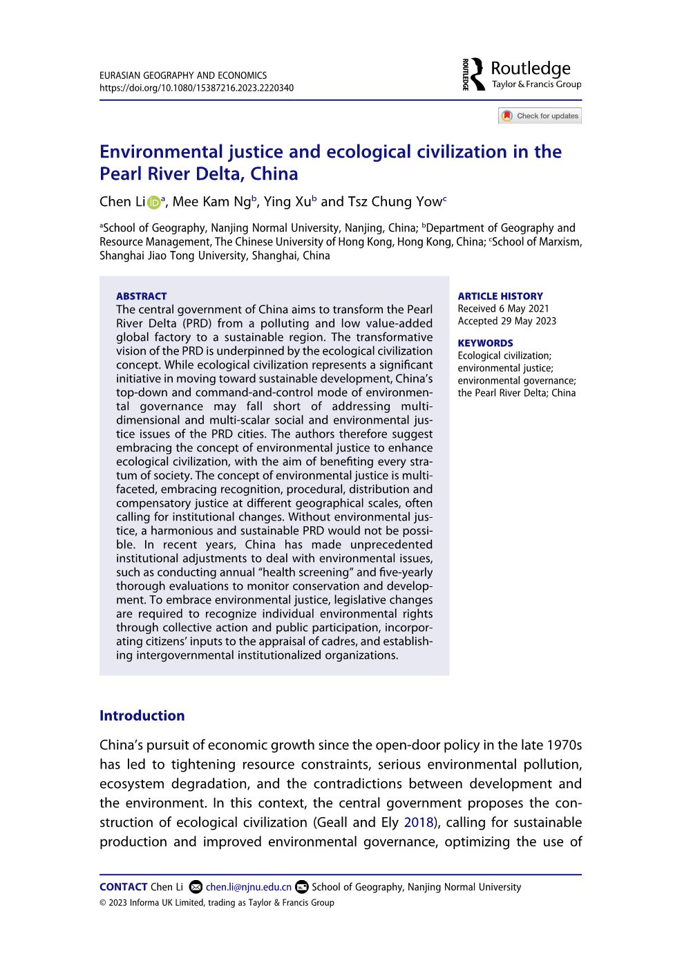
The central government of China aims to transform the Pearl River Delta (PRD) from a polluting and low value-added global factory to a sustainable region. The transformative vision of the PRD is underpinned by the ecological civilization concept. While ecological civilization represents a significant initiative in moving toward sustainable development, China’s top-down and command-and-control mode of environmental governance may fall short of addressing multi-dimensional and multi-scalar social and environmental justice issues of the PRD cities. The authors therefore suggest embracing the concept of environmental justice to enhance ecological civilization, with the aim of benefiting every stratum of society. The concept of environmental justice is multi-faceted, embracing recognition, procedural, distribution and compensatory justice at different geographical scales, often calling for institutional changes. Without environmental justice, a harmonious and sustainable PRD would not be possible. In recent years, China has made unprecedented institutional adjustments to deal with environmental issues, such as conducting annual “health screening” and five-yearly thorough evaluations to monitor conservation and development. To embrace environmental justice, legislative changes are required to recognize individual environmental rights through collective action and public participation, incorporating citizens’ inputs to the appraisal of cadres, and establishing intergovernmental institutionalized organizations.

Urban entrepreneurialism, metagovernance and ‘space of innovation’: Evidence from buildings for innovative industries in Shenzhen, China

Yiling Luo, Jianfa Shen (2022). Urban entrepreneurialism, metagovernance and ‘space of innovation’: Evidence from buildings for innovative industries in Shenzhen, China. Cities,131, 104067. https://doi.org/10.1016/j.cities.2022.104067

2022 Journal Impact Factor (JIF): 6.7

2022 JIF Rank in Subject Category: 3/43 (Top 7.0%)
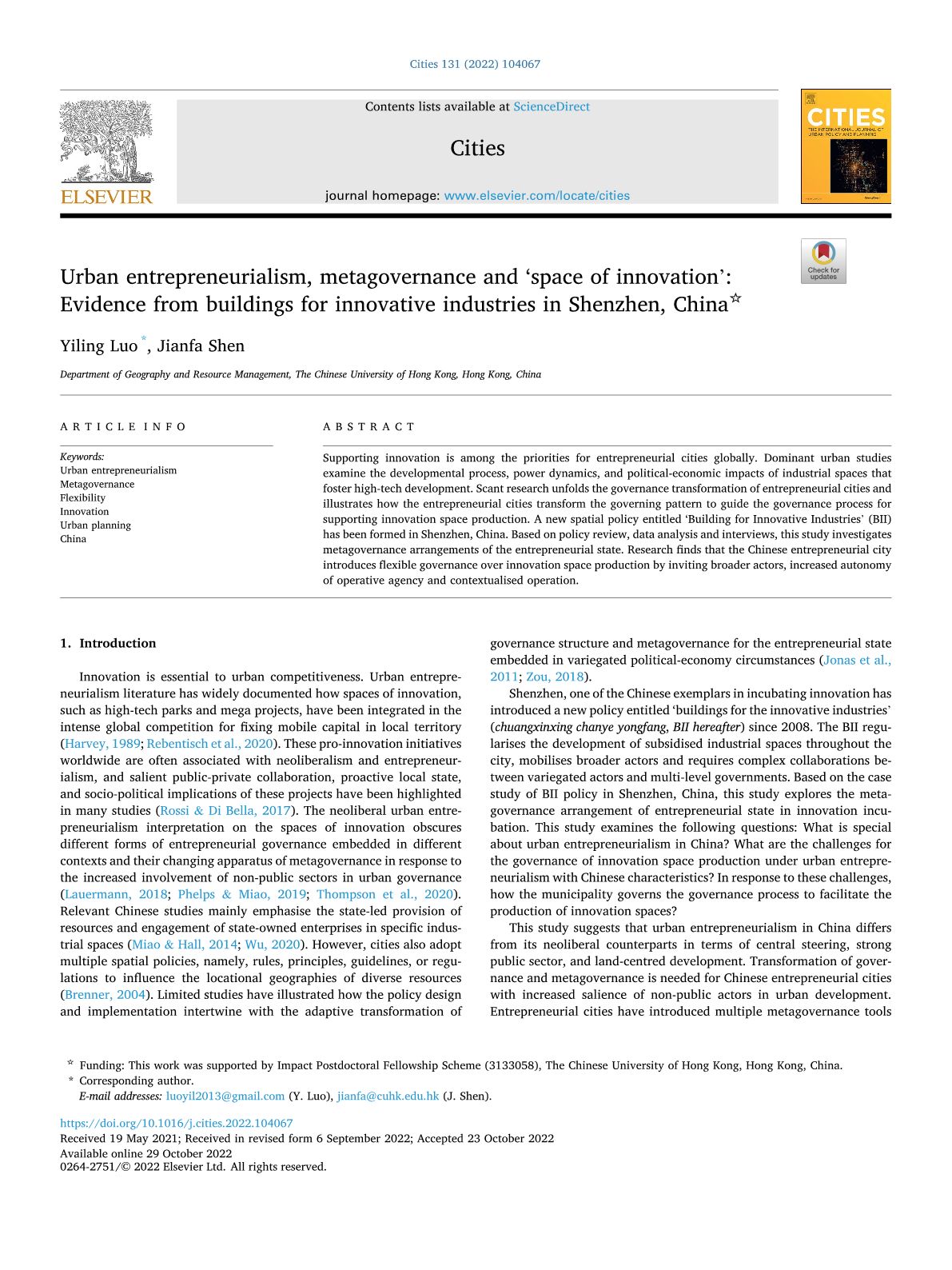
Supporting innovation is among the priorities for entrepreneurial cities globally. Dominant urban studies examine the developmental process, power dynamics, and political-economic impacts of industrial spaces that foster high-tech development. Scant research unfolds the governance transformation of entrepreneurial cities and illustrates how the entrepreneurial cities transform the governing pattern to guide the governance process for supporting innovation space production. A new spatial policy entitled ‘Building for Innovative Industries’ (BII) has been formed in Shenzhen, China. Based on policy review, data analysis and interviews, this study investigates metagovernance arrangements of the entrepreneurial state. Research finds that the Chinese entrepreneurial city introduces flexible governance over innovation space production by inviting broader actors, increased autonomy of operative agency and contextualised operation.

Hukou transfer intention of rural migrants with settlement intention in China: How cities’ administrative level matters

Chenglong Wang, Jianfa Shen, Ye Liu (2023). Hukou transfer intention of rural migrants with settlement intention in China: How cities’ administrative level matters. Journal of Rural Studies, 99, 1-10. https://doi.org/10.1016/j.jrurstud.2023.01.022

2022 Journal Impact Factor (JIF): 5.1

2022 JIF Rank in Subject Category: 9/86 (Top 10.5%)
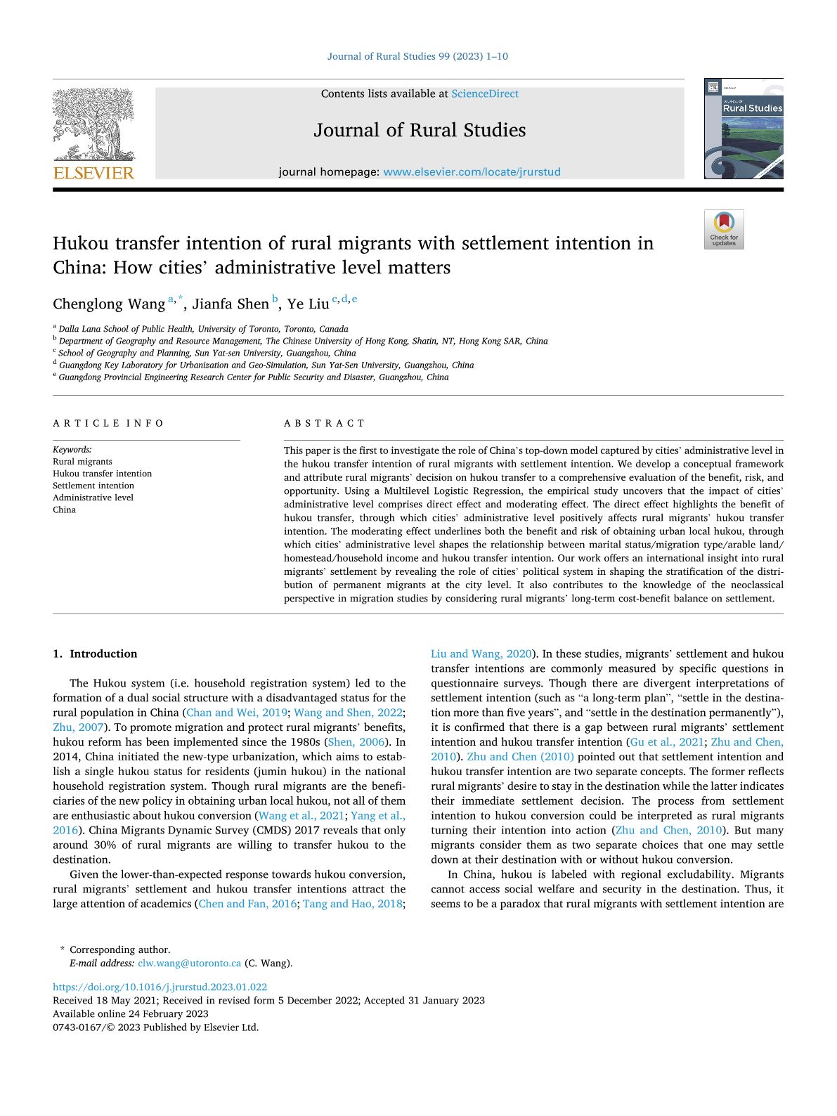
This paper is the first to investigate the role of China’s top-down model captured by cities’ administrative level in the hukou transfer intention of rural migrants with settlement intention. We develop a conceptual framework and attribute rural migrants’ decision on hukou transfer to a comprehensive evaluation of the benefit, risk, and opportunity. Using a Multilevel Logistic Regression, the empirical study uncovers that the impact of cities’ administrative level comprises direct effect and moderating effect. The direct effect highlights the benefit of hukou transfer, through which cities’ administrative level positively affects rural migrants’ hukou transfer intention. The moderating effect underlines both the benefit and risk of obtaining urban local hukou, through which cities’ administrative level shapes the relationship between marital status/migration type/arable land/homestead/household income and hukou transfer intention. Our work offers an international insight into rural migrants’ settlement by revealing the role of cities’ political system in shaping the stratification of the distribution of permanent migrants at the city level. It also contributes to the knowledge of the neoclassical perspective in migration studies by considering rural migrants’ long-term cost-benefit balance on settlement.

Reducing solar PV curtailment through demand-side management and economic dispatch in Karnataka, India

Balasubramanian Sambasivam, Yuan Xu (2023). Reducing solar PV curtailment through demand-side management and economic dispatch in Karnataka, India. Energy Policy,172, 113334. https://doi.org/10.1016/j.enpol.2022.113334

2022 Journal Impact Factor (JIF): 9.0

2022 JIF Rank in Subject Category: 8/380 (Top 2.1%)
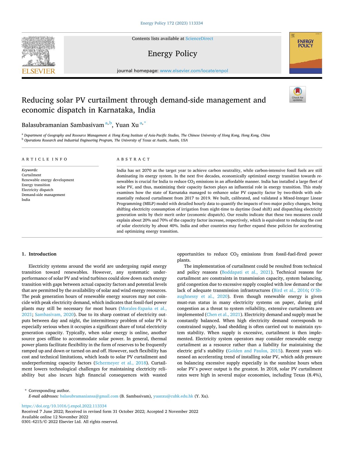
India has set 2070 as the target year to achieve carbon neutrality, while carbon-intensive fossil fuels are still dominating its energy system. In the next five decades, economically optimized energy transition towards renewables is crucial for India to reduce CO2 emissions in an affordable manner. India has installed a large fleet of solar PV, and thus, maximizing their capacity factors plays an influential role in energy transition. This study examines how the state of Karnataka managed to enhance solar PV capacity factor by two-thirds with substantially reduced curtailment from 2017 to 2019. We built, calibrated, and validated a Mixed-Integer Linear Programming (MILP) model with detailed hourly data to quantify the impacts of two major policy changes, being shifting electricity consumption of irrigation from night-time to daytime (load shift) and dispatching electricity generation units by their merit order (economic dispatch). Our results indicate that these two measures could explain about 20% and 70% of the capacity factor increase, respectively, which is equivalent to reducing the cost of solar electricity by about 40%. India and other countries may further expand these policies for accelerating and optimizing energy transition.

2023-24

Compound flood effects, challenges and solutions: Lessons toward climate-resilient Chinese coastal cities

Chan, F. K. S.*, Lu, X.*, Li, J.*, Lai, Y.*, Luo, M.*, Chen, Y. D., Wang, D., Li, N., Chen, W.-Q., Zhu, Y.-G., & Chan, H. K. (2024). Compound flood effects, challenges and solutions: Lessons toward climate-resilient Chinese coastal cities. Ocean & Coastal Management, 249, Article 107015. https://doi.org/10.1016/j.ocecoaman.2023.107015

2023 Journal Impact Factor (JIF): 4.8

2023 JIF Rank in Subject Category: 3/65 (Top 4.6%)

Compound flood events by storm-enhanced intensive rainfall and surges on coastal and inland surface water flooding are increasingly exacerbated, causing significant impacts in coastal cities. In light of climate change and the rapid urbanisation process, future flood risks and consequences of compound floods are growing. Among global coastal cities, Chinese coastal cities face substantial challenges reflected in recent flood impacts and damages. Here we investigate the previous compound flood sources, impacts, consequences, challenges, and more importantly the response measures from the case of Chinese coastal cities by integrating the media sources and governmental literature analyses. We have found that, during the last decade (the 2010s–2020s), the Chinese Central Government (CCG) and Municipality authorities have co-produced good practices to reduce compound flood impacts accordingly via efficient emergency responses, technological services (e.g., via mobile phones and apps), and improvement of the blue-green (i.e., via “Sponge City Program”) and adopted with the engineering measures standard in the coastal urban environment. For the advancement in the next 10 years and beyond, we encourage the governments to transform the Chinese coastal cities by further implementing the “Sponge”, Nature-Based Solutions mixed with communication technologies, engineering and meteorological perspectives. These practices are the keys to improving future Chinese coastal flood resilience in terms of reducing the risk and consequences of the compound flood generated by sea-level rise, storm surges and intensive rainstorms under climate uncertainties

Building resilience in Asian mega-deltas. Nature Reviews. Earth & Environment

Chan, F. K. S.*, Paszkowski, A.*, Wang, Z.*, Lu, X.*, Mitchell, G., Tran, D. D., Warner, J., Li, J., Chen, Y. D., Li, N., Pal, I., Griffiths, J., Chen, J., Chen, W.-Q., & Zhu, Y.-G. (2024). Building resilience in Asian mega-deltas. Nature Reviews. Earth & Environment, 5(7), 522–537. https://doi.org/10.1038/s43017-024-00561-x

2023 Journal Impact Factor (JIF): 49.7

2023 JIF Rank in Subject Category: 1/358 (Top 0.3%)

The five Asian mega-deltas (the Yangtze, the Pearl, the Chao Phraya, the Mekong and the Ganges–Brahmaputra–Meghna deltas) are home to approximately 80% of the global deltaic population and the region experiences 90% of global flood exposure. In this Review, we investigate the similarities and differences between the Asian mega-deltas to identify transferable lessons to improve climate resilience. The deltas are increasingly threatened by coastal flooding, saline intrusion and erosion caused by climate change and human activities such as groundwater extraction and dam construction. Owing to differences in the stages of their development, various resilience measures have been implemented. For example, the Ganges–Brahmaputra–Meghna and Mekong deltas use strategic delta plans to identify risk hotspots and guide decision-making. These deltas also increase resilience at a community level by supporting communities to diversify their livelihoods to respond to changing risks and land conditions. Meanwhile, the Yangtze and Pearl deltas have developed forecasting and sensing technologies to allow them to prepare for and respond to hazards effectively. The Asian mega-deltas should learn from one another to integrate effective resilience plans across regional, delta and community levels. Future cross-delta collaborations and knowledge transfer, for example through the formation of a Regional Delta Resilience Alliance, could help to achieve long-term sustainable delta management.

Essential but challenging climate change education in the Global South

Ma, J.*, & Chen, Y. D. (2023). Essential but challenging climate change education in the Global South. Nature Climate Change, 13(11), 1151–1153. https://doi.org/10.1038/s41558-023-01839-6

2023 Journal Impact Factor (JIF): 30.3

2023 JIF Rank in Subject Category: 1/182 (Top 0.5%)

Climate change education is crucial to countries in the Global South due to their contribution and vulnerability to the climate crisis. However, institutionalizing and implementing climate change education is particularly challenging in developing nations, given inadequate motivation and limited capacity.

Reconceiving China’s urban economic transition through symbiotic state-firm dynamics: An integrated perspective from urban governance and global production networks

Wang, K., Chung, C. K. L., Xu, J., & Long, Z. (2024). Reconceiving China’s urban economic transition through symbiotic state-firm dynamics: An integrated perspective from urban governance and global production networks. Cities, 150, Article 104974. https://doi.org/10.1016/j.cities.2024.104974 

2023 Journal Impact Factor (JIF): 6

2023 JIF Rank in Subject Category: 5/77 (Top 6.5%)

China’s urban economic transition since the 2000s has garnered considerable scholarly interest. Two distinct bodies of scholarship, namely urban governance and global production networks, have investigated this phenomenon, each offering unique insights either from an endogenous state-centric or exogenous firm-centric approach. The former has justifiably accentuated the centrality of the state in shaping Chinas urban-regional economic reconfiguration but lacks exploration of the multifaceted ways in which state apparatus engages with a spectrum of quotidian firm-level activities and the negotiation power these firms wield. The latter embraces an exogenous firm-centric perspective on the economic transition in East Asia latecomer regions, stressing forces of globalisation, foreign investment, and intra/inter/extra-firm networks, but tends to bracket the state into the institutional background and, therefore, downplays its agentic role. By initiating a dialogue between these two theoretical frameworks, this paper formulates a dialectical state-firm relational approach, offering a revitalised, integrative comprehension of China’s urban economic transformation. Employing Dongguan – a globally recognised hub for ICT manufacturing – as an empirical focal point, it elucidates how the relational statefirm dynamics evolve temporally, differ spatially across territories and scales, and display distinct contrasts between high-value-added and labour-intensive sectors within the ICT industry.

Geographies of green industries: The interplay of firms, technologies, and the environment

Zhou, Z., Chung, C. K. L., & Xu, J. (2023). Geographies of green industries: The interplay of firms, technologies, and the environment. Progress in Human Geography, 47(5), 680–698. https://doi.org/10.1177/03091325231188377

2023 Journal Impact Factor (JIF): 6.3

2023 JIF Rank in Subject Category: 6/171 (Top 3.5%)

The emergence of green industries has been considered from multiple social science perspectives. Economic geographers view green industries as unevenly distributed firms forging green development paths. Sustainability transitions scholars view green industries as niche sectors struggling to mainstream green technologies in existing socio-technical systems. Political ecologists view green industries as metabolic actors whose development shapes and is shaped by the environment. Conceptualizing green industries as the interplay of green firms, socio-technical systems and the environment, this article proposes an integrative framework that synthesizes the three aforementioned perspectives for a research agenda of the geographies of green industries.

The impact of greenspace proximity on stress levels and travel behavior among residents in Pasig city, Philippines during the COVID-19 pandemic

Barquilla, C. A. M., Lee, J.*, & He, S. Y. (2023). The impact of greenspace proximity on stress levels and travel behavior among residents in Pasig city, Philippines during the COVID-19 pandemic. Sustainable Cities and Society, 97, Article 104782. https://doi.org/10.1016/j.scs.2023.104782

2023 Journal Impact Factor (JIF): 10.5

2023 JIF Rank in Subject Category: 3/92 (Top 3.3%)

This study investigated the impact of greenspace proximity on stress levels and active travel behavior in post-lockdown Pasig City, Philippines. 307 residents took part in an online survey, sharing insights on mobility changes, park usage, and their perception of park and neighborhood. Pasig City’s greenspaces were classified as Nature parks, Linear parks, Town squares, and Community parks, based on their characteristics and usage. Proximity to these parks was measured via Network analysis in ArcGIS, and data underwent ordered regression analysis with interaction effects for different population groups. Results indicated that proximity to Nature and Community parks correlated with manageable stress levels, while residing near Linear parks was marginally associated with increased walking and cycling. Elderly and unemployed residents near parks experienced greater stress relief and physical activity. The study emphasized residents’ recognition of parks’ role in promoting relaxation and serenity, highlighting a shift in active travel behavior. Additionally, it underscored the potential health benefits of urban greenspaces, emphasizing the need to consider citizens’ subjective experiences when designing and maintaining them. Overall, the study suggests that greenspaces can play a crucial role in fostering well-being and active lifestyles, particularly during stressful and uncertain times.

Travel behavior changes due to life events: Longitudinal evidence from Dutch couple households

Gao, J.*, He, S. Y., Ettema, D., & Helbich, M. (2023). Travel behavior changes due to life events: Longitudinal evidence from Dutch couple households. Transportation Research. Part A, Policy and Practice, 175, Article 103765. https://doi.org/10.1016/j.tra.2023.103765

2023 Journal Impact Factor (JIF): 6.3

2023 JIF Rank in Subject Category: 28/597 (Top 4.7%)

Despite increasing interest in how travel behavior changes over time, few studies have investigated how life events alter travel behavior, especially from a household perspective. This study examined the extent to which life events influenced changes in travel mode frequencies at the household level. We applied structural equation modeling based on the Netherlands Mobility Panel data for 2014 and 2016. For both partners, acquiring a household car significantly increased car use, and disposing of household cars decreased car use frequency. The number of household cars was inversely related to men’s train use. Childbirth in the household decreased both partners’ cycling frequency. Men’s job changes increased train use. These findings emphasize that life events can influence changes in travel behavior within household partners.

Attitudes towards public transport under extended disruptions and massive-scale transit dysfunction: A Hong Kong case study

He, S.Y., Tao, S. and Sun, K.K. (2024). Attitudes towards public transport under extended disruptions and massive-scale transit dysfunction: A Hong Kong case study, Transport Policy, 149, 247-258. https://doi.org/10.1016/j.tranpol.2024.02.008

2023 Journal Impact Factor (JIF): 6.3

2023 JIF Rank in Subject Category: 28/597 (Top 4.7%)

Disruptions to transport systems often significantly change travel behaviour. This is especially true when the disruption lasts over an extended period and is accompanied by the massive-scale dysfunction of transit operations. In addition, although attitude is critical for predicting travel behaviour, there is little documentation of changes in attitudes towards transit modes and the factors influencing such changes during a transit system disruption. Furthermore, few studies have investigated how social movements can exert a pronounced disrupting effect on a transit system. To fill these research gaps and provide policy recommendations for a more responsive contingency plan in response to future transit system disruptions, our study aims to investigate this issue based on the case of Hong Kong during the 2019 social movement. We collected a questionnaire survey representing the period from late June to early July 2020, a few months after the end of the protests. Using structural equation models, we have examined how people’s attitudes towards different transit modes changed during the social movement. Our findings highlight that people’s perception of the city’s urban rail system – the Mass Transit Railway, which the government has a significant stake in and control over – worsened significantly during the transit disruption, but the effects were less pronounced for bus and mini-bus. In addition, attitudes towards the social movement were found to vary significantly across social groups, a finding linked to people’s attitudes towards different transit modes. Importantly, our study reveals that people’s views of social movements can significantly determine how they evaluate impacted and alternative transport modes during transit disruptions. These newly revealed attitudinal dimensions should be fully considered in predicting behavioural change and adjusting transit services under similar conditions.

Using mobile phone big data and street view images to explore the mismatch between walkability and walking behavior

He, X., & He, S. Y.* (2024). Using mobile phone big data and street view images to explore the mismatch between walkability and walking behavior. Transportation Research. Part A, Policy and Practice, 180, Article 103946. https://doi.org/10.1016/j.tra.2023.103946

2023 Journal Impact Factor (JIF): 6.3

2023 JIF Rank in Subject Category: 28/597 (Top 4.7%)

Stimulating more citizens to walk plays an essential role in building a healthy city. This paper explores the mismatch between walkability and walking behavior, using mobile phone data, street view images, and various sources of open data. Using Shenzhen as our case study, we identified walking trips of 6 months in 2021 from cellular mobile data, taking the rule-based heuristics approach. We collected ground truth GPS data to validate the walking trip extraction method. Open data and deep learning enabled quantifying walkability from the perspective of four pedestrian needs: safety, convenience, continuity, and attractiveness. We employed geospatial techniques to identify the mismatch areas between walkability and walking behavior in the city. We also explored the spatially varying effects of walkability on walking behavior. Our results showed that the mismatch areas with high-level walking trips but low-level walkability mainly occurred in the fringe areas of the central business district (CBD) and subcenters that require prioritizing more interventions. Moreover, walkability showed strong effects on walking trips in the inner suburbs. For the four aspects of our walkability framework, safety and convenience had greater positive effects on walking trips in suburbs than in urban areas. Continuity promotes walking trips mainly in the city’s western sector. The positive effect of attractiveness on walking trips clustered in the central and western parts of the city. Based on the findings, we provide prioritized and contextualized built-environment intervention strategies and policy recommendations for urban designers and transportation planners.

Analysis of links between dockless bikeshare and metro trips in Beijing

Zhan, Z., Guo, Y., Noland, R. B., He, S. Y., & Wang, Y.* (2023). Analysis of links between dockless bikeshare and metro trips in Beijing. Transportation Research. Part A, Policy and Practice, 175, Article 103784. https://doi.org/10.1016/j.tra.2023.103784

2023 Journal Impact Factor (JIF): 6.3

2023 JIF Rank in Subject Category: 28/597 (Top 4.7%)

In this study, we examine the factors associated with the integrated use of dockless bikesharing (DBS) and metros. Special attention is paid to the nonlinear effects of these factors, using machine learning; in this case, a random forest model and accumulated local effects (ALE) plots. We measure the integrated use of DBS and metros based on DBS data and metro smart card data in Beijing. Explanatory variables include metro station characteristics, road infrastructure, public transportation services, land use, and urban density, as well as meteorological variables. We find that metro ridership and DBS density around service areas are the most crucial factors for promoting cycling access/ egress near metro stations. After reaching the thresholds of 6,000 trips for metro ridership and 200 bikes/ per km2 for DBS density, notable joint effects are evident between the two variables, which are negative in egress trips but positive in access trips. Bicycle parking and bus transfer distance and their connectivity to metro stations are important for integrated use. We find that buses will be less competitive when exceeding 25 lines per station. Population density has a nonlinear effect, with a positive association below 9,000 persons/ km2 and a decreasing effect above this level. The land-use mix index was also found to be negatively associated with integrated use, and bicycle lanes are not associated with integrated use. Our results demonstrate that public transit service planning should consider the constraints of resources and public space, and we provide recommendations for governments and stakeholders to reallocate DBS and other public transit services around metro stations.

Bikesharing and equity: A nationwide study of bikesharing accessibility in the U.S.

Jin, S. T., Sui, D. Z. (2024). Bikesharing and equity: A nationwide study of bikesharing accessibility in the U.S. Transportation Research Part A: Policy and Practice, 181, Article 103983. https://doi.org/10.1016/j.tra.2024.103983

2023 Journal Impact Factor (JIF): 6.3

2023 JIF Rank in Subject Category: 28/597 (Top 4.7%)

Bikesharing has gained global popularity as a sustainable and healthy mobility option in recent years. However, concerns have been raised about the unequal distribution of bikesharing benefits among different geographic areas and social groups. This study aims to assess bikesharing equity at the census block group (CBG) level in 73 U.S. cities as of July 2022, utilizing a non-parametric generalized additive mixed model (GAMM). Our findings indicate that bikesharing equity varies depending on the indicators used to identify disadvantaged communities. We find that bikesharing is equitable for zero-vehicle communities, as they experience higher levels of accessibility. However, for communities characterized by high levels of deprivation and a significant concentration of minorities, females, youth, and senior populations, bikesharing is inequitable, as these disadvantaged communities have limited access to bikesharing stations compared to their more privileged counterparts. These results emphasize the need for future bikesharing equity programs to prioritize expanding service into underserved disadvantaged communities through installing new stations or transitioning into hybrid systems. In addition, this study suggests using Area Deprivation Index scores over 80 and minority population shares exceeding 70% as thresholds to identify disadvantaged communities, which accounted for 13.5% of the CBGs included in our analysis. Furthermore, gender inequality should be considered in transportation planning efforts.

Shared micromobility and equity: A comparison between station-based, hybrid, and dockless models

Jin, S. T., & Sui, D. Z. (2024). Shared micromobility and equity: A comparison between station-based, hybrid, and dockless models. Transportation Research Part D, Transport and Environment, 129, Article 104113. https://doi.org/10.1016/j.trd.2024.104113

2023 Journal Impact Factor (JIF): 7.3

2023 JIF Rank in Subject Category: 5/57 (Top 8.8%)

This study compares the equality and equity of four shared micromobility models, including station-based bikesharing, hybrid e-bike sharing, hybrid e-scooter sharing, and dockless e-scooter sharing, with a case study in Minneapolis, Minnesota. Equality assessment is made using Lorenz curves and Gini coefficients, which reveals that hybrid and dockless models are relatively more equal than the station-based model. Equity assessment is conducted using regression analysis. Results on supply equity show that station-based and hybrid models are more equitable than the dockless model, as they allocate more devices to economically disadvantaged areas. Regarding utilization equity, regression models yield mixed results: depending on the disadvantaged indicators used to identify disadvantaged communities, both the station-based and hybrid/dockless models can exhibit characteristics of equity or inequity. Overall, our findings suggest that the hybrid model shows the most promising potential for improving both the equality and equity of the spatial distribution of shared micromobility services.

Identifying urban green space deserts by considering different walking distance thresholds for healthy and socially equitable city planning in the Global South

Ahmed, N., Lee, J.*, Liu, D., Kan, Z., & Wang, J. (2023). Identifying urban green space deserts by considering different walking distance thresholds for healthy and socially equitable city planning in the Global South. Urban Forestry & Urban Greening, 89, Article 128123. https://doi.org/10.1016/j.ufug.2023.128123

2023 Journal Impact Factor (JIF): 6

2023 JIF Rank in Subject Category: 2/89 (Top 2.2%)

A lingering question in the research on urban green space (UGS) availability in the Global South is which walking distance threshold should be used due to the absence of consensus on that in the literature and planning guidelines. This paper answers that question by developing an analytical framework for identifying UGS deserts – areas without adequate UGS availability level – considering various walking distance thresholds. We first demonstrate how geographic distributions of UGS deserts can change depending on different walking distance thresholds (e.g., 100, 300, 500 m) of choice. Unreliable and inaccurate detection of UGS deserts can hinder evidence-based land use planning for promoting healthy cities and result in erroneous social equity evaluation. To overcome this limitation, we introduce and examine robust UGS oases and deserts: geographic areas with and without the per capita green space (PCG) level recommended by a local government regardless of different walking distance thresholds used, respectively. With the identified robust UGS deserts and oases, we perform a social equity analysis to investigate inequality and whether there are systematic disadvantages for socioeconomically vulnerable populations to access UGS in Dhaka, a rapidly developing capital city in Bangladesh. The robust UGS deserts approach enables more reliable and informed decision-making to enhance UGS availability and its social equity, thereby facilitating an optimal development of urban policy for healthy cities. More practically, our robust UGS deserts method can be an effective alternative to detect UGS deserts when guidelines for walking distance thresholds are missing which is often the case in low- and middle-income countries.

Measuring exposure and contribution of different types of activity travels to traffic congestion using GPS trajectory data

Kan, Z.*, Liu, D., Yang, X., & Lee, J. (2024). Measuring exposure and contribution of different types of activity travels to traffic congestion using GPS trajectory data. Journal of Transport Geography, 117, Article 103896. https://doi.org/10.1016/j.jtrangeo.2024.103896

2023 Journal Impact Factor (JIF): 5.7

2023 JIF Rank in Subject Category: 7/171 (Top 4.1%)

This study proposes a data-driven framework for understanding the space-time patterns of exposure and contribution of different activities to traffic congestion in urban road networks by using GPS trajectory and Point-of-Interest (POI) big datasets. Taking taxi trips related to traffic congestion in Wuhan, China as a case study, we first infer the types of individual activities from GPS trajectories and POIs and identify traffic congestion on each road. Then we develop two indicators to measure the congestion exposure of different activity types. Further, we reveal the space-time patterns of activity-related congestion through spatiotemporal analysis of the indicators of traffic congestion associated with different activities. The findings of this study shed light on how different types of activities contribute to the space-time heterogeneity of traffic congestion, and highlight the significance of considering the space-time patterns of congestion related with different activity types in urban transportation management.

A Spatial Network-Based Assessment of Individual Exposure to COVID-19

Kan, Z., Mei-Po Kwan, Huang, J., Cai, J., & Liu, D. (2024). A Spatial Network-Based Assessment of Individual Exposure to COVID-19. Annals of the Association of American Geographers, 114(8), 1693–1703. https://doi.org/10.1080/24694452.2023.2266021

2023 Journal Impact Factor (JIF): 3.81

2023 JIF Rank in Subject Category: 7/84 (Top 8.3%)

This study seeks to examine the possible impacts of sociodemographic factors, individual mobility patterns, and daily activities on individual exposure to COVID-19 risk when assessed by different risk measures. Taking Hong Kong as the study area, we first model the risk of COVID-19 using a density-based approach and a network-based approach and reveal the differences in the spatial distributions of COVID-19 transmission risk they obtained. Then, using two-day individual Global Positioning System trajectory data and travel diaries collected from individuals in two communities, we measure individual exposure to COVID-19 transmission risk based on their mobility patterns and reveal the disparities in COVID-19 risk exposure among residents of different demographic groups and neighborhoods when conducting different activities. This study reveals the differences in the spatial patterns of COVID-19 transmission risk when the risk is conceptualized by density and network. It demonstrates the power of a spatial network approach in enhancing our understanding of individual exposure to infectious diseases. This study also advances the existing literature by exploring COVID-19 risk exposure, considering individual daily mobility and addressing the uncertain geographic context problem in analyzing individual COVID-19 risk exposure.

Comparing subjective and objective greenspace accessibility: Implications for real greenspace usage among adults

Liu, D., Kwan, M. P.*, Yang, Z., & Kan, Z. (2024). Comparing subjective and objective greenspace accessibility: Implications for real greenspace usage among adults. Urban Forestry & Urban Greening, 96, Article 128335. https://doi.org/10.1016/j.ufug.2024.128335

2023 Journal Impact Factor (JIF): 6

2023 JIF Rank in Subject Category: 2/89 (Top 2.2%)

This study investigates the relationship between subjective greenspace perception and objective greenspace accessibility as well as the significant factors associated with higher real greenspace usage based on survey data collected in Hong Kong. The results reveal that there is no statistically significant relationship between subjective greenspace perception and objective greenspace accessibility. In terms of the factors contributing to higher real greenspace usage, we found that males tend to utilize greenspaces more frequently than females, while older individuals exhibit a higher frequency of engagement with greenspaces compared to younger individuals. Subjective greenspace perception emerged as a significant predictor of greenspace usage patterns, indicating the importance of creating attractive, safe, and inclusive greenspaces. However, objective greenspace accessibility did not have a significant correlation with actual greenspace usage, highlighting the importance of perceptions in affecting individual decisions on greenspace usage. These findings provide valuable insights for urban planners and policymakers in creating gender-inclusive and age-friendly greenspaces that meet the diverse needs and preferences of the population, ultimately contributing to the well-being and quality of life in Hong Kong and beyond.

How mobility pattern shapes the association between static greenspace and dynamic greenspace exposure

Zheng, L., Kwan, M.-P.*, Liu, Y., Liu, D., Huang, J., & Kan, Z. (2024).  How mobility pattern shapes the association between static greenspace and dynamic greenspace exposure. Environmental Research, 258, Article 119499. https://doi.org/10.1016/j.envres.2024.119499

2023 Journal Impact Factor (JIF): 7.7

2023 JIF Rank in Subject Category: 15/403 (Top 3.7%)

Greenspaces are crucial for enhancing mental and physical health. Recent research has shifted from static methods of assessing exposure to greenspaces, based on fixed locations, to dynamic approaches that account for individual mobility. These dynamic evaluations utilize advanced technologies like GPS tracking and remote sensing to provide more precise exposure estimates. However, little work has been conducted to compare dynamic and static exposure assessments and the effect of individual mobility on these evaluations. This study delves into how greenspaces around homes and workplaces, along with mobility patterns, affect dynamic greenspace exposure in Hong Kong. Data was collected from 787 participants in four communities in Hong Kong using GPS, portable sensors, and surveys. Using multiple statistical tests, our study revealed significant variations in participants’ daily mobility patterns across socio-demographic and temporal factors. Further, using linear mixed-effects models, we identified complex and statistically significant interactions between participants’ static greenspace exposure and their mobility patterns. Our findings suggest that individual mobility patterns significantly modify the relationship between static and dynamic greenspace exposure and play a critical role in explaining socio-demographic and temporal context differences in the relationship between static and dynamic greenspace exposure.

Iterative integration of deep learning in hybrid Earth surface system modelling

Chen, M., Qian, Z., Boers, N., Jakeman, A. J., Kettner, A. J., Brandt, M., Kwan, M. P., Batty, M., Li, W., Zhu, R., Luo, W., Ames, D. P., Barton, C. M., Cuddy, S. M., Koirala, S., Zhang, F., Ratti, C., Liu, J., Zhong, T., … Lü, G. (2023). Iterative integration of deep learning in hybrid Earth surface system modelling. Nature Reviews. Earth & Environment, 4(8), 568–581. https://doi.org/10.1038/s43017-023-00452-7

2023 Journal Impact Factor (JIF): 49.7

2023 JIF Rank in Subject Category: 1/358 (Top 0.3%)

Earth system modelling (ESM) is essential for understanding past, present and future Earth processes. Deep learning (DL), with the data-driven strength of neural networks, has promise for improving ESM by exploiting information from Big Data. Yet existing hybrid ESMs largely have deep neural networks incorporated only during the initial stage of model development. In this Perspective, we examine progress in hybrid ESM, focusing on the Earth surface system, and propose a framework that integrates neural networks into ESM throughout the modelling lifecycle. In this framework, DL computing systems and ESM-related knowledge repositories are set up in a homogeneous computational environment. DL can infer unknown or missing information, feeding it back into the knowledge repositories, while the ESM-related knowledge can constrain inference results of the DL. By fostering collaboration between ESM-related knowledge and DL systems, adaptive guidance plans can be generated through question-answering mechanisms and recommendation functions. As users interact iteratively, the hybrid system deepens its understanding of their preferences, resulting in increasingly customized, scalable and accurate guidance plans for modelling Earth processes. The advancement of this framework necessitates interdisciplinary collaboration, focusing on explainable DL and maintaining observational data to ensure the reliability of simulations.

A Spatial Network-Based Assessment of Individual Exposure to COVID-19

Kan, Z., Mei-Po Kwan, Huang, J., Cai, J., & Liu, D. (2024). A Spatial Network-Based Assessment of Individual Exposure to COVID-19. Annals of the Association of American Geographers, 114(8), 1693–1703. https://doi.org/10.1080/24694452.2023.2266021

2023 Journal Impact Factor (JIF): 3.81

2023 JIF Rank in Subject Category: 7/84 (Top 8.3%)

This study seeks to examine the possible impacts of sociodemographic factors, individual mobility patterns, and daily activities on individual exposure to COVID-19 risk when assessed by different risk measures. Taking Hong Kong as the study area, we first model the risk of COVID-19 using a density-based approach and a network-based approach and reveal the differences in the spatial distributions of COVID-19 transmission risk they obtained. Then, using two-day individual Global Positioning System trajectory data and travel diaries collected from individuals in two communities, we measure individual exposure to COVID-19 transmission risk based on their mobility patterns and reveal the disparities in COVID-19 risk exposure among residents of different demographic groups and neighborhoods when conducting different activities. This study reveals the differences in the spatial patterns of COVID-19 transmission risk when the risk is conceptualized by density and network. It demonstrates the power of a spatial network approach in enhancing our understanding of individual exposure to infectious diseases. This study also advances the existing literature by exploring COVID-19 risk exposure, considering individual daily mobility and addressing the uncertain geographic context problem in analyzing individual COVID-19 risk exposure.

Examining the effects of station-level factors on metro ridership using multiscale geographically weighted regression

Li, M., Kwan, M.-P., Hu, W., Li, R., & Wang, J. (2023). Examining the effects of station-level factors on metro ridership using multiscale geographically weighted regression. Journal of Transport Geography, 113, Article 103720. https://doi.org/10.1016/j.jtrangeo.2023.103720

2023 Journal Impact Factor (JIF): 5.7

2023 JIF Rank in Subject Category: 7/171 (Top 4.1%)

Metro systems provide a mass and sustainable mobility option for urban populations. Drawing on the ridership data in 2019 released by the Shanghai Municipal Transportation Commission, we examine the spatially varying effects of station-level factors measured with different metro-station catchments (MSCs) on the daily and hourly ridership through multiscale geographically weighted regression (MGWR) models. The results indicate that independent variables measured with relatively small and non-overlapping MSCs can better explain the spatial variations in metro ridership. Regarding the important determinants, land use intensity (LUI) demonstrates positive effects diminishing from the core to the peripheral areas, transfer lines (TL) also exhibits positive effects that decrease from southwest to northeast. The effects of road density (RD) and building density (BD) are negative in central urban areas but positive in suburbs, which is the opposite of bus lines (BL). Additionally, the explanatory variables have significantly different ranges of influence, and the range of influence for a single variable also varies across models that use ridership at different times (e.g., weekdays vs. non-weekdays, the morning/evening peak vs. non-peak hours) as dependent variables. This study expands the knowledge of the spatial variations in the relationship between metro ridership and the geographical determinants. The findings can provide empirical evidence and implications for urban planners in formulating context-specific policies to improve the usage of metro systems.

Comparing subjective and objective greenspace accessibility: Implications for real greenspace usage among adults

Liu, D., Kwan, M. P.*, Yang, Z., & Kan, Z. (2024). Comparing subjective and objective greenspace accessibility: Implications for real greenspace usage among adults. Urban Forestry & Urban Greening, 96, Article 128335. https://doi.org/10.1016/j.ufug.2024.128335

2023 Journal Impact Factor (JIF): 6

2023 JIF Rank in Subject Category: 2/89 (Top 2.2%)

This study investigates the relationship between subjective greenspace perception and objective greenspace accessibility as well as the significant factors associated with higher real greenspace usage based on survey data collected in Hong Kong. The results reveal that there is no statistically significant relationship between subjective greenspace perception and objective greenspace accessibility. In terms of the factors contributing to higher real greenspace usage, we found that males tend to utilize greenspaces more frequently than females, while older individuals exhibit a higher frequency of engagement with greenspaces compared to younger individuals. Subjective greenspace perception emerged as a significant predictor of greenspace usage patterns, indicating the importance of creating attractive, safe, and inclusive greenspaces. However, objective greenspace accessibility did not have a significant correlation with actual greenspace usage, highlighting the importance of perceptions in affecting individual decisions on greenspace usage. These findings provide valuable insights for urban planners and policymakers in creating gender-inclusive and age-friendly greenspaces that meet the diverse needs and preferences of the population, ultimately contributing to the well-being and quality of life in Hong Kong and beyond.

Application of the local colocation quotient method in jobs-housing balance measurement based on mobile phone data: A case study of Nanjing City

Liu, H., Kwan, M.-P., Hua, M., Wang, H., & Zheng, J. (2024). Application of the local colocation quotient method in jobs-housing balance measurement based on mobile phone data: A case study of Nanjing City. Computers, Environment and Urban Systems, 109, Article 102079. https://doi.org/10.1016/j.compenvurbsys.2024.102079

2023 Journal Impact Factor (JIF): 7.1

2023 JIF Rank in Subject Category: 5/171 (Top 2.9%)

The issue of jobs-housing balance concerns the sustainable development of cities and the well-being of residents. Conventional measurement approaches, however, often fall short due to the zoning problem (as a subproblem of the modifiable areal unit problem), leading to inconsistent and inaccurate results depending on the spatial partitioning scheme applied. This paper discusses the application and advantages of the local colocation quotient method in jobs-housing balance measurement. A case study of Nanjing, China, is selected, and mobile location data are used to obtain the jobs and housing locations of workers. Then, the adjusted jobs-workers ratio and the local colocation quotient values that reflect the degree of jobs-housing balance are calculated and compared by category. The results show that on the one hand, due to the zoning effect, when points are aggregated into spatial units, some points with different spatial characteristics are masked by the dominant value of the units; on the other hand, the local colocation quotient method can solve the zoning problem and obtain more fine-scale and accurate results, thus providing a new analytical tool and perspective for this field.

Current methods for evaluating people’s exposure to green space: a scoping review

Liu, Y.*, Kwan, M. P., Wong, M. S., & Yu, C. (2023). Current methods for evaluating people’s exposure to green space: a scoping review. Social Science & Medicine, 338, Article 116303. https://doi.org/10.1016/j.socscimed.2023.116303 

2023 Journal Impact Factor (JIF): 4.9

2023 JIF Rank in Subject Category: 37/408 (Top 9.1%)

People’s exposure to green space is a critical link between urban green space and urban residents’ health. Since green space may affect human health through multiple pathways regarding diverse human health outcomes, the measurement of people’s exposure to green space must be tailored to concrete study contexts and research questions. In this scoping review, we systematically categorized the available green space representations and metrics in the last two decades that can be used to derive people’s exposure to green space regarding different research topics. A three-phase systematic review was conducted after a generalized search of relevant research articles from the three most-used publication databases, namely Scopus, the Web of Science, and PubMed. We identified 260 research articles that particularly discuss green space representations and metrics. We further developed a multi-pathway framework to articulate the complicated context issues in green space studies. We categorized the most relevant green space representations and metrics into five groups, including green space indices, the delineation, inventory, and usage of green space, the spatiotemporal evolution of green space, the attributes and components of green space, and the green space landscape and fragmentation. Finally, we discussed the inter-conversion between different green space representations and metrics, the “mobility-turn” in green space studies and how it may affect the derivation of people’s exposure to green space, and other potential methodological issues in measuring people’s exposure to green space. Our scoping review provides the most comprehensive framework and categories for deriving people’s exposure to green space to date, which may strongly support a broad range of studies that concern green space’s health effects.

Confounding associations between green space and outdoor artificial light at night: Systematic investigations and implications for urban health

Liu, Y., Kwan, M.-P., Wang, J., & Cai, J. (2024). Confounding associations between green space and outdoor artificial light at night: Systematic investigations and implications for urban health. Environmental Science and Ecotechnology, 21, Article 100436. https://doi.org/10.1016/j.ese.2024.100436

2023 Journal Impact Factor (JIF): 14

2023 JIF Rank in Subject Category: 9/358 (Top 2.5%)

Excessive urbanization leads to considerable nature deficiency and abundant artificial infrastructure in urban areas, which triggered intensive discussions on people’s exposure to green space and outdoor artificial light at night (ALAN). Recent academic progress highlights that people’s exposure to green space and outdoor ALAN may be confounders of each other but lacks systematic investigations. This study investigates the associations between people’s exposure to green space and outdoor ALAN by adopting the three most used research paradigms: population-level residence-based, individual-level residence-based, and individual-level mobility-oriented paradigms. We employed the green space and outdoor ALAN data of 291 Tertiary Planning Units in Hong Kong for population-level analysis. We also used data from 940 participants in six representative communities for individual-level analyses. Hong Kong green space and outdoor ALAN were derived from high-resolution remote sensing data. The total exposures were derived using the spatiotemporally weighted approaches. Our results confirm that the negative associations between people’s exposure to green space and outdoor ALAN are universal across different research paradigms, spatially non-stationary, and consistent among different socio-demographic groups. We also observed that mobility-oriented measures may lead to stronger negative associations than residence-based measures by mitigating the contextual errors of residence-based measures. Our results highlight the potential confounding associations between people’s exposure to green space and outdoor ALAN, and we strongly recommend relevant studies to consider both of them in modeling people’s health outcomes, especially for those health outcomes impacted by the co-exposure to them.

Geographic uncertainties in external exposome studies: A multi-scale approach to reduce exposure misclassification

Tian, T., Kwan, M.-P., Vermeulen, R.C.H., & Helbich, M. (2024). Geographic uncertainties in external exposome studies: A multi-scale approach to reduce exposure misclassification. Science of the Total Environment, 906, Article 167637. https://doi.org/10.1016/j.scitotenv.2023.167637

2023 Journal Impact Factor (JIF): 8.2

2023 JIF Rank in Subject Category: 31/358 (Top 8.7%)

Background: Many studies on environment-health associations have emphasized that the selected buffer size (i.e., the scale of the geographic context when exposures are assigned at people’s address location) may affect estimated effect sizes. However, there is limited methodological progress in addressing these buffer size-related uncertainties. Aim: We aimed to 1) develop a statistical multi-scale approach to address buffer-related scale effects in cohort studies, and 2) investigate how environment-health associations differ between our multi-scale approach and ad hoc selected buffer sizes. Methods: We used lacunarity analyses to determine the largest meaningful buffer size for multiple high-resolution exposure surfaces (i.e., fine particulate matter [PM2.5], noise, and the normalized difference vegetation index [NDVI]). Exposures were linked to 7.7 million Dutch adults at their home addresses. We assigned exposure estimates based on buffers with fine-grained distance increments until the lacunarity-based upper limit was reached. Bayesian Cox model averaging addressed geographic uncertainties in the estimated exposure effect sizes within the exposure-specific upper buffer limits on mortality. Z-tests assessed statistical differences between averaged effect sizes and those obtained through pre-selected 100, 300, 1200, and 1500 m buffers. Results: The estimated lacunarity curves suggested exposure-specific upper buffer size limits; the largest was for NDVI (960 m), followed by noise (910 m) and PM2.5 (450 m). We recorded 845,229 deaths over eight years of follow-up. Our multi-scale approach indicated that higher values of NDVI were health-protectively associated with mortality risk (hazard ratio [HR]: 0.917, 95 % confidence interval [CI]: 0.886–0.948). Increased noise exposure was associated with an increased risk of mortality (HR: 1.003, 95 % CI: 1.002–1.003), while PM2.5 showed null associations (HR:0.998, 95 % CI: 0.997–1.000). Effect sizes of NDVI and noise differed significantly across the averaged and prespecified buffers (p < 0.05). Conclusions: Geographic uncertainties in residential-based exposure assessments may obscure environment-health associations or risk spurious ones. Our multi-scale approach produced more consistent effect estimates and mitigated contextual uncertainties.

Extracting hierarchical boundaries of places from noisy geotagged user-generated content

Wang, J.*, Kwan, M. P., Xiu, G., Wang, Y., & Liu, Y. (2023). Extracting hierarchical boundaries of places from noisy geotagged user-generated content. International Journal of Applied Earth Observation and Geoinformation, 122, Article 103455. https://doi.org/10.1016/j.jag.2023.103455

2023 Journal Impact Factor (JIF): 7.6

2023 JIF Rank in Subject Category: 6/63 (Top 9.5%)

A place reflects the collective cognition of the geographical extent and semantics of a named spatial domain, acting as a vital reference to a particular space in daily discourse. Boundaries and toponyms are essential identifiers of places. Frameworks that are efficient in real-world boundary determination of cognitive places are still missing. The emergence of a large amount of geotagged user-generated content (geo-UGC) offers new opportunities to model the place boundaries from a more human-centric perspective. However, the broad geographical scales of places and the noise in geo-UGC data conflict with traditional approaches that only focus on places with similar spatial extents. In this paper, we advocate considering spatial hierarchy when determining place boundaries. We propose the Hierarchical Place Detector (HPD), a framework that composes noise detection, spatial hierarchy reconstruction, and boundary extraction, to rebuild the boundaries and spatial hierarchy of places from geo-UGC. The HPD is a state-of-the-art framework for determining and organizing place boundaries by the spatial hierarchy, thereby preserving morphology and geographical relationships among places. The hierarchical boundaries could be fundamental analytical units in various downstream applications, including spatial visualization, geographical information retrieval, navigation services, and spatial interaction modelling.

Assessing the fluctuations in job accessibility under travel time uncertainty

Wang, J., Kwan, M. P.*, & Xiu, G. (2024). Assessing the fluctuations in job accessibility under travel time uncertainty. Applied Geography, 167, Article 103296. https://doi.org/10.1016/j.apgeog.2024.103296

2023 Journal Impact Factor (JIF): 4

2023 JIF Rank in Subject Category: 15/172 (Top 8.7%)

The rapid pace of urbanization and population growth has led to heightened traffic congestion and extended commuting distances, consequently amplifying uncertainties in travel times. For decades, studies have employed average or median travel time to assess job accessibility while neglecting variations and uncertainty in travel time, ultimately leading to imprecise evaluations of urban job accessibility. To bridge this gap, this study investigates the temporal fluctuations in job accessibility with the Accessibility Buffer Index (ABI), which measures the proportionate reduction in accessibility when the transport system fails to operate optimally. Gathering speed data at the street level in Beijing from January to June 2022, we utilize the cumulative-opportunity model with three distinct travel budgets (15 min, 30 min, and 45 min) to finely estimate daily job accessibility in spatiotemporal detail. Our findings reveal significant spatial heterogeneity in job accessibility and ABI, highlighting notable disparities in their spatial distribution. Through the use of ABI, our study offers valuable empirical evidence regarding the characteristics of accessibility fluctuations, thereby presenting a novel perspective to enhance sustainable and reliable urban transportation.

Investigating the neighborhood effect averaging problem (NEAP) in greenspace exposure: A study in Beijing

Wang, J., Kwan, M. P., Xiu, G., Peng, X., & Liu, Y. (2024). Investigating the neighborhood effect averaging problem (NEAP) in greenspace exposure: A study in Beijing. Landscape and Urban Planning, 243, Article 104970. https://doi.org/10.1016/j.landurbplan.2023.104970

2023 Journal Impact Factor (JIF): 7.9

2023 JIF Rank in Subject Category: 3/171 (Top 1.8%)

Urban greenspaces are pivotal in enhancing the well-being and health of city residents. Accurate assessment of an individual’s exposure to these natural settings is thus crucial in urban greenspace planning. However, the dynamic nature of human mobility, which determines the amount of greenspace exposure accessed over time and space, often leads to a divergence between the actual Mobility-Based Exposure (MBE) and the traditional Residence-Based Exposure (RBE). This discrepancy, encapsulated as the neighborhood effect averaging problem (NEAP), prompted us to examine the bias introduced by such discrepancy and its association with various human-based factors. This study delves into the complex interplay among the NEAP, individual mobility patterns, and demographic characteristics with fine-resolution estimations in Beijing, aiming to provide a nuanced understanding of the NEAP’s influence. Uncovering heterogeneous patterns of disparity between RBE and MBE across distinct geographical realms and sociodemographic cohorts, and how such effects are mediated by populations with diverse mobility traits, the study illuminates the prevalence and complexity of the NEAP. Younger individuals, the employed population, those with larger activity spaces, high visitation diversity, and travel frequency, and residents living in areas with significant deviations from mean RBE levels experience a more pronounced NEAP impact. These insights contribute to a holistic grasp of the NEAP and underscore the imperative of inclusive greenspace urban planning that caters to the diverse mobility patterns and disparities among residents from different demographic groups, offering invaluable guidance for policy interventions to amplify greenspace exposure and address health disparities.

How mobility pattern shapes the association between static greenspace and dynamic greenspace exposure

Zheng, L., Kwan, M.-P., Liu, Y., Liu, D., Huang, J., & Kan, Z. (2024).  How mobility pattern shapes the association between static greenspace and dynamic greenspace exposure. Environmental Research, 258, Article 119499. https://doi.org/10.1016/j.envres.2024.119499

2023 Journal Impact Factor (JIF): 7.7

2023 JIF Rank in Subject Category: 15/403 (Top 3.7%)

Greenspaces are crucial for enhancing mental and physical health. Recent research has shifted from static methods of assessing exposure to greenspaces, based on fixed locations, to dynamic approaches that account for individual mobility. These dynamic evaluations utilize advanced technologies like GPS tracking and remote sensing to provide more precise exposure estimates. However, little work has been conducted to compare dynamic and static exposure assessments and the effect of individual mobility on these evaluations. This study delves into how greenspaces around homes and workplaces, along with mobility patterns, affect dynamic greenspace exposure in Hong Kong. Data was collected from 787 participants in four communities in Hong Kong using GPS, portable sensors, and surveys. Using multiple statistical tests, our study revealed significant variations in participants’ daily mobility patterns across socio-demographic and temporal factors. Further, using linear mixed-effects models, we identified complex and statistically significant interactions between participants’ static greenspace exposure and their mobility patterns. Our findings suggest that individual mobility patterns significantly modify the relationship between static and dynamic greenspace exposure and play a critical role in explaining socio-demographic and temporal context differences in the relationship between static and dynamic greenspace exposure.

Impacts of street tree abundance, greenery, structure and management on residential house prices in New York City

Lin, J., Huang, B., Wang, Q., Chen, M., Lee, H.F., and Kwan, M.P. (2024). Impacts of street tree abundance, greenery, structure and management on residential house prices in New York City. Urban Forestry & Urban Greening, 94, Article 128288. https://doi.org/10.1088/1748-9326/ad28d9

2023 Journal Impact Factor (JIF): 6

2023 JIF Rank in Subject Category: 2/89 (Top 2.2%)

Urban trees have been widely linked to residential house prices. However, most existing studies focus on using tree abundance and greenery measures to evaluate the economic benefits of urban trees, while disregarding the effects of tree structure and tree-related management such as intentional maintenance and stewardship. We hypothesize that tree abundance, greenery, structure, and tree-related management are associated with house prices through offering local benefits that accrue to private homeowners and providing desirable living environments. We take street trees in New York City (NYC) as a case study to test the hypothesis. We first derived street tree canopy cover from high-resolution satellite images, street greenery from Google Street View, and street tree structure (e.g., species diversity, tree size, and tree health) and streetscape management variables (e.g., tree stewardship, tree guards that are a man-made structure to protect trees and enhance tree growth, and sidewalk damages adjacent to street trees) from the 2015–2016 street tree census data in NYC. We then built spatial hedonic price models to examine the associations between the above-mentioned street tree variables and residential house prices, after controlling for a variety of covariates. We found that HPMs that incorporate street tree structure and streetscape management offer stronger explanatory power than the one with only street tree abundance. Among the street tree-related variables we considered, tree canopy cover, green view index, tree stewardship and tree guards are statistically associated with increased house prices, while there are no such relationships for species richness, trees’ health status and streetscape sidewalk damages. More research is needed to understand the potential mechanisms and causal pathways that urban tree abundance, structure, and management affect residential house prices.

Soil organic nitrogen content and composition in different wetland habitat types along the south-east coast of China

Lin, X., Yang, Y., Yang, P., Hong, Y., Zhang, L., Tong, C., Lai, D.Y.F., Lin, Y., Tan, L., Tian, Y., & Tang, K.W. (2023). Soil organic nitrogen content and composition in different wetland habitat types along the south-east coast of China. Catena, 232, Article 107457. https://doi.org/10.1016/j.catena.2023.107457

2023 Journal Impact Factor (JIF): 5.4

2023 JIF Rank in Subject Category: 24/253 (Top 9.5%)

Soil organic nitrogen (SON) turnover regulates soil nitrogen (N) storage and availability. The coastal mudflats (MFs) in China have undergone drastic transformation due to invasive Spartina alterniflora (SAs) and subsequent reclamation of Spartina marshes to create aquaculture ponds (APs), but the impact on the amounts and compositions of soil nitrogen remains unclear. This study measured the topsoil total nitrogen (STN) and organic nitrogen (SON) compositions in 21 coastal wetlands in southeastern China. Results show that conversion of MFs to SAs increased STN by 38.5%, whereas subsequent conversion to APs decreased it by 16.4%, and the effect was consistent across the broad geographic and climate gradients. Most of the change occurred in the non-acid-hydrolysable fraction of SON, which accounted for 32–42% of STN. Within the acid-hydrolysable fraction, amino acid N, ammonia N and amino sugar N together accounted for about 57%, with the remaining 43% unidentified chemically. Our results suggest that invasion by S. alterniflora was the overwhelming driver to increase bioavailability of nitrogen and related biogeochemical processes in coastal soil, and the effects were partly reversed in subsequent reclamation of Spartina marshes to create aquaculture ponds.

Carbon fluxes of China’s coastal wetlands and impacts of reclamation and restoration

Lu, W., Xiao, J., Gao, H., Jia, Q., Li, Z., Liang, J., Xing, Q., Mao, D., Li, H., Chu, X., Chen, H., Guo, H., Han, G., Zhao, B., Chen, L., Lai, D. Y. F., Liu, S., & Lin, G. (2024). Carbon fluxes of China’s coastal wetlands and impacts of reclamation and restoration. Global Change Biology, 30(4), Article e17280. https://doi.org/10.1111/gcb.17280

2023 Journal Impact Factor (JIF): 10.8

2023 JIF Rank in Subject Category: 1/74 (Top 1.4%)

Coastal wetlands play an important role in regulating atmospheric carbon dioxide (CO2) concentrations and contribute significantly to climate change mitigation. However, climate change, reclamation, and restoration have been causing substantial changes in coastal wetland areas and carbon exchange in China during recent decades. Here we compiled a carbon flux database consisting of 15 coastal wetland sites to assess the magnitude, patterns, and drivers of carbon fluxes and to compare fluxes among contrasting natural, disturbed, and restored wetlands. The natural coastal wetlands have the average net ecosystem exchange of CO2 (NEE) of −577 g C m−2 year−1, with −821 g C m−2 year−1 for mangrove forests and −430 g C m−2 year−1 for salt marshes. There are pronounced latitudinal patterns for carbon dioxide exchange of natural coastal wetlands: NEE increased whereas gross primary production (GPP) and respiration of ecosystem decreased with increasing latitude. Distinct environmental factors drive annual variations of GPP between mangroves and salt marshes; temperature was the dominant controlling factor in salt marshes, while temperature, precipitation, and solar radiation were co-dominant in mangroves. Meanwhile, both anthropogenic reclamation and restoration had substantial effects on coastal wetland carbon fluxes, and the effect of the anthropogenic perturbation in mangroves was more extensive than that in salt marshes. Furthermore, from 1980 to 2020, anthropogenic reclamation of China’s coastal wetlands caused a carbon loss of ~3720 Gg C, while the mangrove restoration project during the period of 2021–2025 may switch restored coastal wetlands from a carbon source to carbon sink with a net carbon gain of 73 Gg C. The comparison of carbon fluxes among these coastal wetlands can improve our understanding of how anthropogenic perturbation can affect the potentials of coastal blue carbon in China, which has implications for informing conservation and restoration strategies and efforts of coastal wetlands.

Latitudinal responses of wetland soil nitrogen pools to plant invasion and subsequent aquaculture reclamation along the southeastern coast of China

Tan, L., Yang, P., Lin, X., Lin, Y., Zhang, L., Tong, C., Hong, Y., Lai, D. Y. F., & Tang, K. W. (2024). Latitudinal responses of wetland soil nitrogen pools to plant invasion and subsequent aquaculture reclamation along the southeastern coast of China. Agriculture, Ecosystems & Environment, 363, Article 108874. https://doi.org/10.1016/j.agee.2023.108874

2023 Journal Impact Factor (JIF): 6

2023 JIF Rank in Subject Category: 6/89 (Top 6.7%)

The impact of invasive species and land use change on soil nitrogen pools in coastal wetlands has been reported at local scale, but uncertainty persists for regional pattern due to geographical variability and limited field data. This study measured the top soil (upper 20 cm) organic nitrogen (SON), inorganic nitrogen (SIN) and total nitrogen (STN) concentrations and stocks across 21 coastal wetland sites in China (20°42′N-31°51′ N) that had undergone the same sequence of transformation from mudflats (MFs) to invasive Spartina alterniflora marshes (SAs) then to earthen aquaculture ponds (APs). Results showed that the conversion of MF to SA significantly increased SON and SIN concentrations and stocks by 37.7–86.1%, but subsequent conversion to APs significantly decreased them by 13.5–34.6%. SON/SIN ratio decreased upon invasion by S. alterniflora and it had a negative effect on STN accumulation, whereas conversion of SAs to APs showed the opposite trends. The change rates of SON, SIN and STN stocks showed clear decreasing trends with increasing latitude in the MF-to-SA conversion scenario, reflecting the strong influence of environmental temperatures, but weaker or insignificant trends were observed in the SA-to-AP conversion scenario, likely because of mitigating anthropogenic activities in aquaculture ponds. Our findings can be used to inform strategies to control invasive species and reduce the greenhouse gas nitrous oxide (N2O) emissions, and support global N model for climate change in response to habitat modifications in coastal wetlands.

Seasonal variations in source-sink balance of CO2 in subtropical earthen aquaculture ponds: Implications for carbon emission management

Tang, L., Zhang, L., Yang, P., Tong, C., Yang, H., Tan, L., Lin, Y., Lai, D. Y. F., & Tang, K. W. (2023). Seasonal variations in source-sink balance of CO2 in subtropical earthen aquaculture ponds: Implications for carbon emission management. Journal of Hydrology, 626, Article 130330. https://doi.org/10.1016/j.jhydrol.2023.130330

2023 Journal Impact Factor (JIF): 5.9

2023 JIF Rank in Subject Category: 8/127 (Top 6.3%)

Aquaculture ponds serve as focal points for carbon cycling and act as anthropogenic contributors to the emission of carbon dioxide (CO2). To understand the seasonal CO2 dynamics within the ponds, we measured the CO2 concentrations in sediment porewater and the water column in aquaculture ponds in the Shanyutan Wetland in China. Subsequently, the sediment-to-water and water-to-air CO2 fluxes were calculated based on the gas transfer coefficient model. Our results showed that that CO2 flux ranged 0.01–4.58 mmol m−2h−1 across the sediment-to-water interface and −0.08 to 0.45 mmol m−2h−1 across the water-to-air interface throughout the farming period. Photosynthetic activity was the key driver of the temporal variations in water column CO2 concentration and water-to-air CO2 flux, while the change in porewater CO2 concentration and sediment-to-water CO2 flux were governed by sediment temperature which drive the microbial decomposition of organic matter. Based on a simple mass balance approach, the apparent CO2 consumption (ACC) in the water column across all seasons ranged from 0.24 to 2.32 mmol m−2h−1, indicating that the pond water body had a high capacity to “consume” the excess CO2. Our results highlight that the contrasting roles between the sediment compartment and water column compartment in CO2 dynamics, and the possibility to manipulate ACC to reduce the aquaculture carbon footprint.

Precipitation change affects forest soil carbon inputs and pools: A global meta-analysis

Xu, S., Wang, J., Sayer, E. J., Lam, S. K., & Lai, D. Y. F. (2024). Precipitation change affects forest soil carbon inputs and pools: A global meta-analysis. Science of the Total Environment, 908, Article 168171. https://doi.org/10.1016/j.scitotenv.2023.168171

2023 Journal Impact Factor (JIF): 8.2

2023 JIF Rank in Subject Category: 31/358 (Top 8.7%)

The impacts of precipitation change on forest carbon (C) storage will have global consequences, as forests play a major role in sequestering anthropogenic CO2. Although forest soils are one of the largest terrestrial C pools, there is great uncertainty around the response of forest soil organic carbon (SOC) to precipitation change, which limits our ability to predict future forest C storage. To address this, we conducted a meta-analysis to determine the effect of drought and irrigation experiments on SOC pools, plant C inputs and the soil environment based on 161 studies across 139 forest sites worldwide. Overall, forest SOC content was not affected by precipitation change, but both drought and irrigation altered plant C inputs and soil properties associated with SOC formation and storage. Drought may enhance SOC stability by altering soil aggregate fractions, but the effect of irrigation on SOC fractions remains unexplored. The apparent insensitivity of SOC to precipitation change can be explained by the short duration of most experiments and by biome-specific responses of C inputs and pools to drought or irrigation. Importantly, we demonstrate that SOC content is more likely to decline under irrigation at drier temperate sites, but that dry forests are currently underrepresented across experimental studies. Thus, our meta-analysis advances research into the impacts of precipitation change in forests by revealing important differences among forest biomes, which are likely linked to plant adaptation to extant conditions. We further demonstrate important knowledge gaps around how precipitation change will affect SOC stability, as too few studies currently consider distinct soil C pools. To accurately predict future SOC storage in forests, there is an urgent need for coordinated studies of different soil C pools and fractions across existing sites, as well as new experiments in underrepresented forest types.

Spatiotemporal distributions of dissolved N2O concentration, diffusive N2O flux and relevant functional genes along a coastal creek in southeastern China

Yang, P., Lin, Y., Yang, H., Tong, C., Zhang, L., Lai, D. Y. F., Sun, D., Tan, L., Tang, L., Hong, Y., & Tang, K. W. (2024). Spatiotemporal distributions of dissolved N2O concentration, diffusive N2O flux and relevant functional genes along a coastal creek in southeastern China. Journal of Hydrology, 637, Article 131331. https://doi.org/10.1016/j.jhydrol.2024.131331 

2023 Journal Impact Factor (JIF): 5.9

2023 JIF Rank in Subject Category: 8/127 (Top 6.3%)

Increased anthropogenic input of nitrogen into coastal creeks make them potential hotspots for N2O production and emission, but they are often excluded from regional and global N2O budget, and high-resolution sampling is required to characterize the strong spatiotemporal heterogeneity within the creeks. In this study, we analyzed the N2O concentration and diffusive N2O flux within a coastal creek in the Shanyutan Wetland in southeastern China in high spatial resolution across four seasons. Ancillary hydrographical variables and N2O-related functional gene abundances were also measured. Results showed that the creek was consistently oversaturated in N2O, at a seasonal average of 5.6–14.2 nmol/L, relative to the overlying atmosphere. The spatial distribution of N2O followed the gradient of nitrogenous substrate but was inversely related to the salinity gradient, and the coefficient of spatial variation of N2O flux ranged from 66.3 % to 116.5 %. Nitrite reduction (based on nirK and nirS gene abundances) and ammonia oxidation (AOA amoA and AOB amoA) appeared to outpace N2O reduction (nosZ I and nosZ II), and these were the main microbial processes that determined N2O concentration and flux. Both N2O concentration and flux were substantially higher in autumn than those in the other seasons, but that did not appear to be related to precipitation. N2O diffusive flux from the creek averaged 322.2 nmol m−2 h−1, which was over 2 times higher than the global average for lakes and reservoirs. Our results highlight that coastal creeks are strong atmospheric N2O sources with high spatiotemporal variability.

Soil organic nitrogen mineralization and N2O production driven by changes in coastal wetlands

Yang, P., Yang, H., Hong, Y., Lin, X., Zhang, L., Tong, C., Lai, D.Y.F., Tan, L., Lin, Y., Tian, Y., & Tang, K.W. (2024). Soil organic nitrogen mineralization and N2O production driven by changes in coastal wetlands. Global Biogeochemical Cycles, 38(6), Article e2024GB008154. https://dx.doi.org/10.1029/2024GB008154

2023 Journal Impact Factor (JIF): 5.4

2023 JIF Rank in Subject Category: 24/253 (Top 9.5%)

Plant invasion and land reclamation have drastically transformed the landscape of coastal wetlands globally, but their resulting effects on soil organic nitrogen (SON) mineralization and nitrous oxide (N2O) production remain unclear. In this study, we examined 21 coastal wetlands across southern China that have undergone habitat transformation from native mudflats (MFs) to Spartina alterniflora marshes (SAs), and subsequently to earthen aquaculture ponds (APs). We determined the SON net mineralization rate and the presence of pertinent enzyme-encoding genes, namely chiApepA, and pepN. The SON net mineralization rate increased by 46.7% following the conversion of MFs to SAs but decreased by 33.1% in response to the transformation of SAs to APs. Nevertheless, there was no significant difference in the estimated mineralization efficiency of soil microbes among the habitat types. The results of structural equation modeling showed that N-mineralization gene abundance played a major role in regulating SON mineralization. Although less than 20% of the SON was estimated to be labile/semi-labile, SON mineralization was important in sustaining soil N2O production, with 5.8% of the mineralized N being fed into N2O production. Overall, our findings showed that the presence of S. alterniflora increased both SON content and mineralization rate, which would in turn promote further proliferation of this exotic plant along the coast. The conversion of S. alterniflora marshes to APs partially mitigated the positive effects of exotic plant invasion on SON turnover.

Significant inter-annual fluctuation in CO2 and CH4 diffusive fluxes from subtropical aquaculture ponds: Implications for climate change and carbon emission evaluations

Yang, P., Zhang, L., Lin, Y., Yang, H., Lai, D. Y. F., Tong, C., Zhang, Y., Tan, L., Zhao, G., & Tang, K. W. (2024). Significant inter-annual fluctuation in CO2 and CH4 diffusive fluxes from subtropical aquaculture ponds: Implications for climate change and carbon emission evaluations. Water Research, 249, Article 120943. https://doi.org/10.1016/j.watres.2023.120943

2023 Journal Impact Factor (JIF): 11.4

2023 JIF Rank in Subject Category: 1/127 (Top 0.8%)

Aquaculture ponds are potential hotspots for carbon cycling and emission of greenhouse gases (GHGs) like CO2 and CH4, but they are often poorly assessed in the global GHG budget. This study determined the temporal variations of CO2 and CH4 concentrations and diffusive fluxes and their environmental drivers in coastal aquaculture ponds in southeastern China over a five-year period (2017–2021). The findings indicated that CH4 flux from aquaculture ponds fluctuated markedly year-to-year, and CO2 flux varied between positive and negative between years. The coefficient of inter-annual variation of CO2 and CH4 diffusive fluxes was 168% and 127%, respectively, highlighting the importance of long-term observations to improve GHG assessment from aquaculture ponds. In addition to chlorophyll-a and dissolved oxygen as the common environmental drivers, CO2 was further regulated by total dissolved phosphorus and CH4 by dissolved organic carbon. Feed conversion ratio correlated positively with both CO2 and CH4 concentrations and fluxes, showing that unconsumed feeds fueled microbial GHG production. A linear regression based on binned (averaged) monthly CO2 diffusive flux data, calculated from CO2 concentrations, can be used to estimate CH4 diffusive flux with a fair degree of confidence (r2 = 0.66; p < 0.001). This algorithm provides a simple and practical way to assess the total carbon diffusive flux from aquaculture ponds. Overall, this study provides new insights into mitigating the carbon footprint of aquaculture production and assessing the impact of aquaculture ponds on the regional and global scales.

Interaction of reed litter and biochar presences on performances of constructed wetlands

Zhou, T., Hu, W., Lai, D. Y. F., Yin, G., Ren, D., Guo, Z., Zheng, Y., & Wang, J. (2024). Interaction of reed litter and biochar presences on performances of constructed wetlands. Water Research, 254, Article 121387. https://doi.org/10.1016/j.watres.2024.121387

2023 Journal Impact Factor (JIF): 11.4

2023 JIF Rank in Subject Category: 1/127 (Top 0.8%)

Constructed wetlands (CWs) are frequently used for effective biological treatment of nitrogen-rich wastewater with external carbon source addition; however, these approaches often neglect the interaction between plant litter and biochar in biochar-amended CW environments. To address this, we conducted a comprehensive study to assess the impacts of single or combined addition of common reed litter and reed biochar (pyrolyzed at 300 and 500 °C) on nitrogen removal, greenhouse gas emission, dissolved organic matter (DOM) dynamics, and microbial activity. The results showed that combined addition of reed litter and biochar to CWs significantly improved nitrate and total nitrogen removal compared with biochar addition alone. Compared to those without reed litter addition, CWs with reed litter addition had more low-molecular-weight and less aromatic DOM and more protein-like fluorescent DOM, which favored the enrichment of bacteria associated with denitrification. The improved nitrogen removal could be attributed to increases in denitrifying microbes and the relative abundance of functional denitrification genes with litter addition. Moreover, the combined addition of reed litter and 300 °C-heated biochar significantly decreased nitrous oxide (30.7 %) and methane (43.9 %) compared to reed litter addition alone, while the combined addition of reed litter and 500 °C-heated biochar did not. This study demonstrated that the presences of reed litter and biochar in CWs could achieve both high microbial nitrogen removal and relatively low greenhouse gas emissions.

Impacts of street tree abundance, greenery, structure and management on residential house prices in New York City

Lin, J., Huang, B., Wang, Q., Chen, M., Lee, H.F., and Kwan, M.P. (2024). Impacts of street tree abundance, greenery, structure and management on residential house prices in New York City. Urban Forestry & Urban Greening, 94, Article 128288. https://doi.org/10.1016/j.ufug.2024.128288  

2023 Journal Impact Factor (JIF): 6

2023 JIF Rank in Subject Category: 2/89 (Top 2.2%)

Urban trees have been widely linked to residential house prices. However, most existing studies focus on using tree abundance and greenery measures to evaluate the economic benefits of urban trees, while disregarding the effects of tree structure and tree-related management such as intentional maintenance and stewardship. We hypothesize that tree abundance, greenery, structure, and tree-related management are associated with house prices through offering local benefits that accrue to private homeowners and providing desirable living environments. We take street trees in New York City (NYC) as a case study to test the hypothesis. We first derived street tree canopy cover from high-resolution satellite images, street greenery from Google Street View, and street tree structure (e.g., species diversity, tree size, and tree health) and streetscape management variables (e.g., tree stewardship, tree guards that are a man-made structure to protect trees and enhance tree growth, and sidewalk damages adjacent to street trees) from the 2015–2016 street tree census data in NYC. We then built spatial hedonic price models to examine the associations between the above-mentioned street tree variables and residential house prices, after controlling for a variety of covariates. We found that HPMs that incorporate street tree structure and streetscape management offer stronger explanatory power than the one with only street tree abundance. Among the street tree-related variables we considered, tree canopy cover, green view index, tree stewardship and tree guards are statistically associated with increased house prices, while there are no such relationships for species richness, trees’ health status and streetscape sidewalk damages. More research is needed to understand the potential mechanisms and causal pathways that urban tree abundance, structure, and management affect residential house prices.

Global health impacts of ambient fine particulate pollution associated with climate variability

Yim, S.H.L., Li, Y., Huang, T., Lim, J.T., Lee, H.F., Chotirmall, S., Dong, G.H., Abisheganaden, J., Wedzicha, J.A., Schuster, S.C., Horton, B., and Sung, J.J.Y. (2024). Global health impacts of ambient fine particulate pollution associated with climate variability. Environment International, 186, Article 108587. https://doi.org/10.1016/j.envint.2024.108587

2023 Journal Impact Factor (JIF): 10.3

2023 JIF Rank in Subject Category: 21/358 (Top 5.9%)

Air pollution is a key global environmental problem raising human health concern. It is essential to comprehensively assess the long-term characteristics of air pollution and the resultant health impacts. We first assessed the global trends of fine particulate matter (PM2.5) during 1980–2020 using a monthly global PM2.5 reanalysis dataset, and evaluated their association with three types of climate variability including El Niño-Southern Oscillation, Indian Ocean Dipole and North Atlantic Oscillation. We then estimated PM2.5-attributable premature deaths using integrated exposure–response functions. Results show a significant increasing trend of ambient PM2.5 during 1980–2020 due to increases in anthropogenic emissions. Ambient PM2.5 caused a total of ∼ 135 million premature deaths globally during the four decades. Occurrence of air pollution episodes was strongly associated with climate variability, which were associated with up to 14 % increase in annual global PM2.5-attributable premature deaths.

Reconstructing and tracing the evolution of the road networks in the Haidai region of China during the Bronze and Early Iron Ages

Yong, H., Jia, X.*, Li, S., Yang, L., Lee, H. F., & Tang, G. (2024). Reconstructing and tracing the evolution of the road networks in the Haidai region of China during the Bronze and Early Iron Ages. Heritage Science, 12(1), 145. https://doi.org/10.1186/s40494-024-01254-w

2023 Journal Impact Factor (JIF): 2.6

2023 JIF Rank in Subject Category: 4/106 (Top 3.8%)

Reconstructing ancient transportation networks is critical to studying past human mobility patterns. China’s Haidai region was a thriving political and economic hub during the Bronze and Early Iron Ages. We used GIS spatial analysis techniques to build a “Settlement Interaction Model” based on archaeological data from the Haidai region during the Bronze and Early Iron Age (Shang Dynasty, Western Zhou Dynasty, Spring & Autumn Period, and Warring States period). The eight-level road network maps with traffic attributes were distinguished based on topography and settlement size. The total lengths of the road networks were estimated to be 19,112 km in the Shang Dynasty, 35,269 km in the Western Zhou Dynasty, 51,555 km in the Spring & Autumn Period, and 77,456 km in the Warring States Period, with the average road flows of 6.6, 31.7, 42.8, and 75.5, respectively. The Z score and one-sample t-test (p < 0.01) confirmed the reliability of the reconstructed road networks. The Shang Dynasty saw the sporadic appearance of simple road routes. More complex routes emerged during the Western Zhou Dynasty and Spring & Autumn Period. The road networks were finally built during the Warring States Period. The development of road networks was closely related to population growth and urbanization. Exploring methods for reconstructing road networks may help us uncover ancient road networks and better understand ancient cultural exchanges.

Compound flood effects, challenges and solutions: Lessons toward climate-resilient Chinese coastal cities

Chan, F. K. S.*, Lu, X.*, Li, J.*, Lai, Y.*, Luo, M.*, Chen, Y. D., Wang, D., Li, N., Chen, W.-Q., Zhu, Y.-G., & Chan, H. K. (2024). Compound flood effects, challenges and solutions: Lessons toward climate-resilient Chinese coastal cities. Ocean & Coastal Management, 249, Article 107015. https://doi.org/10.1016/j.ocecoaman.2023.107015

2023 Journal Impact Factor (JIF): 4.8

2023 JIF Rank in Subject Category: 3/65 (Top 4.6%)

Compound flood events by storm-enhanced intensive rainfall and surges on coastal and inland surface water flooding are increasingly exacerbated, causing significant impacts in coastal cities. In light of climate change and the rapid urbanisation process, future flood risks and consequences of compound floods are growing. Among global coastal cities, Chinese coastal cities face substantial challenges reflected in recent flood impacts and damages. Here we investigate the previous compound flood sources, impacts, consequences, challenges, and more importantly the response measures from the case of Chinese coastal cities by integrating the media sources and governmental literature analyses. We have found that, during the last decade (the 2010s–2020s), the Chinese Central Government (CCG) and Municipality authorities have co-produced good practices to reduce compound flood impacts accordingly via efficient emergency responses, technological services (e.g., via mobile phones and apps), and improvement of the blue-green (i.e., via “Sponge City Program”) and adopted with the engineering measures standard in the coastal urban environment. For the advancement in the next 10 years and beyond, we encourage the governments to transform the Chinese coastal cities by further implementing the “Sponge”, Nature-Based Solutions mixed with communication technologies, engineering and meteorological perspectives. These practices are the keys to improving future Chinese coastal flood resilience in terms of reducing the risk and consequences of the compound flood generated by sea-level rise, storm surges and intensive rainstorms under climate uncertainties.

Building resilience in Asian mega-deltas

Chan, F. K. S., Paszkowski, A., Wang, Z., Lu, X., Mitchell, G., Tran, D. D., Warner, J., Li, J., Chen, Y. D., Li, N., Pal, I., Griffiths, J., Chen, J., Chen, W.-Q., & Zhu, Y.-G. (2024). Building resilience in Asian mega-deltas. Nature Reviews. Earth & Environment, 5(7), 522–537. https://doi.org/10.1038/s43017-024-00561-x

2023 Journal Impact Factor (JIF): 49.7

2023 JIF Rank in Subject Category: 1/358 (Top 0.3%)

The five Asian mega-deltas (the Yangtze, the Pearl, the Chao Phraya, the Mekong and the Ganges–Brahmaputra–Meghna deltas) are home to approximately 80% of the global deltaic population and the region experiences 90% of global flood exposure. In this Review, we investigate the similarities and differences between the Asian mega-deltas to identify transferable lessons to improve climate resilience. The deltas are increasingly threatened by coastal flooding, saline intrusion and erosion caused by climate change and human activities such as groundwater extraction and dam construction. Owing to differences in the stages of their development, various resilience measures have been implemented. For example, the Ganges–Brahmaputra–Meghna and Mekong deltas use strategic delta plans to identify risk hotspots and guide decision-making. These deltas also increase resilience at a community level by supporting communities to diversify their livelihoods to respond to changing risks and land conditions. Meanwhile, the Yangtze and Pearl deltas have developed forecasting and sensing technologies to allow them to prepare for and respond to hazards effectively. The Asian mega-deltas should learn from one another to integrate effective resilience plans across regional, delta and community levels. Future cross-delta collaborations and knowledge transfer, for example through the formation of a Regional Delta Resilience Alliance, could help to achieve long-term sustainable delta management.

Human-induced intensification of terrestrial water cycle in dry regions of the globe

Guan, Y., Gu, X., Slater, L. J., Li, X., Li, J., Wang, L., Tang, X., Kong, D., & Zhang, X. (2024). Human-induced intensification of terrestrial water cycle in dry regions of the globe. NPJ Climate and Atmospheric Science, 7(1), 45–12. https://doi.org/10.1038/s41612-024-00590-9

2023 Journal Impact Factor (JIF): 8.5

2023 JIF Rank in Subject Category: 5/110 (Top 4.5%)

Anthropogenic climate change (ACC) strengthens the global terrestrial water cycle (TWC) through increases in annual total precipitation (PRCPTOT) over global land. While the increase in the average global terrestrial PRCPTOT has been attributed to ACC, it is unclear whether this is equally true in dry and wet regions, given the difference in PRCPTOT changes between the two climatic regions. Here, we show the increase in PRCPTOT in dry regions is twice as fast as in wet regions of the globe during 1961–2018 in both observations and simulations. This faster increase is projected to grow with future warming, with an intensified human-induced TWC in the driest regions of the globe. We show this phenomenon can be explained by the faster warming and precipitation response rates as well as the stronger moisture transport in dry regions under ACC. Quantitative detection and attribution results show that the global increase in PRCPTOT can no longer be attributed to ACC if dry regions are excluded. From 1961–2018, the observed PRCPTOT increased by 5.63%~7.39% (2.44%~2.80%) over dry (wet) regions, and as much as 89% (as little as 5%) can be attributed to ACC. The faster ACC-induced TWC in dry regions is likely to have both beneficial and detrimental effects on dry regions of the globe, simultaneously alleviating water scarcity while increasing the risk of major flooding.

Species richness and dominant functional groups enhance aboveground biomass, with no effect on belowground biomass in Qinghai-Tibet Plateau’s grasslands

Hossain, M. L., & Li, J. (2024). Species richness and dominant functional groups enhance aboveground biomass, with no effect on belowground biomass in Qinghai-Tibet Plateau’s grasslands. Ecological Informatics, 82, Article 102688. https://doi.org/10.1016/j.ecoinf.2024.102688

2023 Journal Impact Factor (JIF): 5.8

2023 JIF Rank in Subject Category: 16/195 (Top 8.2%)

Understanding the role of plant diversity in maintaining grassland ecosystem functioning is of great importance in ecological research. Despite decades of research, ecologists have struggled to understand the biodiversity-ecosystem functioning relationships and how the dominance of plant functional groups impacts ecosystem function. In attempting to understand (i) the temporal patterns of above- and below-ground biomass (AGB and BGB) and species richness, (ii) whether species richness is consistently associated with AGB and BGB, and (iii) the relative contributions of plant functional groups (forb, grass, legume, and sedge) in stabilizing ecosystem function, we used biomass productivity data of meadow steppe and alpine meadow in the Qinghai-Tibet Plateau (QTP) for the period 2015–2019. Our results show that AGB for both grasslands increased, but BGB stayed steady over 5 years. The rising tendency of AGB was caused by the upward trend of AGB in forbs and grasses, which are the dominant functional groups in QTP, stressing the importance of dominant functional groups to ecosystem functioning. The biodiversity-ecosystem functioning relationships were significantly positive for AGB, stable for BGB, and negative for the BGB:AGB ratio, which highlights the crucial role of higher species richness in ecosystem functioning. Significant differences in mean species richness among sites (9–19 species in meadow steppe and 8–22 species in alpine meadow) highlight the varying levels of species diversity across sites in the QTP. While 42% of the sites showed stable species richness, the reported increasing trends in species richness at 58% of the sites indicate the potential for ecological changes or processes in these areas. AGB in both grasslands increased, while BGB remained stable with increasing precipitation. The top soil layer (0–10 cm) dominated the observed BGB in both grasslands, as abundant nutrients in the top layer provide favorable conditions for root proliferation. In meadow steppe, AGB formed an isometric relationship with BGB, indicating that AGB increased with BGB. This study concludes that species richness influenced ecosystem functioning, and forbs and grasses dominated biomass productivity, of which the topsoil layer contributed three-quarters of BGB. Our study (i) provides empirical evidence of stable to increasing species richness in both grasslands over 5 years, and (ii) highlights the role of greater species richness in enhancing ecosystem functioning. These findings serve as a scientific reference for policymaking regarding ecosystem stability.

Slower-decaying tropical cyclones produce heavier precipitation over China

Lai, Y., Gu, X., Wei, L., Wang, L., Slater, L. J., Li, J., Shi, D., Xiao, M., Wang, L., Guan, Y., Kong, D., & Zhang, X. (2024). Slower-decaying tropical cyclones produce heavier precipitation over China. NPJ Climate and Atmospheric Science, 7(1), Article 99. https://doi.org/10.1038/s41612-024-00655-9

2023 Journal Impact Factor (JIF): 8.5

2023 JIF Rank in Subject Category: 5/110 (Top 4.5%)

The post-landfall decay of tropical cyclones (TC) is often closely linked to the magnitude of damage to the environment, properties, and the loss of human lives. Despite growing interest in how climate change affects TC decay, data uncertainties still prevent a consensus on changes in TC decay rates and related precipitation. Here, after strict data-quality control, we show that the rate of decay of TCs after making landfall in China has significantly slowed down by 45% from 1967 to 2018. We find that, except the warmer sea surface temperature, the eastward shift of TC landfall locations also contributes to the slowdown of TC decay over China. That is TCs making landfall in eastern mainland China (EC) decay slower than that in southern mainland China (SC), and the eastward shift of TCs landfall locations causes more TCs landfalling in EC with slower decay rate. TCs making landfall in EC last longer at sea, carry more moisture upon landfall, and have more favorable dynamic and thermodynamic conditions sustaining them after landfall. Observational evidence shows that the decay of TC-induced precipitation amount and intensity within 48 h of landfall is positively related to the decay rate of landfalling TCs. The significant increase in TC-induced precipitation over the long term, due to the slower decay of landfalling TCs, increases flood risks in China’s coastal areas. Our results highlight evidence of a slowdown in TC decay rates at the regional scale. These findings provide scientific support for the need for better flood management and adaptation strategies in coastal areas under the threat of greater TC-induced precipitation.

Sustainable development of World Cultural Heritage sites in China estimated from optical and SAR remotely sensed data

Chen, F., Guo, H., Ma, P., Tang, Y., Wu, F., Zhu, M., Zhou, W., Gao, S., & Lin, H. (2023). Sustainable development of World Cultural Heritage sites in China estimated from optical and SAR remotely sensed data. Remote Sensing of Environment, 298, Article 113838. https://doi.org/10.1016/j.rse.2023.113838

2023 Journal Impact Factor (JIF): 11.1

2023 JIF Rank in Subject Category: 2/62 (Top 3.2%)

To address the gap of insufficient and incompatible census data on total per capita expenditure, the percentile score model is proposed as an alternative methodological approach to access the progress toward sustainability of cultural World Heritage List (WHL) properties in China by satellite images. We propose two complementary disturbance indicators: The land cover change ratio (LCR) that is visually detected using high-resolution optical images, and the surface deformation estimated using interferometric radar data. The nexus between Sustainable Development Science Satellite 1 (SDGSAT-1) glimmer data (a proxy for socioeconomic development) and LCR measurements are highly correlated (R2 ≈ 0.8). This pattern does not hold, however, for the deformation indicator considering the complexity of relevant driving forces. First-hand scientific percentile scores reveal that 12/30 WHL properties are in good condition with a percentile score > 90, 16/30 properties are in qualified condition, and the remaining two are in disqualified condition; this could be attributable to limitations of the methodological approach in terms of overestimation or underestimation. The methodology may be improved by testing its performance on the achievement assessment of the United Nations (UN) Sustainable Development Goals (SDGs) 11.4.

A knowledge-aware deep learning model for landslide susceptibility assessment in Hong Kong

Chen, L., Ma, P., Fan, X., Wang, X., & Ng, C. W. W. (2024). A knowledge-aware deep learning model for landslide susceptibility assessment in Hong Kong. The Science of the Total Environment, 941, Article 173557. https://doi.org/10.1016/j.scitotenv.2024.173557

2023 Journal Impact Factor (JIF): 8.2

2023 JIF Rank in Subject Category: 31/358 (Top 8.7%)

Despite the success of the growing data-driven landslide susceptibility prediction, the model training heavily relies on the quality of the data (involving topography, geology, hydrology, land cover, climate, and human activity), the structure of the model, and the fine-tuning of the model parameters. Few data-driven methods have considered incorporating ‘landslide priors’, as in this article the prior knowledge or statistics related to landslide occurrence, to enhance the model’s perception in landslide mechanism. The main objective and contribution of this study is the coupling of landslide priors and a deep learning model to improve the model’s transferability and stability. This is accomplished by selecting non-landslide sample grounded on landslide statistics, disentangling input landslide features using a variational autoencoder, and crafting a loss function with physical constraints. This study utilizes the SHAP method to interpret the deep learning model, aiding in the acquisition of feature permutation results to identify underlying landslide causes. The interpretation result indicates that ‘slope’ is the most influential factor. Considering the extreme rainfall impact on landslide occurrences in Hong Kong, we combine this prior into the deep learning model and find feature ranking for ‘rainfall’ improved, in comparison to the ranking result interpreted from a pure MLP. Further, the potency of MT-InSAR is utilized to augment the landslide susceptibility map and promote efficient cross-validation. A comparison of InSAR results with historical images reveals that detectable movement before their occurrence is evident in only a minority of landslides. Most landslides occur spontaneously, exhibiting no precursor motion. Comparing with other data-driven methods, the proposed methods outperform in accuracy (by 2 %–5 %), precision (by 2 %–7 %), recall (by 1 %–3 %), F1-score (by 8 %–10 %), and AuROC (by 2 %–4 %). Especially, the Cohen Kappa performance surpasses nearly 20 %, indicating that the knowledge-aware methodology enhances model generalization and mitigates training bias induced by unbalanced positive and negative samples.

Landslide susceptibility assessment in multiple urban slope settings with a landslide inventory augmented by InSAR techniques

Chen, L., Ma, P., Yu, C., Zheng, Y., Zhu, Q., & Ding, Y. (2023). Landslide susceptibility assessment in multiple urban slope settings with a landslide inventory augmented by InSAR techniques. Engineering Geology, 327, Article 107342. https://doi.org/10.1016/j.enggeo.2023.107342

2023 Journal Impact Factor (JIF): 6.9

2023 JIF Rank in Subject Category: 3/63 (Top 4.8%)

Landslide susceptibility assessment (LSA) evaluates the likelihood of landslide occurrences and can help mitigate and prevent landslide risks. Recently, there have been vast applications of data-driven LSA methods owing to the increased availability of high-quality satellite data and landslide inventories. However, two issues remain to be addressed, as follows: (a) Items in a landslide inventory are mainly historical landslides from the interpretation of optical images and site investigation, resulting in predictive models trained with these items being insensitive to undetectable slope movements, such as slow-moving landslides that have not yet occurred; (b) Most study areas contain a variety of landslide-prone geographical settings that a single model can not accommodate well. Considering the complex landslide causes in Hong Kong with a land area of approximately 1108 km2, we proposed the utilization of multi-temporal InSAR techniques to generate weak landslide samples from slopes with ground surface movements for landslide inventory augmentation; and meta-learn intermediate representations for the fast adaptation of LSA models corresponding to different landslide-prone geographical settings. Besides, we performed feature permutation to identify dominant landslide-predisposing factors. The LSA results in Hong Kong revealed that slope deformation in several mountainous areas is closely associated with the occurrence of recorded landslides. By augmenting the landslide inventory using InSAR techniques, the proposed method enhanced the LSA models’ capacity to identify slow-moving landslides and achieved better statistical performance. The discussion highlights that slope and stream power index (SPI) are the key landslide-predisposing factors in Hong Kong, but the dominant landslide-predisposing factors will vary under different geographical conditions. By comparison with the methods that treat LSA as a binary classification problem, such as support vector machine, multilayer perceptron, deep belief network, and random forest based LSA methods, the proposed method entails a fast-learning strategy and outperforms these methods in data-driven model evaluation indicators, e.g., by 3–6% in accuracy, 2–6% in precision, 1–2% in recall, 3–5% in F1-score, and approximately 10% in Cohen Kappa. The information about the relative importance of landslide predisposing factors, derived through feature permutation, can foster guidance for targeted landslide prevention schemes, such as constructing and maintaining slope consolidation facilities in areas where slope is the dominant landslide-predisposing factor.

Spatial Correlation Constrained Low-rank Modeling for SAR Image Change Detection

Li, W., Wang, H.*, & Ma, P. (2024). Spatial Correlation Constrained Low-rank Modeling for SAR Image Change Detection. IEEE Transactions on Geoscience and Remote Sensing, 62. https://doi.org/10.1109/TGRS.2023.3344062

2023 Journal Impact Factor (JIF): 7.5

2023 JIF Rank in Subject Category: 4/101 (Top 4.0%)

Superpixel analysis is showing great potential for high-resolution synthetic aperture radar (SAR) image change detection (CD), as it uses a larger detection granularity and enhances computational efficiency. However, some deficiencies still exist. It is difficult for previous methods to extract the complete change regions from cluttered backgrounds. Meanwhile, the local spatial correlation and structure consistency are not well represented. To address the above problems and achieve better separation of changed and unchanged superpixels in complicated scenarios, we design a novel unsupervised CD framework from the perspective of low-rank matrix decomposition (LRMD) theory. The entire framework is carried out in two stages. First, the ℓ1 -norm sparsity constraint LRMD model is constructed to decompose change features into a low-rank component associated with background and a sparse component representing changed regions. Then, the local spatial correlation and structure consistency constraint are explicitly modeled by introducing a Laplacian regularization term. The unified model smooths the local similarity superpixels and enlarges the distance between changed regions and the background in the feature subspace. In this stage, the saliency difference image (DI) is generated to indicate the change probabilities of each superpixel. Furthermore, a classification refining (CR) module is designed to learn the projection from the change feature matrix to the saliency DI, which can further fine-tune such obscure regions and boost the binary classification. Extensive experiments on five challenging datasets from the TerraSAR-X sensor demonstrate the effectiveness and superiority of the proposed method.

SAR-Transformer-based decomposition and geophysical interpretation of InSAR time-series deformations for the Hong Kong-Zhuhai-Macao Bridge

Ma, P., Wu, Z., Zhang, Z., & Au, F. T. K. (2024). SAR-Transformer-based decomposition and geophysical interpretation of InSAR time-series deformations for the Hong Kong-Zhuhai-Macao Bridge. Remote Sensing of Environment, 302, Article 113962. https://doi.org/10.1016/j.rse.2023.113962

2023 Journal Impact Factor (JIF): 11.1

2023 JIF Rank in Subject Category: 2/62 (Top 3.2%)

Time-series interferometric synthetic aperture radar (InSAR) provides a unique tool for measuring large-scale and long-term land surface deformation. Under the assumption of a single linear deformation model in conventional InSAR, it is difficult to quantify and interpret the impacts of multiple environmental factors that presumably induce nonlinear deformations. In this paper, we propose a SAR-Transformer method to decompose InSAR time-series signals into various physics-related components and apply the method to evaluate the deformation of the world’s longest cross-sea bridge, the Hong Kong-Zhuhai-Macao Bridge (HZMB). We first developed an improved bridge geometry-based InSAR network to monitor the deformation of the HZMB using Sentinel-1 and COSMO-SkyMed images from 2019 to 2022, which were validated using the leveling and GPS data. The SAR-Transformer model was trained using synthetic InSAR time-series samples and applied to decompose the monitored InSAR measurements. Compared with that of conventional curve-fitting and seasonal-trend decomposition using LOESS, SAR-Transformer reduced the mean absolute error at least by 58.32% and mean absolute percentage error at least by 8.84% for time-series signal reconstruction. We evaluated the decomposed patterns according to the geotechnical, meteorological, and marine processes, and found that: 1) Seasonal thermal expansion owing to temperature changes was significant in all parts of the bridge, and deflection due to concrete shrinkage and creep was observed on cable-stayed bridges. 2) The artificial islands experienced evident ground subsidence with a decelerating trend. In particular, the newly adopted non-dredged reclamation method resulted in a lower decelerated settlement than that of fully-dredged reclamation areas. 3) The seawall showed linear horizontal movement from the outward stretching of the reclaimed soil consolidation and periodic displacement related to sea tidal loading. Furthermore, typhoons and coastal earthquakes had limited effects on the permanent movement of the bridge. These results improve the understanding of the interactions between artificial super-infrastructures and environmental factors, and provide valuable guidelines for the maintenance and management of the HZMB.

Improving time-series InSAR deformation estimation for city clusters by deep learning-based atmospheric delay correction

Ma, P., Yu, C., Jiao, Z., Zheng, Y., Wu, Z., Mao, W., & Lin, H. (2024). Improving time-series InSAR deformation estimation for city clusters by deep learning-based atmospheric delay correction. Remote Sensing of Environment304, Article 114004. https://doi.org/10.1016/j.rse.2024.114004

2023 Journal Impact Factor (JIF): 11.1

2023 JIF Rank in Subject Category: 2/62 (Top 3.2%)

Atmospheric delay (AD) is the main source of error in time-series interferometric synthetic aperture radar (InSAR) deformation estimation over large areas. In this study, we propose a bidirectional gated recurrent unit (BiGRU) model to correct random and seasonal ADs adaptively. The BiGRU model decomposes InSAR time-series measurements into non-seasonal and seasonal components by adopting a branched network structure and extracting component-wise features separately. To remove seasonal ADs and meanwhile preserve true seasonal deformation, a dense and fully connected layer with weighted feature learning was designed. Five typical time-series deformation patterns were simulated for model training, and its robustness was evaluated using synthetic data. We applied the trained model to two city clusters in China (Guangdong and Jiangxi-Hunan) using 178 Sentinle-1 images. The results showed that BiGRU with moderate Generic Atmospheric Correction Online Service (GACOS) and spatiotemporal filtering (pGA_Fi_BiGRU) reduced the standard deviation of InSAR time-series measurements by 64.3% in the Guangdong region and by 53.5% in the Jiangxi-Hunan region compared with the raw data. Compared with the traditional combined GACOS and spatiotemporal filtering processing methods, the pGA_Fi_BiGRU improved the AD reduction performance by 4.7% and by 8.5% in Guangdong and Jiangxi-Hunan, respectively. The InSAR time-series deformation after pGA_Fi_BiGRU processing removed residual ADs and preserved true deformation, which agreed well with the geodetic leveling and Global Navigation Satellite System data. The first overall subsidence velocity of the Irrawaddy Delta city cluster in Myanmar was then mapped, followed by time-series deformation estimation using pGA_Fi_BiGRU. Representative time-series deformation due to groundwater extraction, coastal erosion, and accretion were properly derived, suggesting that the proposed model can be generalized to other city clusters with different atmospheric noise and geophysical dynamics.

Mapping high spatial resolution ionospheric total electron content by integrating Time Series InSAR with International Reference Ionosphere model

Mao, W., Ma, P.*, & Tang, J. (2024). Mapping high spatial resolution ionospheric total electron content by integrating Time Series InSAR with International Reference Ionosphere model. ISPRS Journal of Photogrammetry and Remote Sensing, 214, 153–166. https://doi.org/10.1016/j.isprsjprs.2024.06.003

2023 Journal Impact Factor (JIF): 10.6

2023 JIF Rank in Subject Category: 1/65 (Top 1.5%)

Total electron content (TEC) is a key parameter for characterizing the ionosphere. Conventional TEC measurement methods have low spatial resolution, hindering accurate representation of ionospheric spatial characteristics. Synthetic Aperture Radar (SAR) and Interferometric SAR (InSAR) have shown their potential for high-spatial-resolution TEC estimation. However, SAR-based absolute TEC estimation typically relies on full-polarimetric SAR images, while the InSAR-based method can only extract differential TEC. This study proposes a novel TEC mapping method integrating Time Series InSAR (TS-InSAR) with the International Reference Ionospheric (IRI) model and does not leverage full-polarimetric SAR data. The Advanced Land Observing Satellite-1 (ALOS-1) SAR images covering the Chile and Greenland regions were collected to test the proposed method. The TECs derived from the IRI model and International GNSS Service (IGS) and the electron density observed by the Incoherent Scattering Radar (ISR) site of SONDRESTROM were acquired to evaluate the performance and validate the accuracy of the proposed method, respectively. The results show that the proposed method can achieve TEC mapping with resolutions of tens of meters, much higher than the tens or hundreds of kilometers of the IRI and IGS TECs. The spatial features of our method-derived TECs show overall good consistency with those of the IRI and IGS TECs, but the described spatial information is more detailed. Also, compared to the original IRI model, the improvement rates of root-mean-square errors (RMSEs) between the estimated electron density and ISR observations exceeded 21.67% after the update using the TEC obtained from the proposed method. These experiments demonstrate the proposed method’s feasibility and reliability for ionospheric TEC mapping.

Time Series InSAR Ionospheric Delay Estimation, Correction, and Ground Deformation Monitoring with Reformulating Range Split-Spectrum Interferometry

Mao, W., Wang, X.*, Liu, G., Pirasteh, S., Zhang, R., Lin, H., Xie, Y., Xiang, W., Ma, Z., & Ma, P. (2023). Time Series InSAR Ionospheric Delay Estimation, Correction, and Ground Deformation Monitoring with Reformulating Range Split-Spectrum Interferometry. IEEE Transactions on Geoscience and Remote Sensing, 61. https://doi.org/10.1109/TGRS.2023.3298919

2023 Journal Impact Factor (JIF): 7/5

2023 JIF Rank in Subject Category: 4/101 (Top 4.0%)

Ionospheric phase delay is a critical error source in time series interferometric synthetic aperture radar (TS-InSAR) for the purpose of monitoring ground surface deformation with SAR data obtained from low-frequency radar systems. Recently, the range split-spectrum interferometry (RSSI) method has been employed to estimate and rectify ionospheric errors in TS-InSAR. However, the performance of the RSSI method is largely restricted by the significant linear scale factors resulting from the current small SAR bandwidth. In this study, we propose a reformulating RSSI (Re-RSSI)-based method for correcting the ionospheric error in TS-InSAR by optimizing the linear scale factors, with the aim of improving the accuracy of TS-InSAR measurements. We evaluate the Re-RSSI method using 121 ALOS-1 PALSAR images that cover two distinct regions: the low-latitude Lazufre volcano region and the high-latitude Anaktuvuk River tundra fire region. Our results demonstrate that the Re-RSSI method can effectively remove time series ionospheric errors at both test sites, where we detected ionospheric delays of approximately 2.5 cm/year (yr) and 2.0 cm/yr, respectively. Using Global Navigation Satellite System (GNSS) measurements as ground truth, we achieved an 86.59% improvement rate in the root-mean-square error (RMSE) with the Re-RSSI method, which is significantly higher than the 66.40% improvement rate achieved with the traditional RSSI method.

The assembly of locally rooted industrial networks in the Pearl River Delta region: insights for the regeneration of industrial land

Pan, M.*, & Ng, M. K. (2024). The assembly of locally rooted industrial networks in the Pearl River Delta region: insights for the regeneration of industrial land. Planning Perspectives, 1-19. https://doi.org/10.1080/02665433.2024.2366394

2023 Journal Impact Factor (JIF): 0.8

2023 JIF Rank in Subject Category: 27/525 (Top 5.1%)

Locally rooted industrial networks pose significant challenges to the sustainable regeneration of industrial land in China. This paper examines the process of rural industrialization in the Shunde District of the Pearl River Delta (PRD) region and its relationships to current regeneration practices from a historical perspective. Drawing on assemblage thinking, the paper traces the four stages of Shunde’s industrial networks assembly process and depicts the ongoing regeneration activities, delving into how heterogeneous entities come together and (re)assemble unique networks attached to the locality over time. The findings show that the assembly and regeneration of industrial networks are subject to diverse interactions between multiple translocal assemblages and Shunde as a place-assemblage. These interactions are conditioned by the distributed agency that emerges from the components of the place-assemblage. Local agency’s enactment of sustainable futures requires a comprehensive understanding of the historical development of local industrial networks and the socio-spatial relationships between heterogeneous entities within or across assemblages to inform and precede interventions such as sustainable regeneration policies and practices.

Reconceiving China’s urban economic transition through symbiotic state-firm dynamics: An integrated perspective from urban governance and global production networks

Wang, K., Chung, C. K. L., Xu, J., & Long, Z. (2024). Reconceiving China’s urban economic transition through symbiotic state-firm dynamics: An integrated perspective from urban governance and global production networks. Cities, 150, Article 104974. https://doi.org/10.1016/j.cities.2024.104974

2023 Journal Impact Factor (JIF): 6

2023 JIF Rank in Subject Category: 5/77 (Top 6.5%)

China’s urban economic transition since the 2000s has garnered considerable scholarly interest. Two distinct bodies of scholarship, namely urban governance and global production networks, have investigated this phenomenon, each offering unique insights either from an endogenous state-centric or exogenous firm-centric approach. The former has justifiably accentuated the centrality of the state in shaping Chinas urban-regional economic reconfiguration but lacks exploration of the multifaceted ways in which state apparatus engages with a spectrum of quotidian firm-level activities and the negotiation power these firms wield. The latter embraces an exogenous firm-centric perspective on the economic transition in East Asia latecomer regions, stressing forces of globalisation, foreign investment, and intra/inter/extra-firm networks, but tends to bracket the state into the institutional background and, therefore, downplays its agentic role. By initiating a dialogue between these two theoretical frameworks, this paper formulates a dialectical state-firm relational approach, offering a revitalised, integrative comprehension of China’s urban economic transformation. Employing Dongguan – a globally recognised hub for ICT manufacturing – as an empirical focal point, it elucidates how the relational statefirm dynamics evolve temporally, differ spatially across territories and scales, and display distinct contrasts between high-value-added and labour-intensive sectors within the ICT industry.

Central–local state strategic coupling towards making entrepreneurial cities in China

Zhang, M., & Xu, J. (2024). Central–local state strategic coupling towards making entrepreneurial cities in China. Political Geography, 109, Article 103062. https://doi.org/10.1016/j.polgeo.2024.103062

2023 Journal Impact Factor (JIF): 4.7

2023 JIF Rank in Subject Category: 9/317 (Top 2.8%)

The temporal and geographic varieties of entrepreneurial urban governance have sparked considerable debate. A key research gap that remains unfilled is the role of national states in the transition of urban governance from a singular logic of growth. This paper attempts to reveal how the national state and its top-down territorial logic shape this transition in China. Based on a theoretical engagement between political and economic geographers’ approaches to city-regional development, we conceptualise a ‘central-local state strategic coupling’ between national geopolitical goals and local entrepreneurial strategies. We argue that municipalities endeavour to plug their city-regions into national geopolitical strategies to unlock the resources (e.g., land and financial capital) necessary for the implementation of local entrepreneurial strategies. The central state strategically selects certain city-regions to develop by privileging their municipalities’ access to key resources to facilitate local entrepreneurial strategies. Thus, the central state aligns city-regional development/transformation to its geopolitical goals/strategies in a subtle and depoliticised manner. We substantiate this argument by taking local economic space production as a lens, with a comparative analysis of the emerging urban entrepreneurial/economic space production strategies in three Chinese inland cities.

Geographies of green industries: The interplay of firms, technologies, and the environment

Zhou, Z., Chung, C. K. L., & Xu, J. (2023). Geographies of green industries: The interplay of firms, technologies, and the environment. Progress in Human Geography, 47(5), 680–698. https://doi.org/10.1177/03091325231188377

2023 Journal Impact Factor (JIF): 6.3

2023 JIF Rank in Subject Category: 6/171 (Top 3.5%)

The emergence of green industries has been considered from multiple social science perspectives. Economic geographers view green industries as unevenly distributed firms forging green development paths. Sustainability transitions scholars view green industries as niche sectors struggling to mainstream green technologies in existing socio-technical systems. Political ecologists view green industries as metabolic actors whose development shapes and is shaped by the environment. Conceptualizing green industries as the interplay of green firms, socio-technical systems and the environment, this article proposes an integrative framework that synthesizes the three aforementioned perspectives for a research agenda of the geographies of green industries.

Accelerating carbon neutrality in China: Sensitive intervention points for the energy and transport sectors in Beijing and Hong Kong

Chung, S. Y., Ives, M. C., Allen, M. R., Doorga, J. R. S., & Xu, Y. (2024). Accelerating carbon neutrality in China: Sensitive intervention points for the energy and transport sectors in Beijing and Hong Kong. Journal of Cleaner Production, 450, Article 141681. https://doi.org/10.1016/j.jclepro.2024.141681

2023 Journal Impact Factor (JIF): 9.7

2023 JIF Rank in Subject Category: 24/358 (Top 6.7%)

To limit the detrimental impacts of climate change, large-scale and rapid decarbonization is required. China announced their plan to peak carbon emissions before 2030 and to reach carbon neutrality by 2060, which faces many challenges including rising energy consumption and a significant, ongoing expansion of coal-based electricity generation capacity. This study employs mixed methods to explore a portfolio of climate policies related to the transport and energy sectors for two leading Chinese cities: Beijing and Hong Kong. A total of 32 expert interviews were conducted with four stakeholder groups in both cities to canvas opinions on the most important policies for decarbonization. With the aim to understand how local policy measures can be prioritized for disproportionately large emissions reductions, the Sensitive Intervention Points (SIPs) framework was applied to identify city-level policy interventions with the potential for high impact, speed, feasibility, persistence, and low risk, based on these expert interviews and literature review. With all attributes combined, leveraging the global cost declines in renewable energy was identified as a shared accelerated carbon neutrality pathway for both cities, facilitated by policies to promote the import of low-carbon energy and accelerating the electrification of transport. Alignments were found between this final list of SIPs and policies perceived as important by the experts, indicating that SIPs are generally intuitive, with alternative policy prioritizations likely influenced by additional factors such as the national agenda, budgetary constraints, and the availability of co-benefits.

Evolution of China’s NOx emission control strategy during 2005∼2020 over coal-fired power plants: A satellite-based assessment

Yan, X., Xu, Y., & Pan, G. (2023). Evolution of China’s NOx emission control strategy during 2005∼2020 over coal-fired power plants: A satellite-based assessment. Journal of Environmental Management, 348, Article 119243. https://doi.org/10.1016/j.jenvman.2023.119243

2023 Journal Impact Factor (JIF): 8.0

2023 JIF Rank in Subject Category: 34/358 (Top 9.8%)

Since especially the 12th Five-Year Plan (2011–2015), China has made great efforts to reverse the increasing trend of NOx emissions through end-of-pipe measures. With the Ozone Monitoring Instrument (OMI) level 2 swath product of tropospheric NO2, this study explores the temporal-spatial patterns of NOx concentrations over China’s coal-fired power plants from 2005 to 2020 and investigates the evolution of its control strategy. The nationwide deployment of flue-gas denitration facilities was a critical measure to mitigate NOx emissions from coal-fired power plants, while this study externally assesses the implementation gap of their operation. Our results illustrate that, besides the impacts of economic cycles, China’s control strategy experienced a dramatic transformation from an ad hoc campaign style for meeting short-term temporary targets to more sustainable, technology- and governance-centered institutional arrangements for ensuring long-term fundamental solutions. Furthermore, the satellite-based assessment may provide not only ex post evaluation, but also in-time and independent data for more effective and efficient environmental compliance monitoring.

2024-25

A systematic literature review on payment methods in hospitality and tourism: A systematic literature review on payment methods

Wang, R.*, & Chan, C.-S. (2025). A systematic literature review on payment methods in hospitality and tourism: A systematic literature review on payment methods. Information Technology & Tourism, 27(1), 1–27. https://doi.org/10.1007/s40558-024-00311-1

2024 Journal Impact Factor (JIF): 7.0

2024 JIF Rank in Subject Category: 12/139 (Top 8.6%)

Payment methods have been undergoing a series of developments and changes in recent years due to technological innovations, policy support, and epidemics. This literature review comprehensively examines 265 articles on payment methods over the past decade from various perspectives (consumer, technology, merchant, meso-macro, etc.), focusing on research within the hospitality and tourism sector. Our review indicates that while research on payment methods in the hospitality and tourism field is less extensive than in other domains, it covers a wide range of topics. The most prevalent scenarios for payment methods in hospitality and tourism include restaurants, hotels, transportation, medical tourism, and the sustainability of payment methods. Among these, mobile payments are extensively explored, and digital currencies (including cryptocurrencies and Central Bank Digital Currency) are poised to be the next innovation in payment methods within the hospitality and tourism sector. Although biometric payments have received less attention, the growing habit of using biometrics (fingerprints, face recognition) to unlock personal devices is helping to promote this payment method. Additionally, this study identifies areas for future research focus and direction for scholars while providing both theoretical and practical contributions.

Rapid flips between warm and cold extremes in a warming world

Wu, S., Luo, M.*, Lau, G. N.-C., Zhang, W., Wang, L., Liu, Z., Lin, L., Wang, Y., Ge, E., Li, J., Fan, Y., Chen, Y., Liao, W., Wang, X., Xu, X., Qi, Z., Huang, Z., Chan, F. K. S., Chen, D. Y., … Pei, T*. (2025). Rapid flips between warm and cold extremes in a warming world. Nature Communications, 16(1), Article 3543. https://doi.org/10.1038/s41467-025-58544-5

2024 Journal Impact Factor (JIF): 15.7

2024 JIF Rank in Subject Category: 10/135 (Top 7.4%)

Rapid temperature flips are sudden shifts from extreme warm to cold or vice versa–both challenge humans and ecosystems by leaving a very short time to mitigate two contrasting extremes, but are yet to be understood. Here, we provide a global assessment of rapid temperature flips from 1961 to 2100. Warm-to-cold flips favorably follow wetter and cloudier conditions, while coldto-warm flips exhibit an opposite feature. Of the global areas defined by the Intergovernmental Panel on Climate Change, over 60% have experienced more frequent, intense, and rapid flips since 1961, and this trend will expand to most areas in the future. During 2071–2100 under SSP5-8.5, we detect increases of 6.73–8.03% in flip frequency (relative to 1961–1990), 7.16–7.32% increases in intensity, and 2.47–3.24% decreases in transition duration. Global population exposure will increase over onefold, which is exacerbated in low-income countries (4.08–6.49 times above the global average). Our findings underscore the urgency to understand and mitigate the accelerating hazard flips under global warming.

Effects of the built environment, temporal factors, and ridership

Liu, M., & He, S. Y.* (2025). E-taxi drivers’ charging behavior: Effects of the built environment, temporal factors, and ridership. Journal of Transport Geography, 123, Article 104118. https://doi.org/10.1016/j.jtrangeo.2025.104118

2024 Journal Impact Factor (JIF): 6.3

2024 JIF Rank in Subject Category: 7/173 (Top 4.0%)

Transport electrification is a critical step toward energy conservation and emission reduction. However, the central challenge for electrifying transportation remains insufficient and unsuitable configurations of public charging infrastructure. Understanding the charging behavior of electric taxi (e-taxi) drivers from an urban planning perspective is important for planning public charging infrastructure. In light of this, our study extracts e-taxi drivers’ charging behavior from the large-scale GPS trajectory data of a fully electrified taxi fleet, considers two major concerns of e-taxi drivers (charging and ridership), and examines the specific nonlinear, threshold, and interaction effects of the built environment, temporal factors, and taxi ridership on e-taxi drivers’ usage of charging stations. The results indicate that the built environment represents the largest contributing factor, followed by temporal factors and taxi ridership. Meanwhile, the three variables of interest demonstrate significant nonlinear, threshold, and interactive effects on charging behavior. Research findings from this study can provide insights for future research and offer quantitative support for administrators and planners wanting to deploy appropriate and precise planning strategies that incorporate the charging preferences of e-taxi drivers to improve the effectiveness of spatial planning for public charging stations.

Decoding the spatial effects of walkability on walking behavior among older adults by integrating big data and small data

He, X., & He, S. Y.* (2025). Decoding the spatial effects of walkability on walking behavior among older adults by integrating big data and small data. Cities, 156, Article 105537. https://doi.org/10.1016/j.cities.2024.105537

2024 Journal Impact Factor (JIF): 6.6

2024 JIF Rank in Subject Category: 5/76 (Top 6.6%)

While a walkable environment promotes older adults’ walking, few studies have incorporated big and small data to examine the relationship between walkability and older adults’ walking behaviors. Using Shenzhen in China as the study area, this study explores walkability’s effects on senior walking behaviors by integrating big and small data. The walkability framework is developed regarding four pedestrian needs: safety, convenience, continuity, and attractiveness. The walkability elements are extracted from street view images and diverse open data sources. We quantify the importance of walkability elements from 459 questionnaires across the city as weights to calculate elderly walkability scores. More than 27 million senior walking trips were identified from 6 months of mobile phone data in 2021. We used a geographically weighted Poisson regression model to examine the spatial effects of walkability on senior walking trips. The results show that the most important pedestrian need for seniors is safety, followed in order by attractiveness, convenience, and continuity. Areas with high elderly walkability scores are largely in urban areas and suburban subcenters. Walkability exerts a strong positive role on senior walking trips in the inner suburbs. Based on the findings, we tailor intervention strategies to foster age friendly walking environments.

How does the effect of walkability on walking behavior vary with the time of day? A study of Shenzhen, China

He, X., & He, S. Y.* (2025). How does the effect of walkability on walking behavior vary with the time of day? A study of Shenzhen, China. Journal of Transport Geography, 126, Article 104210. https://doi.org/10.1016/j.jtrangeo.2025.104210

2024 Journal Impact Factor (JIF): 6.3

2024 JIF Rank in Subject Category: 7/173 (Top 4.0%)

Understanding the relationship between walkability and walking behavior is essential for designing pedestrian friendly cities. This study examines the spatiotemporal patterns of walkability’s effects on walking behavior in Shenzhen, China. To assess temporal aspects, we divided the time of day into five periods: before the AM peak, during the AM peak, between the AM and PM peaks, during the PM peak, and after the PM peak. Walkability was quantified based on four pedestrian needs—safety, convenience, continuity, and attractiveness—and incorporated facility opening hours and pedestrian visual factors derived from street view imagery. Over 1.75 billion walking trips were collected from six months of mobile phone data in 2021. We examined the temporal dynamics of walkability’s relative importance and spatial effects on walking trips through machine learning and geospatial models. The results show that convenience was ranked the highest among the four pedestrian needs. Living services were the most important element during the AM peak and between the AM and PM peaks. For the other three periods, leisure services were the highest-ranked factor in relative importance. Based on these results, we propose timing-specific intervention strategies for the building of walkable and inclusive cities.

Robust Disaster Impact Assessment With Synthetic Control Modeling Framework and Daily Nighttime Light Time Series Images

Mu, T., Zheng, Q.*, & He, S. Y. (2025). Robust Disaster Impact Assessment With Synthetic Control Modeling Framework and Daily Nighttime Light Time Series Images. IEEE Transactions on Geoscience and Remote Sensing, 63, 1–12. https://doi.org/10.1109/TGRS.2024.3512549

2024 Journal Impact Factor (JIF): 8.6

2024 JIF Rank in Subject Category: 4/100 (Top 4.0%)

Remotely sensed nighttime light (NTL) has been acknowledged as an ideal proxy of the extent and intensity of human activity. One of its main NTL-based applications is to assess disaster impacts; nevertheless, the full potential of NTL-based disaster impact assessment has been largely constrained due to the uncertainties in estimating business-as-usual (BAU) NTL intensity (i.e., the counterfactual condition with no disaster occurrence) and hurdles in isolating the disaster impact from other cocontributing factors of NTL changes. To address these issues, we adopted the synthetic control (SC) modeling framework to construct a robust estimation of BAU NTL with daily NTL images from NASA’s Black Marble VIIRS product. We further improved the traditional SC model by optimizing donor selection with the dynamic time warping algorithm (DTW) and incorporating random forest regression to better capture target-donor relationships. Applying our model to 20 severe disasters across geographies, types, magnitudes, and socioeconomic contexts, our model significantly outperformed existing approaches, with an average correlation coefficient of 0.94 against reference and a 0.47% difference of covariates. Besides, our model showed a robust performance in detecting disaster impacts with a low impact intensity and short-term impact duration, which were largely under-detected by existing approaches. The resulting disaster impact assessment metrics, including impact duration, impact intensity, and impact severity, provided further insights into the substantial heterogeneity in disaster coping capability and socioeconomic resilience across regions. Our proposed model holds a broad significance in supporting not only strategic and effective disaster relief but also achieving ambitious climate resilience and sustainability goals.

A comparative analysis of the spatial determinants of e-bike and e-scooter sharing link flows

Jin, S. T., & Sui, D. Z. (2024). A comparative analysis of the spatial determinants of e-bike and e-scooter sharing link flows. Journal of Transport Geography, 119, Article 103959. https://doi.org/10.1016/j.jtrangeo.2024.103959

2024 Journal Impact Factor (JIF): 6.3

2024 JIF Rank in Subject Category: 7/173 (Top 4.0%)

Shared micromobility in the U.S. has rebound after the decline caused by the COVID-19 pandemic, with a substantial increase in the adoption of shared e-bikes nationwide. However, research on hybrid e-bike sharing, which combines station-based and dockless systems, is limited. This study addresses this gap by comparing spatial determinants of hybrid e-bike and dockless e-scooter sharing link flows in 32,965 street segments in Portland, Oregon during 2022, using gradient boosting decision tree (GBDT) models. Distance to the city center emerges as the most important determinant for both modes, with closer proximity to the city center associated with higher link flows. Factors such as the presence and types of bike facilities, the availability of streetlights and street trees, and job density also significantly influence e-bike and e-scooter link flows. A notable difference between the two modes is that e-scooter trips are more sensitive to distance to the city center than e-bike trips. Furthermore, bike facilities have a greater impact on e-bike link flows, whereas job density is more influential in determining e-scooter link flows. These findings offer strategies for policymakers and urban planners to promote and manage shared micromobility and optimize the built environment. These strategies include enforcing higher device availability requirements in underprivileged neighborhoods, transitioning e-scooter sharing systems into a hybrid model, expanding the off-street bike trial network and bikeway network, and augmenting the coverage of streetlights and street trees along the bikeway network.

Understanding temporary residential mobility during urban renewal: Insights from a structured community survey and machine learning analysis

Chao, H., Xu, M., Jin, S. T., & Kong, H.* (2024). Understanding temporary residential mobility during urban renewal: Insights from a structured community survey and machine learning analysis. Applied Geography, 172, Article 103425. https://doi.org/10.1016/j.apgeog.2024.103425

2024 Journal Impact Factor (JIF): 5.4

2024 JIF Rank in Subject Category: 11/173 (Top 6.4%)

Existing studies on urban renewal have primarily focused on the final effects of urban redevelopment, while often overlooked the social costs incurred during the temporary displacement phase. This gap is significant, as many residents must vacate their homes for an average of 3–5 years during Shantytown redevelopment, which brings about challenges of renting houses and the associated negative impacts on their well-being before returning to their resettled homes. Therefore, this study focuses on examining the temporary residence arising during Shantytown redevelopment while awaiting resettlement. We selected Heze city as our case study area, which has been through China’s most intensive redevelopment between 2016 and 2018 that affected about 1.2 million population. A structured community survey was conducted, and 1035 valid samples were collected. We then applied spatiotemporal analysis and the Random Forest model to examine stability, direction, and distance of temporary residence mobility, along with its influencing factors. Findings reveal that 92.4% of households move just once or twice during the temporary phase, indicating the preference for stable residence. Regarding moving direction, households seek life service centers rather than city centers, and prefer familiar community environments. Furthermore, 74.8% of households resettled within 2.5 km of their original residence, indicating a preference for nearby temporary housing. The built environment emerged as the most critical factor influencing the mobility, followed by family socioeconomic status, while housing costs, surprisingly, having the minimal impact. This study highlights the importance of considering the interim social costs in urban renewal projects and provides valuable insights for housing market regulation and urban planning to mitigate these effects.

Integrated transit service status assessment using smart transit card big data under the x-minute city framework

Liu, D., Wei, J., & Kan, Z.* (2025). Integrated transit service status assessment using smart transit card big data under the x-minute city framework. Journal of Transport Geography, 125, Article 104189. https://doi.org/10.1016/j.jtrangeo.2025.104189

2024 Journal Impact Factor (JIF): 6.3

2024 JIF Rank in Subject Category: 7/173 (Top 4.0%)

The x-minute city concept emphasizes the importance of residents being able to access locations of urban functions by active transportation modes within a short travel time. However, there are inevitably areas where active transportation modes like walking are insufficient to reach certain locations. In such cases, public transit plays a vital role in providing sustainable and healthy transportation options, especially for residents without cars. This research focuses on the integrated assessment of transit coverage status by combining accessibility and connectivity measures based on smart transit card big data within the x-minute city framework. Using smart transit card big data from Beijing, this study employs an enhanced two-step floating catchment area (E2SFCA) method to calculate the accessibility of transit points, such as bus stops and metro stations, within three common x-minute city travel time thresholds (i.e., 5, 10, and 15-min). The accessibility measures are weighted by passenger volume derived from the smart transit card big data. Additionally, transit connectivity is evaluated using a matrix-based approach based on the real-world multi-modal transit network. By integrating both transit accessibility and connectivity, a composite transit index is developed using a modified z-score framework to assess the transit service status of different areas in Beijing.

An adaptive OD flow clustering method to identify heterogeneous urban mobility trends

Guo, X., Fang, M., Tang, L.*, Kan, Z., Yang, X.*, Pei, T., … & Li, C. (2025). An adaptive OD flow clustering method to identify heterogeneous urban mobility trends. Journal of Transport Geography, 123, Article 104080. https://doi.org/10.1016/j.jtrangeo.2024.104080

2024 Journal Impact Factor (JIF): 6.3

2024 JIF Rank in Subject Category: 7/173 (Top 4.0%)

Origin-Destination (OD) flow, as an abstract representation of the object’s movement or interaction, has been used to reveal the movement patterns of human activities and the coupling process of the human-land system. As a developing spatial analysis method, OD flow clustering can be used to identify the dominant trends and spatial structures of urban mobility. However, urban flow exhibits universal heterogeneity, which is mainly manifested in irregular shapes, uneven distribution, and obvious scale differences. The existing methods are constrained by specific spatial scales and sensitive parameter settings, making it difficult to reveal heterogeneous urban mobility patterns within travel OD data. In this paper, we propose an OD flow analysis method that integrates spatial statistics and density clustering. This method can determine parameter values from datasets without manual intervention and adaptively identify multi-scale mixed OD flow clusters. In the simulation experiment, the proposed method accurately detects all preset OD clusters with less noise. It outperforms the baseline methods in terms of Silhouette Coefficient, V-measure, and Fowlkes Mallows index. As a case study, this method is applied to OD data from Chengdu, China, extracting 63 representative flow clusters and revealing the trends of heterogeneous urban mobility across different lengths and densities for public transit optimization.

Advancing human mobility modeling: a novel path flow approach to mining traffic congestion dynamics

Shi, H., Zhao, Z., Tang, L.*, Kan, Z., & Du, Y. (2025). Advancing human mobility modeling: a novel path flow approach to mining traffic congestion dynamics. International Journal of Geographical Information Science, 39(1), 25-52. https://doi.org/10.1080/13658816.2024.2408293

2024 Journal Impact Factor (JIF): 5.1

2024 JIF Rank in Subject Category: 12/173 (Top 6.9%)

Mining traffic congestion dynamics presents difficulties in data structure and spatiotemporal analysis. Existing studies mainly provide insights from a supply perspective, with a restricted examination of why congestion occurs and how travel demands affect congestion. This study introduces an innovative framework to mine congestion dynamics from the perspective of human mobility. In human mobility modeling, we refine the conventional origin-destination representation of activity flow by introducing “path flow” (PF) which considers space-time paths and movement patterns. In congestion scenarios, congestion-related path flow (CPF) and congested path sub-flow (CPSF) are extended to track individuals’ congestion exposure and explore the correlations between congestion and human mobility. To finely classify congestion related travel demands, a Bayesian inference approach, incorporating destination and spatiotemporal heterogeneities, is developed to deduce trip purposes. The experiments conducted in Wuhan demonstrate the availability and importance of PF in spatiotemporal dynamics analysis of human mobility. Interestingly, we find that 1) the job-housing relationship is imbalanced, with massive residents opting for cross-district living and working; 2) individuals tend to visit tertiary hospitals on weekends and secondary medical facilities with less congestion on weekdays. Notably, path flow can promote the fine-grained modeling of human mobility and provide theoretical support for many urban issues.

The proposal of a 15-minute city composite index through integrating GPS trajectory data-inferred urban function attraction based on the Bayesian framework

Liu, D.*, Kan, Z., & Lee, J. (2024). The proposal of a 15-minute city composite index through integrating GPS trajectory data-inferred urban function attraction based on the Bayesian framework. Applied Geography, 173, Article 103451. https://doi.org/10.1016/j.apgeog.2024.103451

2024 Journal Impact Factor (JIF): 5.4

2024 JIF Rank in Subject Category: 11/173 (Top 6.4%)

The chrono-urbanism framework suggests that urban life quality decreases with increased time spent in transportation, particularly motorized modes. The 15-min city concept, aligned with chrono-urbanism, emphasizes the importance of reaching essential urban functions within a short active travel time and has gained global attention. This study aims to develop a 15-min city composite index score (CIS) using the chrono-urbanism framework. The CIS integrates spatial accessibility to six key urban functions, providing a holistic assessment of the 15-min city status in Wuhan, China. Urban function accessibility is computed based on visitor volume inferred from GPS trajectory data using the Bayesian framework. Results reveal CIS hotspots in Hongshan, Wuchang, Jiangan, and Qingshan districts, with Hongshan having the highest concentration. However, Wuhan faces challenges in achieving comprehensive 15-min city status, as hotspots are mainly concentrated in specific areas like university towns and traditional city centers. The proposed assessment approach is applicable to accurately evaluate the 15-min status in other urban contexts using GPS trajectory data. The study’s findings can assist policymakers in understanding CIS hotspot distribution and developing future planning policies to enhance the overall 15-min city status.

Uncovering travel communities among older and younger adults using smart card data

Wei, J., Kan, Z.*, Kwan, M.-P., Liu, D., Su, L., & Chen, Y. (2024). Uncovering travel communities among older and younger adults using smart card data. Applied Geography, 173, Article 103453. https://doi.org/10.1016/j.apgeog.2024.103453

2024 Journal Impact Factor (JIF): 5.4

2024 JIF Rank in Subject Category: 11/173 (Top 6.4%)

Individual movements within transport networks create activity spaces that shape travel communities. However, few studies have examined the spatial structures within bus travel and the associated factors across different geographic areas, which may overlook the underlying travel patterns and characteristics within these communities. Taking one-month bus smart card data in Beijing, China as a case study, we first build spatial interaction networks for older and younger adults, and conduct analysis on various network measures. Then we detect travel communities using Leiden algorithm and further investigate the determinants for bus flows across different communities based on Poisson regression models. The findings indicate that older adults have a shorter peak interval, more localized activity spaces, lower network connectivity, and weaker interaction strength, suggesting limited mobility in bus travel compared to younger adults. The study highlights that travel duration and land use mix are important predictors for both groups regardless of geographic areas, and there are also differences in the factors influencing bus travel across various regional communities. The results of this study could better portray the mobility patterns, travel networks, activity structures, and determinants impacting bus travel flows among older and younger adults, thereby providing nuanced and efficient strategic support for urban transportation development.

Inter-relationships among individual views of COVID-19 control measures across multi-cultural contexts

Huang, J., Kwan, M.-P.*, Kan, Z., Kieu, M., Lee, J., Schwanen, T., & Yamada, I. (2024). Inter-relationships among individual views of COVID-19 control measures across multi-cultural contexts. Social Science & Medicine, 358, Article 117247. https://doi.org/10.1016/j.socscimed.2024.117247

2024 Journal Impact Factor (JIF): 5.0

2024 JIF Rank in Subject Category: 32/419 (Top 7.6%)

Individual-level georeferenced data have been widely used in COVID-19 control measures around the world. Recent research observed that there is a trade-off relationship between people’s privacy concerns and their acceptance of these control measures. However, whether this trade-off relationship exists across different cultural contexts is still unaddressed. Using data we collected via an international survey (n = 4260) and network analysis, our study found a substantial trade-off inter-relationship among people’s privacy concerns, perceived social benefits, and acceptance across different control measures and study areas. People’s privacy concerns in culturally tight societies (e.g., Japan) have the smallest negative impacts on their acceptance of pandemic control measures. The results also identify people’s key views of specific control measures that can influence their views of other control measures. The impacts of these key views are heightened among participants with a conservative political view, high levels of perceived social tightness, and vertical individualism. Our results indicate that cultural factors are a key mechanism that mediate people’s privacy concerns and their acceptance of pandemic control measures. These close inter-relationships lead to a double-edged sword effect: the increased positive impacts of people’s acceptance and perceived social benefits also lead to increased negative impacts of privacy concerns in different combinations of control strategies. The findings highlight the importance of cultural factors as key determinants that affect people’s acceptance or rejection of specific pandemic control measures.

How greenery exposure influences noise perception across geographic contexts

Wang, L., & Kwan, M.-P.* (2025). How greenery exposure influences noise perception across geographic contexts. Landscape and Urban Planning, 263, Article 105444. https://doi.org/10.1016/j.landurbplan.2025.105444

2024 Journal Impact Factor (JIF): 9.2

2024 JIF Rank in Subject Category: 6/200 (Top 3.0%)

While growing attention has been paid to audio-visual interactions, the findings on the role of greenery exposure in noise perception are inconsistent. The inconsistent conclusions may stem from the uncertain geographic context problem. Building on two distinct mechanisms identified in past studies (i.e., restorative and masking effects and the audio-visual congruency effect), this study aims to unveil how greenery exposure influences noise perception across geographic contexts. Employing portable devices and subjective sensing tools, we collect people’s real-time sound exposure, greenery exposure, and noise perception during their real-life contexts. Subsequently, interpretable machine learning methods are used to investigate the global and local effects of greenery exposure on noise perception. The results include: i) a significant and positive association between real time sound level and perceived noise level was observed, with greenery exposure significantly moderating the association; ii) notable non-linearity in such relationships was also identified, with consistent sound level and greenery exposure thresholds across geographic contexts. While the restorative and masking effects dominate, their magnitudes vary, and the audio-visual congruency effect can be identified locally. The prevalence of the two distinct mechanisms is associated with specific urban functional contexts. The findings can serve as scientific references for policymakers on noise governance and greenery design.

Cross-regional and multi-entity resource coordination can enhance the supply of disaster relief materials during flood events in China

Yao, Q., Wang, J.*, Li, M.*, Kwan, M.-P., & Yin, J. (2025). Cross-regional and multi-entity resource coordination can enhance the supply of disaster relief materials during flood events in China. Communications Earth & Environment, 6(1), Article 472. https://doi.org/10.1038/s43247-025-02461-4

2024 Journal Impact Factor (JIF): 8.9

2024 JIF Rank in Subject Category: 8/258 (Top 3.1%)


Municipalities face growing challenges in independently managing frequent and severe external shocks, often constrained by limited relief supplies and inefficient allocation strategies. Here we develop and implement hybrid coordination strategies that integrate cross-regional and multi-entity resource allocation to enhance national flood resilience across China’s eight major river basins. By incorporating cross-regional coordination among government reserves, we demonstrate that the 12-h demand coverage rate (DCR) for 1-in-100-year basin flood events can increase from 15% to 51%. Expanding to multi-entity coordination, which integrates enterprise reserves, further improves the 12-h DCR to 76%. Optimizing enterprise contractual reserve proportions can achieve complete demand coverage, even in the Yangtze and Pearl River basins with dense populations and large relief shortages. Our work provides insights into operational disaster relief coordination and informs flood management strategies for other countries facing extreme flooding challenges.

How mobility-based exposure measures may mitigate the underestimation of the association between green space exposures and health

Liu, Y., Kwan, M.-P.*, Song, L., Yu, C., & Cui, Y. (2025). How mobility-based exposure measures may mitigate the underestimation of the association between green space exposures and health. Social Science & Medicine, 379, Article 118190. https://doi.org/10.1016/j.socscimed.2025.118190

2024 Journal Impact Factor (JIF): 5.0

2024 JIF Rank in Subject Category: 32/419 (Top 7.6%)

Recent urban green space research highlighted that mobility-based measures of green space exposure may significantly mitigate a particular type of exposure measurement error (contextual errors) of residence-based measures. In this study, we examined an important manifestation of the contextual errors of residence-based measures: neighborhood effect averaging. We analytically illustrated that the contextual errors of residence based measures may lead to a considerable underestimation of the associations between green space exposures and human health, and the reduction of such underestimation can be quantified through a mitigating factor. We employed data from a cross-sectional survey to assess the usefulness of our analytics. Based on participants’ 7-day GPS trajectories, we derived residence-based and mobility-based measures of participants’ exposures to green space using a spatiotemporally weighted approach. Logistic regression was employed to estimate the associations between green space exposures and participants’ overall health. We derived consistent and significant mitigating factors based on our analytics from the magnitudes of the estimated associations or the variances of green space exposure distributions. Our results indicate that mobility-based measures reduced about 20.9 % – 52.3 % of the underestimation of the associations between green space exposure and health, which reflected the considerable influence of exposure measurement errors. Our study sheds light on how contextual errors may obfuscate the association between green space exposures and human health, which may also be true for other mobility-dependent environmental factors. This has crucial implications for a broad range of environmental and public health studies that need accurate estimation of health impacts.

15-minute city beyond the urban core: Lessons from the urban-suburban disparity in PCR accessibility within the X-minute framework

Wang, J., Kwan, M.-P.*, Liu, D., Liu, Y., & Wang, Y. (2025). 15-minute city beyond the urban core: Lessons from the urban-suburban disparity in PCR accessibility within the X-minute framework. Transportation Research. Part A, Policy and Practice, 198, Article 104546. https://doi.org/10.1016/j.tra.2025.104546

2024 Journal Impact Factor (JIF): 6.8

2024 JIF Rank in Subject Category: 22/617 (Top 3.6%)

The 15-minute city concept has garnered increasing attention as a transformative urban planning paradigm to enhance accessibility, sustainability, and livability. However, critical gaps remain in its practical application. Current studies predominantly emphasize urban cores and active transportation modes while neglecting the nuanced challenges of suburban areas and the pivotal role of public transit (PT). This study critically examines the 15-minute city framework through the lens of accessibility disparities, using Polymerase Chain Reaction (PCR) testing facilities across 10 Chinese megacities as a case study. Our findings highlight that suburban residents face significantly greater accessibility challenges, including longer travel times and reduced access during nighttime, compared to their urban counterparts. The results underscore the limitations of a narrow focus on active modes in the urban core within the 15-minute city framework, revealing that PT schedules and facility operating hours distinctly affect accessibility outcomes in suburban neighborhoods. Solely focusing on 15-minute accessibility will underestimate their impacts. We advocate for an expanded framework that integrates a 15-minute city model for urban cores with a 15-30-45-minute approach for suburban areas, leveraging PT to address diverse transportation needs. Our findings advance theoretical and methodological approaches to the 15-minute city, offering actionable insights for policymakers to develop more inclusive, adaptable, and equitable urban planning strategies.

The impacts of people’s behavioral patterns and built environment features on daily carbon footprints

Huang, J., & Kwan, M.-P.* (2025). The impacts of people’s behavioral patterns and built environment features on daily carbon footprints. Energy and Buildings, 341, Article 115819. https://doi.org/10.1016/j.enbuild.2025.115819

2024 Journal Impact Factor (JIF): 7.1

2024 JIF Rank in Subject Category: 12/183 (Top 6.6%)

Green and compact built environmental features are believed to be sustainable urban environmental designs that can facilitate low-carbon behaviors by reshaping people’s daily behaviors. Previous studies in this field tend to use spatially aggregated data or ignore people’s daily mobility, which might generate misleading empirical findings. Therefore, this study seeks to go beyond previous studies by using individual-level data to examine the associations between individuals’ daily carbon footprints with their daily behavioral patterns and built environmental features around their residential areas and daily activity locations. Specifically, using individual-level data collected by portable real-time sensors, an activity-travel diary, and a questionnaire from four communities in Hong Kong, we found that the daily travel radius of gyration and the out-of-home time ratio were strongly negatively associated with daily carbon footprints. Additionally, built environment features, particularly the density of open space and recreational land, woodland, shrubland, and commercial land, were directly and indirectly associated with carbon footprints. These associations varied across different communities and different measurements of built environment features. These findings have significant implications for sustainable built environmental design and low-carbon society transition strategies. They also highlight the significance of using individual-level data to examine the impacts of people’s behavioral patterns and built environment features on daily carbon footprints, thus providing a broader perspective for future research in this field.

Spatiotemporal evolutions and drivers of ground-level ozone in China (2015–2020): A GTWR-Kriging approach

Yang, Z., Ren, Y., Shen, L., Liao, X., & Kwan, M.-P.* (2025). Spatiotemporal evolutions and drivers of ground-level ozone in China (2015–2020): A GTWR-Kriging approach. Environmental Research, 279, Article 121748. https://doi.org/10.1016/j.envres.2025.121748

2024 Journal Impact Factor (JIF): 7.7

2024 JIF Rank in Subject Category: 18/419 (Top 4.3%)

Ground-level ozone pollution has emerged as a primary environmental challenge in China. An accurate and high resolution analysis of ground-level ozone concentrations is crucial for effectively mitigating pollution and achieving sustainability goals. However, previous studies had inherent limitations in fulfilling this requirement from both data and method perspectives. Additionally, comprehensive analyses of spatiotemporal evolution and factors influencing ozone pollution are scant, particularly those based on accurate pollution delineation. This study introduces a Geographically and Temporally Weighted Regression-Kriging (GTWR-Kriging) model to address spatial and temporal non-stationarity and thus enhance model prediction performance. Model validation and comparison demonstrate that the GTWR-Kriging model approaches the estimation accuracy of general machine learning models while surpassing traditional linear models. Importantly, it maintains strong interpretability regarding factors influencing ozone pollution. This study identifies that CO2 anthropogenic emissions, 10 m V wind component, and leaf area index with low vegetation, surface net thermal radiation, total precipitation, and grassland are primary drivers of ozone pollution. Leveraging ozone-related big data, this study extends the GTWR-Kriging model nationally, generating high-resolution (1 km × 1 km) maps of ground-level ozone concentrations across China from 2015 to 2020. A spatiotemporal analysis across 337 prefectural cities identifies four Primary Prevention and Control Regions for Ozone Pollution. Theoretically, the development of the GTWR Kriging model enriches the literature for accurate and high-resolution ozone studies and environmental science. Practically, empirical insights from the 1km × 1 km ozone maps and influencing factors support tailored and evidence-based policy-making for effective ozone pollution prevention and control.

Simulation and exposure assessment of hourly traffic noise in Hong Kong using a minimal error iterative model based on diversion strategies

Zou, K., Yu, X., Kwok, C. Y. T., Wong, M. S.*, Kwan, M.-P., & Hou, H. (Cynthia). (2025). Simulation and exposure assessment of hourly traffic noise in Hong Kong using a minimal error iterative model based on diversion strategies. Computers, Environment and Urban Systems, 120, Article 102300. https://doi.org/10.1016/j.compenvurbsys.2025.102300

2024 Journal Impact Factor (JIF): 8.3

2024 JIF Rank in Subject Category: 5/173 (Top 2.9%)

Traffic noise poses a globally significant environmental threat to urban livability, particularly in high-density areas where conventional noise assessment methods struggle to capture dynamic spatio-temporal variations. The Minimal Error Iterative Model based on Diversion Strategies (MEI-DS) was proposed in this study to derive high-resolution traffic flow networks with overcoming temporal granularity limitations. A case study in Hong Kong, China, a high-density building environment city was conducted to examine the model performance, with an average relative error of 0.48 %. Afterwards, a novel noise assessment framework was developed by integrating MEI-DS-generated flows with noise source model and 3D noise propagation model. This approach reveals striking spatiotemporal heterogeneities: Peak noise levels occur between 08:00–09:00 on weekdays, while Saturdays show persistently high noise levels from 09:00 to 20:00. Sundays exhibit minimal diurnal noise fluctuations. Multi-scale assessments (city-district-building-individual) reveal 85.9 % of the population experiences noise exposure exceeding WHO-recommended thresholds. This study offers actionable insights to inform urban planning and develop health-centric strategies for mitigating traffic noise, and the proposed model can also be transferred to other regions with strong potential to address the impact of traffic noise on environmental health.

Cross-validation between GPS-derived trajectories and activity-travel diaries for transport geography studies

Wang, J., Liu, Y., & Kwan, M.-P.* (2025). Cross-validation between GPS-derived trajectories and activity-travel diaries for transport geography studies. Journal of Transport Geography, 126, Article 104239. https://doi.org/10.1016/j.jtrangeo.2025.104239

2024 Journal Impact Factor (JIF): 6.3

2024 JIF Rank in Subject Category: 7/173 (Top 4.0%)

Transport and health studies need elaborated contextual information to establish causally relevant associations between built environment factors, mobility characteristics, and health outcomes. However, current approaches face various challenges in reliably obtaining contextual attributes. Therefore, investigating the capability of combining contextual attributes collected from different time-geographic approaches is essential for promoting data quality of contextual attributes but missing in previous studies. To address this issue, this study employed data collected in a cross-sectional survey in Hong Kong to cross-validate activity-travel diaries and GPS-derived trajectories, two primary data collection approaches in transport geography studies. We recruited 782 participants in four representative communities through a stratified sampling scheme. Participants were asked to fill out activity-travel diaries and carry a GPS-equipped smartphone on a working day and a non-working day, respectively. Staying/moving events were identified from the GPS-derived trajectories using a spatiotemporal clustering algorithm while activity-travel records were manually aggregated as activity-travel events, which were then matched with the corresponding staying/moving events. Rigorous preprocessing revealed that about 90 % of the 8500 detected events matched well across the two approaches, and about 76 % of them are one-to-one matched events. Yet, the matching rate shows significant disparities between different socio-demographic groups and geographic and activity contexts. The findings indicate that GPS-derived events can mitigate recall biases in the temporality of activity/travel, while diary-based events provide enriched contextual attributes unavailable from GPS data alone. Our study systematically articulates the (mis)match between different approaches for collecting contextual attributes, and it provides essential insights and protocols for a broad scope of environmental and transport studies that need elaborate and comprehensive contextual information.

Association between real-time noise exposure in broader activity contexts and job satisfaction: Evidence from Guangzhou, China

Song, J., Zhou, S., Kwan, M.-P.*, Liao, Y., Liu, D., & Zhang, X. (2025). Association between real-time noise exposure in broader activity contexts and job satisfaction: Evidence from Guangzhou, China. Cities, 161, Article 105912. https://doi.org/10.1016/j.cities.2025.105912

2024 Journal Impact Factor (JIF): 6.6

2024 JIF Rank in Subject Category: 5/76 (Top 6.6%)

Numerous studies have examined the relationship between workplace-based stationary sound levels and people’s work satisfaction. However, few have considered individual-based dynamic sound levels in broader pre-work activity contexts, such as homes and commuting routes besides workplaces. To address this research gap, this study applied the temporality of environmental exposure and examined the time-lagged and cumulative effects of sound levels of pre-work activities in different activity contexts on people’s work satisfaction. Individual-based continuous sound levels data and context-based work satisfaction data were collected using portable sound level sensors, Global Positioning Systems, and activity diary data. Partial least squares path analysis was used to examine the effect pathways of sound levels in broader activity contexts on people’s work satisfaction. The study found that (1) Sound levels during work had a significant negative direct effect on people’s work satisfaction. (2) Sound levels from pre-work commuting exhibited negative direct time-lagged effects on people’s work satisfaction, while sound levels during pre-work dining had a positive direct time-lagged effect. (3) Sound levels during pre-work sleep had a significant negative indirect time-lagged effect on people’s work satisfaction, mediated by sleep satisfaction. (4) Sound levels during pre-work commuting significantly strengthened the negative effects of sound levels during work on people’s work satisfaction, whereas sound levels during dining significantly weakened these negative effects. These results indicate that individual-based mobile sound levels sensing can effectively capture exposure across various activity contexts and help examine its association with people’s work satisfaction.

Associations of long-term joint exposure to multiple ambient air pollutants with the incidence of age-related eye diseases.

Li, Y., Zhang, Y., Kam, K. W., Chan, P., Liu, D., Zaabaar, E., Zhang, X. J., Ho, M., Ng, M. P., Ip, P., Young, A., Pang, C. P., Tham, C. C., Kwan, M. P., Chen, L. J.*, & Yam, J. C.* (2025). Associations of long-term joint exposure to multiple ambient air pollutants with the incidence of age-related eye diseases. Ecotoxicology and Environmental Safety, 294, Article 118052. https://doi.org/10.1016/j.ecoenv.2025.118052

2024 Journal Impact Factor (JIF): 6.1

2024 JIF Rank in Subject Category: 10/106 (Top 9.4%)

Objectives: The associations between long-term joint exposure to low levels of multiple air pollutants and the incidence of common age-related eye diseases (AREDs), including cataract, glaucoma, and age-related macular degeneration (AMD), remain underexplored. Methods: We conducted a prospective cohort study using UK Biobank data from 441,567 participants without cataract, glaucoma, or AMD at baseline. An air pollution score was constructed to assess the combined effect of multiple air pollutants, including PM2.5, PM2.5–10, PM10, NO2 and NO. Cox proportional hazards models were used to evaluate associations. Results: Over a median follow-up of 14.41 years, 55,104 participants developed cataract, 11,940 glaucoma, and 9060 AMD. A relatively stronger association was observed between combined exposure to multiple pollutants and AREDs incidence compared to exposure to individual pollutants. For every interquartile range increase in the air pollution score, the risk of incident AREDs increased by 4–5 % (cataract, HR [95 % CI], 1.05 [1.04–1.06]; glaucoma, 1.04 [1.02, 1.06]; AMD, 1.04 [1.01, 1.07]), suggesting the potential additive or synergistic effects of exposure to pollutant mixtures. Compared to individuals in the lowest exposure quartile, those in the highest had a 13 %, 9 %, and 14 % greater risk of developing cataract (1.13 [1.10–1.16]), glaucoma (1.09 [1.03–1.15]), and AMD (1.14 [1.07–1.22]), respectively. Conclusions: Long-term joint exposure to multiple air pollutants, even at low concentrations, is associated with an increased risk of AREDs incidence, suggesting that reducing air pollution level could improve human ocular health. These findings provide a more comprehensive understanding of air pollution’s impact on ocular health in the real world.

The time-lagged effect of noise exposure on noise annoyance: The role of temporal, spatial and social contexts

Song, J., Zhou, S., Kwan, M.-P.*, Song, G., Long, J., & Song, W. (2025). The time-lagged effect of noise exposure on noise annoyance: The role of temporal, spatial and social contexts. Social Science & Medicine, 368, Article 117817. https://doi.org/10.1016/j.socscimed.2025.117817

2024 Journal Impact Factor (JIF): 5.0

2024 JIF Rank in Subject Category: 32/419 (Top 7.6%)

While some research has examined the time-lagged effect of restorative soundscape in specific contexts (e.g., parks), how the time-lagged effect of noise annoyance during people’s daily activities may vary across different temporal, spatial, and social contexts remains largely unknown. To address this research gap, we utilized Ecological Momentary Assessment (EMA) data to measure people’s real-time noise annoyance and activity diary data to assess their time-lagged noise annoyance. Real-time noise exposure was captured by portable noise sensors. We employed fixed effects ordered panel logistic regression to examine the effects of different thresholds of noise levels on people’s time-lagged noise annoyance, and how it varied across different temporal, spatial, and social contexts. The results indicated that: (1) there were significant time-lagged effects between participants’ real-time noise exposure and their time-lagged noise annoyance; (2) participants’ time-lagged noise annoyance associated with an activity was influenced by its temporal, spatial, and social contexts, particularly on weekdays; (3) participants’ time-lagged noise annoyance was significantly associated with measured noise levels, with the highest coefficient for 65 dB, followed by 70 dB; and (4) there were significant interaction effects between noise levels and temporal-spatial-social contexts on participants’ time-lagged noise annoyance (particularly when noise levels exceeded 70 dB). These findings enhance our understanding and have crucial implications for the implementation of noise control policies, which should consider not only noise levels but also the time-lagged effects of noise, particularly on weekdays, at outdoor recreational activity sites, as well as the potential vulnerabilities of individuals experiencing noise exposure in isolation.

Dietary changes are associated with an increase in air pollution-related health and environmental inequity in China

Luo, B., Huang, J., Liu, X., Kwan, M.-P.*, & Tai, A. P. K.* (2025). Dietary changes are associated with an increase in air pollution-related health and environmental inequity in China. Communications Earth & Environment, 6(1), Article 79. https://doi.org/10.1038/s43247-025-02050-5

2024 Journal Impact Factor (JIF): 8.9

2024 JIF Rank in Subject Category: 8/258 (Top 3.1%)

Agriculture is an important contributor to air pollution and its health impacts, with ramifications for environmental and health inequity. A substantial fraction of these effects can be attributable to dietary changes, but the extent of such impacts remains unclear. Here we show that the PM2.5-related mortality attributable specifically to dietary changes and the associated rising agricultural emissions has a high Gini coefficient of 0.369 in China in 2010, and raises the Gini coefficient of all-cause PM2.5- related mortality from 0.189 to 0.197 with more uneven allocation among income groups, reflecting worsened health inequity and an export of pollution from richer coastal regions to poorer agricultural regions via food trade. Such mortality is associated positively with urbanization but negatively with green space and healthcare quality. Our results also provide empirical evidence for the environmental Kuznets curve hypothesis, and offer decision support for equitable clean air, food and health policies in China.

Associations between individuals’ daily carbon footprints and exposures to air pollution, noise, and greenspace in space and time

Huang, J., & Kwan, M.-P.* (2025). Associations between individuals’ daily carbon footprints and exposures to air pollution, noise, and greenspace in space and time. Geography and Sustainability, 6(3), Article 100260. https://doi.org/10.1016/j.geosus.2024.100260

2024 Journal Impact Factor (JIF): 8.0

2024 JIF Rank in Subject Category: 3/67 (Top 4.5%)

To mitigate the catastrophic impacts of climate change, many measures and strategies have been designed and implemented to encourage people to change their daily behaviors for a low-carbon society transition. However, most people generate carbon emissions through their daily activities in space and time. They are also exposed to multiple environmental factors (e.g., air pollution, noise, and greenspace). Changing people’s behaviors to reduce carbon emissions can also influence their multiple environmental exposures and further influence their health outcomes. Thus, this study seeks to examine the associations between individuals’ daily carbon footprints and their exposures to multiple environmental factors (i.e., air pollution, noise, and greenspace) across different spatial and temporal contexts using individual-level data collected by portable real-time sensors, an activity-travel diary, and a questionnaire from four communities in Hong Kong. The results first indicated that individuals’ carbon footprints of daily activities varied across different spatial and temporal contexts, with home and nighttime having the highest estimated carbon footprints. We also found that activity carbon footprints have a positive association with PM2.5, which is particularly strong at home and from morning to nighttime, and mixed associations with noise (positive at home and nighttime, while negative in other places and during travel, from morning to afternoon). Besides, carbon footprints also have consistent negative associations with shrubland and woodland across different spatial and temporal contexts. The findings can provide essential insights into effective measures for promoting the transition to a low-carbon society.

Deciphering popular routes in urban parks: The impact of environmental factors on the amount, intensity and diversity of physical activity

Li, J., Ma, H., Kwan, M.-P.*, & Zhang, S. (2025). Deciphering popular routes in urban parks: The impact of environmental factors on the amount, intensity and diversity of physical activity. Urban Forestry & Urban Greening, 105, Article 128684. https://doi.org/10.1016/j.ufug.2025.128684

2024 Journal Impact Factor (JIF): 6.7

2024 JIF Rank in Subject Category: 2/92 (Top 2.2%)

Urban parks play a crucial role in human health and well-being, such as promoting physical activity (PA). However, past studies on park-based PA often overlooked other PA characteristics beyond the amount of PA. To bridge this gap, we explored what environmental factors are significantly associated with PA amount, intensity, and diversity, utilizing PA trajectory data collected from the Keep application, which includes walking, jogging, and cycling, with Nanjing as a case study. We employed hierarchical linear models (HLMs) to examine the associations between environmental features and PA at two nested levels: the route level (environmental factors along routes) and the park level (environmental factors of parks and neighborhoods). The results showed that: (1) PA intensity significantly increased on exercise routes located along park boundary trails or shaped as loops. (2) Blue space density emerged as the most essential landscape feature in explaining overall PA amount, while the Normalized Difference Vegetation Index (NDVI) showed a negative association with PA amount. (3) Linear and sports parks were associated with higher PA intensity, while specialized and nature parks were associated with greater PA diversity compared to comprehensive parks. (4) The density of transit stops around parks was positively associated with PA amount and diversity and population density was positively associated with PA intensity, while Services and Facilities Points Of Interest (SFPOI) negatively affected PA amount and intensity. Based on these findings, we recommend strategies for urban fitness trail planning and infrastructure allocation to support the nuanced park environmental management. These proposals aim to increase park utilization for PA and promote urban public health and well-being.

How objective and subjective greenspace, combined with air and noise pollution, impacts mental health through the mediation of physical activity

Yang, Z., Kwan, M.-P.*, Liu, D., & Huang, J. (2025). How objective and subjective greenspace, combined with air and noise pollution, impacts mental health through the mediation of physical activity. Urban Forestry & Urban Greening, 105, Article 128683. https://doi.org/10.1016/j.ufug.2025.128683

2024 Journal Impact Factor (JIF): 6.7

2024 JIF Rank in Subject Category: 2/92 (Top 2.2%)


Global mental health is facing challenges. Environmental factors, such as enhanced greenspace and reduced air and noise pollution, alongside physical activity, are assumed to be significant promoters of mental health. However, previous studies have not thoroughly investigated the combined effects of greenspace, air pollution, noise pollution, and physical activity regarding their impact on mental health. Moreover, there is a scant consideration of the subjective versus objective assessments of greenspace exposure. Therefore, this study aims to bridge these gaps by systematically exploring how objective and subjective greenspace, combined with air and noise pollution, impacts mental health through the mediation of physical activity. Data were gathered from 683 participants in Hong Kong between November 19, 2021 and April 6, 2023, supplemented by NDVI data from Sentinel-2. Structural equation modeling and mediation analyses were employed. The findings indicated that (1) Objective greenspace does not necessarily affect perceived and real usage of greenspace; rather, the quality of greenspace plays a more critical role; (2) Physical activity significantly mediates the relationships between greenspace, air pollution, and noise pollution and mental health, with a more pronounced effect for greenspace; (3) Combined effects showed that greenspace has the most substantial total effect on mental health, followed by air pollution and noise pollution. Our study enriches the existing literature and suggests the necessity of integrating urban greenspace planning with environmental governance, focusing particularly on greenspace quality.

Evaluating spatial variation of accessibility to urban green spaces and its inequity in Chicago: Perspectives from multi-types of travel modes and travel time

Fang, D., Liu, D., & Kwan, M.-P.* (2025). Evaluating spatial variation of accessibility to urban green spaces and its inequity in Chicago: Perspectives from multi-types of travel modes and travel time. Urban Forestry & Urban Greening, 104, Article 128593. https://doi.org/10.1016/j.ufug.2024.128593

2024 Journal Impact Factor (JIF): 6.7

2024 JIF Rank in Subject Category: 2/92 (Top 2.2%)

Urban green spaces (UGS) significantly benefit public health outcomes. Providing equal access to UGS and ensuring a better match between UGS demand and supply are crucial for developing sustainable cities. This study employed the 3SFCA method and multi-source data to explore the spatial variation and equity in UGS accessibility in the City of Chicago by considering different types of UGS, travel modes, and travel time thresholds. The Gini index and spatial statistical methods are used to evaluate the inequity in and the mismatch between UGS accessibility and demand. The findings showed significant disparities in accessibility and high inequity among different types of UGS, travel modes, and travel time thresholds. The travel mode of driving and a larger travel time threshold led to more homogeneous distributions of accessibility and mild inequity but exacerbated the mismatch between UGS accessibility and demand. Census tracts in the eastern part of Chicago have consistently low accessibility with a high demand-low supply mismatch while the rest of the city had high accessibility to UGS with a low demand-high supply mismatch under certain circumstances. The findings offer insights into the spatial patterns of UGS accessibility and inequity and contribute to more effective planning policies to improve the quality of human life.

Exploring the inequality in fine-grained primary healthcare accessibility in Macau based on high-resolution geospatial data under the 15-minute city framework

Liu, D., Wang, J., Song, J., Kwan, M.-P.*, Fang, D., Ariga, T., Chen, Y., & Stinckwich, S. (2025). Exploring the inequality in fine-grained primary healthcare accessibility in Macau based on high-resolution geospatial data under the 15-minute city framework. Applied Geography, 174, Article 103473. https://doi.org/10.1016/j.apgeog.2024.103473

2024 Journal Impact Factor (JIF): 5.4

2024 JIF Rank in Subject Category: 11/173 (Top 6.4%)

Primary healthcare (PHC) acts as a cornerstone of public health. The 15-min city concept, advocating convenient access to essential urban services such as PHC within a 15-min walk, has gained traction globally. However, there remains a lack of understanding regarding the 15-min accessibility to PHC services, crucial for physically vulnerable individuals requiring regular medical attention. Previous healthcare accessibility studies often use the traditional floating catchment area (FCA) method, which overlooks demand and service supply inflation within catchment areas, potentially leading to inaccuracies in accessibility estimates. This study addresses the gap in understanding fine-grained 15-min accessibility to PHC services by employing an enhanced two-step floating catchment area (E2SFCA) method, which considers the inflation effect. Additionally, our study incorporates hot spot analysis (Getis-Ord Gi*), bivariate local Moran’s I (Bi-LISA), and the Gini index to reveal inter- and intraparish accessibility inequalities across the 7 parishes in Macau. Findings highlight Nossa Senhora de F´ atima parish as having the highest concentration of low-income public housing estates and significant inter- and intraparish 15-min PHC accessibility inequalities. This emphasizes the need for policymakers to consider integrating PHC facilities when developing public housing estates for low-income residents.

Analytically articulating the effect of buffer size on urban green space exposure measures

Liu, Y.*, Kwan, M.-P., & Wang, J. (2025). Analytically articulating the effect of buffer size on urban green space exposure measures. International Journal of Geographical Information Science, 39(2), 255–276. https://doi.org/10.1080/13658816.2024.2400260

2024 Journal Impact Factor (JIF): 5.1

2024 JIF Rank in Subject Category: 12/173 (Top 6.9%)

Advanced techniques in Geographic Information Systems (GIS) currently provide one of the most promising approaches to investigating the health impacts of green space. The GIS solution of deriving causally relevant green space exposures still faces challenges from the arbitrary determination of the contextual unit size. This paper presents an in-depth and rigorously defined analytical framework to illustrate the effect of buffer and to find the optimal buffer radius. We employed a cross-sectional study with 980 participants in Hong Kong to validate our analytics. The home locations, socio-demographic attributes, and self-reported health statuses were collected from questionnaires. Residence based green space exposures were derived using an exhaustive range of buffer radii and fine-grained remote sensing data. Participants’ overall health was modeled through logistic regression to validate our analytics. Our results clearly indicate the U shaped p-value curves along the gradient of buffer radii, which illustrates the optimal buffer sizes in pertinent geographic contexts. We also observed two independent ranges of optimal buffer sizes. Our work elicited the effect of buffer size on green space exposure measures and essential implications for a range of health geography and environmental health studies that require accurate green space exposure measures.

Assessing momentary stress responses to dynamic real-time greenspace exposure: Unveiling algorithmic uncertainty and the temporality of exposure context

Yu, C., Kwan, M.-P.*, & Liu, Y. (2024). Assessing momentary stress responses to dynamic real-time greenspace exposure: Unveiling algorithmic uncertainty and the temporality of exposure context. Social Science & Medicine, 363, Article 117411. https://doi.org/10.1016/j.socscimed.2024.117411

2024 Journal Impact Factor (JIF): 5.0

2024 JIF Rank in Subject Category: 32/419 (Top 7.6%)

Mental stress issues are emerging among residents of modern cities. Among environmental factors associated with stress mitigation, greenspace has consistently been shown to have significant stress-reducing properties. However, the temporality of greenspace exposure, particularly the cumulative threshold effect in urban environments, has been largely neglected in past studies. In addition, different algorithms and their related measurements of greenspace have led to inconsistent mental health outcomes. To address both gaps, we evaluated the dynamic greenspace exposure of 221 Hong Kong residents by integrating three distinct green space measurements: the Normalized Difference Vegetation Index (NDVI), the Green Space Area Ratio (GSAR), and the Eyelevel Green View Index (GVI) based on individual real-time GPS data. We subsequently gauged individual momentary stress levels via Ecological Momentary Assessment (EMA) and modeled its association with dynamic green space exposure using mixed ordinal logistic regression across diverse cumulative time frames. The results reveal great disparities in greenspace-stress association between different greenspace measurements and different cumulative time frames: (1) Among the three measurements, GVI is the most robust and effective measurement in assessing the stress-reducing effect in urban environments. (2) Within specific time frames, cumulative exposure has a more pronounced stress-reducing influence than momentary exposure. (3) The stress reducing effects of cumulative eye-level greenspace exposure exhibit two temporal phases: A continuous exposure spanning 12–36 min leads to a progressive enhancement in the stress-mitigating effect of eye-level greenspace, peaking initially and then diminishing after 36 min. Upon extended exposure reaching 2.3 h, the stress alleviating impact of eye-level green space peaks once again before gradually waning. Our research underscores the need for multiple measurements of environmental exposure to address the algorithmic uncertainty in environmental health research and deeper insights into the temporality of the greenspace-mental relationship.

Machine-based understanding of noise perception in urban environments using mobility-based sensing data

Song, L., Liu, D., Kwan, M.-P.*, Liu, Y., & Zhang, Y. (2024). Machine-based understanding of noise perception in urban environments using mobility-based sensing data. Computers, Environment and Urban Systems, 114, Article 102204. https://doi.org/10.1016/j.compenvurbsys.2024.102204

2024 Journal Impact Factor (JIF): 8.3

2024 JIF Rank in Subject Category: 5/173 (Top 2.9%)

An accurate understanding of noise perception is important for urban planning, noise management and public health. However, the visual and acoustic urban landscapes are intrinsically linked: the intricate interplay between what we see and hear shapes noise perception in the urban environment. To measure this complex and mixed effect, we conducted a mobility-based survey in Hong Kong with 800 participants, recording their noise exposure, noise perception and GPS trajectories. In addition, we acquired Google Street View images associated with each GPS trajectory point and extracted the urban visual environment from them. This study used a multisensory framework combined with XG Boost and Shapley additive interpretation (SHAP) models to construct an interpretable classification model for noise perception. Compared to relying solely on sound pressure levels, our model exhibited significant improvements in predicting noise perception, achieving a six-classification accuracy of approximately 0.75. Our findings revealed that the most influential factors affecting noise perception are the sound pressure levels and the proportion of buildings, plants, sky, and light intensity. Further, we discovered non-linear relationships between visual factors and noise perception: an excessive number of buildings exacerbated noise annoyance and stress levels and diminished objective noise perception at the same time. On the other hand, the presence of green plants mitigated the effect of noise on stress levels, but beyond a certain threshold, it led to worsened objective noise perception and noise annoyance instead. Our study provides insight into the objective and subjective perception of noise pressure, which contributes to advancing our understanding of complex and dynamic urban environments.

The Universal Neighborhood Effect Averaging in Mobility-Dependent Environmental Exposures

Cai, J., & Kwan, M.-P.* (2024). The Universal Neighborhood Effect Averaging in Mobility-Dependent Environmental Exposures. Environmental Science & Technology, 58(45), 20030–20039. https://doi.org/10.1021/acs.est.4c02464

2024 Journal Impact Factor (JIF): 11.3

2024 JIF Rank in Subject Category: 19/374 (Top 5.1%)

The neighborhood effect averaging problem (NEAP) is a fundamental statistical phenomenon in mobility-dependent environmental exposures. It suggests that individual environmental exposures tend toward the average exposure in the study area when considering human mobility. However, the universality of the NEAP across various environmental exposures and the mechanisms underlying its occurrence remain unclear. Here, using a large human mobility data set of more than 27 000 individuals in the Chicago Metropolitan Area, we provide robust evidence of the existence of the NEAP in a range of individual environmental exposures, including green spaces, air pollution, healthy food environments, transit accessibility, and crime rates. We also unveil the social and spatial disparities in the NEAP’s influence on individual environmental exposure estimates. To further reveal the mechanisms behind the NEAP, we perform multi scenario analyses based on environmental variation and human mobility simulations. The results reveal that the NEAP is a statistical phenomenon of regression to the mean (RTM) under the constraints of spatial autocorrelation in environmental data. Increasing travel distances and out-of-home durations can intensify and promote the NEAP’s impact, particularly for highly dynamic environmental factors like air pollution. These findings illuminate the complex interplay between human mobility and environmental factors, guiding more effective public health interventions.

Uncovering travel communities among older and younger adults using smart card data

Wei, J., Kan, Z.*, Kwan, M.-P., Liu, D., Su, L., & Chen, Y. (2024). Uncovering travel communities among older and younger adults using smart card data. Applied Geography, 173, Article 103453. https://doi.org/10.1016/j.apgeog.2024.103453

2024 Journal Impact Factor (JIF): 5.4

2024 JIF Rank in Subject Category: 11/173 (Top 6.4%)

Individual movements within transport networks create activity spaces that shape travel communities. However, few studies have examined the spatial structures within bus travel and the associated factors across different geographic areas, which may overlook the underlying travel patterns and characteristics within these communities. Taking one-month bus smart card data in Beijing, China as a case study, we first build spatial interaction networks for older and younger adults, and conduct analysis on various network measures. Then we detect travel communities using Leiden algorithm and further investigate the determinants for bus flows across different communities based on Poisson regression models. The findings indicate that older adults have a shorter peak interval, more localized activity spaces, lower network connectivity, and weaker interaction strength, suggesting limited mobility in bus travel compared to younger adults. The study highlights that travel duration and land use mix are important predictors for both groups regardless of geographic areas, and there are also differences in the factors influencing bus travel across various regional communities. The results of this study could better portray the mobility patterns, travel networks, activity structures, and determinants impacting bus travel flows among older and younger adults, thereby providing nuanced and efficient strategic support for urban transportation development.

Inter-relationships among individual views of COVID-19 control measures across multi-cultural contexts

Huang, J., Kwan, M.-P.*, Kan, Z., Kieu, M., Lee, J., Schwanen, T., & Yamada, I. (2024). Inter-relationships among individual views of COVID-19 control measures across multi-cultural contexts. Social Science & Medicine, 358, Article 117247. https://doi.org/10.1016/j.socscimed.2024.117247

2024 Journal Impact Factor (JIF): 5.0

2024 JIF Rank in Subject Category: 32/419 (Top 7.6%)

Individual-level georeferenced data have been widely used in COVID-19 control measures around the world. Recent research observed that there is a trade-off relationship between people’s privacy concerns and their acceptance of these control measures. However, whether this trade-off relationship exists across different cultural contexts is still unaddressed. Using data we collected via an international survey (n = 4260) and network analysis, our study found a substantial trade-off inter-relationship among people’s privacy concerns, perceived social benefits, and acceptance across different control measures and study areas. People’s privacy concerns in culturally tight societies (e.g., Japan) have the smallest negative impacts on their acceptance of pandemic control measures. The results also identify people’s key views of specific control measures that can influence their views of other control measures. The impacts of these key views are heightened among participants with a conservative political view, high levels of perceived social tightness, and vertical individualism. Our results indicate that cultural factors are a key mechanism that mediate people’s privacy concerns and their acceptance of pandemic control measures. These close inter-relationships lead to a double-edged sword effect: the increased positive impacts of people’s acceptance and perceived social benefits also lead to increased negative impacts of privacy concerns in different combinations of control strategies. The findings highlight the importance of cultural factors as key determinants that affect people’s acceptance or rejection of specific pandemic control measures.

Non-linear associations between noise level and people’s short-term noise annoyance in different activity contexts

Song, J., Zhou, S., Zou, D., Kwan, M.-P.*, Cai, J., & Lu, J. (2024). Non-linear associations between noise level and people’s short-term noise annoyance in different activity contexts. Environmental Research, 260, Article 119772. https://doi.org/10.1016/j.envres.2024.119772

2024 Journal Impact Factor (JIF): 7.7

2024 JIF Rank in Subject Category: 18/419 (Top 4.3%)

Recent research has become increasingly interested in the on-linear associations between noise levels and people’s short-term noise annoyance. However, there has been limited investigation into measuring short-term noise annoyance and how different activity contexts may affect these non-linear associations. To address this research gap, this study measured people’s short-term noise annoyance using real-time Ecological Momentary Assessment (EMA) data and the Day Reconstruction Method’s (DRM) recalled data. Corresponding noise levels were captured using Global Positioning Systems and portable noise sensors. Employing the Shapley additive explanations method, we examined the non-linear associations between noise level and people’s real-time and recalled noise annoyance across different activity contexts. The results indicated that 1) People had greater sensitivity to noise levels in real-time annoyance (non-linear association threshold: 60 dB) compared to recalled annoyance, which had a higher non-linear association threshold of 70 dB. 2) The non-linear associations between noise level and people’s real-time/recalled noise annoyance varied between different activity contexts. People tended to be more sensitive to noise in real-time annoyance than recalled annoyance on travel routes and at workplaces. 3) Among the factors examined, the contribution of noise level varied across activity contexts. Noise level contributed more significantly to people’s real-time noise annoyance in outdoor recreational sites and on travel routes. These findings enhance our understanding of the non-linear association between noise level and people’s short-term noise annoyance, moving beyond the linear paradigm. Policymakers should consider the non-linear relationships and different activity contexts when implementing noise control measures.

Sensing noise exposure and its inequality based on noise complaint data through vision-language hybrid method

Zhang, Y., Kwan, M.-P.*, & Ma, H. (2024). Sensing noise exposure and its inequality based on noise complaint data through vision-language hybrid method. Applied Geography, 171, Article 103369. https://doi.org/10.1016/j.apgeog.2024.103369

2024 Journal Impact Factor (JIF): 5.4

2024 JIF Rank in Subject Category: 11/173 (Top 6.4%)

This study seeks to reveal urban noise exposure patterns and inequalities using noise complaint data and vision-language hybrid method. By applying a natural language processing model to 17,243 noise complaint records, we uncovered distinct patterns of traffic, industrial, and living noise exposures across residential communities. Our analysis of street view images near complaint locations, utilizing a Residual Network (ResNet) model and Class Activation Mapping (CAM), identified the key environmental elements of different noise sources. Notably, our assessment of noise exposure inequality across 9791 communities yielded a counterintuitive finding: contrary to previous studies in Western contexts, rich communities in China experience higher and more unequal noise exposure compared to average communities, with Gini coefficients exceeding 0.8. This unexpected result likely stems from China’s unique rapid urbanization process. Our use of crowdsourced complaint data aligns more closely with human subjective perceptions of noise, offering a novel perspective on noise exposure inequality. These findings challenge existing assumptions about the relationship between socioeconomic status and environmental quality in urban China, and have significant implications for urban planning and noise management strategies in rapidly developing cities.

A robust method for evaluating the potentials of 15-minute cities: Implications for sustainable urban futures

Wang, J., Kwan, M.-P.*, Xiu, G., & Deng, F. (2024). A robust method for evaluating the potentials of 15-minute cities: Implications for sustainable urban futures. Geography and Sustainability, 5(4), 597–606. https://doi.org/10.1016/j.geosus.2024.07.004

2024 Journal Impact Factor (JIF): 8.0

2024 JIF Rank in Subject Category: 3/67 (Top 4.5%)

The ‘15-minute city’ (15minC) concept, which aspires to bring essential services within reach via a 15-minute walk for all residents, represents a pivotal paradigm shift in sustainable urban development. However, the achievability of this concept for different cities varies considerably across diverse population distributions, urban contexts, and development priorities. In this study, we propose a robust method for evaluating a city’s 15minC potential — a city’s capability to achieve widespread 15-minute accessibility while maintaining an optimal balance between resource efficiency and resident accessibility. We employ the Location Set Covering Problem optimization model to analyze the resources required to achieve full coverage of 15-minute accessibility and the knee point detection algorithm to assess a city’s 15minC potential. Across 23 major Chinese cities, our method exhibits a sharp sensitivity to delineate distinct 15minC potentials. It reveals that cities’ current 15minC development level doesn’t align with their inherent potential uniformly. Key determinants include how well current facility locations match population centers and the population density in remote areas. Further, reducing facility constructions by two thirds has only a marginal impact on accessibility, emphasizing the need for tailored, data-driven planning in effective and sustainable urban development based on the distinct potentials of cities. Our approach prioritizes resource efficiency, minimizing the inefficient use of facilities that serve only a small portion of residents while maximizing the benefits of the 15minC and therefore has significant implications for a sustainable urban future.

Vegetation-driven differences in soil CO2 emissions and carbon-sequestering microbiomes of estuarine salt marsh and mangrove wetlands

Wang, L., Xie, Y., Wang, W.*, Li, Y., Hou, N., Yin, R., Song, Z., Sardans, J., Ge, M., Liao, Y., Lai, D. Y. F., & Peñuelas, J. (2025). Vegetation-driven differences in soil CO2 emissions and carbon-sequestering microbiomes of estuarine salt marsh and mangrove wetlands. Environmental Research, 282, Article 122053. https://doi.org/10.1016/j.envres.2025.122053

2024 Journal Impact Factor (JIF): 7.7

2024 JIF Rank in Subject Category: 18/419 (Top 4.3%)

Estuarine wetlands, particularly salt marshes and mangroves, play a critical role as blue carbon ecosystems, yet their mechanisms of carbon sequestration and emission remain poorly understood. Vegetation type significantly influences soil microbial communities and CO2 dynamics, but comparative studies across wetland types are limited. This study investigates the Minjiang River Estuary wetland to quantify vegetation-driven differences in soil CO2 emissions and carbon-sequestering functional microbiomes among Phragmites australis (salt marsh), Cyperus malaccensis (salt marsh), and Kandelia obovata (mangrove) wetlands. We conducted a one-year field monitoring campaign, measuring soil physicochemical properties (temperature, pH, electrical conductivity, water content), CO2 emissions, and microbial communities (cbbL gene sequencing). Temperature sensitivity (Q10) of CO2 emissions was calculated, and microbial networks were analyzed using co-occurrence patterns and random forest modeling. Mangrove (K. obovata) soils exhibited higher pH, moisture, and salinity but 71.5 % lower CO2 emissions than P. australis wetlands (p < 0.05). Microbial drivers differed by vegetation: Sulfuritortus and Alkali spirillum predicted emissions in salt marshes, while Thioalkalivibrio and Thiobacillus dominated in mangroves (p < 0.05). Specifically, the temperature sensitivity of soil respiration (Q10) was significantly higher in mangrove wetlands than in salt marsh wetlands (2.18 vs. 1.28–1.95), indicating greater climate vulnerability. Network analysis revealed mangrove microbiomes were more stable and interconnected, correlating with suppressed emissions. These findings reveal that mangroves demonstrate superior carbon sequestration potential, attributed to distinct microbial consortia and soil properties, thus supporting their prioritization in blue carbon strategies. Crucially, however, their temperature-sensitive CO2 emissions also highlight a significant vulnerability under warming conditions. This dual insight advances the mechanistic understanding of wetland carbon climate feedbacks and informs the development of more effective nature-based climate solutions.

Ecosystem‐Scale Carbon Dioxide, Methane and Water Vapor Fluxes From Subtropical Brackish Fishponds: Temporal Variability, Environmental Drivers, and Implications for Nature‐Based Climate Solutions

Liu, J., Neogi, S., & Lai, D. Y. F.* (2025). Ecosystem‐Scale Carbon Dioxide, Methane and Water Vapor Fluxes From Subtropical Brackish Fishponds: Temporal Variability, Environmental Drivers, and Implications for Nature‐Based Climate Solutions. Earth’s Future, 13(5). https://doi.org/10.1029/2024EF005277

2024 Journal Impact Factor (JIF): 8.2

2024 JIF Rank in Subject Category: 12/258 (Top 4.7%)

Coastal wetlands such as mangroves have a great potential in sequestering blue carbon and mitigating future climate change. Yet, these wetlands are being increasingly converted to aquaculture ponds, which could trigger a pulse emission of greenhouse gases (GHGs) from existing carbon stocks, a loss of opportunity for future carbon sequestration from mangroves, and an additional GHG emission incurred from pond establishment and operation. In this study, we determined the magnitude, temporal variations and environmental drivers of ecosystem‐scale carbon dioxide (CO2), methane (CH4) and water vapor fluxes from the subtropical brackish fishponds using the eddy covariance technique, and assessed the net carbon impact arising from the conversion of mangroves to fishponds under three conservation scenarios. Our results showed that the brackish fishponds were significant sources of carbon and water, with a mean annual emission of 687.6 ± 83.1 gC m− 2 for CO2, 101.5 ± 2.7 gC m− 2 for CH4, and 2422.5 ± 48.0 mm for water vapor. Fishpond CH4 and water vapor fluxes exhibited distinct seasonal patterns with higher fluxes in summer. CO2, CH4, and water vapor fluxes were driven predominantly by shortwave radiation, air temperature, and wind speed, respectively. At the current deforestation rate, the global carbon impact arising from mangrove conversion to fishponds could reach 109 Gt CO2‐equivalent by 2100. Halting global mangrove conversion to aquaculture ponds by 2030 could reduce the net carbon impact by 90.2 Gt CO2‐equivalents by 2100. Thus, preserving coastal wetlands from conversion to aquaculture ponds is among the most effective nature‐based climate solutions.

Lignin-Based Functional Materials in Agricultural Application: A Review

Abbas, A., Lai, D. Y. F., Peng, P.*, & She, D.* (2025). Lignin-Based Functional Materials in Agricultural Application: A Review. Journal of Agricultural and Food Chemistry, 73(10), 5685–5710. https://doi.org/10.1021/acs.jafc.4c11601

2024 Journal Impact Factor (JIF): 6.2

2024 JIF Rank in Subject Category: 7/94 (Top 7.4%)

The demand for biodegradable, sustainable, and eco-friendly alternatives is growing in crop production and protection, which forces an urgent need for society to shift toward more sustainable agricultural development. In recent years, the development and research of lignin-based functional materials have gained increasing attention and impetus, and their use has become more widespread in sustainable agriculture. This review covers the latest research on the potential applications of lignin based functional materials in plant protectants, sensors for pollutant detection, toxic element removal in soil and water, enzyme immobilization, plant growth regulators/biostimulants, hydrogels, and mulching films. Finally, future challenges and perspectives of lignin-based functional materials are discussed to provide a new strategy for the promotion of sustainable agriculture.

Magnitude, spatial patterns and drivers of methane fluxes from coastal salt marshes and mangrove forests in China

Yu, Y., Lai, D. Y. F., Hu, M.*, & Tong, C.* (2025). Magnitude, spatial patterns and drivers of methane fluxes from coastal salt marshes and mangrove forests in China. Science China. Earth Sciences, 68(3), 850–866. https://doi.org/10.1007/s11430-024-1475-4

2024 Journal Impact Factor (JIF): 5.8

2024 JIF Rank in Subject Category: 22/258 (Top 8.5%)

Methane (CH4) is a highly potent greenhouse gas due to its high radiative forcing and global warming potential. Understanding the magnitude, spatial patterns, and drivers of CH4 emission from wetlands at the regional scale is crucial for formulating suitable strategies to mitigate future climate change. In this study, we synthesized the CH4 flux data reported for major plant communities in the coastal salt marshes and mangrove forests in China and produced a spatial map of CH4 fluxes from the mangrove sediments and salt marshes in China based on the results of machine learning models. Moreover, we examined the main drivers of CH4 flux from these coastal wetlands and estimated the annual CH4 emissions from the salt marshes and mangrove forests in different coastal provinces of China using a bottom-up approach. Our results showed that the mean CH4 fluxes from the salt marsh and mangrove ecosystems in China were 2.22±0.29 and 2.26±0.55 mg m−2 h −1, respectively. Across China, the total annual CH4 emission from salt marshes was 31,179.75 Mg CH4 a −1, while that from mangroves was 5,533.97 Mg CH4 a −1 with the sediments contributing to 12.7% (701.64 Mg CH4 a −1) of the total efflux. The salt marshes and mangroves in China accounted for 2.75% and 0.14%–0.15% of the global annual CH4 emissions from these two ecosystems, respectively. Moreover, we found that CH4 emissions from the salt marshes and mangroves could offset the cooling impact arising from net carbon dioxide uptake by 88% and 53%, respectively, over a 100-year time scale. Mean annual temperature, soil moisture, and soil organic carbon content were the main factors controlling CH4 emissions from these coastal wetlands. Furthermore, we found that CH4 fluxes from the salt marshes in China decreased with latitude, which implied a possible increase in marsh CH4 emission in response to global warming that should be considered carefully when developing nature-based climate solutions to achieve national goals for carbon neutrality.

CIRSM-Net: A Cyclic Registration Network for SAR and Optical Images

Wang, P.*, Liu, Y., Liang, X., Zhu, D., Gong, X., Ye, Y., Lee, H. F., & Huang, B.* (2025). CIRSM-Net: A Cyclic Registration Network for SAR and Optical Images. IEEE Transactions on Geoscience and Remote Sensing, 63, 1–19. https://doi.org/10.1109/TGRS.2025.3540258

2024 Journal Impact Factor (JIF): 8.6

2024 JIF Rank in Subject Category: 4/100 (Top 4.0%)

The registration of synthetic aperture radar (SAR) and optical images is critical in multimodal remote sensing image fusion. In recent years, deep learning-based registration networks have been continuously introduced. However, owing to the significant disparities in viewing angles and radiometric properties between SAR and optical images, current deep learning methods struggle to fully exploit the physical properties of radar imaging. In addition, many existing matching networks typically perform only a forward pass, resulting in suboptimal model performance. This article proposes a cyclic iterative registration SAR mechanism network (termed as CIRSM-Net) for the registration of SAR and optical images. First, we design a learning module that integrates the radar equation with a microwave scattering model to capture deep features from SAR images, and design a corresponding scattering feature loss to aid in better generalization across various radar images. Then, to explore optimization methods for matching networks, this study proposes a strategy of multiple iterative optimizations within the matching network. Specifically, it integrates speeding up radiation-variation insensitive feature transform (RIFT2) supervision in the backend matching network and iteratively optimizes the final output. Finally, during the iteration process, we propose an innovative matching loss function that combines the rotation invariance supervision of RIFT2 with iterative optimization techniques to enhance feature matching accuracy. Experimental results on both public and our own datasets additionally confirm the effectiveness and superiority of the proposed approach, demonstrating its significant potential for practical applications.

Amelioration of habitat since the early Holocene contributed to the origin of agriculture in the farming-pastoral zone of northern China

Jia, X.*, Zhang, Z., Sun, Y.*, Jiang, R., Yi, S., Chen, W., Sun, J., Li, G., Wang, S., Li, E., Hu, X., Bao, Q., Lee, H. F., & Lu, H. (2024). Amelioration of habitat since the early Holocene contributed to the origin of agriculture in the farming-pastoral zone of northern China. Science China. Earth Sciences, 67(8), 2535–2546. https://doi.org/10.1007/s11430-023-1316-9

2024 Journal Impact Factor (JIF): 5.8

2024 JIF Rank in Subject Category: 22/258 (Top 8.5%)

The origin of agriculture in the farming-pastoral zone of northern China remains in dispute. The central region of the Inner Mongolia Plateau is located in the core area of the farming-pastoral zone; thus, it is a critical region for exploring the origin of the dryland farming system in northern China. This study selected the Yumin Site and Banan Site, which belong to the Yumin Culture-the beginning of Neolithic culture in Inner Mongolia-as the research objects. Based on the quartz optically stimulated luminescence (OSL) dating on the sedimentary sections from the Yumin site (YM) and Banan site (BN1 and BN2), the Holocene chronology framework of each section was established. After that, by identifying carbonized grains in the Yumin site and the multi-proxy analysis of each section, we investigated the relationship between the origin of agriculture and climate change in this region. The results revealed that the timing of the origin of agriculture recorded in the Yumin site lagged behind the timing of a significant increase of precipitation during the early Holocene but coincided with the timing of a significant increase of vegetation around 8.4 ka. This phenomenon was further confirmed by the published high-resolution paleoenvironmental records from the surrounding area of the Yumin Culture. We propose that with the gradual amelioration of hydrothermal conditions since the beginning of the Holocene, the regional ecosystem had been improved, resulting in the gradual conversion of the land surface from infertile sand to organic-rich soil, providing an appropriate environmental foundation for the origin of dryland farming in northern China around 8.4 ka. This study highlighted that the “accumulative environmental effects” during the early Holocene played a vital role in the origin of agriculture in northern China and provided a reference for agricultural management in the context of future climate change.

Policy instruments and green innovation: Evidence and implications for corporate performance

Li, F., Li, J.*, & Wang, D. (2024). Policy instruments and green innovation: Evidence and implications for corporate performance. Journal of Cleaner Production, 471, Article 143443. https://doi.org/10.1016/j.jclepro.2024.143443

2024 Journal Impact Factor (JIF): 10.0

2024 JIF Rank in Subject Category: 23/374 (Top 6.1%)

Green innovation is a pivotal means of achieving economic growth while mitigating environmental harm, and encouraging green innovation is a goal of policymakers. This paper systematically reviews the literature on the impact of diverse policy instruments on green innovation and corporate performance. We derive three main conclusions. (a) The majority of studies demonstrate that implementing policy instruments (including demand pull policies, technology-push policies, and soft and systemic instruments) positively promotes the growth of green patents. (b) The development of green innovation involves passive diffusion, influenced by domestic policy interventions, international spillovers, and inter-firm knowledge flow. (c) The impact of environmental regulation and green innovation on firm performance is intricate, with the mediating role of green innovation remaining ambiguous. Finally, the paper concludes by highlighting potential new research directions in green innovation.

Frequent land-ocean transboundary migration of tropical heatwaves under climate change

Gu, X., Jiang, Z., Guan, Y*., Luo, M., Li, J., Wang, L.*, Zhang, X., Kong, D., & Wang, L. (2025). Frequent land-ocean transboundary migration of tropical heatwaves under climate change. Nature Communications, 16(1), Article 3400. https://doi.org/10.1038/s41467-025-58586-9

2024 Journal Impact Factor (JIF): 15.7

2024 JIF Rank in Subject Category: 10/135 (Top 7.4%)

Anthropogenic warming has exacerbated atmospheric heatwaves globally, yet the transboundary migration of heatwaves between land and ocean, along with the anthropogenic influence on this process, remain unclear. Here, we employ a Lagrangian tracking approach to identify and track spatiotemporally contiguous warm-season heatwaves in both reanalyses and simulations. This way, we show that land-ocean transboundary heatwaves, especially in the tropics, exhibit longer persistence, wider areal extent, and greater intensity than those confined to land or ocean. These transboundary migrations are primarily driven by the movement of high-pressure systems (such as the westward extension of subtropical highs) and the propagation of Rossby waves. Associated with increasing greenhouse gas concentrations, the frequency of tropical heatwave migrations has increased over the past four decades, and is projected to accelerate further in the twenty-first century under the high-emissions scenario. Anthropogenically-driven landward migrations are amplified by stronger landward winds that drive heat advection, while oceanward processes are likely intensified by increased land-ocean temperature gradient. These intensified transboundary heatwaves not only accentuate humid heat risks for humans but also threaten ecosystems.

Transforming agriculture with vermicompost: 7-year empirical evidence from drought-prone and salinization-affected regions of Bangladesh

Hossain, M. L.*, Shapna, K. J., Li, J.*, Kabir, M. H., Siddika, F., Khandker, S., & Beierkuhnlein, C. (2025). Transforming agriculture with vermicompost: 7-year empirical evidence from drought-prone and salinization-affected regions of Bangladesh. Journal of Cleaner Production, 508, Article 145595. https://doi.org/10.1016/j.jclepro.2025.145595

2024 Journal Impact Factor (JIF): 10.0

2024 JIF Rank in Subject Category: 23/374 (Top 6.1%)

Global agricultural production has been affected by the increased frequency of climate extremes (e.g., droughts) in dry regions and heightened soil and water salinity in coastal regions. Exploration of sustainable agricultural practices is central to addressing the impacts of climate-induced shocks, restore soil fertility, and ensure food security. While there is growing evidence of crop losses due to increased drought and soil salinity, empirical evidence on nature-based solutions for increasing crop production through soil fertility recovery remains limited and poorly understood. Investigating the soil nutrients (nitrogen, phosphorus, potassium) and salinity from the 37 field experiments (22 treatments and 15 control plots in 11 villages) over 2017–2023, this study examined the effects of vermicompost on soil nutrients and salinity (electrical conductivity [EC]) in drought-prone and salinization-affected regions of Bangladesh. Results reveal that the application of vermicompost reduced soil salinity in salinization-affected region and enhanced soil nutrient contents in both regions over 7 years. In vermicompost-utilized experiments in the salinization-affected region, soil salinity (EC1:5) levels decreased from 5.56–7.65 dS m− 1 in 2017 to 4.93–5.89 dS m− 1 in 2023. Soil salinity and nutrient contents showed significant differences among the vermicompost-applied experiments, while no detectable changes in salinity and nutrient contents were found in the controlled experiments. None of the cropping patterns in salinization-affected region (brinjal-watermelon and potato-watermelon) and drought-prone region (brinjal-pointed gourd and brinjal sesame) had significant effects on the observed changes in soil salinity and nutrient contents. These findings suggest that regardless of the crop combinations, vermicompost is a sustainable and versatile soil amendment, which can be effectively used in diverse agricultural systems and environments. The study provides empirical evidence to support policy decisions aimed at promoting sustainable agricultural practices and enhancing soil health using vermicompost. The findings inform strategies for reducing soil salinity and enhancing sustainable agriculture in comparable regions worldwide.

Comparison and integration of hydrological models and machine learning models in global monthly streamflow simulation

Zhang, J., Kong, D.*, Li, J.*, Qiu, J., Zhang, Y., Gu, X., & Guo, M. (2025). Comparison and integration of hydrological models and machine learning models in global monthly streamflow simulation. Journal of Hydrology, 650, Article 132549. https://doi.org/10.1016/j.jhydrol.2024.132549

2024 Journal Impact Factor (JIF): 6.3

2024 JIF Rank in Subject Category: 19/258 (Top 7.4%)

With the advancement of machine learning technology, machine learning models (MLMs) are progressively emerging as a pivotal branch in streamflow simulation. However, compared to traditional hydrological models (HMs), a comprehensive understanding of their strengths and applicability across diverse climatic regions worldwide remains elusive. This study compares the performance of four widely used lumped HMs (GR2M, XAJ, SAC, and Alpine) with four prevalent MLMs (RF, GBDT, DNN, and CNN) across 16,218 catchments worldwide. Results show that MLMs can’t always surpass HMs. Although the percentage of qualified-level accuracy (Kling–Gupta efficiency, KGE ≥ 0.2) is higher in the MLMs group, the HMs have a higher percentage of good level accuracy (KGE > 0.6). HMs outperform MLMs in Southeastern North America, Western Europe, and most regions of the Southern Hemisphere. To combine the merits of HMs and MLMs, the performance of seven multi-model weighting ensemble methods (MWEs) is evaluated. The optimal MWE is employed to unify the results of four HMs and four MLMs, further improving the simulation accuracy. The MWEs improve the simulation accuracy effectively and the Inverse Rank Prediction Combination (InvW) is the best-performing MWE, which elevates the percentage of qualified accuracy by 13 % and 6 % for the best-performing HM and MLM, respectively. Despite the improvements with InvW, correlation analyses of KGE with catchment humidity index (HI), mean temperature (Tair), and leaf area index (LAI) reveal that simulating streamflow in dry, cold, and lower vegetated areas remains challenging (RHI = 0.36, RTair = 0.1, and RLAI = 0.19). Additionally, the precision of streamflow simulations diminishes in areas heavily impacted by human activities, primarily due to hydraulic engineering and water withdrawals. Our study systematically evaluates the performance of different HMs and MLMs in different regions, proposes a framework to combine the merits of HMs and MLMs, and sheds light on the constraining factors of accurate streamflow simulation.

Rapid flips between warm and cold extremes in a warming world

Wu, S., Luo, M.*, Lau, G. N.-C., Zhang, W., Wang, L., Liu, Z., Lin, L., Wang, Y., Ge, E., Li, J., Fan, Y., Chen, Y., Liao, W., Wang, X., Xu, X., Qi, Z., Huang, Z., Chan, F. K. S., Chen, D. Y., … Pei, T*. (2025). Rapid flips between warm and cold extremes in a warming world. Nature Communications, 16(1), Article 3543. https://doi.org/10.1038/s41467-025-58544-5

2024 Journal Impact Factor (JIF): 15.7

2024 JIF Rank in Subject Category: 10/135 (Top 7.4%)

Rapid temperature flips are sudden shifts from extreme warm to cold or vice versa–both challenge humans and ecosystems by leaving a very short time to mitigate two contrasting extremes, but are yet to be understood. Here, we provide a global assessment of rapid temperature flips from 1961 to 2100. Warm-to-cold flips favorably follow wetter and cloudier conditions, while cold-to-warm flips exhibit an opposite feature. Of the global areas defined by the Intergovernmental Panel on Climate Change, over 60% have experienced more frequent, intense, and rapid flips since 1961, and this trend will expand to most areas in the future. During 2071–2100 under SSP5-8.5, we detect increases of 6.73–8.03% in flip frequency (relative to 1961–1990), 7.16–7.32% increases in intensity, and 2.47–3.24% decreases in transition duration. Global population exposure will increase over onefold, which is exacerbated in low-income countries (4.08–6.49 times above the global average). Our findings underscore the urgency to understand and mitigate the accelerating hazard flips under global warming.

Human-perceived temperature changes linked to local climate zones under extreme hot and cold weathers: A study in the North China Plain

Li, X., Luo, M.*, Li, J., Wu, S., Zhang, H., Huang, Z., Wang, Q., Cao, W., Tang, Y., & Wang, X. (2025). Human-perceived temperature changes linked to local climate zones under extreme hot and cold weathers: A study in the North China Plain. Sustainable Cities and Society, 121, Article 106201. https://doi.org/10.1016/j.scs.2025.106201

2024 Journal Impact Factor (JIF): 12

2024 JIF Rank in Subject Category: 3/95 (Top 3.2%)

Human-perceived temperature (HPT) describes the combined effects of multiple meteorological factors on human body. However, the relationship between HPT, local climate zones (LCZs), and extreme weather events remains unclear, especially for rapidly urbanizing regions including the North China Plain (NCP), one of the most populated regions vulnerable to heat stress. Here, we examine the HPT changes associated with LCZ and temperature extremes by taking NCP as an example. We show that HPT in built-up areas of NCP is warmer than that in natural surfaces, with an average summer heat index of 27.69 ◦C and 27.26 ◦C, respectively. Mid- and high rise buildings exhibit higher HPTs than low-rise. This difference is even larger in denser building agglomerations (0.80 ◦C in compact areas versus 0.75 ◦C in open zones). Urban thermal environment is more comfortable in greenery, particularly tree-covered areas. A comparison between normal and extreme weather conditions reveals a remarkable cooling effect by urban greenery. Nevertheless, during extreme heat, urban trees may have diminished cooling and potentially exacerbate humid heat threat, likely via increased water vapor by evapotranspiration. Under extreme conditions, LCZs 7 and 10 demonstrate high HPT variability and vulnerability. These findings provide valuable insights for improving urban climate resilience, landscape planning, and sustainable development.

Global Greening Major Contributed by Climate Change With More Than Two Times Rate Against the History Period During the 21th Century

Zhang, H., Hu, Z.*, Chen, X.*, Li, J., Zhang, Q., & Zheng, X. (2025). Global Greening Major Contributed by Climate Change With More Than Two Times Rate Against the History Period During the 21th Century. Global Change Biology, 31(3), e70126-n/a. https://doi.org/10.1111/gcb.70126

2024 Journal Impact Factor (JIF): 12.1

2024 JIF Rank in Subject Category: 1/74 (Top 1.4%)


Future variations of global vegetation are of paramount importance for the socio-ecological systems. However, up to now, it is still difficult to develop an approach to project the global vegetation considering the spatial heterogeneities from vegetation, climate factors, and models. Therefore, this study first proposes a novel model framework named GGMAOC (grid-by-grid; multialgorithms; optimal combination) to construct an optimal model using six algorithms (i.e., LR: linear regression; SVR: support vector regression; RF: random forest; CNN: convolutional neural network; and LSTM: long short-term memory; transformer) based on five climatic factors (i.e., Tmp: temperature; Pre: precipitation; ET: evapotranspiration, SM: soil moisture, and CO2). The optimal model is employed to project the future changes in leaf area index (LAI) for the global and four sub-regions: the high-latitude northern hemisphere (NH), the mid-latitude NH, the tropics, and the mid-latitude southern hemisphere. Our results indicate that global LAI will continue to increase, with the greening rate expanding to 2.25 times in high-latitude NH by 2100 against the 1982–2014 period. Moreover, RF shows strong applicability in the global and NH models. In this study, we introduce an innovative model GGMAOC, which provides a new optimal model scheme for environmental and geoscientific research.

Ecosystem carbon accumulation of Sonneratia apetala mangroves along an afforestation chronology in Bangladesh

Ahmed, S., Hossain, M. L., Roy, S. K., Li, J., & Salam, M. A.* (2024). Ecosystem carbon accumulation of Sonneratia apetala mangroves along an afforestation chronology in Bangladesh. Ocean & Coastal Management, 259, Article 107466. https://doi.org/10.1016/j.ocecoaman.2024.107466

2024 Journal Impact Factor (JIF): 5.4

2024 JIF Rank in Subject Category: 3/65 (Top 4.6%)

Coastal plantation ecosystems play a vital role in the protection of coastal regions, biodiversity conservation, and the provision of valuable ecosystem services. These ecosystems have been recognized for their capacity to sequester carbon, making them instrumental in mitigating global warming. In this study, we assessed ecosystem carbon (EC) density levels in Sonneratia apetala planted coastal ecosystems in the Char Kukri-Mukri and Montaz mangrove reserves in the south-central Bangladesh. Using 48 representative plots from four stand ages (8–32 years), carbon density changes in trees and soil (0–15 and 15–30 cm) were evaluated. Results showed significant differences in vegetation carbon (VC) density, soil organic carbon (SOC) concentration, SOC density, and EC density among different stand ages, soil depths and mangroves. The increased EC density in Char Kukri Mukri (12.21 t ha− 1 yr− 1 ) and in Char Montaj (12.62 t ha− 1 yr− 1 ) with advancing stand ages (year-8 to year-32) provides empirical evidence of the effectiveness of afforestation in enhancing EC density in S. apetala planted mangroves. Regardless of stand age, the higher SOC density found in the upper soil layer (51 t ha− 1 in year-32 stand) compared to the lower layer (38 t ha− 1 in year-32 stand) in both mangroves highlights that the majority of soil carbon is concentrated in the top 15 cm of the forest floor. Within the 0–30 cm soil layer, SOC density demonstrated an increasing trend, with rates of 1.30 t ha− 1 yr− 1 in Char Montaj, and 1.33 t ha− 1 yr− 1 in Char Kukri Mukri mangroves between year-8 and year-32 stands. This study provides valuable insights for policymakers, land managers, and conservation practitioners, emphasizing the significance of coastal plantation ecosystems in carbon sequestration and the need for informed management strategies to optimize their climate mitigation potential.

High spatiotemporal resolution estimation and analysis of global surface CO concentrations using a deep learning model

Hu, M., Lu, X.*, Chen, Y., Chen, W., Guo, C., Xian, C., & Fung, J. C. H. (2024). High spatiotemporal resolution estimation and analysis of global surface CO concentrations using a deep learning model. Journal of Environmental Management, 371, Article 123096. https://doi.org/10.1016/j.jenvman.2024.123096

2024 Journal Impact Factor (JIF): 8.4

2024 JIF Rank in Subject Category: 31/374 (Top 8.3%)

Ambient carbon monoxide (CO) is a primary air pollutant that poses significant health risks and contributes to the formation of secondary atmospheric pollutants, such as ozone (O3). This study aims to elucidate global CO pollution in relation to health risks and the influence of natural events like wildfires. Utilizing artificial intelligence (AI) big data techniques, we developed a high-performance Convolutional Neural Network (CNN)-based Residual Network (ResNet) model to estimate daily global CO concentrations at a high spatial resolution of 0.07◦ from June 2018 to May 2021. Our model integrated the global TROPOMI Total Column of atmospheric CO (TCCO) product and reanalysis datasets, achieving desirable estimation accuracies with R-values (correlation coefficients) of 0.90 and 0.96 for daily and monthly predictions, respectively. The analysis reveals that the CO concentrations were relatively high in northern and central China, as well as northern India, particularly during winter months. Given the significant role of wildfires in increasing surface CO levels, we examined their impact in the Indochina Peninsula, the Amazon Rain Forest, and Central Africa. Our results show increases of 60.0%, 28.7%, and 40.8% in CO concentrations for these regions during wildfire seasons, respectively. Additionally, we estimated short-term mortality cases related to CO exposure in 17 countries for 2019, with China having the highest mortality cases of 23,400 (95% confidence interval: 0–99,500). Our findings highlight the critical need for ongoing monitoring of CO levels and their health implications. The daily surface CO concentration dataset is publicly available and can support future relevant sustainable studies, which is accessible at https://doi.org/10.5 281/zenodo.11806178.

Development of a multi-module data-driven integrated framework for identifying drivers of atmospheric particulate nitrate and reduction emissions: An application in an industrial city, China

Dong, J., Yan, Y.*, Peng, L.*, Lu, X., Yue, K., Niu, Y., Li, J., Ge, Y., Xie, K., & Duan, X. (2025). Development of a multi-module data-driven integrated framework for identifying drivers of atmospheric particulate nitrate and reduction emissions: An application in an industrial city, China. Environment International, 198, Article 109394. https://doi.org/10.1016/j.envint.2025.109394

2024 Journal Impact Factor (JIF): 9.7

2024 JIF Rank in Subject Category: 25/374 (Top 6.7%)

Atmospheric particulate nitrate (pNO3 – ), a crucial component of fine particulate matter, significantly contributes to haze pollution. The formation of pNO3 – is driven by multiple factors including meteorology, emissions, and atmospheric chemistry. Understanding the key drivers of pNO3 – formation and developing an accurate and physically meaningful method for the timely assessment of the direct causes of pNO3 – pollution are essential. In this study, we propose a multi-module data-driven integrated framework that incorporates and improves four distinct machine learning modules. This framework enhances the physical interpretability of the statistical outcomes of the driving factors of pNO3 – , quantifies the impacts of multiple factors on pNO3 – , and reveals emission reduction trends. Our findings show that meteorology and emissions affect pNO3 – by 35.3 % and 64.7 %, respectively, while atmospheric chemistry (48.0 %) and humidity (17.1 %) are the key drivers of its formation. Photochemistry promotes the formation of pNO3 – in summer, whereas liquid-phase reactions dominate in winter at higher humidity levels (>60 %). The industry source (IS) (14.3 %), combustion source (CS) (12.8 %), and transportation source (TS) (11.8 %) are the main emission sources. The formation of pNO3 – by the primary emissions and the transformation of NOx emitted from CS and TS is more sensitive to the changes of meteorological conditions, and controlling CS has the greater benefits to reduce pNO3 – . The proposed framework could provide a reliable method for identifying drivers of pNO3 – pollution at different haze events, supporting the formulation of control measures.

AirQFormer: Improving regional air quality forecast with a hybrid deep learning model

Hu, M., Lu, X., Chen, Y., Li, Z., Wang, Y., & Fung, J. C. H.* (2025). AirQFormer: Improving regional air quality forecast with a hybrid deep learning model. Sustainable Cities and Society, 119, Article 106113. https://doi.org/10.1016/j.scs.2024.106113

2024 Journal Impact Factor (JIF): 12.0

2024 JIF Rank in Subject Category: 3/95 (Top 3.2%)

Accurate air quality forecasting is crucial in providing reliable early warning information to the public. However, predictions generated by three-dimensional chemical transport models, such as the widely used Community Multiscale Air Quality (CMAQ) model, often exhibit considerable biases compared to observations. Postprocessing techniques can substantially enhance the forecasting skill of air quality models. In this paper, a hybrid deep learning model, namely AirQFormer, is proposed as an end-to-end bias correction method to improve the accuracy and reliability of regional CMAQ forecasts over 72 h. The performance of AirQFormer was evaluated based on ozone observations from the Greater Bay Area in Southern China for the year 2023. AirQFormer demonstrated superior accuracy at the temporal scale compared to the CMAQ model and the long short term memory (LSTM) model over the 72-hour forecasting period. It achieved an average reduction of 35 % (5.2 ppbv) in mean absolute error (MAE) and 33 % (6.5 ppbv) in root mean square error (RMSE) compared to the CMAQ model. Additionally, it showed a 12 % reduction (1.1 ppbv) in MAE and an 11 % reduction (1.4 ppbv) in RMSE compared to the LSTM model. At the spatial scale, AirQFormer outperformed both the CMAQ model and traditional spatial bias correction methods, with MAE values being 31 % (4.5 ppbv) and 5 % (0.5 ppbv) lower than those of the CMAQ model and traditional methods, respectively. Regarding peak value forecasting, AirQFormer exhibited notable improvements compared to the CMAQ model. The false alarm rate of AirQFormer is 12 % lower than that of the CMAQ model, indicating a more accurate identification of episode events. These results demonstrate the effectiveness of our proposed model in improving air quality predictions

Dynamic landslide susceptibility mapping over last three decades to uncover variations in landslide causation in subtropical urban mountainous areas

Ma, P., Chen, L.*, Yu, C., Zhu, Q., Ding, Y., Wu, Z., Li, H., Tian, C., & Fan, X. (2025). Dynamic landslide susceptibility mapping over last three decades to uncover variations in landslide causation in subtropical urban mountainous areas. Remote Sensing of Environment, 326, Article 114800. https://doi.org/10.1016/j.rse.2025.114800

2024 Journal Impact Factor (JIF): 11.4

2024 JIF Rank in Subject Category: 3/65 (Top 4.6%)

Landslide susceptibility assessment (LSA) plays a vital role in disaster prevention and mitigation. Recently, numerous data-driven LSA approaches have emerged. Nonetheless, most of them neglected the rapid oscillations within the landslide-prone environment, primarily due to significant changes in external triggers such as rainfall, which would render landslides susceptible to varying causations over time. Thus, conducting dynamic landslide susceptibility mapping (D-LSM) and revealing the underlying trends in landslide causes, become increasingly important for effective landslide hazard assessment. This study decomposed the entire D-LSM task into yearly LSA subtasks, and innovatively meta-learned intermediate representations that can be well-generalized and finetuned in a fast-adaptation manner. Then, to interpret the model predictions and characterize the variations in landslide causation, Shapley Additive exPlanations (SHAP) was utilized for feature permutation year by year. In addition, MT-InSAR techniques were applied to enhance and validate the D-LSM results. The study area was Lantau Island, Hong Kong, where the yearly LSA was executed from 1992 to 2019. The performance comparison results show that the proposed method outperformed the other approaches with regard to accuracy (3 %–7 %), precision (2 %–9 %), recall (3 %–5 %), and F1-score (2 %–7 %), even when adopting a fast adaptation strategy using only 5 samples and 5 gradient descent updates. This validates the applicability of meta-learning for identifying commonalities across multi-temporal LSA tasks. The overall model interpretation results indicate that slope and extreme rainfall were the primary contributors to landslide occurrences in Hong Kong. The feature permutation results over the 30 years reveal a variation in landslide causation, particularly a dramatic shift in the ranking of some contributing factors under extreme weather conditions. Remarkably, the importance of AERD (Annual Extreme Rainfall Days), a factor indicating extreme rainfall intensity, was deeply affected by global climate change and the government’s Landslide Prevention and Mitigation Programme (LPMitP).

SFD-YOLO: A novel framework for subsidence funnels detection in China based on large-scale SAR interferograms

Guo, J., Zhang, Z.*, Ma, P., Wang, M., Zhang, X., Li, D., & Sui, B. (2025). SFD-YOLO: A novel framework for subsidence funnels detection in China based on large-scale SAR interferograms. International Journal of Applied Earth Observation and Geoinformation, 140, Article 104605. https://doi.org/10.1016/j.jag.2025.104605

2024 Journal Impact Factor (JIF): 8.6

2024 JIF Rank in Subject Category: 5/65 (Top 7.7%)

Accurate identification of subsidence funnels is essential for assessing surface deformation in mining areas, preventing disasters, and optimizing resource management. However, recognizing subsidence funnels of varying sizes in large-scale interferograms poses significant challenges, particularly for small-sized funnels. Their indistinct features and susceptibility to background noise interference often result in suboptimal detection accuracy. To address these challenges, this study proposes a deep learning network based on the YOLO architecture—SFD-YOLO (Sinking Funnel Detection-YOLO). The model incorporates the DWR-C2f module, which enhances multi-scale feature extraction and significantly improves the detection of small-sized subsidence funnels. Additionally, the innovative Inner-WIoU regression loss function improves the localization accuracy of detection boxes while also alleviates the imbalance between hard and easy samples. Experimental results demonstrate that the fully trained SFD-YOLO model achieves an mAP50 accuracy of 92.00% while maintaining high efficiency, significantly outperforming other advanced methods. Applying the SFD-YOLO model to interferograms across China detected a total of 3,842 subsidence funnels, with Shanxi, Inner Mongolia, Shaanxi, and Anhui identified as the four provinces with the highest funnel number. Overall, subsidence funnels are predominantly distributed in northern and northwestern China. Further analysis and experimental evaluation reveal that the SFD-YOLO model exhibits strong generalization capabilities across complex surface environments nationwide and multi-source satellite data.

Large-area urban TomoSAR method with limited a priori knowledge and a complex deep learning model

Duan, H., Liu, Y., Zhang, H.*, Ma, P., Shi, Z., Guo, Z., Tang, Y., Wu, F., & Wang, C. (2025). Large-area urban TomoSAR method with limited a priori knowledge and a complex deep learning model. International Journal of Applied Earth Observation and Geoinformation, 139, Article 104521. https://doi.org/10.1016/j.jag.2025.104521

2024 Journal Impact Factor (JIF): 8.6

2024 JIF Rank in Subject Category: 5/65 (Top 7.7%)

Buildings are crucial to cities, and tomographic synthetic aperture radar (TomoSAR) is an important tool for monitoring the heights, linear deformations and thermal amplitudes of buildings. However, existing TomoSAR height inversion methods do not fully leverage a priori knowledge, compromising the accuracy of deformation estimation; deep learning-based methods involve the integration of multiple steps, complicating the process. Additionally, the computational inefficiency of existing algorithms significantly hinders the large-scale practical deployment of TomoSAR. To address the above issues, this study proposes a novel large-area urban TomoSAR method integrating limited a priori knowledge constraints with a complex-valued (CV) deep learning model. By refining scatterer types and Permanent Scatterer (PS) height sample sets under limited a priori height data constraints, the proposed CV-TomoPS-Net establishes an end-to-end framework for scatterer classification and PS height regression. Additionally, the proposed fast beamforming method, paired with an adaptive spatial search mechanism, enables rapid large-area inversion of deformation and thermal amplitude parameters. Experiments were conducted in Shenzhen city using COSMO-SkyMed SAR data from 2020 to 2023 and limited a priori data. Results show that the proposed method improves the accuracy of scatterer type classification by 16 %, reduces the height calculation error by 30 %, and improves the monitoring efficiency by 80 % compared with the traditional beamforming method. Validation via corner reflectors deformation monitoring confirmed reliability, with a 1.5 mm average error. These results highlight the practical applicability of the proposed method for largescale urban monitoring and its potential to provide technical support for sustainable urban development.

Inter-annual changes and growth trends mapping of mangrove using Landsat time series imagery

Huang, X., Fu, Y.*, Ding, H.*, Tang, G., Ma, P., Liu, L., Xue, Y., Wu, S., & Chen, Y. (2025). Inter-annual changes and growth trends mapping of mangrove using Landsat time series imagery. GIScience and Remote Sensing, 62(1). https://doi.org/10.1080/15481603.2025.2480422

2024 Journal Impact Factor (JIF): 6.9

2024 JIF Rank in Subject Category: 4/67 (Top 6.0%)

Mangroves, as the most prolific but vulnerable ecosystems, necessitate continuous monitoring for effective conservation. However, continuous mangrove mapping is challenging due to extensive land use changes and highly intertidal dynamics. In this study, a novel mangrove index, named the Composite Mangrove Index (CMI), was developed to map and assess the growth trends of mangroves, based on the truth that the spectral-temporal features of mangrove wetland environment related to greenness, moisture, and bare soil. To facilitate long-term mapping of mangroves, the Continuous Change Detection and Classification (CCDC) algorithm was utilized on the Google Earth Engine platform (GEE). The innovative mangrove mapping framework using the CMI based CCDC was applied in three diverse regions (i.e. Guangdong-Hong Kong-Macao Greater Bay Area (GBA) in southern China, Sundarbans in India and Bangladesh, and Gulf of Paria (GP) in northern Venezuela). The results showed that annual mangrove maps of these three typical regions from 2000 to 2020 achieved overall accuracy exceeding 92%, indicating the ability of CMI to capture the temporal inter-annual characteristics of mangroves. The area of mangroves represented a total increase of 700 ha in the GBA, while slightly decreasing in the Sundarbans and the GP. By comparing Fractional Vegetation Cover (FVC) and CMI with two mangrove types, CMI proved to be effective in not only assessing mangrove growth status but also monitoring recovery and degradation growth trends of mangroves, surpassing some existing indices (MI, EVI, TCA). Controlled experiments also demonstrated that CMI outperformed in mangrove classification compared to some mangrove indices (MI, MVI, CMRI). The distinctive CMI values can offer a rapid method to detect and quantify the growth trends for mangrove afforestation, restoration and even degradation. Therefore, the proposed CMI with CCDC provides new slight to monitor the ongoing efforts in mangrove conservation and shed light on understanding the mangrove dynamics.

Enhanced Multidimensional Harmonic Retrieval in MIMO Wireless Channel Sounding

Zhang, Y., Xu, W., Jin, A.-L.*, Tang, T., Li, M., Ma, P., Jiang, L., & Gao, S. (2025). Enhanced Multidimensional Harmonic Retrieval in MIMO Wireless Channel Sounding. IEEE Internet of Things Journal, 12(11), 16243–16255. https://doi.org/10.1109/JIOT.2025.3531641

2024 Journal Impact Factor (JIF): 8.9

2024 JIF Rank in Subject Category: 11/258 (Top 4.3%)

This article introduces a recursive parallel dynamic mode decomposition (RPDMD) scheme tailored for multidimensional harmonic retrieval (MHR), specifically applied to MIMO wireless channel sounding. The RPDMD algorithm is devised to address the complexities inherent in multidimensional scenarios, leveraging the dynamic mode decomposition (DMD) framework within a recursive parallel structure. Initially, the observed tensorial multidimensional harmonic data is transformed into a 2-D matrix format along the rth dimension. Subsequently, DMD dissects this matrix data into eigenvalues and their associated modes. The real and imaginary components of the DMD eigenvalues yield damping factors and frequencies in the rth dimension, respectively. Furthermore, recursive DMD is employed to scrutinize each mode independently for parameter retrieval across the remaining dimensions, enabling parallel analysis. Ultimately, this high-dimensional correlated decomposition scheme delivers paired damping factors and frequencies for all tones. Notably, the proposed approach can ascertain the number of tones in undamped sinusoidal signals, making it particularly suitable for MHR even without prior knowledge of the source count. Numerical experiments demonstrate the accuracy and robustness of the RPDMD scheme, with comparative analysis indicating that RPDMD outperforms similar methods, achieving optimal results with minimal mean square error in high signal-to-noise ratio scenarios. This work presents an effective data-driven solution for the MHR problem in MIMO wireless channel sounding.

SCGC-Net: Spatial Context-Guided Calibration Network for Multisource RSI Landslides Detection

Fan, Y., Ma, P., Hu, Q., Liu, G., Guo, Z., Tang, Y., Wu, F., & Zhang, H.* (2025). SCGC-Net: Spatial Context-Guided Calibration Network for Multisource RSI Landslides Detection. IEEE Transactions on Geoscience and Remote Sensing, 63, 1–17. https://doi.org/10.1109/TGRS.2025.3528750

2024 Journal Impact Factor (JIF): 8.6

2024 JIF Rank in Subject Category: 4/100 (Top 4.0%)

Landslide is a common geological disaster, and rapid landslide extraction using high-resolution remote sensing imagery (RSI) is of great significance for emergency rescue and damage assessment. In RSI, landslides often have irregular shapes, large-scale variations, and are easily affected by environmental factors. Existing deep learning methods have limited ability in extracting multiscale features, integrating these features effectively, and adapting to complex environments, resulting in models that are not optimized for robustness. To overcome these challenges, this study proposes a spatial context-guided calibration network (SCGC-Net) for multisource remote sensing data. SCGC-Net introduces a novel combination of hybrid multiscale feature extraction, context-aware modulation of landslide characteristics, and a progressive feature calibration fusion strategy, enabling efficient feature extraction, accurate feature integration, and enhanced cross-domain generalization when working with multisource remote sensing data. SCGC-Net was tested on several datasets representing diverse geographical regions and imaging platforms, including the CAS Landslide Dataset (CLD), HR-GLDD, Bijie, and global very-high-resolution landslide mapping (GVLM). Experimental results indicate that SCGC-Net outperforms existing methods across all evaluation metrics and exhibits superior generalization performance in domain adaptation experiments.

Estimating anthropogenic CO2 emissions from China’s Yangtze River Delta using OCO-2 observations and WRF-Chem simulations

Sheng, M., Hou, Y., Song, H., Ye, X., Lei, L., Ma, P., & Zeng, Z.-C.* (2025). Estimating anthropogenic CO2 emissions from China’s Yangtze River Delta using OCO-2 observations and WRF-Chem simulations. Remote Sensing of Environment, 316, Article 114515. https://doi.org/10.1016/j.rse.2024.114515

2024 Journal Impact Factor (JIF): 11.4

2024 JIF Rank in Subject Category: 2/65 (Top 4.6%)

Satellite-based measurements have emerged as an effective method for the top-down estimates of anthropogenic CO2 emissions. Changes in the column-averaged dry-air mole fractions of CO2 (XCO2) in the atmosphere reflect contributions from both human activities and natural processes, posing challenges in accurately extracting anthropogenic XCO2 signals and quantifying urban CO2 emissions. Here, we introduce a novel method based on spatial autocorrelation to directly identify anthropogenic XCO2 signals from satellite measurements of Orbiting Carbon Observatory-2 (OCO-2). These signals serve as constraints for atmospheric transport model simulations, enabling the verification of emission inventory over urban areas. Utilizing 35 OCO-2 overpasses over the Yangtze River Delta urban agglomeration, we demonstrate the effectiveness of local Moran’s I statistics in detecting localized anthropogenic XCO2 enhancements. The results show an average XCO2 increase of 1.36–4.41 ppm in proximity to major cities and areas with intensive industrial activity. A case study near Nanjing, based on eight overpasses, reveals XCO2 enhancements with peaks ranging from 2.26 to 4.72 ppm. To establish the relationship between these XCO2 enhancements and CO2 emissions, we conducted WRF-Chem simulations driven by emissions from the Emissions Database for Global Atmospheric Research (EDGAR). Discrepancies between observed and simulated XCO2 enhancements were primarily attributed to uncertainties in the prior emissions, the calculation of urban XCO2 enhancements from OCO-2 data, and complex atmospheric transport dynamics. From our estimates, the daily CO2 emissions in Nanjing is 0.65 ± 0.15 MtCO2/day, which is different from the EDGAR inventory by − 10.5 % to 77.3 % (i.e., 0.17 ± 0.14 MtCO2 /day). Error analysis suggests an uncertainty in CO2 emission estimates associated with XCO2 enhancement and wind speed ranging from 16 % to 32 % (i.e., 0.08–0.15 MtCO2/day). This study proposes an objective approach to assess urban CO2 emissions, leveraging satellite XCO2 observations to improve accuracy and reliability in emission inventories.

How will ai transform urban observing, sensing, imaging, and mapping?

Weng, Q., Li, Z., Cao, Y., Lu, X., Gamba, P., Zhu, X., Xu, Y., Zhang, F., Qin, R., Yang, Micheal. Y., Ma, P., Huang, W., Yin, T., Zheng, Q., Zhou, Y., & Asner, G.* (2024). How will ai transform urban observing, sensing, imaging, and mapping? Npj Urban Sustainability, 4(1), Article 50. https://doi.org/10.1038/s42949-024-00188-3

2024 Journal Impact Factor (JIF): 8.8

2024 JIF Rank in Subject Category: 2/76 (Top 2.6%)

Advances in artificial intelligence (AI) and Earth observation (EO) have transformed urban studies. This paper provides a commentary on how the AI-EO integration offers advancements in urban studies and applications. We conclude that AI will provide a deeper interpretation and autonomous identification of urban issues and the creation of customized urban designs. Open issues remain, especially in integrating diverse geospatial big data, data security, and developing a general analytical framework.

Mapping vertical and horizonal deformation of the newly reclaimed third runway at Hong Kong International Airport with PAZ, COSMO-SkyMed, and Sentinel-1 SAR images

Ma, P., & Jiang, X.* (2024). Mapping vertical and horizonal deformation of the newly reclaimed third runway at Hong Kong International Airport with PAZ, COSMO-SkyMed, and Sentinel-1 SAR images. International Journal of Applied Earth Observation and Geoinformation, 132, Article 104030. https://doi.org/10.1016/j.jag.2024.104030

2024 Journal Impact Factor (JIF): 8.6

2024 JIF Rank in Subject Category: 5/65 (Top 7.7%)

In order to meet long-term air transportation needs, Hong Kong International Airport (HKIA) has been constructing the third runway system (3RS) through land reclamation projects since 2016. However, the third runway and taxiway, which were paved in September 2021, suffered from severe surface settlement. Therefore, we attempted to reveal the settlement pattern within the 3RS and analyze the factors contributing to this displacement. Employing the multi-temporal interferometric synthetic aperture radar (MT-InSAR) technique, we utilized PAZ, COSMO-SkyMed, and Sentinel-1 satellite images to extract ground displacements along the radar line of sight. The results show that, compared with COSMO-SkyMed and Sentinel-1 images, PAZ demonstrates superior performance in the deformation monitoring of the HKIA, with more deformation details and larger displacements. The maximum settlement rate derived by PAZ on the 3RS exceeds 110 mm/year. To ensure the reliability of the derived displacements along the LOS, we validated them through cross-validation, comparing the outcomes from different SAR data with data from GPS stations. In order to gain a detailed deformation information, we derived the vertical and horizontal (ground range direction) displacements by utilizing deformation measurements along the LOS of multiple SAR satellites and the geometric information, and the maximum values recorded for vertical and E-W displacements reached 88.31 mm/y and 41.91 mm/y, respectively. Furthermore, our investigation revealed that the significant local deformation observed on the taxiway and third runway was predominantly attributed to various factors including the creep of soft soil, consolidation of filling materials, characteristics of road surface materials, and distinct stages of construction.

Automatic Detection of Subsidence Funnels in Large-Scale SAR Interferograms Based on an Improved-YOLOv8 Model

Guo, J., Zhang, Z.*, Wang, M., Ma, P., Gao, W., & Liu, X. (2024). Automatic Detection of Subsidence Funnels in Large-Scale SAR Interferograms Based on an Improved-YOLOv8 Model. IEEE Transactions on Geoscience and Remote Sensing, 62, Article 6200117. https://doi.org/10.1109/TGRS.2024.3421662

2024 Journal Impact Factor (JIF): 8.6

2024 JIF Rank in Subject Category: 4/100 (Top 4.0%)

Coal mining activities can induce ground subsidence, collapse, and even surface fissures, posing a severe threat to human safety. In this article, a novel method integrating interferometric synthetic aperture radar (InSAR) and convolutional neural networks (CNNs) was proposed for automated subsidence funnel identification. Initially, a hybrid InSAR dataset was constructed by combining real samples from mining areas obtained through interferometric processing with simulated samples synthesized using the probability integral method, Polin noise, and complex Gaussian white noise. Subsequently, on the basis of the YOLOv8 algorithm, the adaptive detection head dynamic head (Dyhead) based on attention mechanism and the regression box loss function Wise-intersection over union (WIoU) that can improve the problem of uneven sample difficulty were introduced, resulting in the proposed Improved-YOLOv8 model. Trained on the hybrid dataset, it significantly improved detection accuracy compared to five base models, achieving AP50, AP75, and AP50−95 of 92.0%, 60.0%, and 54.1% respectively. Further experiments and analyses indicate that the trained ImprovedYOLOv8 model exhibits satisfactory applicability and accuracy for different surface types and other satellite datasets, and performs well in subsidence funnels detection task covering the entire Shanxi. Therefore, the proposed method shows significant application potential in determining the location distribution of subsidence funnels over wide areas, regularly updating data and monitoring geological disasters in mining areas.

Identifying the spatio-temporal dynamics of mega city region range and hinterland: A perspective of inter-city flows

Hu, H., Shen, J.*, Gu, H., & Zhang, J. (2024). Identifying the spatio-temporal dynamics of mega city region range and hinterland: A perspective of inter-city flows. Computers, Environment and Urban Systems, 112, Article 102146. https://doi.org/10.1016/j.compenvurbsys.2024.102146

2024 Journal Impact Factor (JIF): 8.3

2024 JIF Rank in Subject Category: 5/173 (Top 2.9%)

Mega city regions (MCRs) have emerged in many countries in the process of urbanisation. Understanding the spatio-temporal dynamics of MCRs is crucial for sustainable urban development. However, the spatial scales and boundaries of these MCRs remain poorly defined, and their temporal dynamics have received limited attention. To address these gaps, we propose a new framework and GSMA algorithm that considers inter-city flows to identify MCRs’ central cities, ranges and hinterlands. By utilising comprehensive data of over 30 million intercity flow records covering 369 cities from Amap and Tencent, calibrated with official data from the Ministry of Transport, we identify 10 MCRs and 16 central cities in China, providing a clearer understanding of the spatial ranges and core areas of MCRs. We find that MCR ranges show relative stability during routine activities and expansions during holiday periods. Compared with previous methods, the proposed framework and algorithm have two prominent advantages. First, our methodology incorporates the directional characteristics of flows into the identification of MCRs’ central cities. Second, we strike a balance between enlarging regional influence and tightening the internal connections in MCR delineation. In addition, by incorporating temporal changes in intercity flows, the study reveals the temporal dynamics of MCRs which reflects the intricate interplay between human activities and urban system dynamics.

Towards a socially resilient city: Healthcare accessibility and rural migrants’ identity integration in urban China

Wang, C.*, & Shen, J. (2025). Towards a socially resilient city: Healthcare accessibility and rural migrants’ identity integration in urban China. Applied Geography, 176, Article 103542. https://doi.org/10.1016/j.apgeog.2025.103542

2024 Journal Impact Factor (JIF): 5.4

2024 JIF Rank in Subject Category: 11/173 (Top 6.4%)

Aligned with the Sustainable Development Goals’ emphasis on mitigating inequalities and fostering inclusive human settlements, China initiated the New-Type Urbanization (NTU) plan to reduce disparities in public service access for rural migrants, with healthcare accessibility being a primary focus. This study pioneers the exploration of the relationship between the temporal distance to healthcare services and rural migrants’ identity integration through the lens of social resilience. Theoretically, we posit that economic, perceived, and institutional supports shape this relationship, highlighting the mediating role of urban contexts. Empirically, our analysis utilizes survey data from 94,221 rural migrants across 172 prefecture-level cities, employing a multilevel logistic regression model. The findings indicate that neoclassical and structural perspectives provide limited explanatory power for the relationship between healthcare accessibility and rural migrants’ identity integration at the city level. Our analysis revealed that enhanced healthcare access significantly strengthens identity integration, particularly in cities with limited medical resources or challenging living conditions, such as severe air pollution and inadequate green spaces. These results underscore the critical role of perceived support and partially affirm the significance of institutional support. We propose optimizing spatial healthcare planning as a strategic solution to address medical staff shortages and enhance healthcare accessibility.

They believe students can fly: A scoping review on the utilization of drones in educational settings

Jiang, M. Y.-C., Jong, M. S.-Y., Chai, C. S., Huang, B., Chen, G., Lo, C.-K., & Wong, F. K.-K. (2024). They believe students can fly: A scoping review on the utilization of drones in educational settings. Computers and Education, 220, Article 105113. https://doi.org/10.1016/j.compedu.2024.105113

2024 Journal Impact Factor (JIF): 10.5

2024 JIF Rank in Subject Category: 5/762 (Top 0.7%)

In the past decade, drones have become another cutting-edge technology for educators, especially those in STEM-related domains. Accordingly, there is a significant need to thoroughly examine how drones are integrated into current pedagogical practices. This study scopes the domain of drone-based learning based on a collection of forty-eight articles identified via systematic searches across the Web of Science (WoS) databases. The analytical framework for coding is underpinned by the Substitution-Augmentation-Modification-Redefinition (SAMR) model. The review explored trends, domains and pedagogical activities, research approaches, learners and learning objectives, variables and aspects of interest, and most importantly, the integration levels of drones into current pedagogical practices. The findings highlight that drones are predominantly utilized in short-term, intermittent, and collaborative learning activities, particularly within STEM-related fields. Notably, the analysis reveals a prevalent use of drones to transform learning, mainly at the Modification and Redefinition levels of the SAMR framework. Regarding drone types, off-the-shelf drones are primarily used for applying-oriented learning and are evenly distributed across the Augmentation, Modification, and Redefinition levels. Conversely, custom-built drones are typically utilized for creating-oriented tasks and are most often associated with the highest SAMR level, i.e., Redefinition. Building upon these findings, the present work underscores the importance of addressing the novelty effect associated with drone-based learning, exploring strategies for sustaining student engagement over time, and investigating the cognitive benefits of intermittent drone use in educational settings. The collaborative nature of drone-based activities is also emphasized, calling for more process-oriented research to understand how drones influence collaborative learning.

Dynamic landslide susceptibility mapping over last three decades to uncover variations in landslide causation in subtropical urban mountainous areas

Ma, P., Chen, L.*, Yu, C., Zhu, Q., Ding, Y., Wu, Z., Li, H., Tian, C., & Fan, X. (2025). Dynamic landslide susceptibility mapping over last three decades to uncover variations in landslide causation in subtropical urban mountainous areas. Remote Sensing of Environment, 326, Article 114800. https://doi.org/10.1016/j.rse.2025.114800

2024 Journal Impact Factor (JIF): 11.4

2024 JIF Rank in Subject Category: 3/65 (Top 4.6%)

Landslide susceptibility assessment (LSA) plays a vital role in disaster prevention and mitigation. Recently, numerous data-driven LSA approaches have emerged. Nonetheless, most of them neglected the rapid oscillations within the landslide-prone environment, primarily due to significant changes in external triggers such as rainfall, which would render landslides susceptible to varying causations over time. Thus, conducting dynamic landslide susceptibility mapping (D-LSM) and revealing the underlying trends in landslide causes, become increasingly important for effective landslide hazard assessment. This study decomposed the entire D-LSM task into yearly LSA subtasks, and innovatively meta-learned intermediate representations that can be well-generalized and finetuned in a fast-adaptation manner. Then, to interpret the model predictions and characterize the variations in landslide causation, Shapley Additive exPlanations (SHAP) was utilized for feature permutation year by year. In addition, MT-InSAR techniques were applied to enhance and validate the D-LSM results. The study area was Lantau Island, Hong Kong, where the yearly LSA was executed from 1992 to 2019. The performance comparison results show that the proposed method outperformed the other approaches with regard to accuracy (3 %–7 %), precision (2 %–9 %), recall (3 %–5 %), and F1-score (2 %–7 %), even when adopting a fast adaptation strategy using only 5 samples and 5 gradient descent updates. This validates the applicability of meta-learning for identifying commonalities across multi-temporal LSA tasks. The overall model interpretation results indicate that slope and extreme rainfall were the primary contributors to landslide occurrences in Hong Kong. The feature permutation results over the 30 years reveal a variation in landslide causation, particularly a dramatic shift in the ranking of some contributing factors under extreme weather conditions. Remarkably, the importance of AERD (Annual Extreme Rainfall Days), a factor indicating extreme rainfall intensity, was deeply affected by global climate change and the government’s Landslide Prevention and Mitigation Programme (LPMitP).

Towards practically adequate theories in geography

Yeung, H. W.* (2025). Towards practically adequate theories in geography. Dialogues in Human Geography, 15(1), 166–171. https://doi.org/10.1177/20438206251321092

2024 Journal Impact Factor (JIF): 9.6

2024 JIF Rank in Subject Category: 1/173 (Top 0.6%)

Having my ‘little’ book commented upon through close and generous readings by four leading figures in cultural, political, quantitative, and urban geography is a once-a-lifetime gift that I will value for a very long time to come. This response seeks to augment some of their key points and to clarify further my own thought beyond the book. Indeed, there is much for me to agree with the supportive observations and even some of those reservations and disagreements from critics too. In what follows, I want to focus on three specific issues in relation to (different) styles of theory, the usefulness of (geographical) theory, and causality in context. These go beyond my earlier responses in other critical fora (Yeung, 2024a, 2025a, 2025b).

Geopolitics and the changing landscape of global value chains and competition in the global semiconductor industry: Rivalry and catch-up in chip manufacturing in East Asia

Wong, C.-Y., Yeung, H. W., Huang, S., Song, J., & Lee, K.* (2024). Geopolitics and the changing landscape of global value chains and competition in the global semiconductor industry: Rivalry and catch-up in chip manufacturing in East Asia. Technological Forecasting & Social Change, 209, Article 123749. https://doi.org/10.1016/j.techfore.2024.123749

2024 Journal Impact Factor (JIF): 13.3

2024 JIF Rank in Subject Category: 4/316 (Top 1.3%)

This paper examines the changing landscape of GVCs and competition in the global semiconductor industry in the context of new geopolitics featured by the United States implementing “chokepoint” measures to limit the rise of semiconductor manufacturing in China. Overall, the paper finds that these US measures, like the IRA and CHIPS act, will have important impacts on semiconductor GVCs, especially in three types of memory (HBM, DRAM and NAND) and logic chips, and will slow down the speed and process of China’s catching up and possibility of leapfrogging. By developing a conceptual framework for analyzing realism-based great power rivalries and national firm responses, we note that lead firms in South Korea and Taiwan can muddle through by reconfiguring their modes of GVCs, which can be summarized as “a bigger capacity and higher-ends in home bases and a smaller capacity and lower-ends abroad.” Analyses of US patents show that Korea and Taiwan have maintained their technological superiority in terms of both quantity and quality of their patents, compared to China, whereas Japan has lost its past superiority to China at least in patent quantity. We also find that the pace of China’s catch-up is very fast in quantity, but slow in quality in key segments (DRAM, NAND and logic chips), except HBM which is the most recent segment where China has already surpassed Korea or Taiwan in terms of the number of patents. Whereas China has been catching up rapidly in the number of patents, it might encounter problems in turning that into market catch-up given the existing restrictions in accessing complementary technologies and chipmaking equipment, such as advanced lithography machines (EUV) or even more matured technologies (DUV), and software. Severely constrained by these technological entry barriers, the degree of catching up by China tends to be faster in lower-end products by foundry firms (e.g. SMIC), medium to high in NAND memory chips (e.g. YTMC), and slow or difficult in DRAM (e.g. CXMT). In the meantime, China has been making progress in domesticating value chains in diverse equipment and components in chip manufacturing.

Robust Disaster Impact Assessment With Synthetic Control Modeling Framework and Daily Nighttime Light Time Series Images

Mu, T., Zheng, Q.*, & He, S. Y. (2025). Robust Disaster Impact Assessment With Synthetic Control Modeling Framework and Daily Nighttime Light Time Series Images. IEEE Transactions on Geoscience and Remote Sensing, 63, 1–12. https://doi.org/10.1109/TGRS.2024.3512549

2024 Journal Impact Factor (JIF): 8.6

2024 JIF Rank in Subject Category: 4/100 (Top 4.0%)

Remotely sensed nighttime light (NTL) has been acknowledged as an ideal proxy of the extent and intensity of human activity. One of its main NTL-based applications is to assess disaster impacts; nevertheless, the full potential of NTL-based disaster impact assessment has been largely constrained due to the uncertainties in estimating business-as-usual (BAU) NTL intensity (i.e., the counterfactual condition with no disaster occurrence) and hurdles in isolating the disaster impact from other cocontributing factors of NTL changes. To address these issues, we adopted the synthetic control (SC) modeling framework to construct a robust estimation of BAU NTL with daily NTL images from NASA’s Black Marble VIIRS product. We further improved the traditional SC model by optimizing donor selection with the dynamic time warping algorithm (DTW) and incorporating random forest regression to better capture target-donor relationships. Applying our model to 20 severe disasters across geographies, types, magnitudes, and socioeconomic contexts, our model significantly outperformed existing approaches, with an average correlation coefficient of 0.94 against reference and a 0.47% difference of covariates. Besides, our model showed a robust performance in detecting disaster impacts with a low impact intensity and short-term impact duration, which were largely under-detected by existing approaches. The resulting disaster impact assessment metrics, including impact duration, impact intensity, and impact severity, provided further insights into the substantial heterogeneity in disaster coping capability and socioeconomic resilience across regions. Our proposed model holds a broad significance in supporting not only strategic and effective disaster relief but also achieving ambitious climate resilience and sustainability goals.

Nighttime lights reveal substantial spatial heterogeneity and inequality in post-hurricane recovery

Zheng, Q.*, Zeng, Y., Zhou, Y., Wang, Z., Mu, T., & Weng, Q.* (2025). Nighttime lights reveal substantial spatial heterogeneity and inequality in post-hurricane recovery. Remote Sensing of Environment, 319, Article 114645. https://doi.org/10.1016/j.rse.2025.114645

2024 Journal Impact Factor (JIF): 11.4

2024 JIF Rank in Subject Category: 3/65 (Top 4.6%)

While severe hurricanes continue to challenge the resilience of local communities, fine-scale knowledge of post hurricane recovery remains scarce. Existing recovery tracking approaches mainly rely on aggregated metrics that would disguise the spatial heterogeneity in recovery patterns. Here, we present a spatiotemporally explicit investigation into the recovery of human activity after 10 recent severe hurricanes in the U.S., with daily nighttime light (NTL) time series images from NASA’s Black Marble VIIRS NTL product suite. We utilized a Bayesian-based time series change detection model and temporal clustering algorithm to analyze the post hurricane recovery of each built-up area pixel within 446 counties severely affected by the hurricanes. To investigate the potential inaccuracies stemming from assessments using aggregated statistics, we further compared the recovery pattern estimated at pixel scale with that estimated by aggregated NTL radiance at county and census tract scales. Last, we examined the inequality in post-hurricane recovery and how it related to socioeconomic factors and current hurricane assistance programs. Our analysis shows a 7-fold difference in the recovery duration of hurricane-affected built-up areas within a county, with one-third of the areas experiencing a prolonged recovery lasting over 200 days. We emphasize the necessity of fine-scale knowledge in recovery assessments as aggregated statistics tend to largely underestimate the severity of hurricane impact and spatial heterogeneity of recovery. More importantly, we identify a prevailing recovery inequality across minority and disadvantaged populations, as well as a continued disproportionate allocation of hurricane assistance served as a key driver of exacerbating recovery inequality. Our study offers nuanced insights into the spatial heterogeneity of post-hurricane recovery that can inform strategic and equitable recovery efforts, as well as more effective hurricane relief programs and protocols.

Logic combination and diagnostic rule-based method for consistency assessment and its application to cross-sensor calibrated nighttime light image products

Zheng, Z., Zheng, Q., Wu, Z.*, Cao, Z.*, Zhu, H., Chen, Y., Jiang, B., Guo, Y., Xu, D., & Marinello, F. (2025). Logic combination and diagnostic rule-based method for consistency assessment and its application to cross-sensor calibrated nighttime light image products. Remote Sensing of Environment, 318, Article 114598.

2024 Journal Impact Factor (JIF): 11.4

2024 JIF Rank in Subject Category: 3/65 (Top 4.6%)


With observations from the Defense Meteorological Satellite Programme’s Operational Line Scanning System (DMSP/OLS, 1992–2013) and the Suomi National Polar-Orbiting Partnership’s Visible Infrared Imaging Radiometer Suite (NPP/VIIRS, 2012-), night-time light (NTL) imagery has become one of the most unique and widely used data for understanding human activities due to its unique low-light detection capability and close correlation with socioeconomic development. Its capability for long-term observation has been further enhanced by the recent advancement in cross-sensor calibrated NTL products, which address the inconsistency between DMSP-OLS and VIIRS data and combine them together as extended NTL time series (ENTL). Despite the prosperity of cross-sensor calibration models, comprehensive and in-depth assessments of temporal consistency of their resulting ENTL products remain scarce or constrained at an aggregated scale. This study developed a new assessment scheme based on logical combinations and diagnosis rules for NTL intensity trends. Compared to previous schemes, the proposed scheme offers significant advantages in fine-grained, non-subjective intervention and semi-automation for NTL intensity consistency assessment, and its derived consistency profile layer of ENTL products can more effectively inform end-users in ENTL products selection of products and account for uncertainty in their analysis. Based on the assessment, we generated a standard light intensity dynamic trend layer (SNID) to illustrate the characteristics of global NTL intensity variations over the period from 1992 to 2020 and the applied this layer to validate the effectiveness and applicability of six most representative ENTL products. Our results showed that the scheme can automatically generate NTL intensity consistency features at a finer spatial scale than the previous TSOL-based method, and revealed for the first time a fact that has been neglected before, that is, there was a distinct gap in NTL intensity consistency among different ENTL products, with the percentage of well-matched units fluctuating from 52.81 % to 84.46 %. These variations were particularly evident in regions with high light intensity, rural areas, and high-latitude regions, reflecting the influence of spatial heterogeneity and calibration strategies. In summary, this study refines the detection process for the consistency profile of ENTL products, significantly enhancing their reliability in socioeconomic analysis and urban expansion research. By revealing the intensity consistency differences among various products, it provides critical guidance for users in data selection and application, helping to better address uncertainty.

Mapping land- and offshore-based wind turbines in China in 2023 with Sentinel-2 satellite data

He, T., Hu, Y., Li, F., Chen, Y., Zhang, M., Zheng, Q., Jin, Y., & Ren, H.* (2025). Mapping land- and offshore-based wind turbines in China in 2023 with Sentinel-2 satellite data. Renewable & Sustainable Energy Reviews, 214, Article 115566. https://doi.org/10.1016/j.rser.2025.115566

2024 Journal Impact Factor (JIF): 16.3

2024 JIF Rank in Subject Category: 3/103 (Top 2.9%)

Global wind power generation has grown rapidly in recent years, with China emerging as the world’s largest market. Wind turbines, the key devices for this generation, are widely distributed both on land and at sea. Accurate mapping and regular updates of their locations are essential for energy production predictions, efficiency assessment, and environmental impact evaluation. While satellite remote sensing facilitates rapid mapping of offshore wind turbines, methods for detecting land-based wind turbines remain underdeveloped. To address this issue, this study proposes a novel framework for wind turbine detection using Sentinel-2 MSI data and generates the first map of both land- and offshore-based wind turbines in China in 2023. A total of 148,181 land- and 7,541 offshore-based wind turbines are detected with satisfactory accuracy (OA = 0.964, F-score = 0.963). We find that land-based turbines are primarily concentrated in northwest and north China, with the largest numbers found in Inner Mongolia, Xinjiang, Hebei, and Gansu provinces (>10,000 units). Inner Mongolia is the leading contributor, with over 23,000 units. These turbines are mainly located in areas with low altitudes, gentle slopes, strong winds, and surrounding land cover types of grasslands, cropland, and barren land. Offshore turbines are mostly found in nearshore areas with uniform distribution. This wind turbine map provides essential information for predicting wind power production, optimizing wind farm sites, and evaluating environmental impacts. Moreover, the proposed approach relies entirely on Sentinel-2 data, currently the highest-resolution open-access satellite data globally, providing valuable support for wind turbine localization and installation date updates.

How will ai transform urban observing, sensing, imaging, and mapping?

Weng, Q.*, Li, Z., Cao, Y., Lu, X., Gamba, P., Zhu, X., Xu, Y., Zhang, F., Qin, R., Yang, Micheal. Y., Ma, P., Huang, W., Yin, T., Zheng, Q., Zhou, Y., & Asner, G.* (2024). How will ai transform urban observing, sensing, imaging, and mapping? Npj Urban Sustainability, 4(1), Article 50. https://doi.org/10.1038/s42949-024-00188-3

2024 Journal Impact Factor (JIF): 8.8

2024 JIF Rank in Subject Category: 2/76 (Top 2.6%)

Advances in artificial intelligence (AI) and Earth observation (EO) have transformed urban studies. This paper provides a commentary on how the AI-EO integration offers advancements in urban studies and applications. We conclude that AI will provide a deeper interpretation and autonomous identification of urban issues and the creation of customized urban designs. Open issues remain, especially in integrating diverse geospatial big data, data security, and developing a general analytical framework.

An Object-Oriented Nighttime Light Classification Based on Light Color Temperature: A New Perspective From AAV Nighttime Images

Zou, C., Chen, Z.*, Yu, B., Zheng, Q., & Wang, C. (2025). An Object-Oriented Nighttime Light Classification Based on Light Color Temperature: A New Perspective From AAV Nighttime Images. IEEE Transactions on Geoscience and Remote Sensing, 63, Article 5613113. https://doi.org/10.1109/TGRS.2025.3543379

2024 Journal Impact Factor (JIF): 8.6

2024 JIF Rank in Subject Category: 4/100 (Top 4.0%)

The nighttime urban environment is increasingly affected by various forms of artificial light at night. Color temperature, a critical characteristic of light, has significant effects on numerous fields and industries. The widespread adoption of light-emitting diode (LED) light, a low-carbon technology, has resulted in extensive use of lights with varying color temperatures in diverse settings. However, it is crucial to recognize that different color temperatures have distinct impacts on human health and ecological systems. Therefore, understanding the spatial distribution and composition of nighttime light (NTL) with different color temperatures is essential for developing sustainable strategies that balance public safety, energy consumption, and ecosystem conservation. In response to this need, we propose a color temperature-based lighting source classification system utilizing autonomous aerial vehicle (AAV)-captured NTL images, rather than the traditional satellite-based NTL images, due to the superiority of spatial resolution (SR). We employ an object-oriented classification method to categorize lights into high-pressure sodium (HPS), warm LEDs, cool LEDs, and colored LEDs. Moreover, to evaluate the effect of flight altitude on classification accuracy, we classify lights at seven different altitudes and compare their accuracy at each level. Our results indicate that the random forest (RF) algorithm can accurately identify the four types of lights, with the highest classification accuracy achieved at a flight altitude of 350 m, where the overall accuracy (OA) and kappa coefficient were 0.957 and 0.947, respectively. Moreover, at this altitude, the highest producer’s accuracy (PA) for warm LEDs and colored LEDs was 0.971 and 0.942, respectively, while the user’s accuracy (UA) for each light type exceeded 0.9. In addition, the methodology also demonstrated strong performance in more complicated regions, as evidenced by an off-site application accuracy of 0.847 and a kappa coefficient of 0.808. This study is the first to identify NTL types based on color temperature, offering a new perspective for urban lighting planning and light pollution management.