Deploying Geospatial Big Data and Real-time Mobile Sensing to Assess the Health Impacts of Individual Exposure to Green/blue Spaces, Light at Night, Air Pollution, and Noise (GLAN) (PI: Mei-Po Kwan; supported by a Hong Kong Research Grants Council (RGC) Collaborative Research Fund).
關美寶教授
The environment in which people live has a crucial impact on their health. However, most studies on the health impacts of environmental risk factors considered only one or two environmental risk factors based on people’s exposures to these factors in their residential neighborhoods. This project seeks to more accurately assess individual exposure to green/blue spaces (e.g., parks and beaches), light at night, air pollution and noise (GLAN) and its impacts on people’s health in Hong Kong and Guangzhou. It is based on a dynamic multi-exposure, multi-outcome conceptual framework that considers many mediating pathways and confounders. Data will be obtained through: (a) creating a high-resolution geospatial big dataset of the environmental factors in the study areas, and (b) collecting individual-level data in each study area using GPS tracking and real-time mobile sensing (e.g., air pollutant sensors). Using these data, hypotheses about the direct and indirect health impacts of GLAN exposure will be tested. By addressing the limitations of past studies, the results will provide reliable scientific evidence for developing effective preventive measures or policies and facilitating the creation of healthy living environments.
|
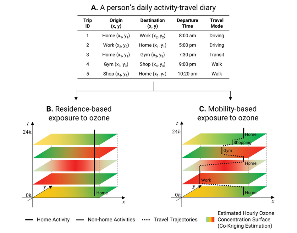
The static residence-based approach ignores people’s daily mobility lives and their exposures at the locations they visit at different times of a day, while the dynamic mobility-based approach take these into account. (Source: Kim, Junghwan, and Mei-Po Kwan. 2021. How neighborhood effect averaging might affect assessment of individual exposures to air pollution: A study of ozone exposures in Los Angeles. Annals of the American Association of Geographers 111(1): 121-140.) |


