Evaluating Individual Exposure to Noise and Air Pollution Using GPS and Mobile Sensors (PI: Mei-Po Kwan; supported by a Hong Kong Research Grants Council (RGC) General Research Fund).
关美宝教授
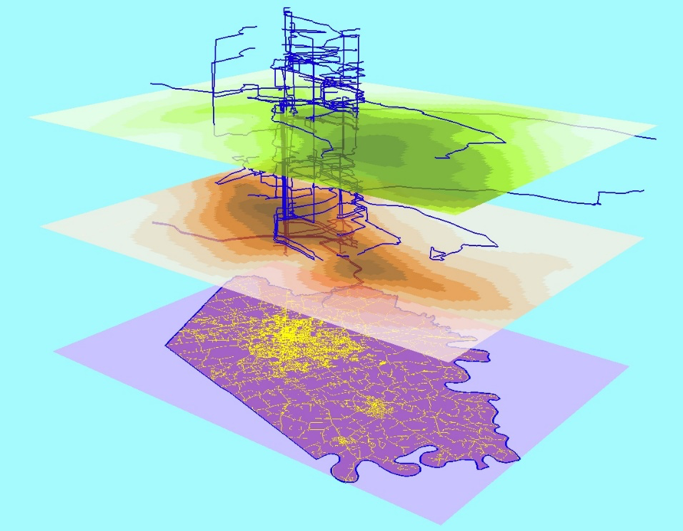
This project seeks to more accurately assess individual exposure to noise and air pollution (NAP) and its health impacts using real-time individual-level data collected from human participants using global positioning systems (GPS), mobile noise and air pollutant sensors, and advanced geospatial analytics. Using the high-resolution real-time GPS data and individual exposure data collected by mobile sensors, the study addresses the major limitations of past studies by taking into account: (a) individuals’ actual activity locations and environments in space and time (e.g., workplace, shopping malls); (b) the high-rise environments of the study areas; and (c) indoor exposure to NAP, in contrast to an exclusive focus on outdoor exposure. The results of the proposed study will provide reliable scientific evidence for developing effective preventive measures and policies as well as improving urban designs through facilitating the creation of healthy living environments, which will in turn significantly benefit the residents of the two study areas (Hong Kong and Guangzhou) in the long run.
|
Environmental influences (e.g., air pollution) vary over space and time in a highly complex manner. As people move through the changing pollution field over time during the day, their exposures to these environmental influences also change. Using real-time data collected with GPS and mobile sensors can more accurately measure people’s exposures to these environmental risk factors. (Source: Kwan, Mei-Po. 2012. How GIS can help address the uncertain geographic context problem in social science research. Annals of GIS 18(4): 245-255.) |