Destination
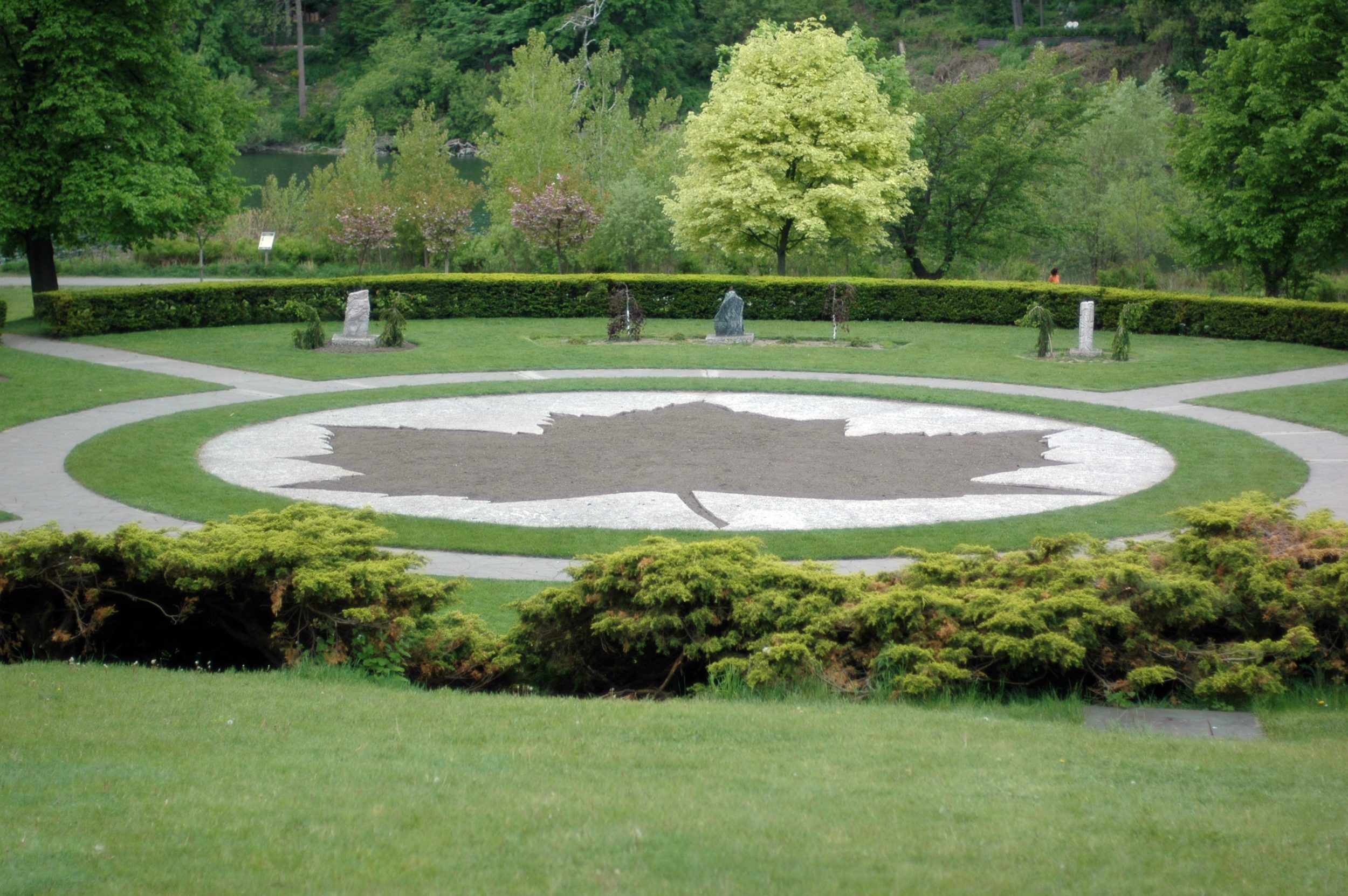
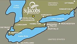
加拿大(北美)Canada (North America)
Canada’s land area is 9,970,610 km2 which is the second largest country in the world. It is a federation which consists of ten provinces and three territories. The provinces are Alberta, British Columbia, Manitoba, New Brunswick, Newfoundland and Labrador, Nova Scotia, Ontario, Prince Edward Island, Quebec, and Saskatchewan. The three territories are Northwest Territories, Nunavut, and Yukon.Its geographical extension has occupied over six time zones. Ottawa is the Capital of Canada which is located in Ontario. Canada has 10 provinces and 3 territories. The National emblem is the maple leaf which is found in the middle of the National Flag. The population in Canada in April 2007 is estimated at 32,852,800. The largest city in Canada is Toronto followed by Montreal, Vancouver, Ottawa-Hull, and Edmonton. About 31 percent of the population live in the largest cities of Toronto, Montreal and Vancouver. Canada is a multi-national and multi-cultural country with different ethnic groups including British, French, German, Italian, Ukrainian, Dutch, Polish, Chinese, South Asian, Jewish, West Indian, Portuguese and Scandinavian.
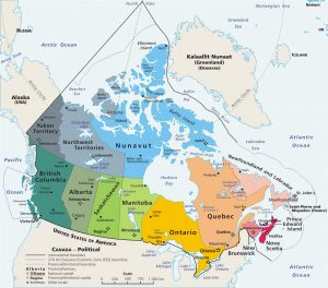
Map showing the boundary of Canada in North America (Source: www.wikipedia.com)
Ontario is Canada’s second largest province, covering more than one million square kilometers. The province is bounded by Quebec on the east, Manitoba on the west, Hudson Bay and James Bay on the north, and the St. Lawrence River and the Great Lakes on the south. Ontario’s landforms are the products of continental uplift and erosion, the movement of glaciers, and the continuing actions of wind, waves, water and gravity. Niagara Falls is a world-famous tourist destination, attracting 18 million visitors a year.
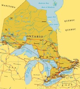
Map showing the Ontario province (Source: http://www.ontariooutdoor.com/en/map_ontario.html)
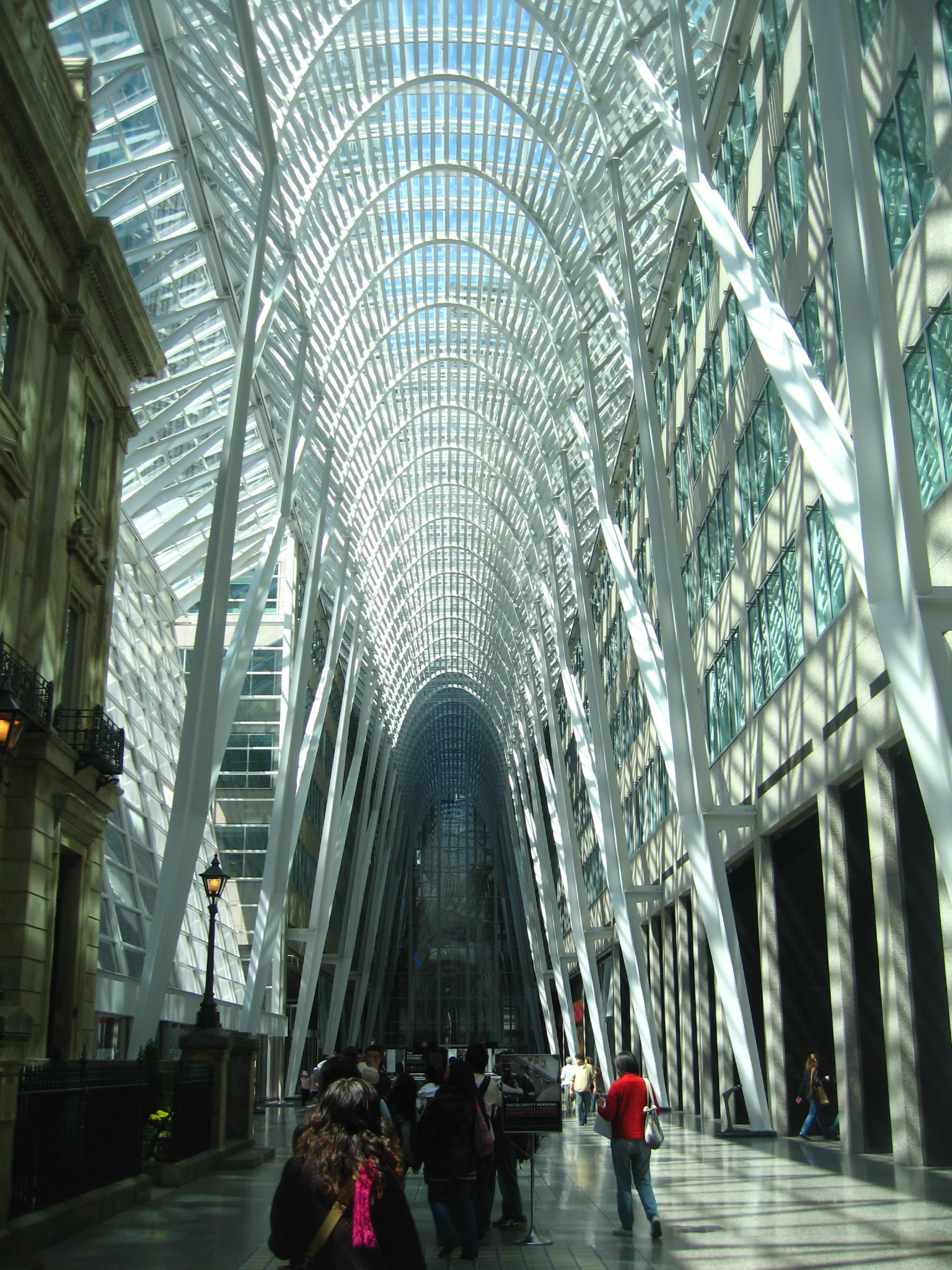
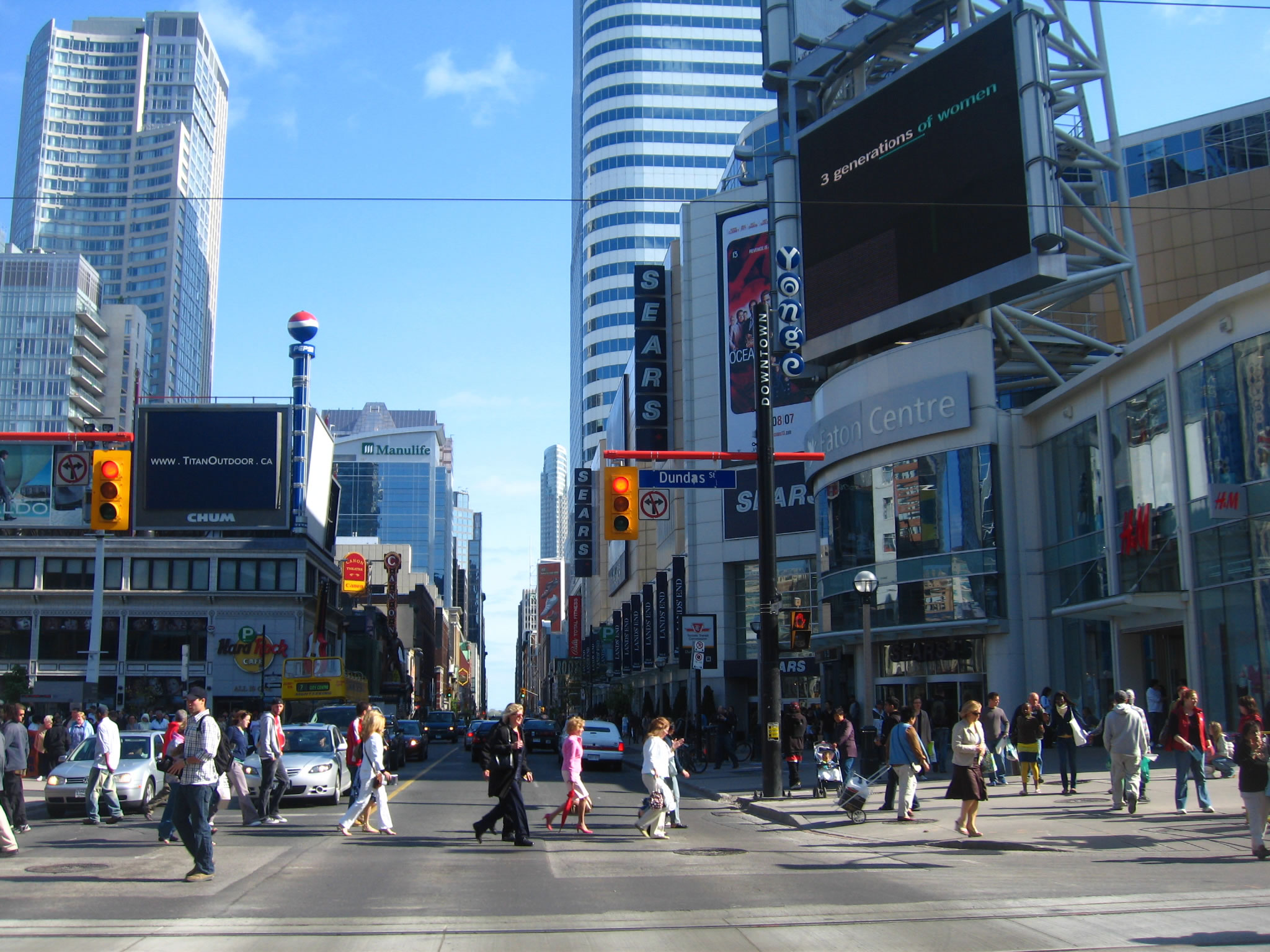
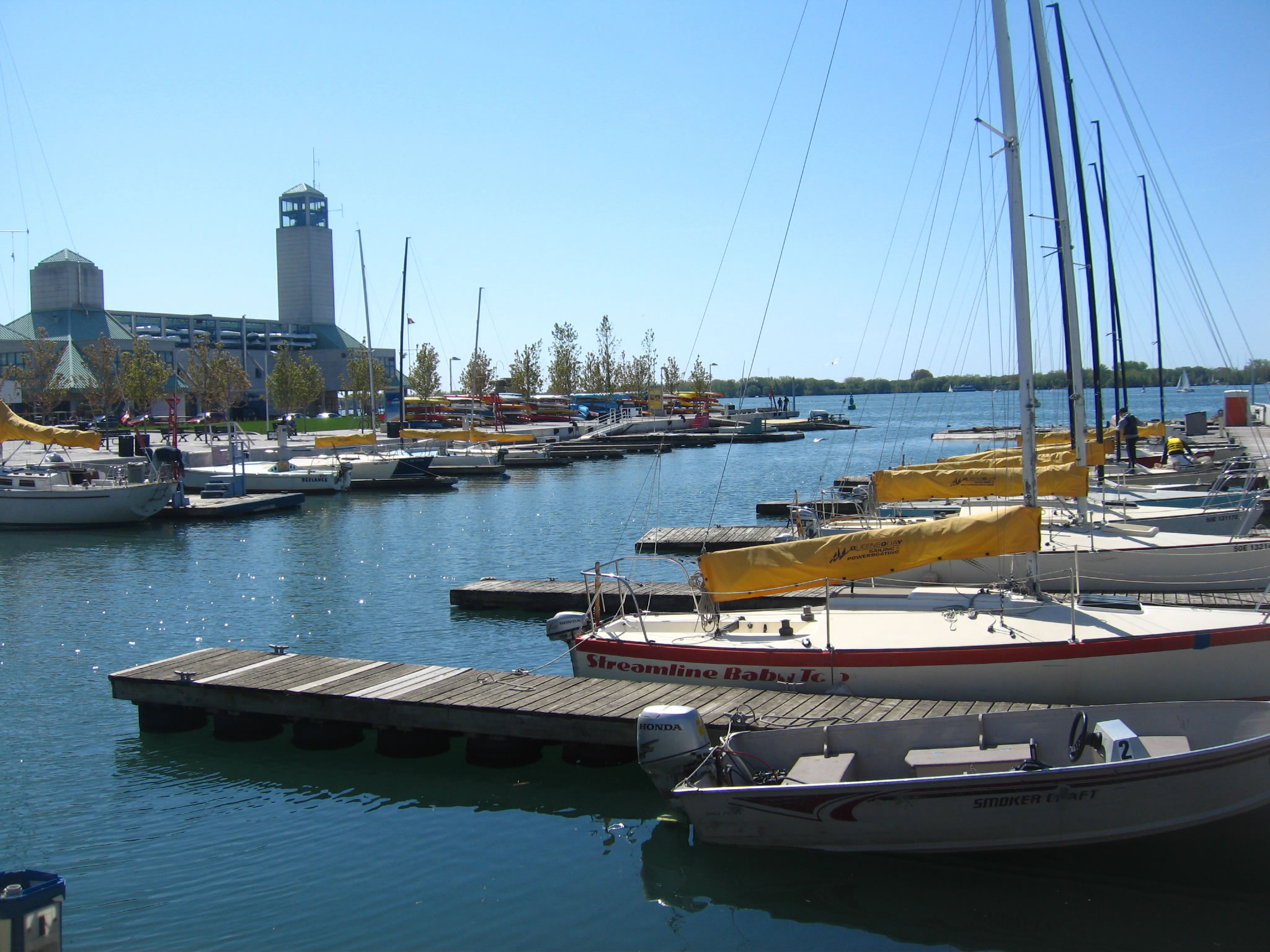
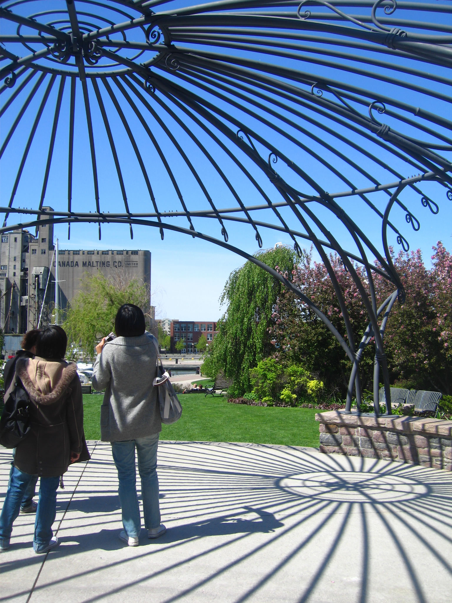
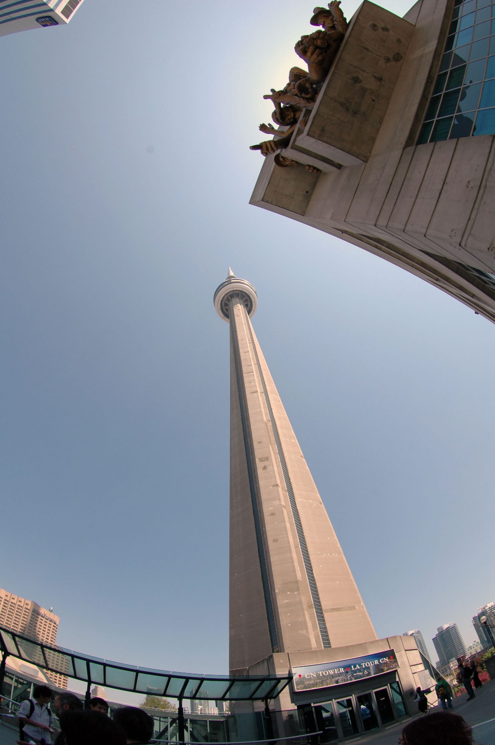
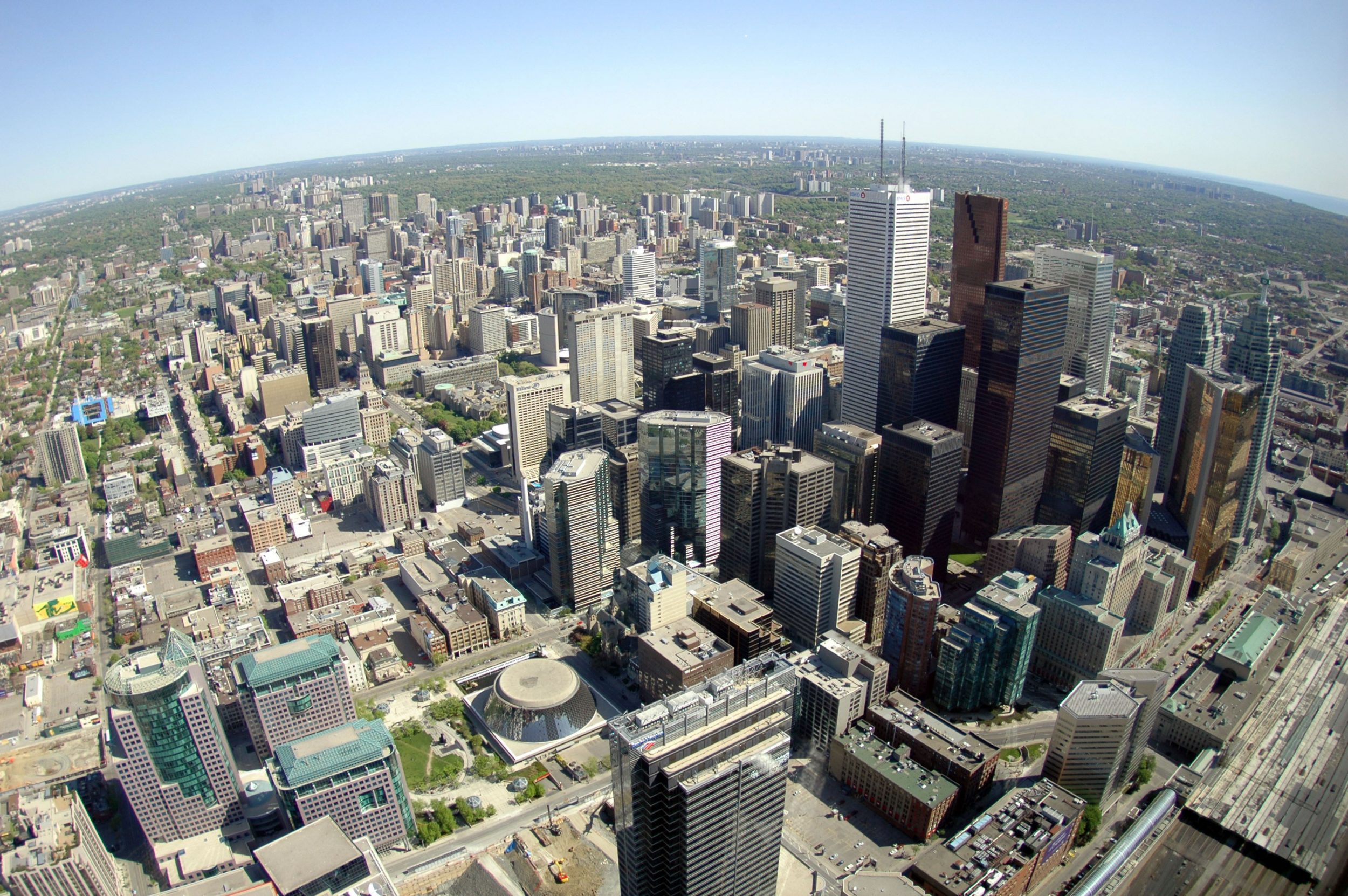
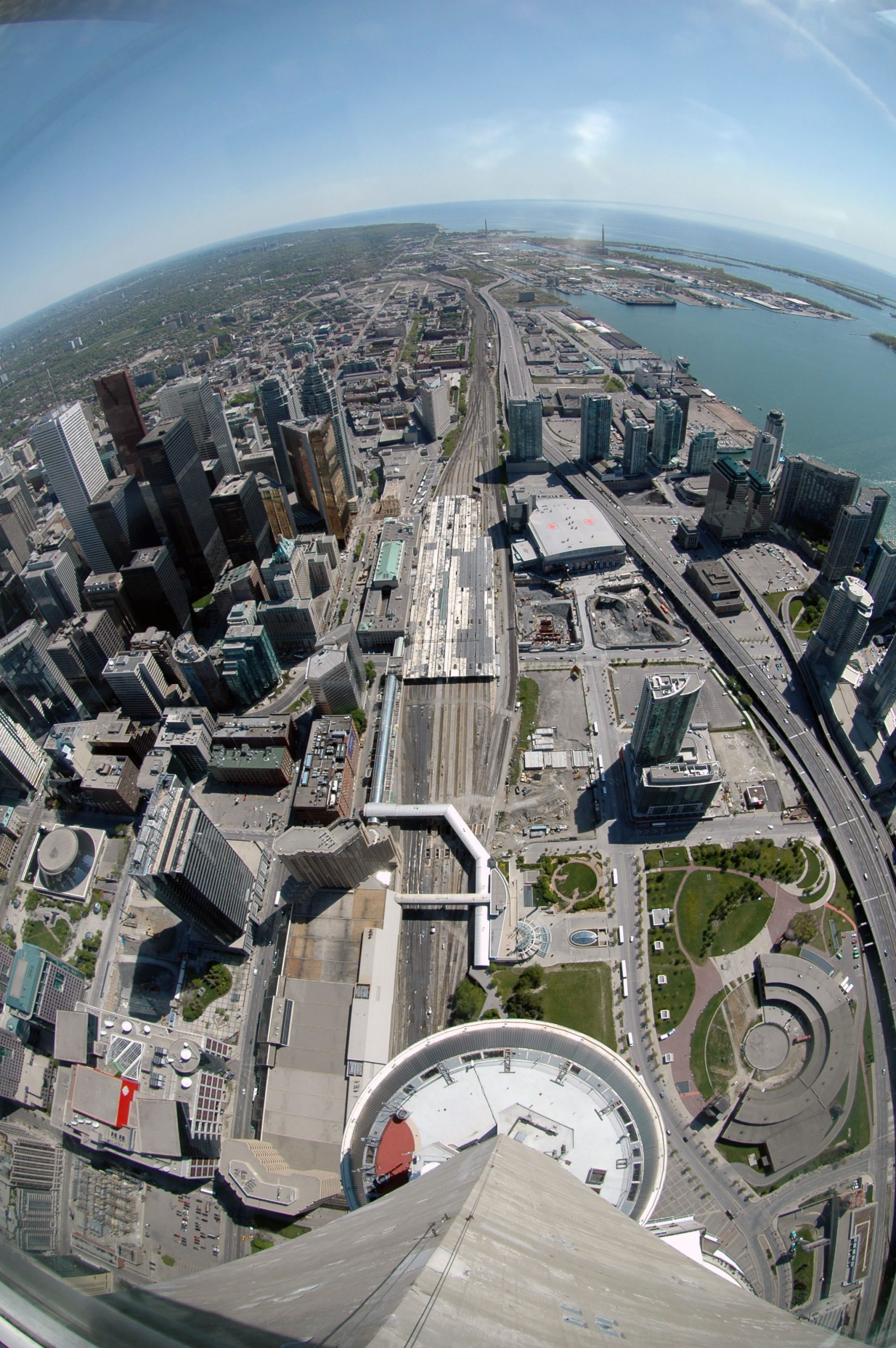
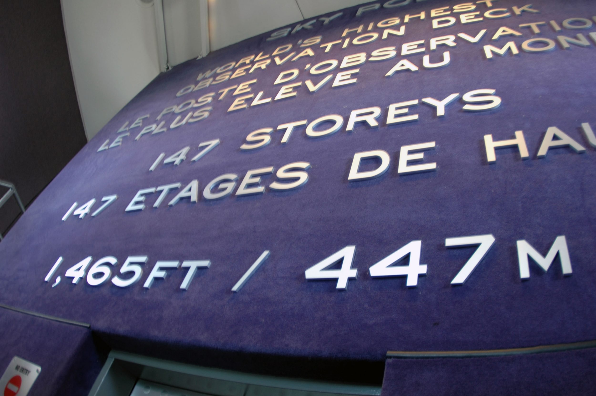
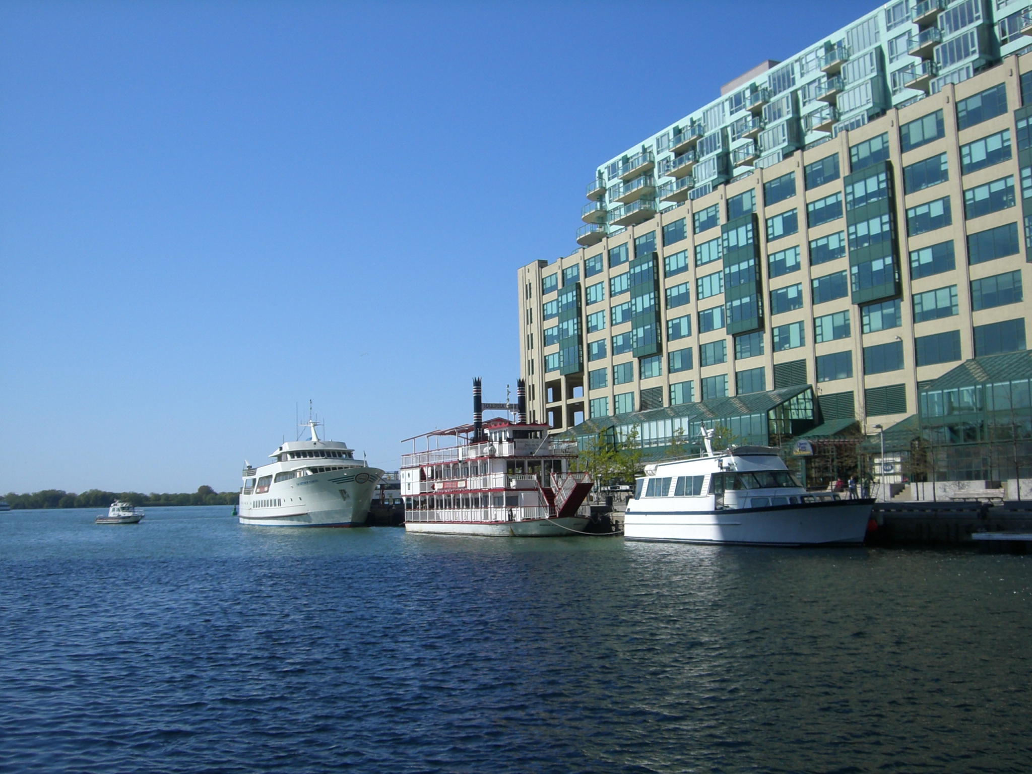
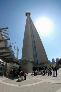
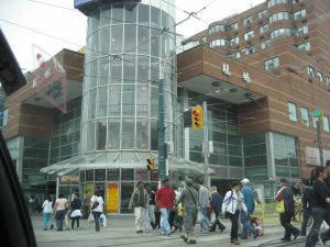
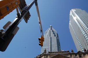
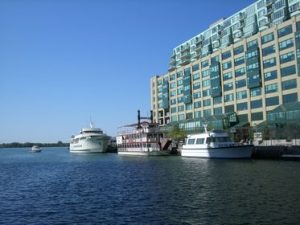
Toronto – the name derived from the Huron word for “fishing weir” – is on the northwest shore of Lake Ontario. Toronto covers 641 km2. and stretches 43 km from east to west and 21 km from north to south at its longest points. Toronto is Canada’s largest city, the heart of the nation’s commercial, financial, industrial, and cultural life, and is one of the world’s most liveable urban centres. Toronto is also the home of the world’s tallest building (CN Tower at 553.33 m) as well as the world’s longest street starts at the City’s lakeshore (Yonge Street at 1,896 km).
The CN Tour in Toronto, Canada
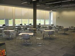
Kitchener-Waterloo is located in the Region of Waterloo, in the heart of southwestern Ontario. Kitchener was originally known as Berlin (reflecting its Mennonite and German origins) but was renamed for Field Marshall Lord Horatio Kitchener in 1916 at the height of World War I. Waterloo was named after a place just south of Brussels, Belgium, where the Allied armies, under the British and Prussian commanders, defeated Napoleon and the French army in 1815. The two cities which are always named as Twin Cities (KW), have a population of 277,000. The area is referred to as Canada’s Technology Triangle, because it is defined by an exceptional business base, a diversity of industry, world-class educational institutions and its history of technological innovation.
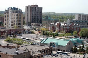
Overview of the Kitchener-Waterloo Twin Cities
Itinerary and Schedule
Toronto and Waterloo, Southern Ontario, Canada, North America
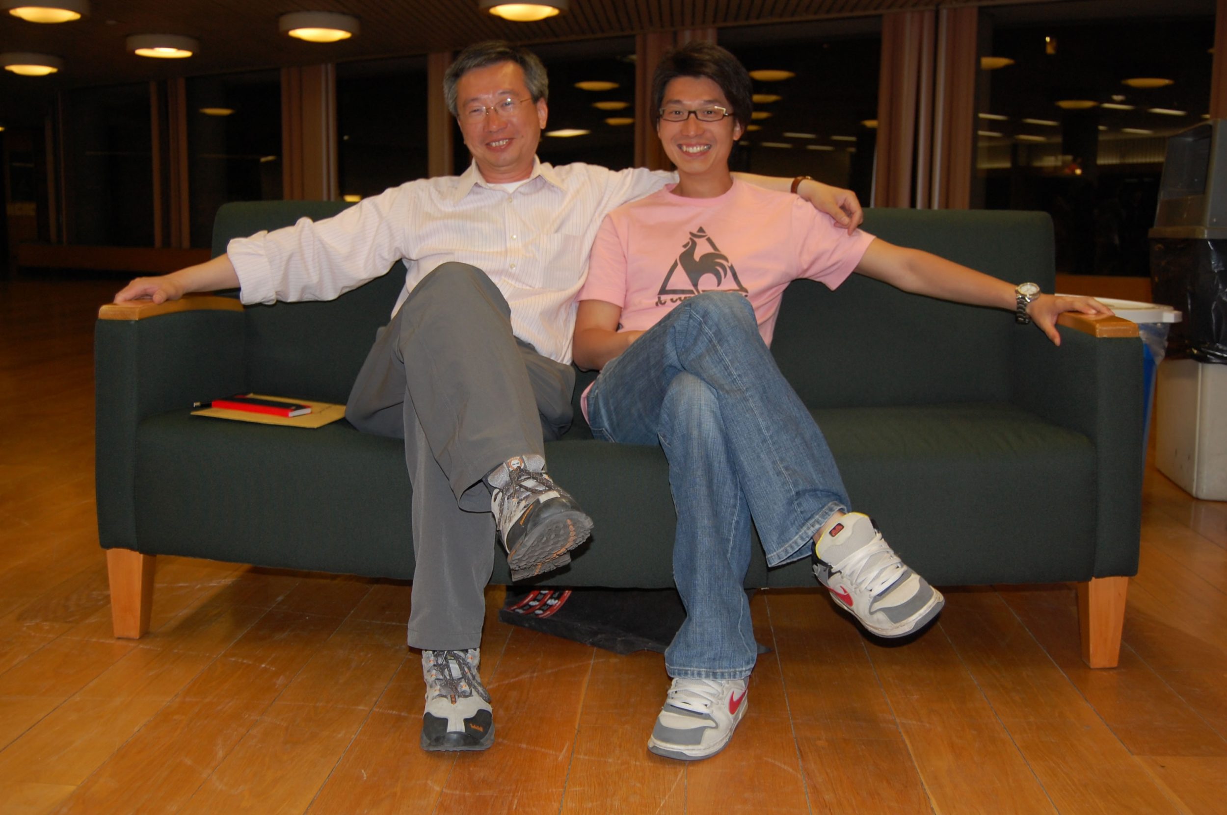
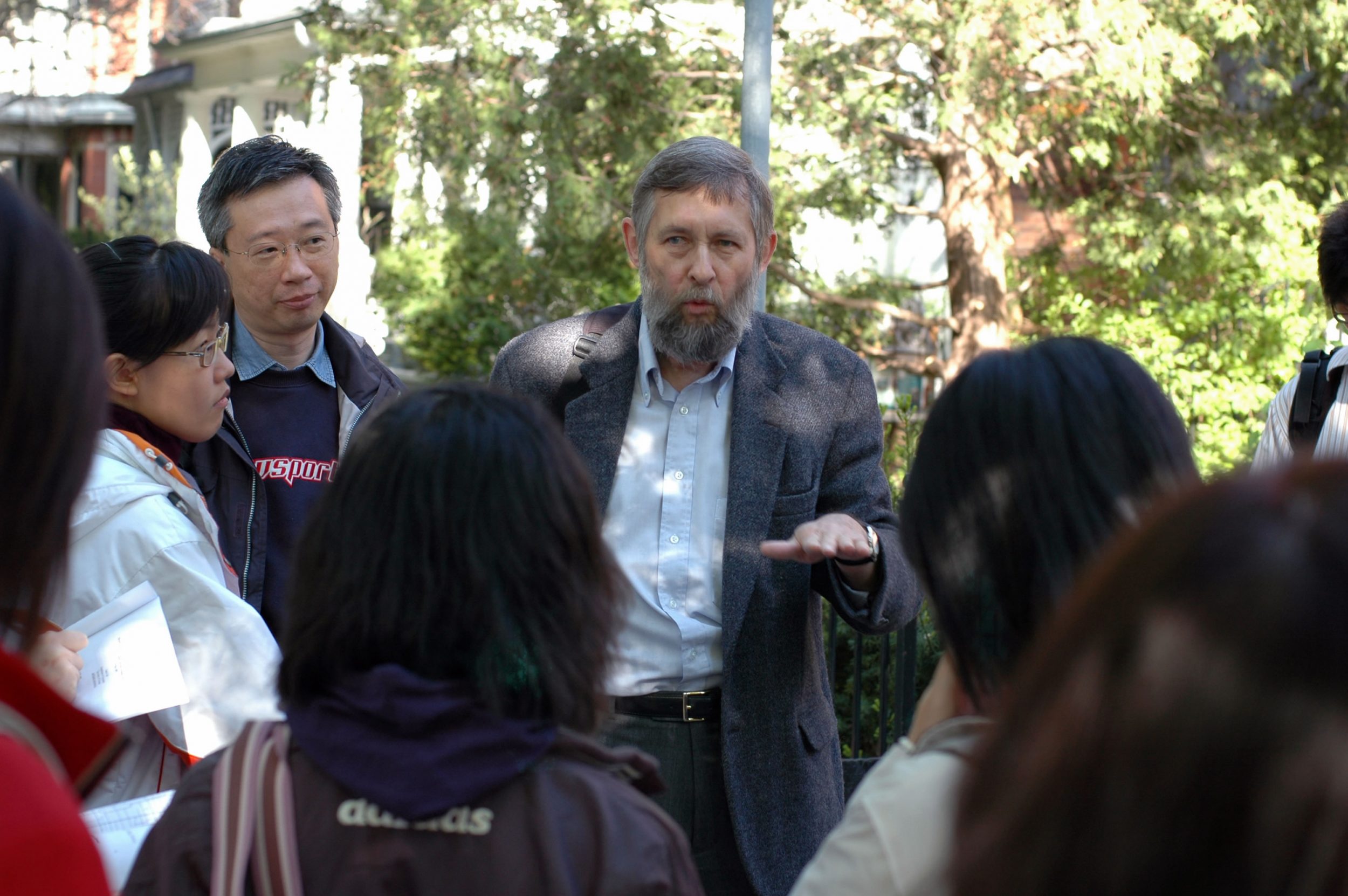
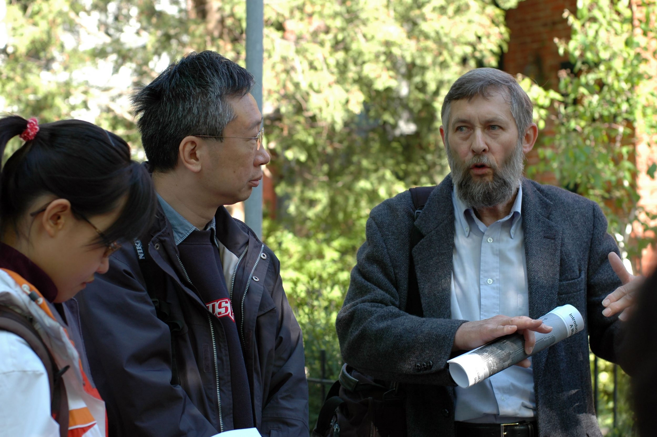
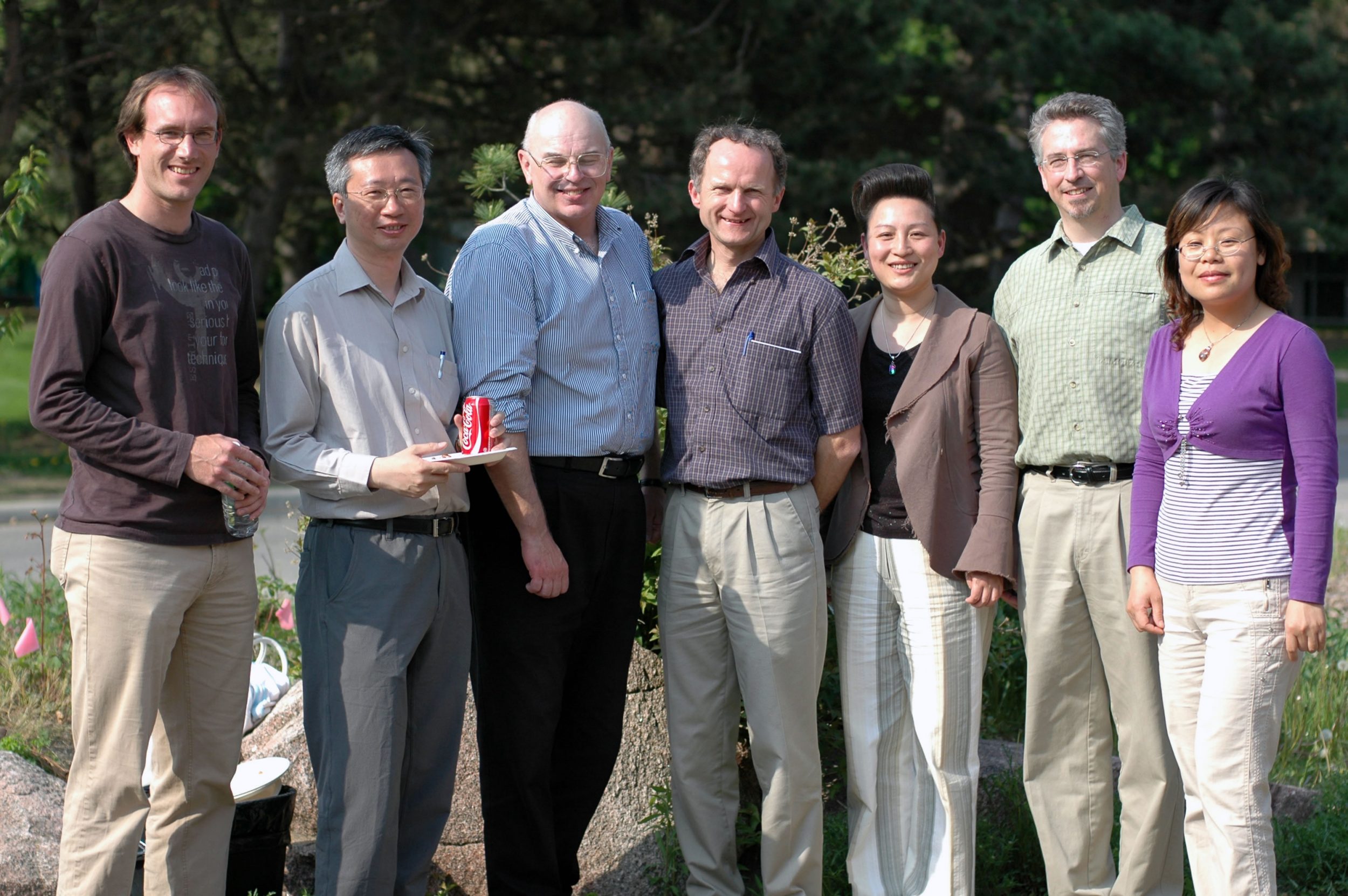
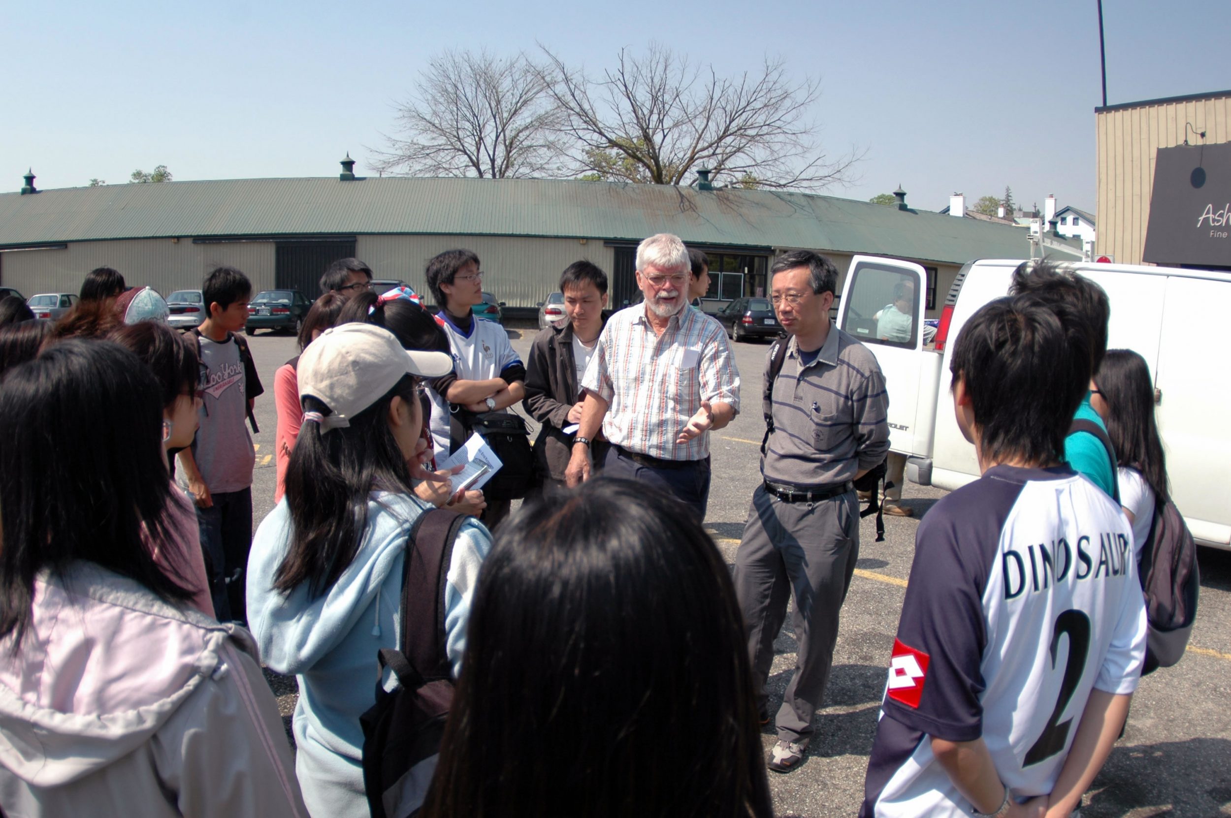
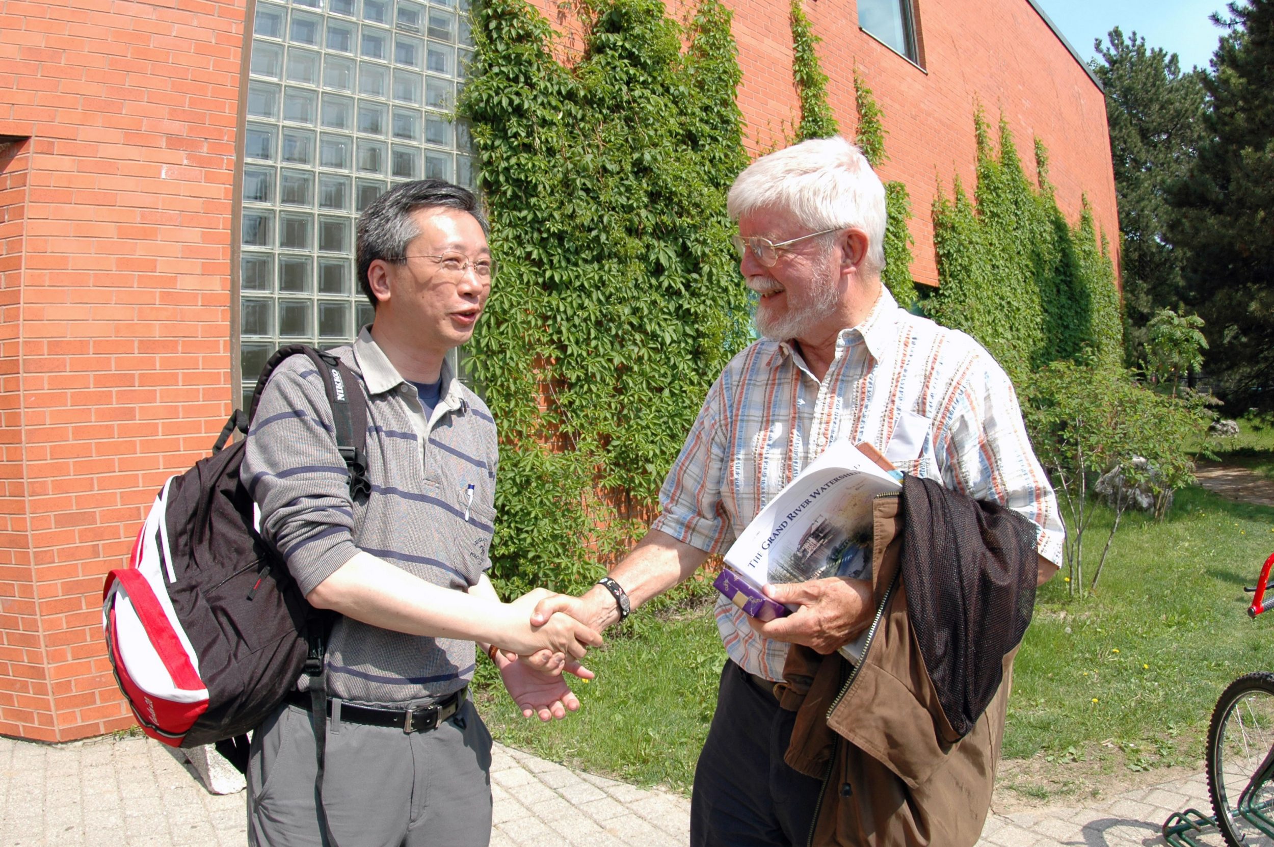
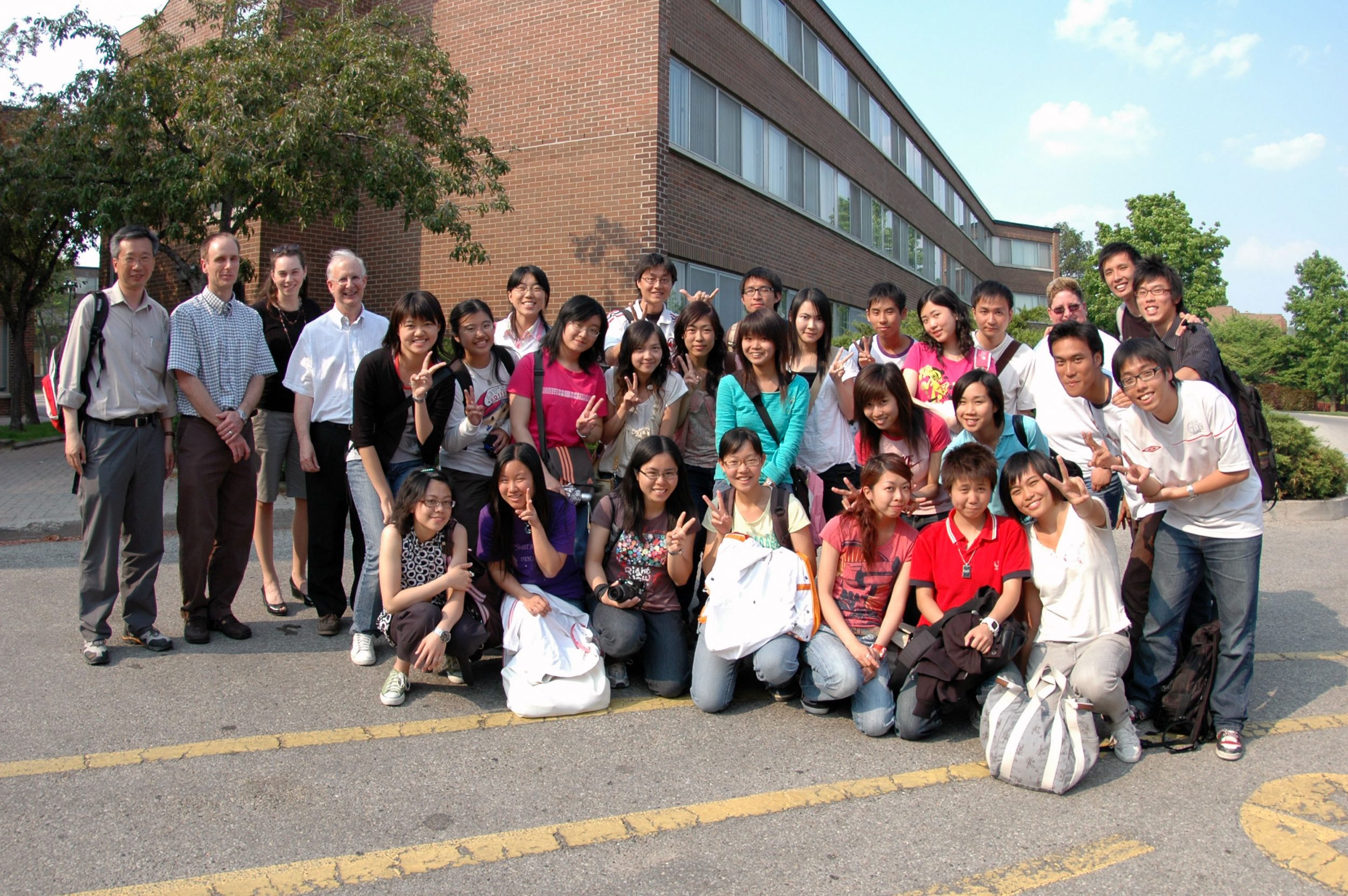
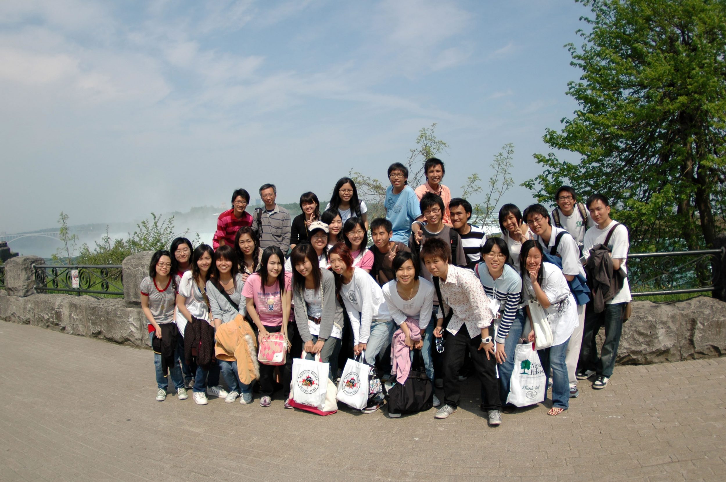
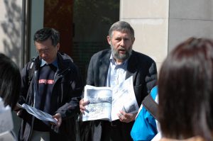
In late May 2007, a field trip to the Southern Ontario, Canada, North America was organized by the Department of Geography and Resource Management. This was the first time for the department to organize a trip to the North America. A total of 26 undergraduate students have joined the trip together with Prof. Fung Tung as trip leader and Mr. Wong Kwan Kit, Frankie as Graduate Assistant. Special thanks are given to Prof. Gunter Gad from the University of Toronto; Prof. Paul Parker, Prof. Gordon Nelson, Prof. Ellsworth LeDrew, Prof. Bruce Mitchell, Ms. Zhao Suping and Ms. Susie Castela from the Department of Geography, University of Waterloo for their assistance in organizing the trip as well as comprehensive guidance and explanation during our trip.
Prof. Gunter Gad Prof. Paul Parker
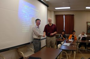
Prof. Gordan Nelson Prof. Ellsworth LeDrew
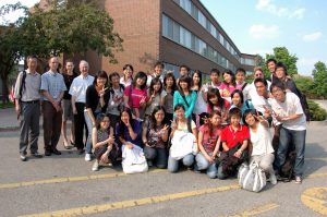
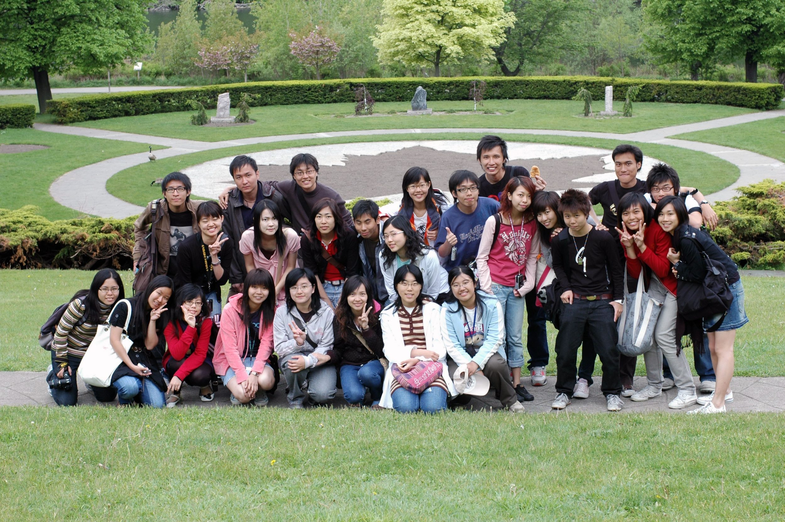
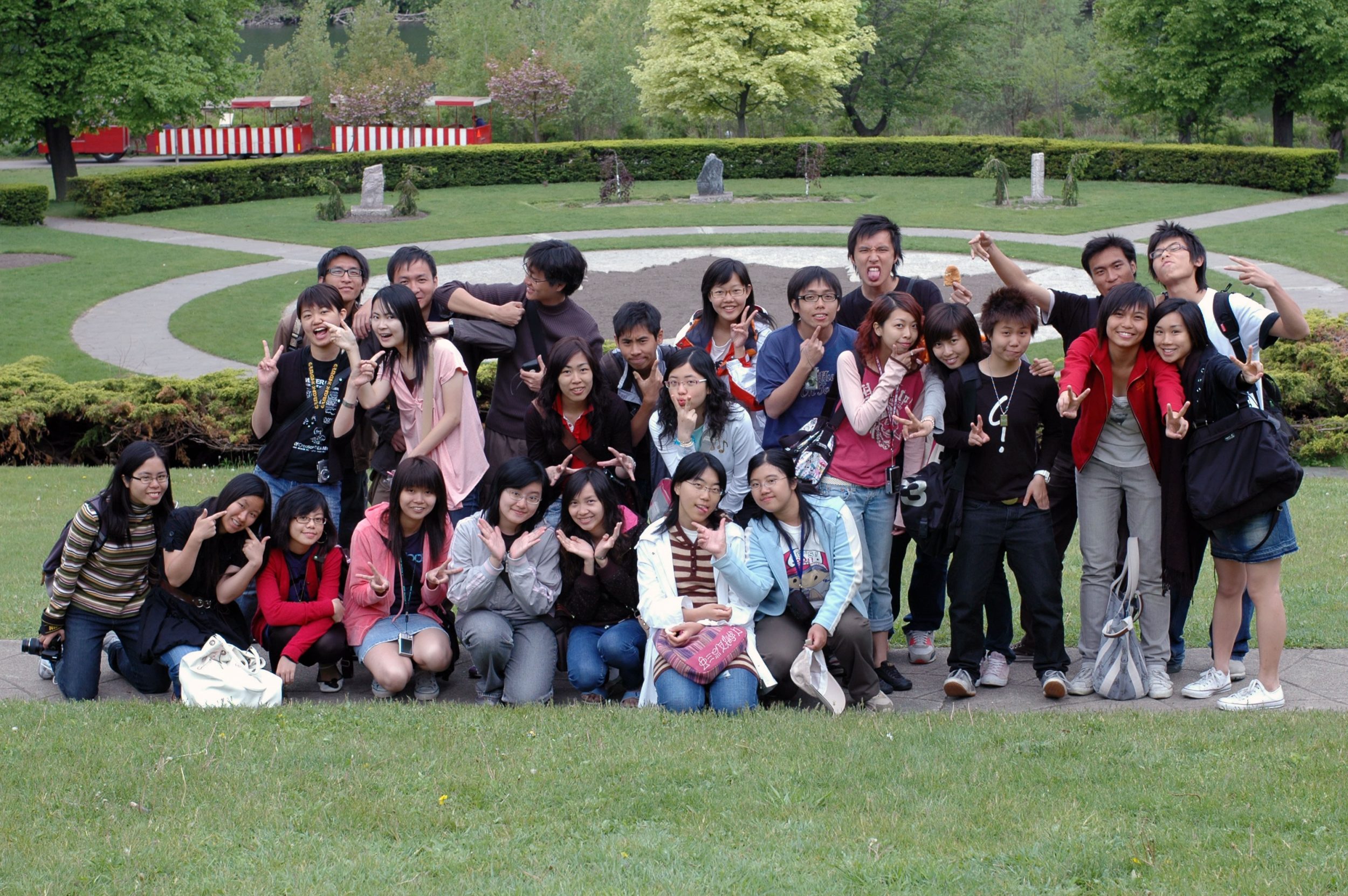
The Study Group
The Study Mode
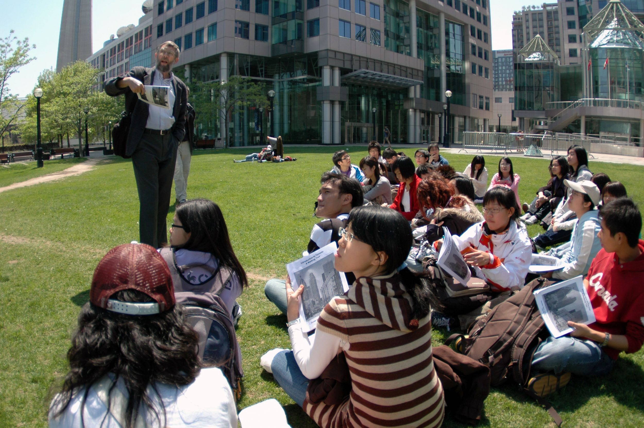
Field trips of the department encourage students to study a variety of topics in Geography. Before the trip, 26 students are divided into 6 groups. Each group is assigned a special topic concerning the studies either in Toronto or Kitchener-Waterloo (KW), which is shown in the itinerary below. Students are required to search and gather information, read relevant articles related to the topic assigned. We have scheduled two meeting sections for the students to present their findings. During the trip, various study modes including lectures, guided tours as well as fieldwork such as land-use and questionnaire survey are conducted.
Assessment
This field trip allowed studesnts to fulfill a compulsory course requirement for all major students. Assessments for the students are based on their preparation, participation and presentation before as well as during the trip. Students (in group) are required to submit a detailed report concerning the topic of their study as well as preparing a website (in group) for the theme of their study.
DAY 1
17/05/2007
DAY 2
18/05/2007
DAY 3
19/05/2007
DAY 4
20/05/2007
Free Day: local orientation in Waterloo
DAY 5
21/05/2007
Toyota Motor Manufacturing Centre
Waterloo Research and Technology Park
DAY 6
22/05/2007
Grand River Conservation Authority: Heritage river, floodplain management, Watershed Planning
DAY 7
23/05/2007
Remote Sensing Projects at Waterloo:
The Canadian Cryospheric Information Network
The IPY Canadian Metadata Master Directory
The World Bank Coral Reef Project
Waste Management and Water Conservation
Erb St. Landfill Site, Waterloo Moraine, urban growth pressures
DAY 8
24/05/2007
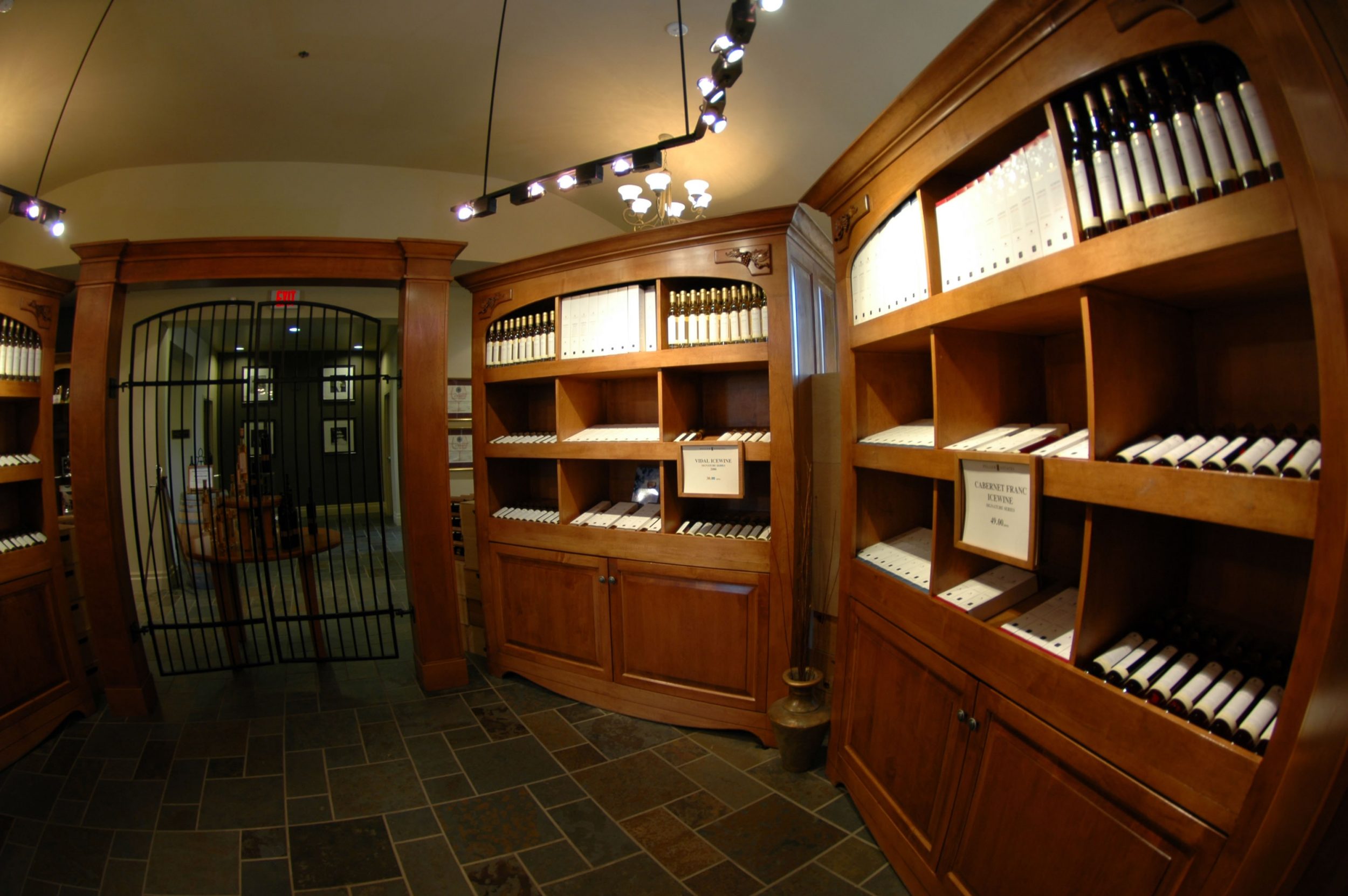
Specialized agriculture: ice wine production: Niagara vineyards
DAY 9
25/05/2007
Self exploration
DAY 10
26/05/2007
DAY 11
27/05/2007
Research Content
For each group, the students are required to give a brief account on the followings related to their topic assigned.
Why we want to study this topic?
What information collected to be shared with the large group?
What do you expect to see in that particular date?
Group presentation files:
Group 1: Niagara Fall
Group 2: Urban and Village Transformation in Waterloo
Group 3: Industrial Transformation in Toronto
Group 4: Urban Development in Downtown Tornoto
Group 5: Toronto Waterfront Revitalization programme
Group 6: Resource Management: Grand River Conservation
Based on the information collected, each small group should discuss and present ONE research project which they consider important in geographical studies. The presentation will include the followings:
Title of a proposed research
Objectives of the research
Methods proposed to work on this research
What sorts of information will be required in this proposal and what collection methods you expect to be used
Presentation files:
Group 1: The Environmental Sustainability of the Niagara Falls Tourism
Group 2: The Impact of Rural Tourism on the Preservation of the Local Heritage
Group 3: industrial Transformation: Towards a High-tech Environment
Group 4: Development in Downtown Toronto
Group 5: The Future Development of Hung Hom.pdf
Group 6: An Evaluation of Watershed Planning in Grand River Water Pollution from Urban Land Uses in Waterloo
Student Sharing
Student Projects
Group 1: Niagara Fall
Group 2: Chinese Diaspora
Group 3: Industrial Transformation in Waterloo
Group 4: Urban planning in downtown Toronto:
A lesson for Hong Kong
Group 5: Toronto Waterfront Revitalization programme
Group 6: Resource Management: Grand River Conservation
Student Afterthoughts and Comments
Chan Ying Kit, Gordon
MoreDung Wan Yee, Winnie
MoreMak Kit Yan, Jenny
MoreShing Nok Yi, Fiona
MoreKwok Kai Ling, Carol
MoreSit Hing Yu, Terence
MoreChen Zhouyi, Joey
MoreWong Siu Man
MoreDao Chun Yeung
MoreTsang Kai Ho
MoreStudent Projects
Group 1: Niagara Fall
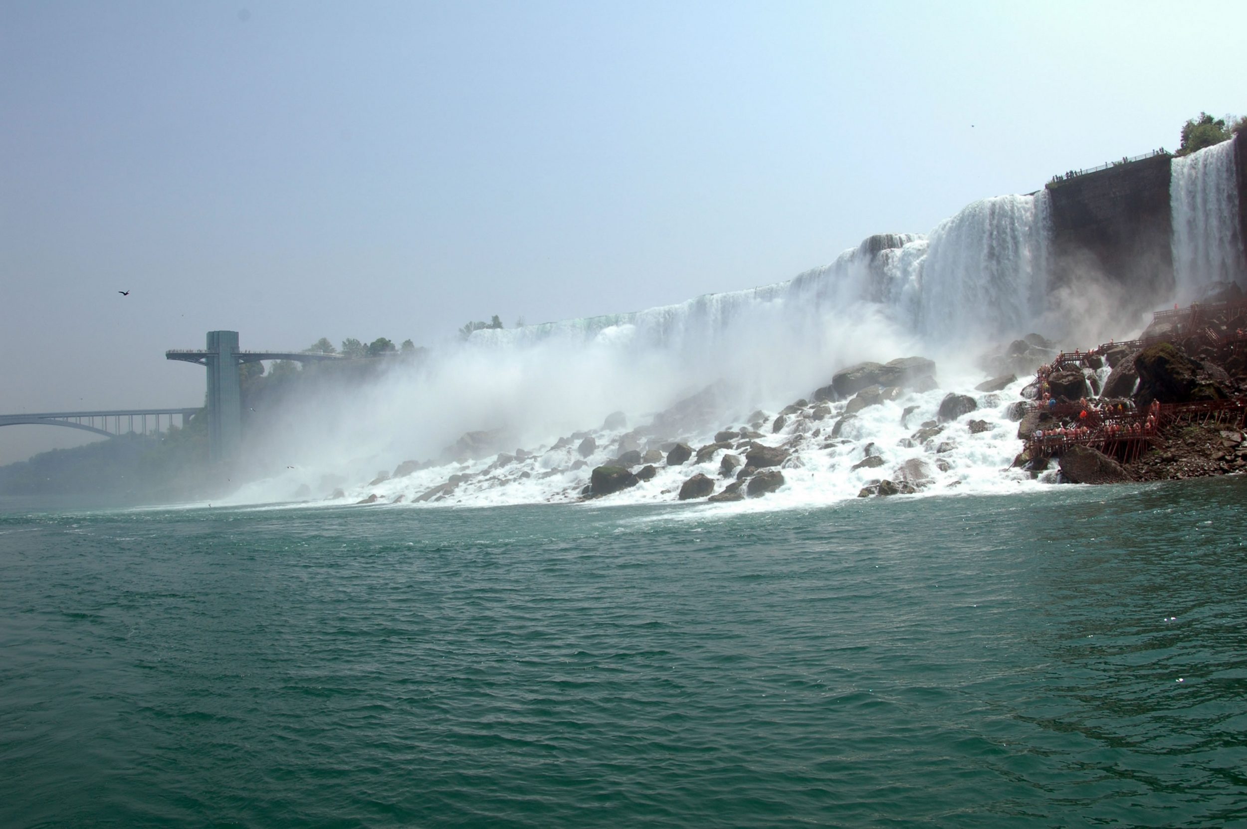
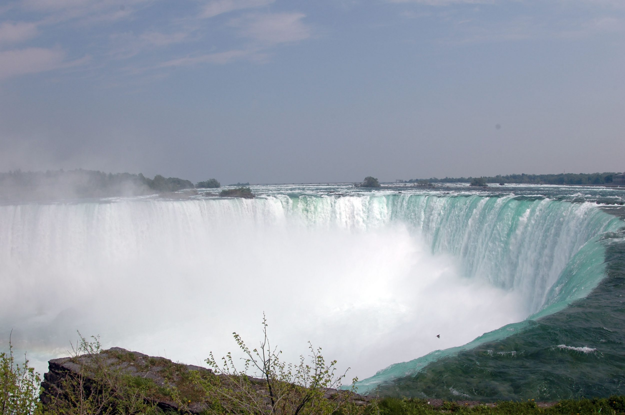
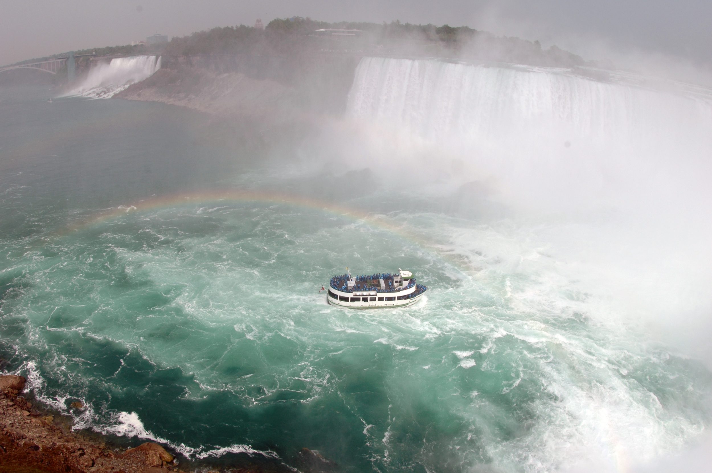
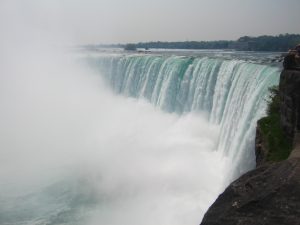
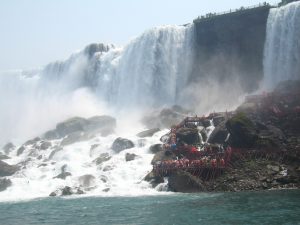
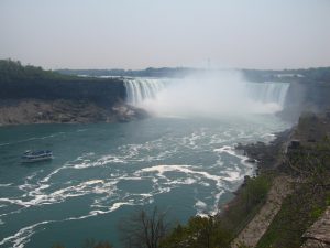
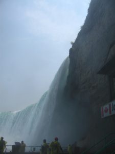
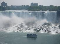
Being one of the seven world wonders and a well-known tourist site, the Niagara Falls is a group of massive falls situated on the section of Niagara River locating on the border between Ontario, Canada, and New York State, the United States. It is shared between the twin cities, both named as Niagara Falls, located in different countries. It consists of three falls, namely the Canadian Horseshoe Falls (54-57m high, 670m wide), the American Falls (21-34m high, 260m wide) and the smaller, adjacent Bridal Veil Falls (15m wide) (see Figure 2). The Niagara Falls was formed after glaciers receded at the end of the last ice age, the Wisconsin Glaciation (NFTA, 2007a). Although the Falls is not exceptionally tall in the world, the width and the massive enormous amount of discharge, with more than 168,000 m³ of water falling per minute in high flow and almost 110,000 m³ on average (NPC, 2007a), makes it one of the most powerful and magnificent waterfall in the world.
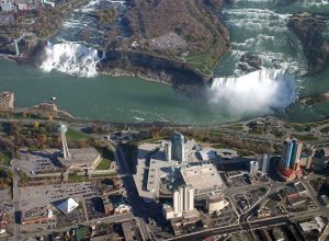
Figure 1. Aerial photo of the Niagara Falls taken from the Canadian side (Source: http://upload.wikimedia.org/wikipedia/en/e/e0/Niagara_falls_aerial.id.jpg)
Niagara Falls is prominent for its beauty and as a precious source of hydroelectric power for the neighboring regions. Tourism development has been initiated since the 1820s when the first paved road and the first canal was constructed in 1827 and 1829 respectively (NPC, 2007). Since then, the international tourism, together with urban and commercial development in the Niagara Region has grown exponentially over centuries. Besides sightseeing in the Falls, there are plenty of leisure facilities including casinos, amusement parks, theaters, museums, towers, balloon and helicopter rides, as well as boat ride and natural trails. Currently, the total number of visitors in 2007 is estimated to be 20 million.
Reference
Anderson D. (2003). Environment Canada’s response to environmental petition no.74. Retrieved on June 28, 2007, from http://www.oag-bvg.gc.ca/domino/petitions.nsf/viewe1.0/553F00715F2308BE85256DFE00633F4D
Carmichaelu, B.A. (2005). Understanding the wine tourism: Experience for winery visitors in the Niagara Region, Ontario, Canada. Tourism Geographies, 7, (2), pp.185–204.
City Hall Niagara Falls (2007). Niagara Falls tourism information. Retrieved June 28, 2007, from http://www.niagarafalls.ca/tourism/index.asp
Eckdish, K.R. (2004). National planning landmarks and pioneers: Niagara reservation. Planning, 70 (4), p.26.
http://www.niagaraparks.com/aboutus/aboutus.php
http://www.opg.com/power/hydro/new_projects/ntp/ntp_beck.asp
Info Niagara (2007). Niagara Falls history. Retrieved Juen 28, 2007, from http://www.infoniagara.com/other/history/index.html
International Water Law Project (2007). Treaty Between the United States of America and Canada Relating to the Uses of the Waters of the Niagara River. Retrieved June 28, 2007, from http://waterlaw.org/regionaldocs/niagra1950.html
Langan, F. (2006). Canada turns to Niagara Falls for energy, The Christian Science Monitor. Retrieved June 28, 2007, from http://www.csmonitor.com/2006/0821/p07s02-woam.html
Niagara Falls Thunder Alley (NFTA) (2007a). Niagara Falls origins: A geological history. Retrieved June 29, 2007, http://www.niagarafrontier.com/origins.html
Niagara Falls Thunder Alley (NFTA) (2007b). Dewatered American Falls (1969). Retrieved June 29, 2007, from http://www.niagarafrontier.com/dewater.html
Niagara Falls Thunder Alley (NFTA) (2007c). Niagara Falls: Environmental impacts. Retrieved June 29, 2007, from http://www.niagarafrontier.com/environment.html
Niagara Parks Commission (NPC) (2007a). Falls facts: Niagara Parks and Niagara Falls. Retrieved June 28, 2007, from http://www.niagaraparks.com/nfgg/falls_facts.php
Niagara Parks Commission (NPC) (2007b). Old Fort Erie: Niagara Parks. Retrieved June 28, 2007, from http://www.niagaraparks.com/heritage/forterie.php
Niagara Parks Commission (NPC) (2007c). Niagara glen: Niagara Parks. Retrieved June 28, 2007, from http://www.niagaraparks.com/nature/niagaraglen.php
Niagara Parks Commission (NPC) (2007d). Bontanical gardens: Niagara Parks. Retrieved June 27, 2007, from http://www.niagaraparks.com/garden/botanical.php
Niagara Parks Commission (NPC) (2007e). Education programs: Niagara Parks. Retrieved June 27, 2007, from http://www.niagaraparks.com/group-tours/educational.php
Niagara River Toxics Management Plan (NRTMP). (2007). Niagara river toxics management plan progress report: Executive summary. Retrieved June 28, 2007, from http://www.hazmatmag.com/posted_documents/nrtmp/niagara_1.asp
Philbert, F. J. (1991) The Niagara River: A water quality management overview. Environmental Monitoring and Assessment. 17 (2-3). Retrieved June 28, 2007, from http://www.springerlink.com/content/l976153127162673/fulltext.pdf
The Regional Municipality of Niagara, (2005). Assessing Niagara Region against the Melbourne Principles. Niagara Region. Retrieved June 27, 2007, from http://www.regional.niagara.on.ca/government/initiatives/sustainability/background.aspx
Tourism Niagara, (2005). Wine: Tourism Niagara. Retrieved June 30, 2007, from http://www.tourismniagara.com/wine_country.html
Weaver, D. (2006). Sustainable Tourism. Oxford: Elsevier Ltd.
Yee, J., Yee, S. & Zhang, J. (2002). The Niagara agricultural weather network. Retrieved June 28, 2007, from http://merlin.cs.wwu.edu/~zhangj/home/papers/Yee2.pdf
Group 2: Chinese Diaspora
Introduction
Chinese Diaspora refers to the migration of Chinese people to other countries beyond China.
Chinese people began immigrating to Canada in the 1850s and have in recent years arrived from a number of countries as well as from the two Chinas (mainland China and Taiwan).
Before the 1960s, the Chinese were under the same restrictions for admission as other people from Asia. A few were admitted after 1947, but between 1968 and 1984, 170,000 ethnic Chinese immigrants came to Canada, principally from mainland China, Taiwan, Indochina, and particularly Hong Kong. Between 1984 and the early 1990s, another 176,000 immigrants from that part of the world entered the country.
Many of the immigrants from Hong Kong brought large amounts of capital with them after 1985, under a government program that admitted as immigrants without other tests those who could invest at least $250,000 in Canadian business ventures. Most of these people invested in Canada in order to shelter money and guarantee themselves asylum after the British agreement in 1984 to allow Hong Kong to become reunited with China in 1997. These rich businesspeople were deeply resented by many Canadians.
Many of the other Chinese newcomers were highly educated and in professional occupations, although they typically earned less than Canadians in comparable jobs. Most first-generation Chinese immigrants speak Chinese at home, but there has been a substantial language loss and a major shift to English in the second generation. The size of the Chinese community in several Canadian cities, especially Vancouver and Toronto, has made possible a substantial cultural life and many institutions, such as newspapers, radio stations, and banks, to help maintain it.
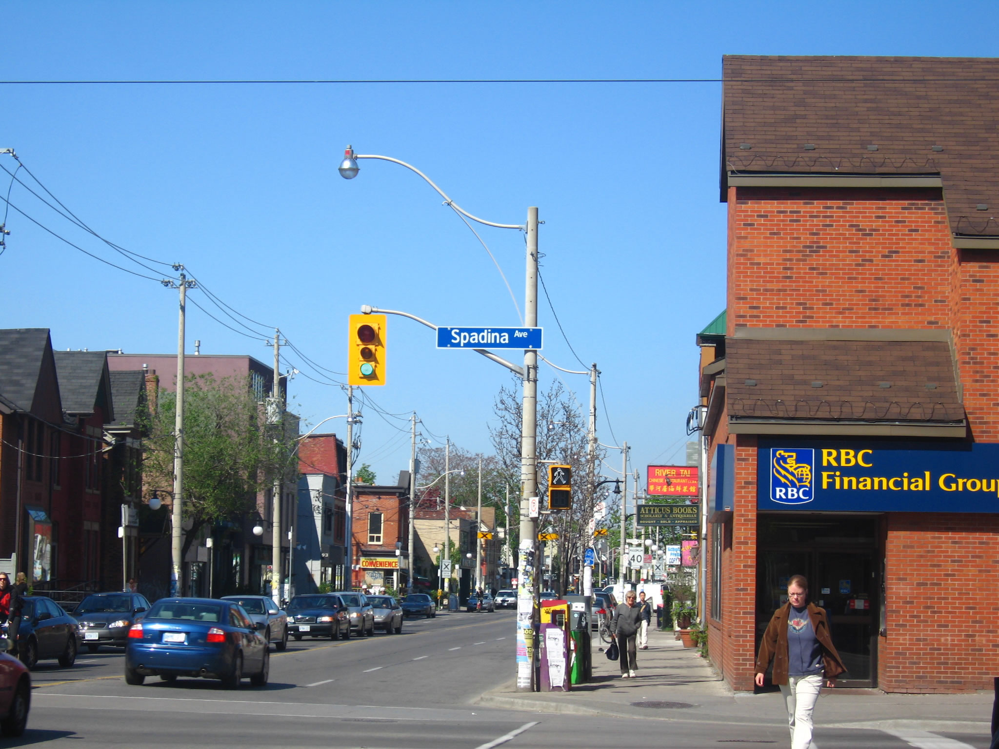
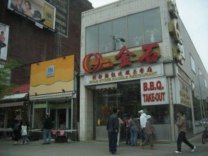
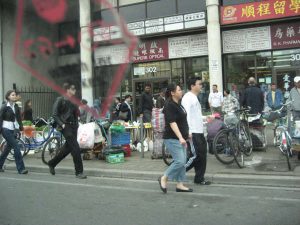
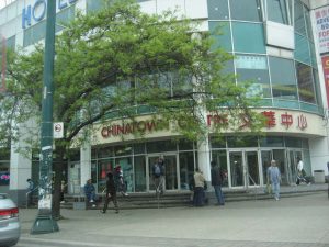
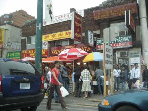
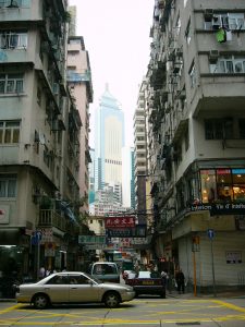
Toronto has at least six major Chinatowns, three are located within the city boundaries, and while the other three are located in adjacent suburbs.
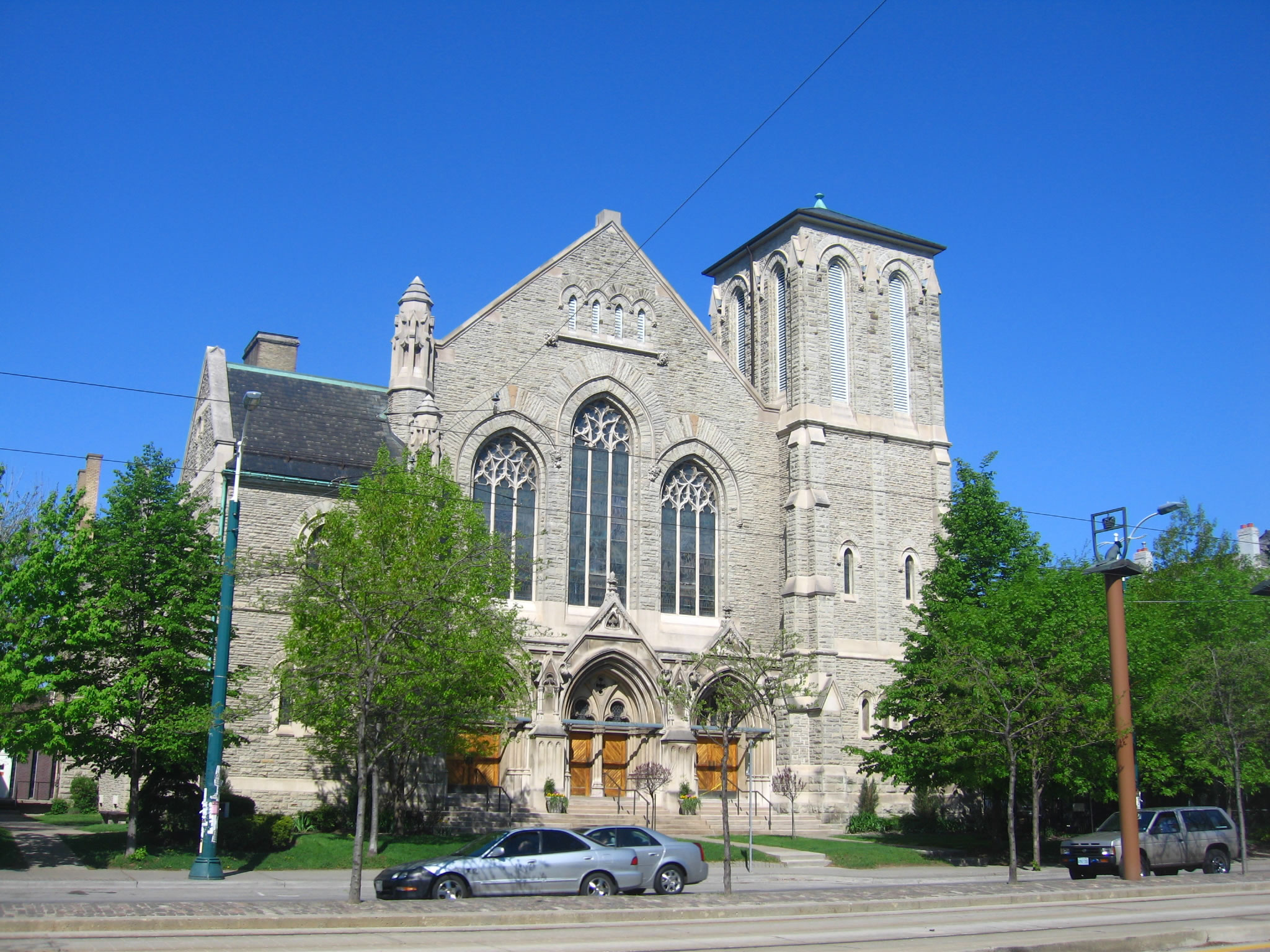
The major focus of this paper’s study will be The Old Chinatown, which is located within the intersection of Dundas Street West and Spadina Avenue. It has grown significantly and reflects the diverse set of Asian cultures through its shops and restaurants. Toronto’s oldest Chinatown is struggling to revitalize and redefine itself as it is faced with an ageing population, which could be seen through its decline in tourism, and most clearly through the lure of the suburban Chinatowns that continue to draw money and professional immigrants away from downtown.
Younger generations of higher income immigrants from the Chinese mainland, Taiwan and Hong Kong have moved out, so those left in the district are typically older and senior generations.
However, the arrival of The University of Toronto and Ryerson University that are adjacent to Chinatown has helped accelerate the gentrification of the district, which has brought in younger professionals into the area. Other Chinatowns include East Chinatown and Scarborough. Scarborough saw an influx of Hong Kong Chinese and Taiwanese during the 1980s.
Chinese Diasporas can be vital in both the local scale and the international scale. These districts can be both beneficial and problematic locally and internationally.
An obvious benefit in the international scale would be improving international relations. There can be direct and indirect effects towards international relations.
A direct effect would be granting political leaders with diasporic links. Diasporas have significant presence in political scene in some countries even though in terms of number; it might be small percentage of the total populations. Therefore, in areas where the minority status of Diaspora usually means that they are left out of the top political post. Thus, an increasing number of Chinese Diaspora at higher political level with increasing frequencies will occur.
Another direct effect would be the relations between the host nation and the home nation can depend on the treatment of Diaspora in host nation. The concerns and interest for diasporic communities by the home nation can seriously affect the international relations between the host nation and the home nation.
Although the diasporic communities have direct implication to international policies, however, the most powerful link is economics. This indirect effect is powerful enough to the extent in which it is able to blur domestic and international boundaries, as well as, economic and political divides. Another indirect effect would be social networks and transnational interdependence.
Chinese Diasporic communities have provided the “outside” world with a stronger Chinese cultural understanding and respect. This includes a stronger understanding of our religion and our lifestyles. This understanding, not only aids international relations, it also facilitates tourism in certain districts. Tourism can help the host nation economically by creating more revenue. Moreover, a better understanding and respect will definitely diminish the severity of discrimination towards Chinese Diasporic communities. Thus, there will be less face-to-face paucity and misunderstanding, which could help stabilize the society.
By attracting more young professionals through Chinese Diasporic communities, the host nation will be able to experience a “brain-gain” situation. This could certainly help develop the host nation’s economy and bring about new businesses and technologies. This puts the host nation in a higher status and puts it in a position with a higher advantage than other nations. To balance this, problems may arise that Diasporic communities that occupy an older generation may benefit less. This may give rise to certain districts being less developed and looked after. One example would be the Older Chinatown this paper focuses on.
Research Objectives:
To get an impression and obtain related information of China Town by questionnaires and landuse survey
To evaluate the importance of China Town as one of the Chinese culture cluster
To investigate the living standard of Chinese people
To examine the general environment(e.g. transport, hygiene, shops) of China Town
To find out possible problems exist in China Town(e.g. language, culture, ageing)
To access the effect of China Town to Toronto development
Methodology:
I. Field Observation
We observe in the field to get an impression and obtain related information for further investigation.
For example, the transport system(transit and subway) in the China Town area, the different types of shops in China Town along Spadina Avenue and Dundas Street, and the general environment, including hygiene, facilities, culture and so on, in China Town.
II. Questionnaires
It was carried out along Spadina Avenue and Dundas Street West in the Chinatown area and here were 80 interviewees in total. Our survey was conducted in Chinese and it was a carried out in a random sampling manner.
There are almost closed-end questions since it is categorized that easier for the interviewees to choose the answer and can reflect their perception directly.
For example, question 5 is one of the closed-end questions, which reflect the types of activities that interviewee will do in China Town.
By interviewing the Chinese in China Town, we can achieve our aims, which will be explained below in detail, and get the first-hand information and basic idea of how the cluster of Chinese culture in China Town affect the tourism in Toronto.
Conclusion:
Chinatown is the symbolic center of overseas Chinese community. Many Chinese shops and restaurants clustered in small areas. It is not only a commercial centre, most importantly, it has vital cultural values.
Chinatowns integtate the overseas Chinese, providing a place in a foreign society as a distinct ethnic group, and giving specific policies, state support and administrative bodies. However, Chinatown has been declining over the years, many social and crime problems have been generated. More concerns should be put in order to tackle these problems.
Overall speaking, interviewees did not notice much change in Chinatown in both living condition and accessibility. Development is still limited in Chinatown and the unique Chinese culture might be one of the reasons that may hinder development in a Western country. Shops might have increased because of the increase of population but at the same time resulting in a less hygienic and crowded living condition.
Limitations:
Close-ended question
Close-ended questions may miss our important dimensions since it limit the choice of interviewees to the fixed few choices.
Respondents may provide answers which were irrelevant to the questions, making the interviewers difficult to choose the correct answer by themselves especially if they don’t realize the relationship between the questions and the answers.
Interviewees may missed out some choices and choose those answer that they are impressed, which will cause bias in the result.
Open-ended question
Interviewees may not provide an answer if they can’t think of anything to answer the question or they need time to response, which will slow down the process of interview.
Required more experienced interviewers to analyze the response from the interviewees and drop down the important words clearly and accurately. Otherwise, mis-coding will cause bias.
Attitude questions
Since we adopt odd number of alternatives for the interviewees to choose the level, most of them may response to the neutral one, which may not reflect the positive or negative attitude.
Snap shots of Chinatown in Toronto
Reference
Bumsted, J. M. (2003). Canada’s Diverse Peoples.
Lim, S. P. (2000). The Question of Diaspora in International Relations. Retrieved June 28, 2007 from http://uk.geocities.com/tafk2/sneeze/diaspora_c4b.htm
Rosenblatt Associates (2007). Top 10 Reasons to Come to Canada . Retrieved July 2, 2007 from http://www.immigrate.net/law/en/Canada/10ReasonsToCanada.asp
Group 3: Industrial Transformation in Waterloo
Introducton
Traditionally, Canada had been a manufacturing country which embraced the concept of diversity that a number of manufacturing industries like furniture, textiles to metal work can be found within the region. However, due to economic recession in the 1980’s and early 1990’s, Canada’s manufacturing industry was hit by a huge blow that a large proportion of them leaved Canada for places with lower production costs (Prof. Paul Parker, personal communication, 22 May, 2007). Since then, there was a mushrooming in the development of the high-tech industries based on the comparative advantage concept as the then living standard of Canada can sustain long term growth of this industry. However, high-tech industries rooted in the Canada’s soil as early as the 1960’s when computers were just being developed. And in 1987, Canada’s Technology Triangle, including the city of Waterloo, Kitchener and Cambridge, was set up to promote the cluster of technology development (Prof. Paul Parker, personal communication, 22 May, 2007). Nowadays, more than 400 high tech firms are located in Waterloo, fuelling her economy in an ever growing proportion of added-values (Prof. Paul Parker, personal communication, 22 May, 2007).
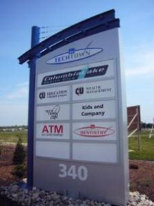
Waterloo’s Technology Park
This transformation from a manufacturing economy to a high-tech environment interested us and we spent a day (Prof. Paul Parker, personal communication, 22 May, 2007) visiting places of importance in terms of Canada’s technology development. The schedule for that day’s trip is described below.
In the morning, we took a bus and left the campus of University of Waterloo. We went past one of the famous high-tech firms called Research in Motion, producer of Blackberry wireless platform. Then we arrived at the Waterloo Park and took a view of the Perimeter Institute. After that we went to Kitchener and walked past the School of Pharmacy upon which the new industry of health science is based. We then got to the top floor of the Kitchener City Hall and took a perspective of the whole Kitchener’s urban morphology. Later, in the afternoon, we went to the Toyota Motor Manufacturing Centre (TMMC) in Cambridge and were shown the whole high-tech process of producing automobiles in a chain-car tour. After that, we visited the Accelerator Centre back in the Technology Park of Waterloo and saw the government’s effort in helping nurture high tech industry by smoothing the process of ‘turning an idea into a business.’
In this report, we will first discuss the background of Canada’s industrial transformation and then we will go on to report the data we collected for the two main research places to give an introduction to Toyota Motor Manufacturing Canada and Accelerator Centre at the Technology Park of Waterloo. After that, the social implication of industrial transformation will be examined while the report will end with an evaluation of our project proposal.
Background of Industrial Transformation
Waterloo is the smallest city in the Regional Municipality of Waterloo. Regional Municipality of Waterloo is formed by three cities of Cambridge, Kitchener and Waterloo and four rural townships (Prof. Paul Parker, personal communication, 22 May, 2007). People called the three cities as Canadian Technology Triangle since 1987. Canadian Technology Triangle refers to the cooperation of Cambridge, Kitchener and Waterloo developing high technology (Wikipedia, 2007).

![]()

The Canadian Technology Triangle
Source: http://www.techtriangle.com/
Why the industry of Canada had to head towards another direction starting from the 1980’s? It is because along with the development of Waterloo, land rent, wages and raw materials increased and thus the cost of the production (Prof. Paul Parker, personal communication, 22 May, 2007). The traditional industrial factories, without guaranteeing a sustainable profitable margin, they departed from Waterloo and found other places with lower cost of production. This was marked by the huge scale of industrial plants closures and job losses in the early 1980’s (Prof. Paul Parker, personal communication, 22 May, 2007). On the other hand, high tech firms were not affected by the increased land rent so much because they are high value added industry and land utilization is much smaller in scale since they do not need too much space and the profits can cover the total cost of the production.
In addition, the high level education also helps high tech industry in Waterloo a lot. University of Waterloo is ranked at the top of university in Canada. The subject like Engineering, Computer Science and Mathematics in University of Waterloo are famous in the world (Wikipedia, 2007). Therefore, the university provides a lot of high skilled labour for Waterloo every year and it helps the development of high technology a lot in Waterloo.
Nowadays, 400 high tech firms are located in Waterloo and Waterloo has been the second most important industrial city in Canada (Prof. Paul Parker, personal communication, 22 May, 2007). Besides, many high skilled labours are needed in the area. Accelerator Centre is one of the channels of looking for the excellent workers for the high tech firms. Moreover, Toyota Motor Manufacturing Centre is also one of the successful examples with high technology in Waterloo. Thus, Waterloo has become one of the world’s top seven intelligent communities of 2006 and the world’s top intelligent communities 2007 (Intelligent Community Forum, 2007).
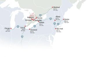
Physical Location of the Canadian Technology Triangle
Source: http://www.techtriangle.com/
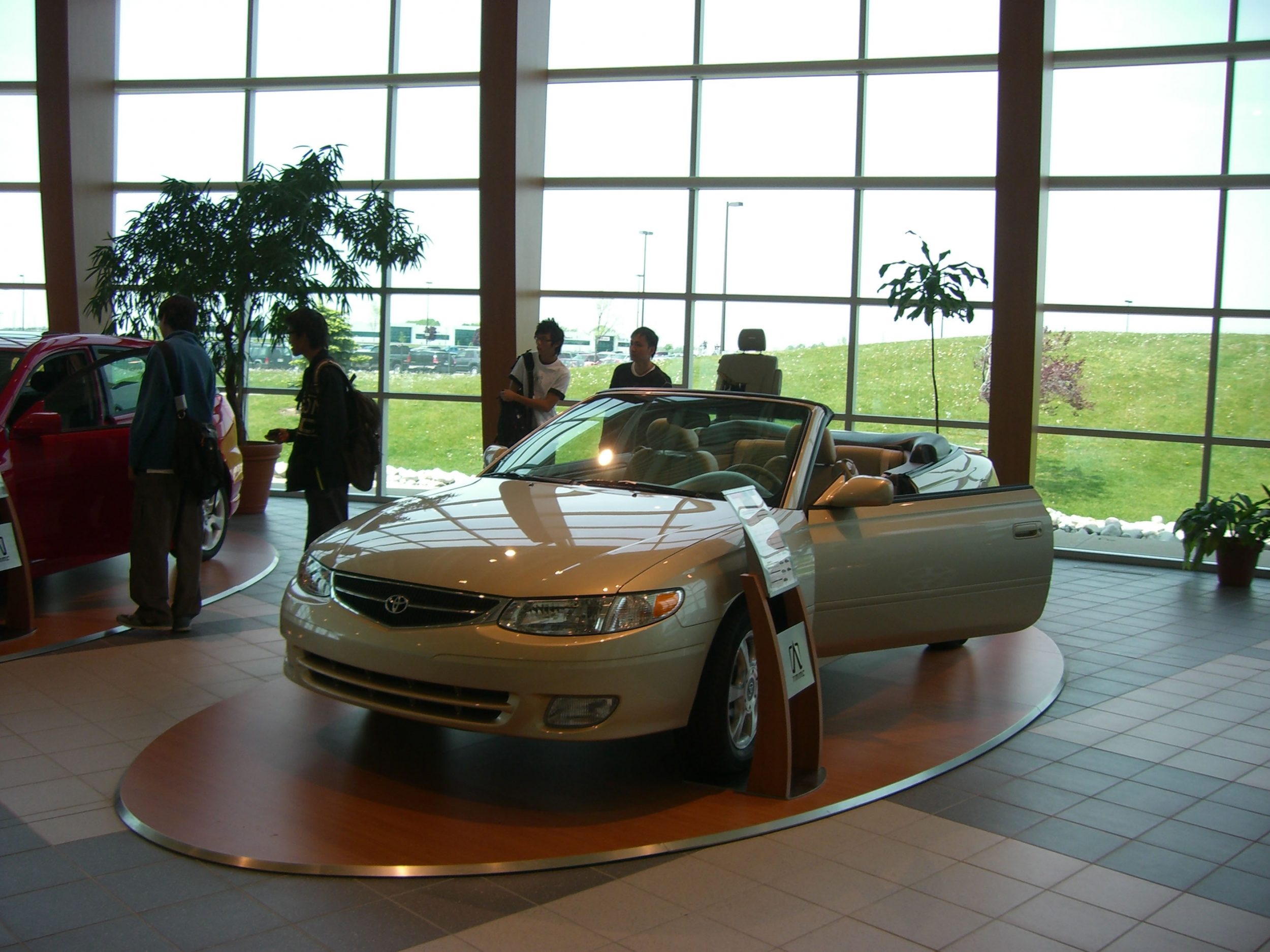
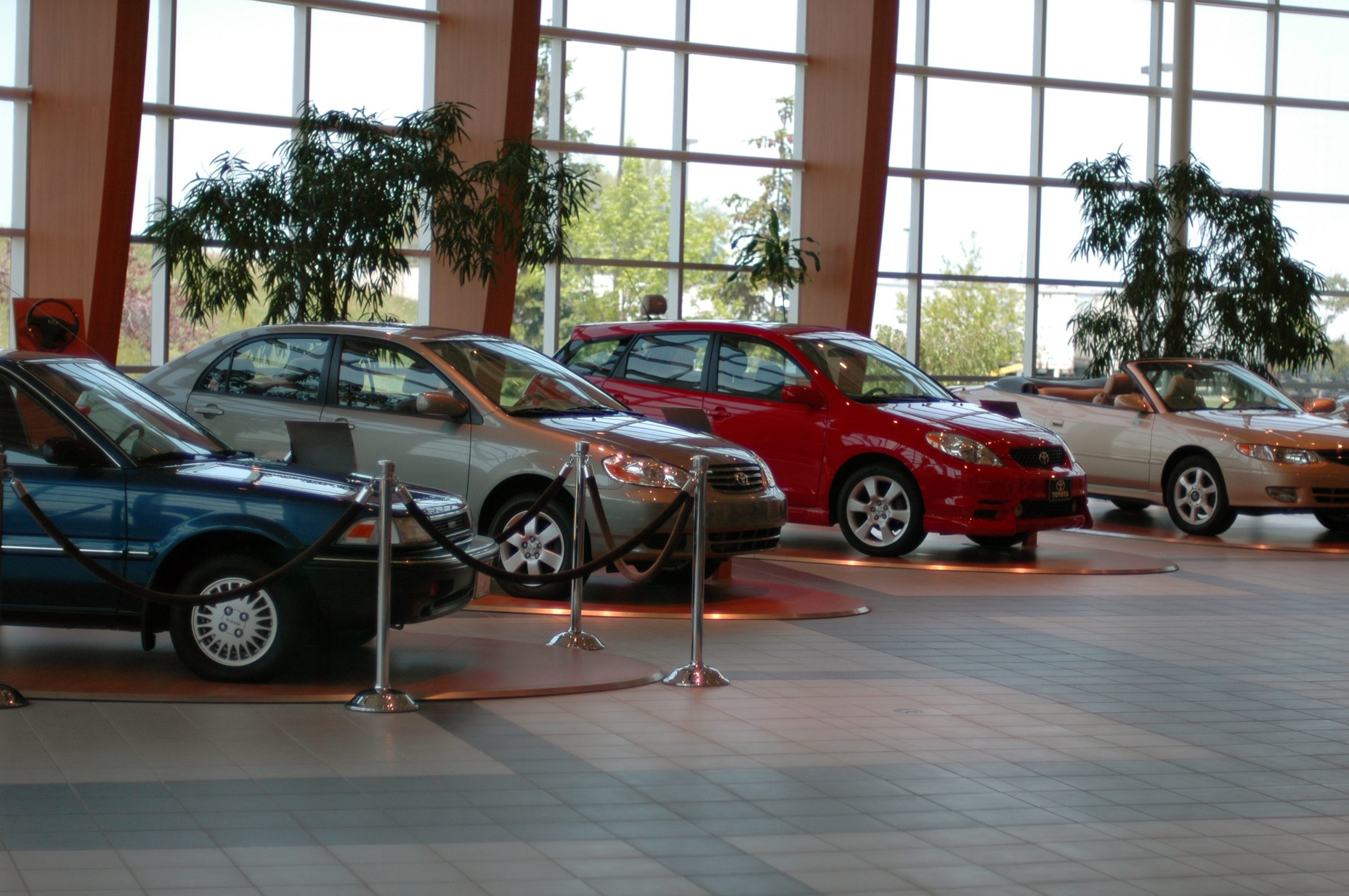
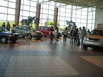
Toyota Motor Manufacturing Canada
Toyota is one of the most famous automobile manufacturing companies in the world. Over the continent of North America, there are 17 manufacturing plants. Its first and only plant in Canada now is called Toyota Motor Manufacturing Canada (TMMC), which is located in Cambridge, Ontario. It was established in Sept 1986. TMMC mainly produces three types of cars, they are Matrix, Lexus RX330 and Corolla (Toyota Motor Sales, U.S.A., Inc., 2007).
The rationale of choosing Cambridge as the location is because of its proximity to the University of Waterloo. TMMC is a magnet that can attract a lot of elites from the university. During summer break, lots of talented graduates are looking for summer jobs and TMMC is a good place for them. Also, according to the educational system of University of Waterloo, students have to work outside school to gain 2-year working experience. TMMC is definitely one of their destinations.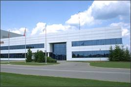
Besides, transportation network is a crucial concern for the plant. TMMC is located near one of the major highways, highway 401 to Detroit. It is more convenient to delivery finished products to the markets.
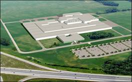
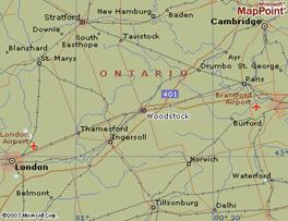
In 2008, there will be a new manufacturing plant built in Woodstock. It is the second Toyota plant in Canada. The location of the new plant is adjacent to several highways like highway 401 and 403. Moreover, its educated labor pool and proximity to the Cambridge plant (40km away) are also reasons why this location was picked.
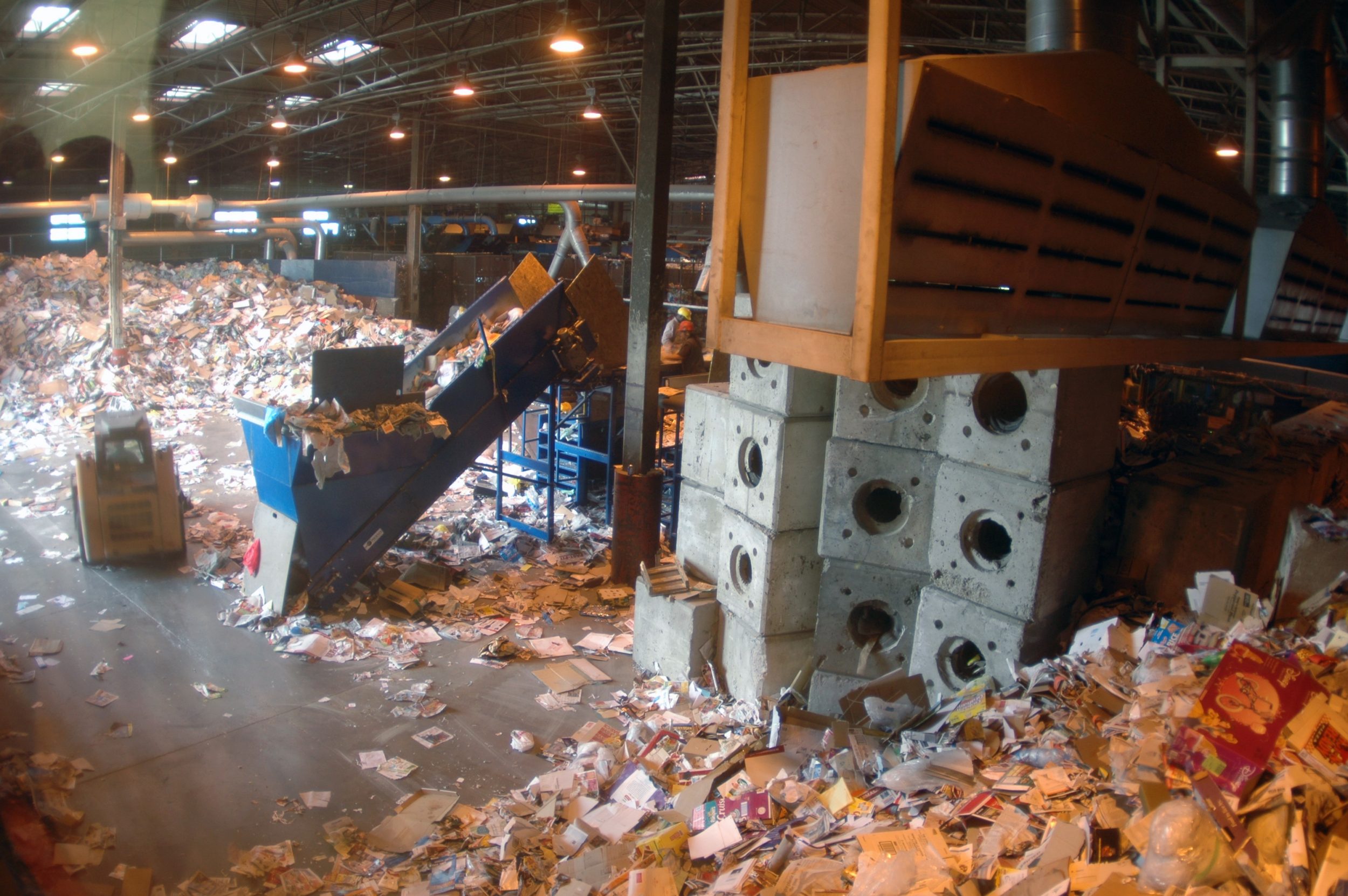
During manufacturing, some environmental pollution will be created inevitably, especially for heavy industry. However, Toyota plays an important role on environment conservation. For example, All Toyota Plants in North America are certified by ISO 14001. ISO 14001 is a voluntary standard. With this certification, Toyota plant has to develop its own environmental system and policy for environmental conservation. In TMMC, the average electricity charge is much higher than that of domestic use. It is because it shows the commitment of TMMC in perusing good environment. If TMMC uses a lot of electricity, it has to pay a lot more. Economically, the expenses will increase. So TMMC may find alternative ways to minimize the use of electricity like installing heat recovery units on the paint booth and boiler.
Another example is the way they recycle. TMMC aims for zero landfill by recycling. It is now recycling 99% of the scrap iron, as well as packaging bags, paint solvent and used oil. They also recycle engine blocks that reduce 500,000 pound of them filling up in the landfill site every year.
TMMC also practices alternatives recycling like composting, as well as recycling used water by its water recycling system. Moreover, different kinds of recycling rubbish bins are places inside the plant so that the employers can sort out the waste rather than throwing them in one bin altogether.
Every year, TMMC will provide training to the workers to update and refresh their environmental knowledge and awareness. For example, workers in TMMC need to learn how to treat hazardous disposal and learn environmental management system. Also, they have to take ISO 14001 quizzes twice a year.

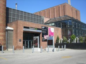
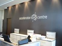
Accelerator Centre
The acceleratorcentre was opened in May 2006. It is located in the Research & Technology Park, which is very near to the University of Waterloo. It is a not-for-profit corporation, which aims at accelerating innovative venture to commercialize their products or services through the provision of both “hardware” and “software”.
Services
Hardware refers to some facilities and infrastructure, including professional offices suites, basic office furniture, meeting rooms and networking area, etc. Such free provision of hardware can significantly lower the construction cost in the early stage of business operation, thus essential for business starters whose initial capital is usually lacking. The acceleratorcentre goes beyond simply providing hardware; it also involves “software”.
Software refers to the some business advice, mentoring, administrative support, education programs and networking opportunities, etc. The business advice aims to assist the entrepreneurs to maximize their market potential, and make their incredible ideas a saleable product in the market. On the other hand, the networking opportunities, which is a process attempting to match the innovative talent with the highly effective people and unlimited resources, including finance, HR, design and business planning, etc, is found to be especially useful for the young entrepreneurs as it is often one of the greatest obstacles for the beginners.
Reference
Intelligent Community Forum. (2007). Top Seven By Year. Retrieved 18th June, from
http://www.intelligentcommunity.org/
Saunders, R. (2003). Defining Vulnerability in the Labor Market. Canada: Canadian Policy Research Networks.
Statistics Canada. (2007). Employment by Industry. Retrieved 29th June, 2007, from http://www40.statcan.ca/l01/cst01/econ40.htm
Statistics Canada. (2007). Canada: Economic and Fianancial Data. Retrieved 29th June, 2007, from http://www40.statcan.ca/l01/cst01/econ40.htm
Maxwell, J. (2003). The Great Social Transformation: Implications for the Social
Role of Government in Ontario. Ottawa: Canadian Policy Research Networks.
Toyota Motor Sales, U.S.A., Inc.. (2007). Environment. Retrieved 4th July, 2007,
from http://www.toyota.com/about/environment/index.html
Toyota Motor Sales, U.S.A., Inc.. (2007). Environment Awards for Toyota. Retrieved
4th July, 2007, from http://www.toyota.com/about/environment/awards/index.html
Wikipedia. (2007). Waterloo, Ontario. Retrieved 26th June, 2007, from
http://en.wikipedia.org/w/index.php?title=Waterloo%2C_Ontario&oldid=140626992
Group 4: Urban planning in downtown Toronto:
A lesson for Hong Kong
Hong Kong, being one of the most rapidly developed city in the previous decays, has become a well-known international financial center. However, it was said that because of its rapid development, there are insufficient planning in the urban area and has resulted in many social problems. After investigating the urban planning in Toronto, is there anything the Hong Kong can learn from this well-developed Canadian city? What are the differences between the urban planning of Toronto and Hong Kong?
We will be investigating the above in four areas:
- Neighbourhood at Spdina Avenue and Willcocks
- St. Lawerence Market at King Street and Front Street
- The Financial District at King Street and Bay Street
- The King-Spadina Manufacturing District.

Neighbourhood at Spdina Avenue and Willcocks
According to the Official Plan for the City of Toronto, three-quarters of the city’s area is used for neighbourhoods, parks, ravines, watercourses and valley. One of the factors that Toronto attracts people to live and work there is the variety and quality of the residential community, Neighbourhoods.
Neighbourhood is a well-planned and protected place connecting people to develop a common sense of community. There are hundreds of neighbourhoods containing low-rise residential buildings, parks, schools, local institutions and small-scale stores in Toronto. In 1950-1970, there were many high-rise offices, institutions ad residential buildings constructed in the midst of low-scale residential neighbourhoods. However, after 1976, there was a change in spatial pattern. No more new high-rise buildings are allowed to be built in the neighbourhoods. Hence, the neighbourhoods are protected.
Nowadays, as the economy has changed, people have begun to work at home. This reduces trips to works and enhances safety. These home occupations help to provide a sense of neighbourhood. Besides, educational land use has been added in neighbourhoods. This integration of neighbourhoods and schools help to ensure the quality of life. The stability of the physical character of neighbourhoods is one of the keys to Toronto’s success. Under the policies of the Official Plan, there are three major elements in neighbourhoods.
First, it is to maintain buildings in low-rise in neighbourhoods. Neighbourhoods are considered as physically stable areas made up of low-rise residential buildings which include detached houses, duplexes, triplexes and walk-u
apartments that are four-storey or less. Besides, parks, low-rise local institutions, home occupations, cultural and recreational facilities and small-scale retail, service and office uses are also provided in neighbourhoods. In neighbourhoods, the low-rise local institutions play an important role of the daily life in neighbourhoods. They includes, schools, place of worship, community centres, libraries, day nurseries and private home daycare, seniors and nursing homes and long-term care facilities, public transit facilities, utility and telecommunications installations and public services.
Second, it is to protect the character and reinforce the stability of the neighbourhoods. At the boundary points between neighbourhoods and growth areas with mixed land use, there should be a transition in height, scale and density provided. It helps to protect the neighbourhoods not to be affected by nearby land use. Therefore, the mixed land use can be compatible with the neighbourhoods. Also, to attenuate traffic and parking impacts on adjacent neighbourhoods streets. This can reduce the diminishing on the residential amenity of those neighbourhoods.
The third element is to improve and enhance the living environment and infrastructure of neighbourhoods. To provide adequate privacy, sunlight and sky views for residents of new and existing neighbourhoods. There should be enough space and distance between building walls. On newly created or existing public streets, there should be no gates limiting public access. It should locate and screen service areas and garbage storage in order to minimize the impacts on existing and new neighbourhoods.
Moreover, maintaining roads and sidewalks in a good condition. Improving and expanding existing parks, recreational facilities, libraries, local institutions, local bus and streetcar services for neighbourhoods residents. Discouraging parking on local street for non-residential purposes. And, creating new community facilities and local institutions, and adapting existing service to changes in the social, health and recreational needs of the neighbourhoods.
Therefore, there are a lot of benefits living in neighbourhoods. There is better transit service. This can reduce reliance on private automobile. There are greater hosing choices, increased shopping opportunity and improved pedestrians environment.
Comparing with residential area in Hong Kong, there is no neighbourhood. It is because land is limited in Hong Kong. It is difficult to develop low-rise residential area with spacious parks. Most of the residential buildings in Hong Kong are over 30 storeys. And they are very to each other. Therefore, the privacy, sunlight and sky views of the residents are hardly be guaranteed in Hong Kong
However, there are many public estates in Hong Kong which have the same functions of the neighbourhoods in Toronto. In most of the public estates, there are shops, market, community centres, schools and playgrounds. This can give a sense of community to residents. The difference is that Hong Kong has a smaller scale than Toronto. Besides, the transportation network of public estates in Hong Kong is well-developed. There are bus, taxi, mini-bus and railway near the estates. Same as the neighbourhoods in Toronto, the accessibility is very high to the residents.
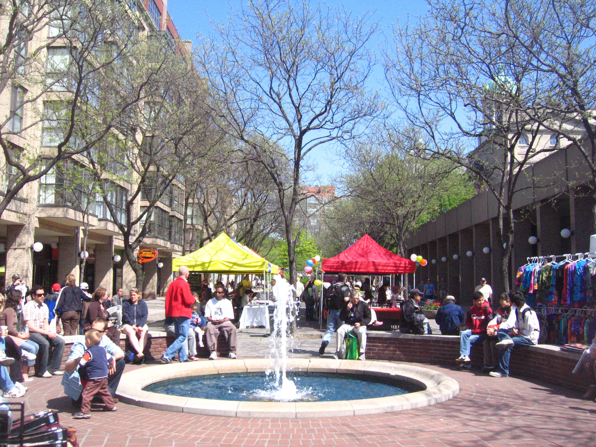
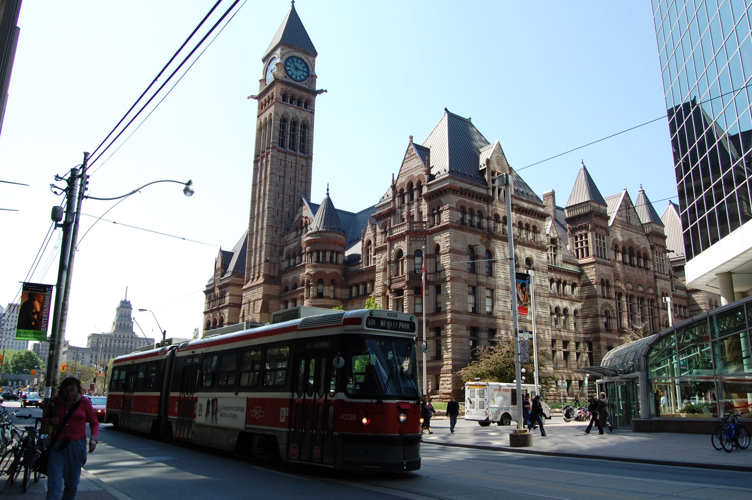
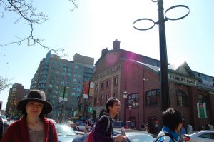
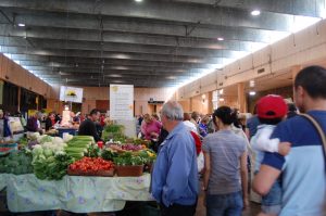
St. Lawerence Market at King Street and Front Street
The St. Lawrence Market at King Street and Front Street gained its name mainly from the well-known waterway of the northeast Canada, The St. Lawrence Seaway. In the past, the seaway largely supported the long distance trade of all kinds of goods, including raw materials and textile. The St. Lawrence Seaway was officially opened in 1959, and has served 40% of the YS manufacturing and half of the production of US soybeans and corn (Digital Wizards Inc., 2007). Its vibrant activity in long distance trade can be observed by the establishment of the banking and financial activities nearby.
In the area around the St. Lawrence Market, a design of a ‘community’ can be found. The St. Lawrence Market was commonly considered as a design to serve the purpose to retain the local neighbourhood. As mentioned in the previous sections, neighbourhood is one of the main considerations in the process of town planning in Toronto, so that a common sense of community can be developed. The St. Lawrence neighourhood was initiated to respond to ‘the changes made in federal, provincial and municipal housing policies in the early 1970s’ (CEDRO, 2001). In the area, there are provisions of all kinds of essential social facilities and amenities. For example, there we can find performing centers like the St. Lawrence Centre for Performing Arts, waterfront recreation, schools, hospitals and public transit.
The reason for such a ‘community’ being designated here is because of the fact that the area is very near to the downtown adjacently, and since large part of the land was previously in the hands of the public sector, it was easy to be assembled for development. Hoping to create a type of neighbourhood that was ‘affordable, centrally located and is controlled by residents’ (CEDRO, 2001), the planners and working committees tried to plan the area with a high degree of openness, and encouraged community participation. This helped avoiding government-dictated form of planning that was often found in the past, which in fact failed the aim of creating an area for whom that are really using it and living there.
We can see that in the area around the St. Lawrence Market, people from differentiated range of income, social class, age and household size settled. This has created a mixture of people from different social background and set as an ‘origin’ of how social cohesion was enhanced in the area, which is near to the downtown.
Apart from that, the St. Lawrence area is also considered as a social gathering place. As described by Professor Gad, the St. Lawrence Market is a place with social cohesion and gathering taking place. It was said that such gathering was not only limited to the getting-together of a particular social group (e.g. only farmers getting together on the Saturday Farmers’ Market), but a place where people from different group and different social strata get together. This includes the intellectuals, common citizens and also farmers. This is especially true on the weekend, where many citizens are off from work. So, they can go to the place with their family, buying fresh food sold by the farmers, spending some time relaxing and socializing with the others. Serving as a social gathering place enhancing cohesion among different social groups, it created a network among the local people.
Another feature we can notice in the area is the provision of protected walkway. This was also a part of the planning. These protected walkways were created next to the shops located at the ground floor, and were aimed to protect the pedestrians from the snow storms in the winter, while they can walk under the warm sunshine in the summer. However, such protected walkway was commented as a feature that favours only the pedestrians but not the shopkeepers. This is because such provision has somehow prevented the customers from getting into the shops to do some shopping.
In the area around the St. Lawrence Market, there is also the existence of a visual corridor. A visual corridor means that the people in the place are capable of viewing the area even at a far distance. Such visual corridor implies that there must be the construction of low-rise settlement in the area. This is important, because according to the urban development plan, it hoped to allow the public to get close to the waterway and allowing them to get close to nature. So, the public reach the sea visually and physically in a short distance and in a straight road due to the design of a neat street grid system.
Another purpose of the creation of a visual corridor is that, this allows the public from viewing the church from every corner in the downtown. This shows the importance of the church and the old church building in the area, which is said to be the forerunner of the existing church.
Apart from that, there are also some wholesale buildings in the area. They were 3-story high and have been renewed in the recent years due to the development plan. This is because in the past, as mentioned, the St. Lawrence area was famous for its manufacturing and wholesale. After the decline of the manufacturing industry, the old buildings were now being turned into warehouses. These buildings were old and are considered to have historical value. So in 1970, the government has passed the Heritage Act to preserve the buildings in the area.
When we compare the St. Lawrence Market with similar cases in Hong Kong, it is indeed quite hard to find an example to compare it with. This is because in Hong Kong, we seldom find a place that is serving both as a market place and most importantly, a place that enhance social cohesion. Indeed, in the past, the wet market may somehow serve such purpose to some extent, that although they are mainly selling fresh foods, we can still find some degree of social cohesion on going. For example, at the top floor of the wet market, there are some low-priced restaurants where we may find some people (mainly from the lower strata of the society) get together. However, nowadays, with the opening of large scale supermarkets, like Wellcome and Parknshop, many local people now turn to these branches for buying fresh food because of the more hygienic condition. This in the end has diminished the significance of the local wet markets, and symbolically, Hong Kong is losing a similar icon of social cohesion like that of the St. Lawrence Market in Toronto.
Reference
CEDRO, University of Calgary (2001) Directions for New Urban Neighbourhoods:
Learning from St. Lawrence. Retrieved 5 July, 2007 from the World Wide Web www.ucalgary.ca/EV/designresearch/projects/2001/CEDRO/cedro/cip_acupp_css/index.html
City of Toronto. (2006). King-Spadina Secondary Plan Review. Retrieved on 28 June 2007, from the World Wide Web: http://www.toronto.ca/planning/king_spadina.htm
City of Toronto. (2007). Official Plan for the City of Toronto. Retrieved on 2 July, 2007, from the World Wide Web: http://www.toronto.ca/planning/official_plan/pdf_chapter1-5/chapter1-5_searchable_locked.pdf
City of Toronto (2007) The St. Lawrence Market. Retrieved from the World Wide Web
http://www.stlawrencemarket.com/
Digital Wizards Inc. (2007) The St. Lawrence Seaway: Economic Engine of the
Northeast. Retrieved 5 July, 2007 from the World Wide Web
http://www.greatcanadianrivers.com/rivers/stlawer/economy-home.html
Gad, Gunter. (1999). Downtown Montreal and Toronto: Distinct Places with Much in Common. Canadian Journal of Regional Science, 22(1), 143-170.
Gad, Gunter. (2007). Introduction to Toronto: A walking tour. Toronto: Department of Geography, University of Toronto.
Hill, Sharon. (2006). King-Spadina Study, King-Spadina.com. Retrieved on 28 June 2007, from the World Wide Web: http://www.king-spadina.com/firstStep.html
Urban Renewal Authority. (2007). Kwun Tong Town Centre Project. Retrieved on 28 June 2007, from the World Wide Web: http://www.ura.org.hk/html/c800000e33e.html
Vinodrai, Tara. (2001). A Tale of Three Cities: The Dynamics of Manufacturing in Toronto, Montreal and Vancouver, 1976-1997. Ottawa: Statistics Canada.
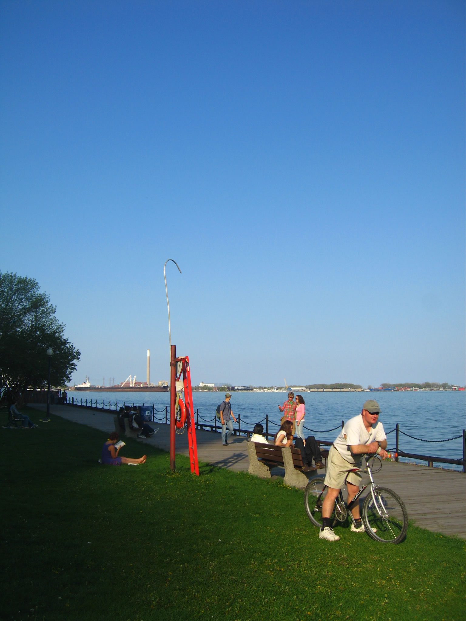
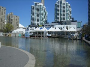
Group 5: Toronto Waterfront Revitalization programme
In this North America Field Trip, we visited Toronto and Waterloo. Everybody knows that field trip is very important for Geography students, because we can see the real world and apply what we have studied before into the real world. This time, we had the field trip with Dr. Fung, who is very familiar with these two cities, and we have gained lot knowledge about geography, customs, and living style of Canada accompanying with Dr. Fung.
Our project is about the waterfront area in Toronto, since both Hong Kong and Toronto are famous costal cities; we decided to compare the waterfronts in both cities. After visiting the Toronto Central Waterfront and comparing it with Hong Kong Tsim Sha Tsui Waterfront, we found that there are some drawbacks of the Toronto one and advantages of our Hong Kong one, so we can absorb the good ideas of planning a waterfront of both cities, which is extremely worthy and valuable to our further studies. Also this can really show the flexibility of GRM department, we can do what we want and handle it all by ourselves.
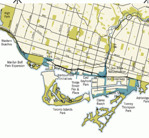
Waterfront Development Projects – Central Waterfront
Introduction
Central waterfront contains over 800 hectares of land in which are mostly vacant and underused. Over 70 percent of lands are in government ownership, so that revitalization can be in a huge scale. The plan will focus on 10km of shoreline, including Exhibition Place, Central Bayfront, Harbour Front etc. Now, the Central waterfront is undergoing the second stage of revitalization which is called “MAKE WAVES”.
Core principles of the project
Removing barriers/ making connections
A network of parks and public area
To promote a clean and green environment
To create dynamic and diverse new communities
The Central Waterfront
Removing barriers/ making connections
In fact, the connection between waterfront and the city is now cutting off by the Gardiner Expressway. One of the aims is to re-connect the inner city (downtown) to the lake Ontario.
In the future, there will be:
GO transit: to upgrade the Union Station, also build one more station and a new transit line from Exhibition Place to Port lands
Re-locate the highway to underground
Right-of-ways: providing Bus lines and Streetcar lines in road and also widening roads
Transform more roads for cycling
To build cultural corridors from the lake to the inner city
No railings — Providing a much closer human-water relationship to people
A network of parks and public area
Aim to build a waterfront as a destination for tourists, celebration and local enjoyment. Therefore, it is supposed to create more parks and public areas.
Along the waterfront:
Create more parks, e.g. To larger the New Frot York Park also build a new lake Ontario Park along the north shore
Ship channels: in order to accumulate transportation speed, it is proposed to build channel from inner harbour to the lake
Design of park: More sustainable: use new technological method to reduce the disturbance but more ecological
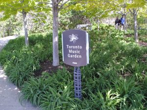
Toronto Music Garden
To promote a clean and green environment
Aim to reduce the use of autos, also building flood prevention berm along the Don River and re-naturalizing the month of the Don River
Promoting local sustainable in which to encourage citizen to live and work close together in order to reduce commuter trips
Reclamation is limited only for stabilizing shorelines, but not for land creation
Use of eco-friendly power: e.g. anaerobic digestion, solar and wind power
Water treatment as close as the source of pollution
To create dynamic and diverse new communities
To design district with suitable function, includes:
Port Land – Green industries
West Don Lands – mixed-use communities
East Bayfront – Working and living
Exhibition Place – A place for work, live and celebrate
Policies:
Balance of land uses: To build new schools, community services related facilities
Housing option: To offer affordable and low-end-of market housing
Creating special places: To keep and rehabilitate view corridors, also providing space for bio-technology industries
An exhibition gallery — In the past, it was a power plant
Harbourfront Centre and York Quay Centre
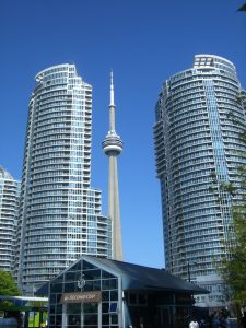
CN Tower — The world’s tallest freestanding structure on land
Reference
City of Toronto (2007). City of Toronto: Waterfront. Retrieved July 1, 2007 from http://www.toronto.ca/waterfront/index.htm
The University of Idaho Community (2007). Design and Planning Research Page. Retrieved June 30, 2007 from The University of Idaho Community , Web site: http://www.class.uidaho.edu/communityresearch
Travel + Leisure (2007). Travel + Leisure. Retrieved June 30, 2007 from Travel + Leisure, Web site: http://www.travelandleisure.com/
TWRC (2006). TWRC. Retrieved June 30, 2007 from , Web site: http://www.towaterfront.ca/index.php?home=true
Wikipedia (2007). Toronto_waterfront, Retrieved June 30, 2007 from , Web site: http://en.wikipedia.org/wiki/Toronto_waterfront
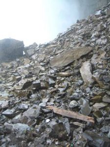
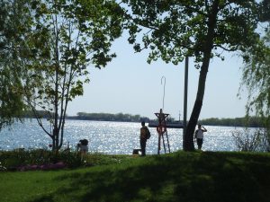
Group 6: Resource Management: Grand River Conservation
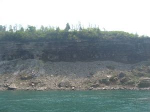
Introduction of the Grand River
Geographical information
(The Grand River Watershed, 2003)
flowing 290km
from the Dundalk Highlands to Lake Erie
the Grand River watershed covers 7 000 sq. km
the watershed is about 1 hr from Toronto and London along the Trans Canada Highway
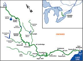
Map of Grand River Watershed (Friends of the Grand River, 2007)
History
(The Grand River Watershed, 2003)
there were man from about 11 000 years ago
human activities facilitated a series of changes in climate, vegetation, soils, and wildlife
a navigation canal was operated along the main river in the 19th century
people and goods moved along the Grand
in the late 19th and early 20th centuries, major floods occurred because of the serious deforestation
diverse watershed land use (e.g. residential, industrial, agricultural…)
the Grand is important for Canada, in terms of both natural and cultural
human settlement and hence waste disposal with the low summer flow of the Grand
à need of conservation
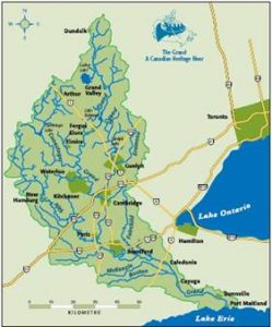
Map of Grand River watershed (Grand River Conservation Authority, 2007c)
Importance of the Grand
(The Grand River Watershed, 2003)
In 1994, the Grand was designated by the federal-provincial Heritage Rivers Board as one of Canada’s Heritage Rivers
Heritage Conservation
Natural Heritage Conservation
Aim:
Maintain the ecosystem
Preserve the stream channels and natural features
Reserve the potential chemical and medical uses
Provide recreation opportunity
Example:
The Canada’s largest urban green spaces
— rare Charitable Research Reserve
The Charitable Research Reserve rare (rare, 2005a)
rare Charitable Research Reserve, a non-profit organization established in 2002, owns a 370-hectare land reserve with a rich diversity of natural landscapes and wildlife habitats (rare, 2006).
1. Location
The 370-hectare nature reserve is located where the Grand and Speed Rivers meet, and rare is in the heartland of the Grand River watershed. It is the property of natural and agricultural landscapes that abuts the City of Cambridge, forming a large piece of green space separating the urban areas of Galt, Preston and Blair.
2. High ecological value of rare Charitable Research Reserve:
Designation of Environmentally Sensitive Landscapes (ESL) (rare, 2007)
3610-arce Blair-Bechtel-Cruickston ESL in North Dumfries and Cambridge
The 913 acres of rare lands make up a large portion of this ESL
Almost all urban developments and a number of other activities that are harmful to the rural nature of this reserve are prohibited

Rich biodiversity (rare, 2005a)
a wintering habitat for bald eagles
one of the last places in Ontario that has old-growth Carolinian forest
55 rare and endangered species living there
201 species of birds are found on the property
encompasses two Environmentally Sensitive Policy Areas
consist of six different types of habitat, including alvars – a rare type of ecological zone that’s found in few places on Earth outside of the Great Lakes Basin.
Bald Eagle ( Source: rare (2005b)
3. The objectives of rare Charitable Research Reserve: (rare, 2005a)
To preserve, protect, restore and improve the natural resources and wildlife habitat
To encourage and promote public awareness of the natural resources, and the appreciation of their value in enhancing the quality of life.
To facilitate research, seminars, interpretive activities, conferences and public forums about the flora, fauna, agricultural practices, hydrology and geology of the Region.
To purchase, maintain and preserve historical buildings and archaeological sites in the Region
4. Environmental education
Guided Hikes and Walks
Wildflower Hike
Spring Migration Hike
Workshops
Bald eagle monitoring workshop
Frogwatch workshop
Public Trail System
rare Administrative Office/Information Centre
giving short lecture
provides a general picture to the public about what the main job of rare is
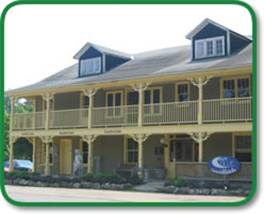
rare Information Centre (rare, 2005c)
Cultural Heritage Conservation
Aim:
Preserve the local cultural character and its atmosphere
Preserve the existing topography and traditional streetscape
Preserve the buildings with distinctive architectural merits and historical values
Example:
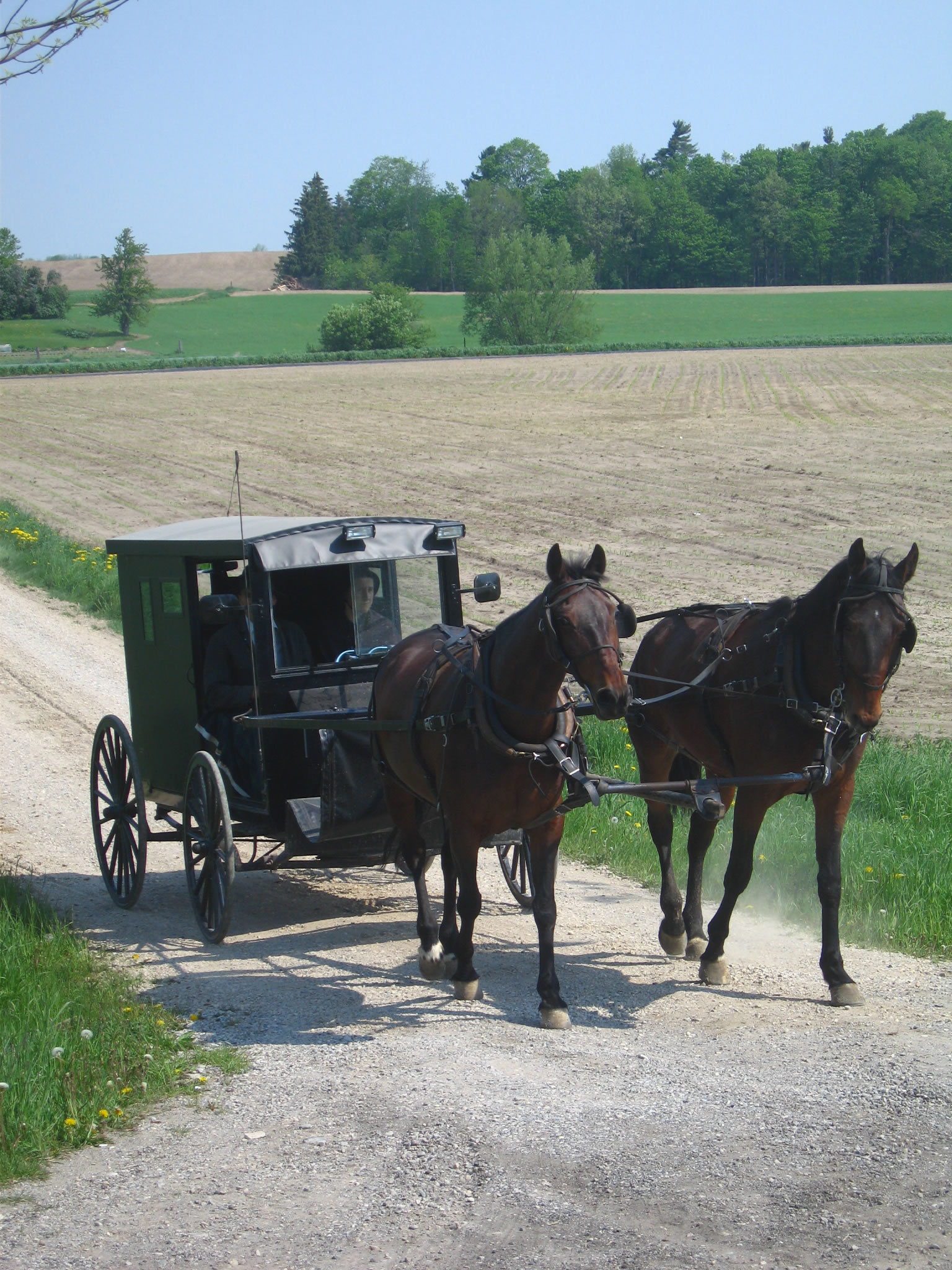
St. Jacobs

The location of St. Jacobs
(Mercedes Corp, 2006a)
Settlement (Nelson, 2003)
St. Jacobs is located in southwest Ontario and north of Waterloo in Woolwich Township, Waterloo Region
Pennsylvania-German Mennonites began to settle in St. Jacobs since 1790s
The name of the town was changed from “Jacobstettel” to “St. Jacobs” in 1852
Old Order Mennonites resist the use of modern technology, such as electricity and motor car, instead, they retain the old living style, such as traditional dressing and horse carts as main transportation mean
But not all the Mennonites follow the traditional lifestyle as the Old Order Mennonites, for example, some of them begin to use mobile phone
Economics
In the early years, Mennonites mainly relied on agricultural activities, for instance, mixed farming of grain, corn, feed crops as well as raising cattle
In mid-1970s, St. Jacobs moved form a declining rural village to a famous tourism site because of its traditional and religious customs and lifestyles
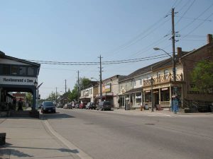
The old main street
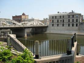
Grand River bank in Cambridge, Ontario
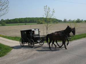
Mennonite in St. Jacobs
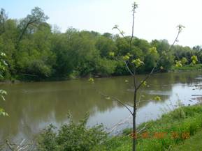
Grand River
Reference
Cooke, S. (2006). Water quality in the Grand River: A summary of current conditions (2000-2004) and long term trends. Cambridge: Grand River Conservation Authority.
Cruickston Charitable Research Reserve. (2007). About Cruickston. Retrieved June 20, 2007 from the World Wide Web: http://www.raresites.org/about.html
Grand River Conservation Authority (2005). Grand River Conservation Authority 2005 Fall Report. The Grand, pp.3-11.
Grand River Conservation Authority (2007a). The Grand River Watershed. Retrieved June 18, 2007 from http://www.sourcewater.ca/index/document.cfm?Sec=7&Sub1=0&sub2=0
Grand River Conservation Authority (2007b). Water supplies and water quality. Retrieved June 18, 2007 from http://www.grandriver.ca/index/document.cfm?Sec=67&Sub1=0&sub2=0
Grand River Conservation Authority (GRCA). (2007c). Conserving our future. Retrieved July 2, 2007 from the World Wide Web: http://www.grandriver.ca/Grca/pdf/GRCABrochure.pdf
Mercedes Corp.(2006a). Farmers’ Markets. Retrieved June 20, 2007 from the World Wide Web: http://www.stjacobs.com/html/shopping-farmersmarkets.html
Mercedes Corp.(2006b). Maps. Retrieved June 20, 2007 from the World Wide Web: http://www.stjacobs.com/html/maps.html
Nelson, G. (2003). The Grand River Watershed. Waterloo: University of Waterloo.
Nicholas, Hill. (1984). Cambridge (Galt) — a Heritage Conservation District Plan. Retrieved June 20, 2007 from the World Wide Web: http://www.city.cambridge.on.ca/planningdoc/main-street-HCDP.pdf
rare. (2005a). Save the land. Retrieved June 20, 2007 from the World Wide Web:
http://www.raretome.ca/cms/en/savetheland.aspx
rare. (2005b). Nurture Wildlife. Retrieved June 20, 2007 from the World Wide Web: http://www.raretome.ca/cms/en/nurturewildlife.aspx
rare. (2005c).Contact Us. Retrieved June 20, 2007 from the World Wide Web: http://www.raretome.ca/aspx/public/contact/contact.aspx?menuid=16
rare. (2006). A Registry of Accomplishments and Commitments, 2005. Retrieved June 26, 2007 from the World Wide Web:
rare. (2007). The rare review (Spring / Summer 2007). Cambridge: rare Charitable Research Reserve.
The Friends of the Grand River (2007). Maps. Retrieved June 22, 2007 from http://www.friendsofthegrandriver.com/map.htm
Wikipedia. (2007). St Jacobs Market. Retrieved June 20, 2007 from the World Wide Web: http://en.wikipedia.org/wiki/Image:St_Jacobs_Market.jpg
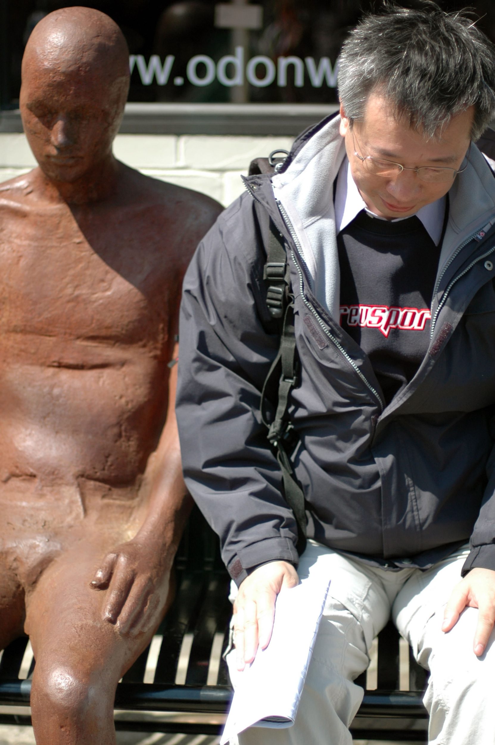
Student Afterthoughts and Comments
Chan Ying Kit, Gordon
I would like to thank Prof. Fung and Mr. Frankie Wong for their hard-working and well-organized preparation for this fruitful field-trip. It is my first time to travel with long-hour flight into another foreign country. I feel my horizon is really broadened after the trip. There are precious moments spending with those professors from the University of Toronto and the University of Waterloo. Their guest lectures as well as their detailed explanations at the field are very useful, meaningful and inspiring. Other unforgettable moments include the visit to a landfill site, traveling in the Tunnel of Journel behind the falls, eating BBQ pork dinner in Toronto’s China Town, as well as ice wine tasting and the “multi-visiting” of the Toronto’s waterfront. This trip helps me to refresh my geographical knowledge, and also it provides me one of the most memorable period of time in my life.
Dung Wan Yee, Winnie
The field trip to North America is an invaluable experience for me. The most impressive thing is having the chance hardly ever had to meet other professors of other universities and representatives of government department. I have learnt a lot from their precise and concise presentation. With actual field observation, I have acquired knowledge on different topics within limited time, such as the watershed planning of the Grand River and the urban development of downtown Toronto. Moreover, field works such as doing questionnaire offer me an opportunity to talk with the local people and learn about their lives in Canada.
Although this is my first time traveling to Canada, thanks to the arrangement of the department, I quickly got with the new environment. If I have a change, I would like to participant in another field trip.
Mak Kit Yan, Jenny
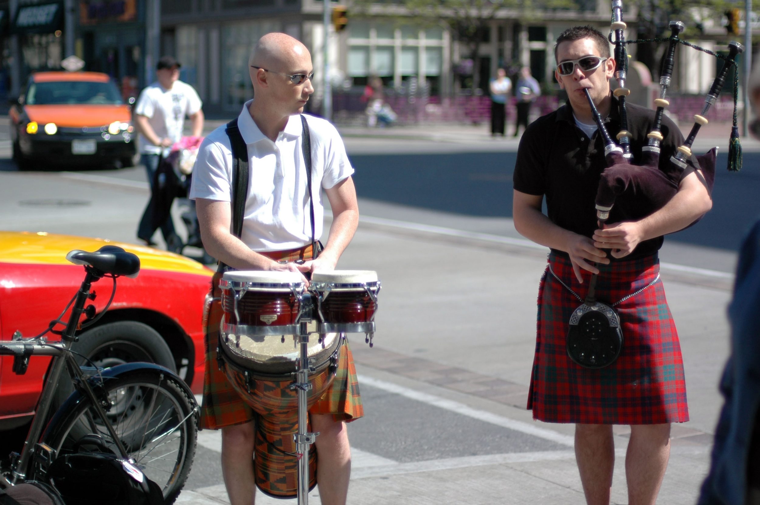
It is the first time I went to Canada. It is really a great experience for me traveling to this faraway country. Green grass and trees, lovely squirrels, groups of goose can be found in Toronto and Waterloo.
We stayed at University of Toronto during the days in Toronto. It’s a nice place although we have to share the washroom with boys. Prof. Fung has invited some professors in Toronto and Waterloo talking to us. We went to St. Lawrence Market where sells farm products on Saturdays and second-hand goods on Sundays with cheap price.
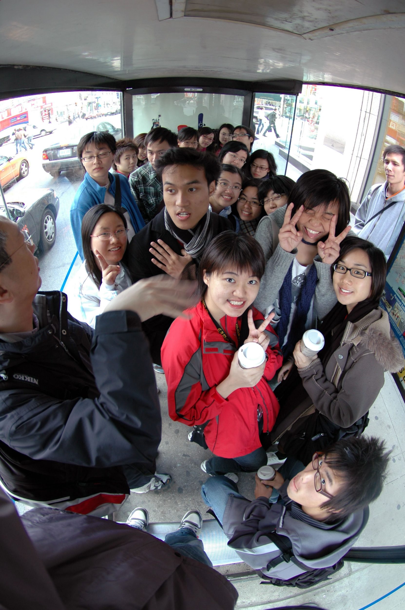
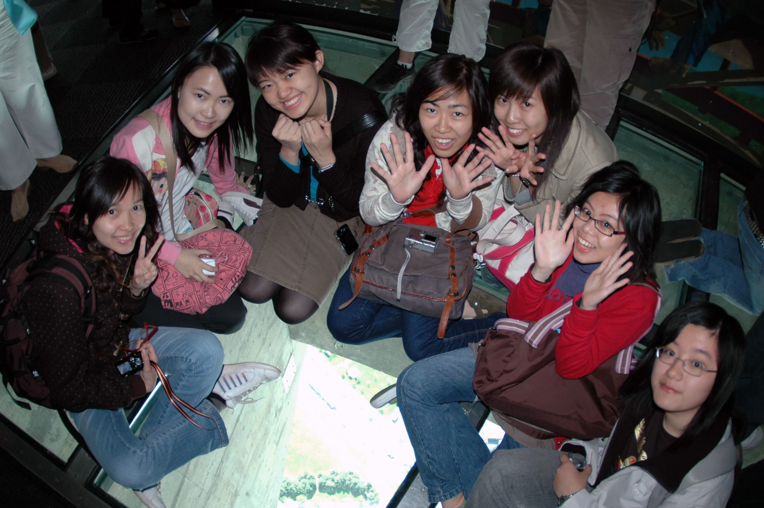
Also, we went to the highest building in the world. It is the CN Tower. The most exciting thing is we took many nice photos on the glass floor on the tower. We screamed at first when standing on the glass floor and I could feel I was shaking on the floor at that time.
On the other hand, we have to do some preparation and research before and during the field trip. The topic of our group is the industrial transformation in Waterloo. We visited the Toyota Motor Manufacturing Centre (TMMC) and Accelerator Centre in Cambridge and Waterloo where provide some information for us to know more about the development of high-tech industry in Waterloo. We went on a chain-car taking us to see the procedures of making the cars in TMMC. Although we cannot walk everywhere we want, it is very comfortable and funny for us to sit on the chain-car.
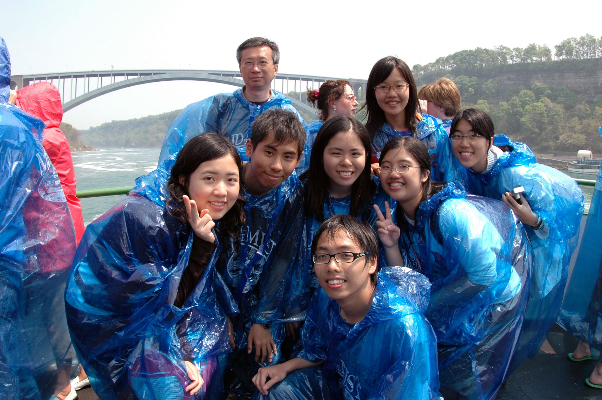
The most impressed place we went is Niagara Falls. It is amazing and wonderful. In order to see the falls with a little distance, we went abroad the Maid of the Mist. The pouring water from the falls was just like raining dogs and cats. Also, the government uses the fall for hydroelectric. Can you feel how powerful Niagara Falls is!?
To sum up, it is an educational trip for us and we have learned a lot from it. I have built up friendship with my mates who I didn’t talk with them much in Hong Kong before. The trip has brought me much more fun than I thought!
Shing Nok Yi, Fiona
After taking fifteen hours plane, we finally arrived to the continent of North America. My first impression of Canada is that the air there is very fresh and clean. . I took a deep breath without hesitation. The sky is clear with only a few high clouds. The weather is a bit cool and dry which is totally suitable for me because I do not like living in a hot and humid area. The building and population density is extremely low. We feel so relieved there.
Thanks to the preparation of Prof. Fung and our tutor Frankie, we lived in two of the most famous Universities in Canada, University of Toronto and University of Waterloo. The hostel is cozy and tidy. But I have never imagined that one could be woke up by beautiful birds’ songs next to your windows and the noise from a group of ducks around the campus. That was really interesting. It was just like living in the farm. Everything is so natural and simple. The distance between an everyday supermarket and your hostel takes at least fifteen minutes walk if you do not have a car. It is the only thing I was not used to. Also, there is very little entertainment except snooker. Students can fully concentrate on their study. There is no wonder many talents are come from Canada.
We went to many different places in Canada, like Ontario Science museum, CN Tower, Korean town, China Town, High Park, CBD of Toronto, SOHO Place, Waterloo, Kitchener, Grand River, landfill site, TMMC, accelerator centre, St. Jacobs, the Niagara falls, vineyard etc. My most unforgettable scene in Canada was the visit to Niagara falls. It is one of the seven wonders in the world and places you must go before you die. I am so lucky that I have a valuable chance to be there. The falls are awesome that you would never forget. You wonder the power of nature. The view is wonderful. We also took the the ship “Maid of the Mist” to go in front of the fall. I remember that all my hair was wet because there was a big hole on my raincoat. But still we felt excited. You just did not want to leave and wanted to stay one more second. However, our schedule was tight and we needed to go to our next stop, the vineyard. I had my first chance to taste ice-wine. It was very nice. I bought one back to Hong Kong and share with my friends.
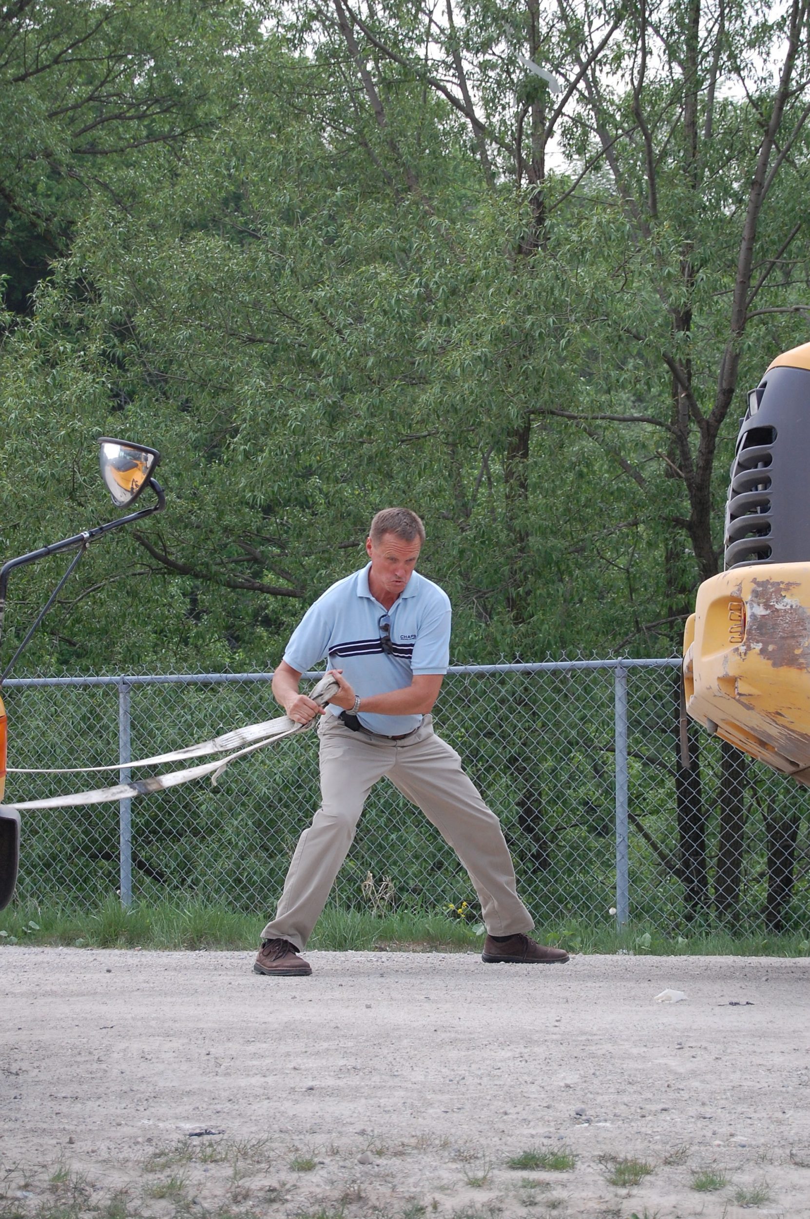
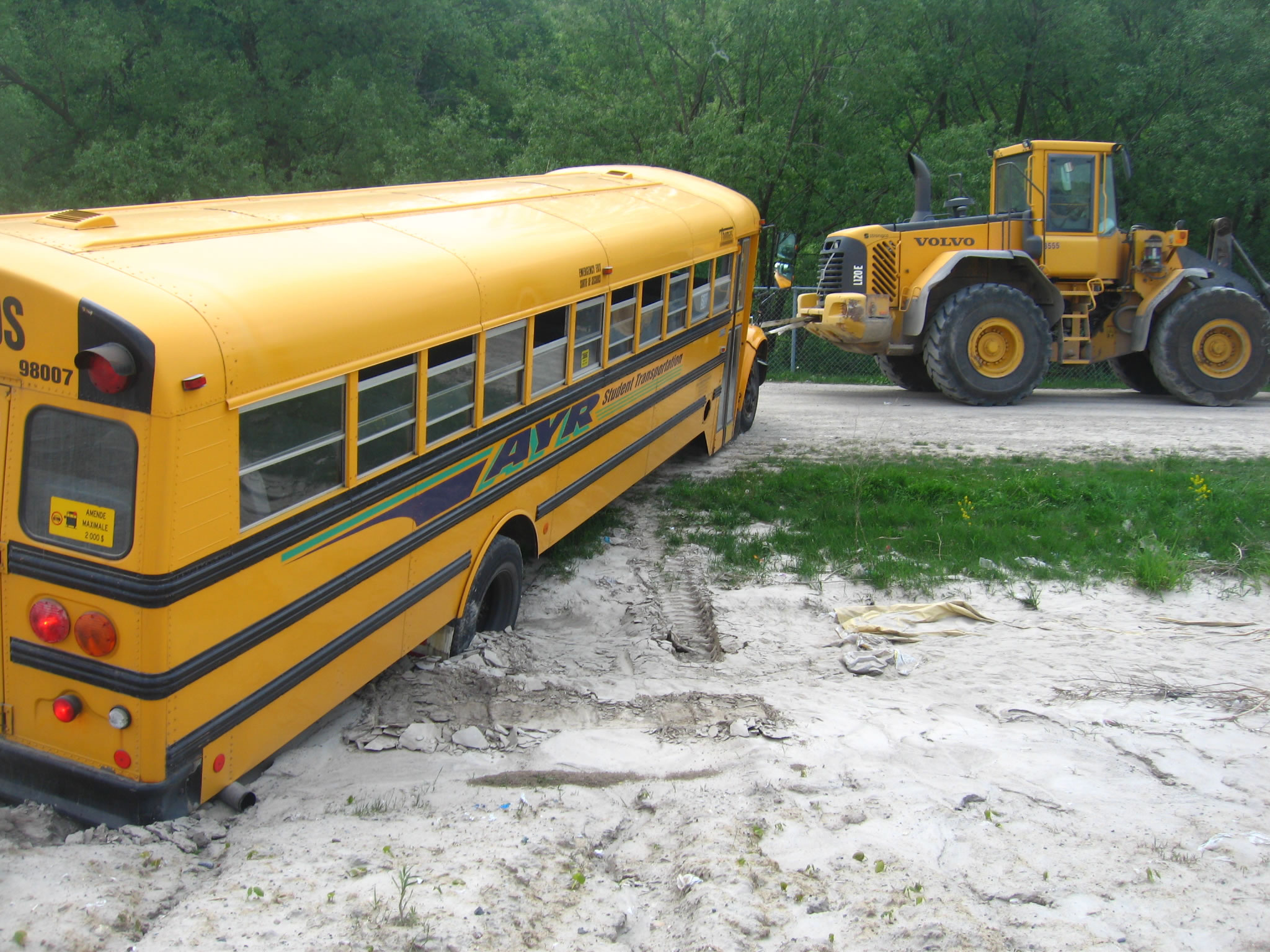
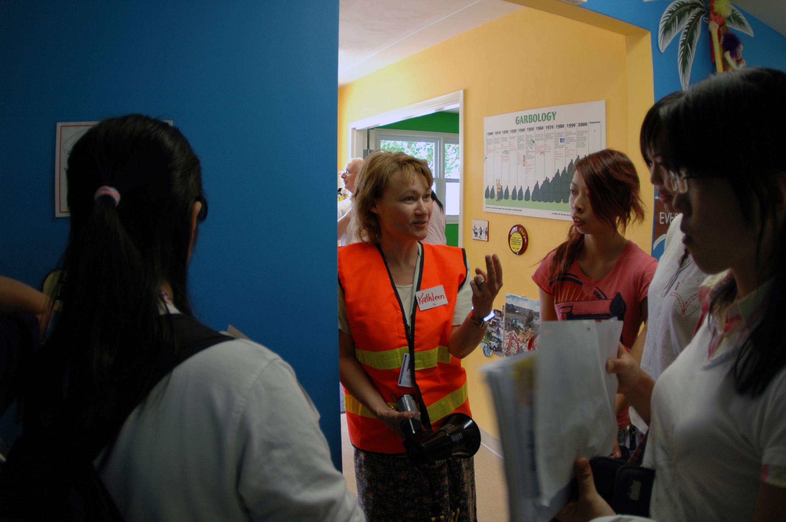
I also appreciate the way Canada treats the rubbish. In every single house, there is a blue box. People put recyclable rubbish in that box. Then the rubbish is delivered to the landfill. The landfill is organized one. Recyclable rubbish like paper and aluminum cans are placed in a separate area. We also had a valuable chance to take a ride to the heart of the landfill. However, we did not smell anything bad most of the time. I think it is due to the comprehensive treatment in Canada.
Besides, one interesting thing I found in Canada is that people have a very good relationship with their pets, say dogs. People often take their lovable pets out for a walk. Dogs are so lucky in Canada. There are many dogs’ parks in Canada. They are large and clean. They can always go play with their masters.
People keep asking me do I want to stay in Canada longer. Right now, my answer is no. It is good for traveling or field trip, we learn a lot from Canada, from environment to culture. However, if I have to settle there, I think the pace is a bit slow for me. Especially we are still young and energetic, we still need to explore more and play more. However, when I get older, Canada maybe a good place for me to retire. It is because the weather is nice, the neighborhood is harmonious. Anyway, I still find this field trip enjoyable and useful. I had a very good time with my classmates. The overall workload is not much and not harsh. I think I made a correct choice to North America Field Trip.
Kwok Kai Ling, Carol
After about 15 hours of flight, we arrived at Toronto airport with great delight. It was a great place with harmony, clean air, and planning.
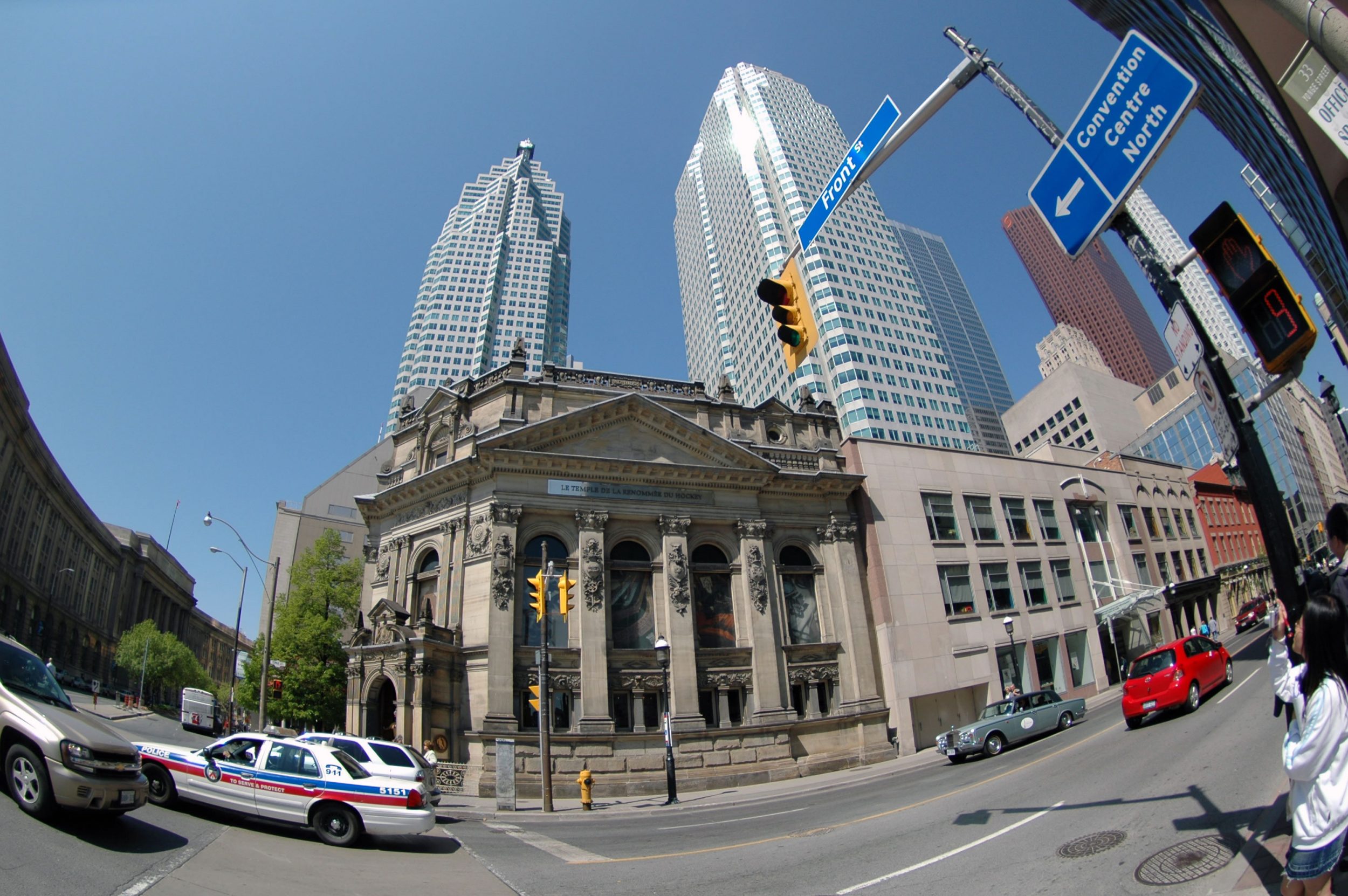
In the downtown area of Toronto, I was impressed by the way a government react to preserve historical buildings, which are usually demolished in market force. History tells about our past. I believe that a place without its own history is dry and dull. Luckily enough, with various policies, the tradition al beautiful old buildings were preserved and turned into different uses including shops, offices, restaurants, whatever. I appreciate all these, but I doubted when I look at Queen ‘s pier in Hong Kong. I understand there is sometimes inevitable trade-off between economic development and cultural preservation, although we emphasis balance of interests in many occasions.
The food, especially the Vietnam cuisine, in the China Town is also fantastic. There are several China Towns in Toronto, some old, some new. The one near to UT (University of Toronto) is relatively new and it is probably a tourist spot. In China Town, there were surge of Vietnam restaurants in recent years. Since most of the owners were really native Vietnamese, the food is native too! It was spicy and delicious. And we enjoyed so much. This is contrary to Hong Kong, where Vietnam restaurants are also common in many senses, as most of the food is not that “native” indeed.
After days of visit in the downtown area, we head to the relatively remote UW (University of Waterloo), which is a renowned or its computer and high tech education. Here, I smelled the calm and harmony. The trees, the grass and the animals are all around. I loved it. During the days, we also visited the Toyota Motor Manufacturing Canada and Accelerator Centre. In the Toyota plant, we took the chain-car to get familiar with the car-making procedure. Its effectiveness impressed me a lot. For the Accelerator, I would regard it as a dream-come-true platform for me, as a teenager. It helps to put your innovative idea into real business, really world. It is really new for me, as in Hong Kong, not much support is given by the government to aid the young talents, especially the scientists.
In the last day, we visited the Niagara Falls. It was breathtaking. It is especially true when I took the boat to the bottom of the Falls with our classmates. We were just so close to the Falls that we could hear the loud water sound nearby. It was like raining so heavily that we need to all hide inside our raincoats. I am sure that its sound and its magnificent view will be deep inside my heart forever.
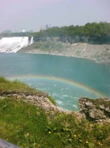
( So lucky that I could see the Rainbow in Niagara Falls)
The trip to Canada is memorable for me. I reflected a lot and enjoyed a lot.
The sound, the smell and the warmth. All are unforgettable memories for me.
Sit Hing Yu, Terence
A wonderful field trip it was.
40 students, our tutor and professor spent a meaningful and fruitful week in Canada. We enjoyed the warmth of sunshine and harmony of the atmosphere. We were also welcomed by the hospitable professors from the University of Toronto and the University of Waterloo. However, please do not perceive that this field trip is only for fun. Academic-wise, I think this field trip offered me a brand new perspective on urban planning and the latest development of Canada. A lot of representatives from related parties, e.g. water management, garbage disposal, Toyota Motor Manufacturing Canada, Accelerator Centre at the technology park of the University of Waterloo, etc. shared their valuable time with us and kindly offered their insight into different aspects of development.
My friend and I coping with jet lag
However, ‘life’ at Canada was no harsh at all. Although our professor did organize a tightly-packed learning tour for each day, academic activities ended around 4 to 5 o’clock in the evening. That means, we would always have our free time to relax and experience the culture and the living of Canada in the evening. Personally speaking, the balance between academic work and free time is just at the right amount and thus my classmates and I really enjoyed the field trip.
My friend and I coping with jet lag
Enjoying a pizza in Little Italy
People like to say see things yourself is better then read them on book. This is absolutely true. This is the first time I have been so far away and Canada was always a fainted image in my heart. No matter how well you know the things and food are expensive there, no matter how well you understand the hospitality (average time lag of a local person ‘asking’ to offer help when you suddenly show a map on the street, finding your way through, is around 2 seconds!) of the people there, you never experience and feel that unless you yourself is right there.

Enjoying a pizza in Little Italy
On the other hand, after the field trip, I strongly believe that there are always something that you can’t simply search for them on the internet. How can you see the process of garbage recycling , get a thorough understanding of what the Accelerator Centre of Canada is doing to nurture technology development, the strict regulations and innovative ideas on planning of the Canada Government simply on the internet? Even if so, it will always take up a lot of your time for the searching work.
So trust me, field trip is really a great opportunity for learning and experiencing different cultures of the world and you will always gain a new insight and broaden your horizon after every field trip.
See you at the Niagara!
Chen Zhouyi, Joey
I always enjoy having a field trip with all the geography-lovers, and in GRM department, we can go field trip with different years students, which is a good opportunities for everyone to share the knowledge and build up friendship.
I do learn a lot from the other people, especially from my group mates, who always give me lots of support. As this time I am the group leader, I need to hold discussion from time to time; it also helped me to improve my leadership ability.
Wong Siu Man
It is my first time to go to Canada. Both Toronto and Waterloo are clean and beautiful cities. The tranquil and green environment makes me feel comfortable and relax. In this field trip, I have gained many valuable experiences. Visiting Toyota Motor Manufacturing Centre and landfill site gave me a very deep impression. Having an overseas field trip, it not only can broaden my horizon and knowledge, but also give me an opportunity to meet year 1 and year 3 students.
Dao Chun Yeung
Canada is spacious with lots of open spaces and a number of communities such as Little Italy, Little Korea, Little India, Chinatown, etc. set up by people of different races and a large variety of cuisines from all around the world. Not only are there many Chinese, there exist people coming from different countries. What amaze me are the harmony and the leisure within the University of Waterloo, which is composed of three colleges each with different religions. Landfill is another surprise to me during the trip. It is because this is a rare chance that someone can stand on landfills. It is also a good opportunity for me to know more about my classmates.
Tsang Kai Ho
You can not believe that Canada is so beautiful, you can see the “BLUE SKY” clearly that we can’t in Hong Kong. Also, you can walk closely to the lake – something can’t be done in HK. There are much more things waiting for you to discover. In the field trip, I know more about my group mates; also I have met many friends that I didn’t know before. It is very happy you could have dinner talking happily with friends all the day during the field trip. I promise that this will be a memorable trip.